Corrie Spout

Waterfall in Stirlingshire

Scotland

Corrie Spout

Birkenburn Reservoir The dam of Birkenburn reservoir set in the Kilsyth Hills, Stirlingshire. The distant view is towards Tinto. <a href="https://www.geograph.org.uk/photo/1058884">NS9534 : The enormous cairn on Tinto summit</a>
Birkenburn Reservoir Credit: Richard Webb

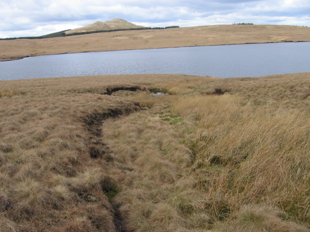
Corrie Spout is a magnificent waterfall located in Stirlingshire, Scotland. Nestled within the picturesque Trossachs National Park, it is a popular destination for nature enthusiasts and hikers alike. The waterfall is situated in a deep glacial corrie, surrounded by towering cliffs and lush greenery, creating a truly awe-inspiring sight.

Reaching a height of approximately 90 feet, Corrie Spout is an impressive cascade of water that plunges down into a rocky gorge below. The waterfall is fed by the waters of the Ardoch Burn, which flows through the surrounding hills and mountains, adding to the beauty and power of the falls.

To access Corrie Spout, visitors can embark on a scenic hike along a well-marked trail that winds its way through the enchanting Scottish countryside. The trail offers stunning panoramic views of the surrounding landscapes, with glimpses of Loch Ard and Ben Lomond in the distance.

Once at the waterfall, visitors can witness the sheer force of nature as the water crashes down into the pool below, creating a mesmerizing display of power. The sound of rushing water and the mist that fills the air add to the sensory experience, making it a truly immersive encounter with nature.

Corrie Spout is not only a natural wonder but also a habitat for various wildlife species. Birdwatchers may catch a glimpse of peregrine falcons, buzzards, or ravens soaring above the cliffs, while red deer and mountain hares may be spotted in the surrounding hills.

Overall, visiting Corrie Spout is a remarkable experience that showcases the beauty and grandeur of Scotland's natural landscapes.

If you have any feedback on the listing, please let us know in the comments section below.

Corrie Spout Images

Images are sourced within 2km of 55.985052/-4.1234311 or Grid Reference NS6778. Thanks to Geograph Open Source API. All images are credited.

Birkenburn Reservoir The dam of Birkenburn reservoir set in the Kilsyth Hills, Stirlingshire. The distant view is towards Tinto. <a href="https://www.geograph.org.uk/photo/1058884">NS9534 : The enormous cairn on Tinto summit</a>
Birkenburn Reservoir
The dam of Birkenburn reservoir set in the Kilsyth Hills, Stirlingshire. The distant view is towards Tinto. NS9534 : The enormous cairn on Tinto summit
Emerald Green Bog at Gray Mare Looking towards Meikle Bin
Emerald Green Bog at Gray Mare
Looking towards Meikle Bin
Birkenburn Reservoir Directly under the regular NE approach path into Glasgow Airport
Birkenburn Reservoir
Directly under the regular NE approach path into Glasgow Airport
Across Birkenburn Reservoir towards Meikle Bin
Rough grasses on the plateau. With Meikle Bin (the Bin) as a backdrop.
Rough grasses on the plateau.
With Meikle Bin (the Bin) as a backdrop.
The High Road To the plateau of the Kilsyth Hills and Birkenburn Reservoir.
The High Road
To the plateau of the Kilsyth Hills and Birkenburn Reservoir.
Gray Mair and Plea Muir
Birkenburn and Meikle Bin Across the contractor's road.
Birkenburn and Meikle Bin
Across the contractor's road.
Johnnie's Dam The official name is Birkenburn Reservoir but generations of locals know it as the title name; 'Johnnie's Dam'.
The reservoir was built in 1830 to regulate the flow of water to the summit level of the Forth & Clyde Canal. Water from Johnnie's Dam follows a complicated route from the dam along the Birken Burn and down the Garrel to Garrel Mill where it is intercepted by a weir and diverted off through a lade past Colzium House into Banton Loch or Townhead Reservoir. From there it is taken by the Shawend Burn and another lade into the Forth & Clyde Canal at Craigmarloch bridge.
Johnnie's Dam
The official name is Birkenburn Reservoir but generations of locals know it as the title name; 'Johnnie's Dam'. The reservoir was built in 1830 to regulate the flow of water to the summit level of the Forth & Clyde Canal. Water from Johnnie's Dam follows a complicated route from the dam along the Birken Burn and down the Garrel to Garrel Mill where it is intercepted by a weir and diverted off through a lade past Colzium House into Banton Loch or Townhead Reservoir. From there it is taken by the Shawend Burn and another lade into the Forth & Clyde Canal at Craigmarloch bridge.
Birken Burn The shallow valley of the burn as it heads in an easterly direction towards Laird's Loup and its name change to the Garrel Burn.
Birken Burn
The shallow valley of the burn as it heads in an easterly direction towards Laird's Loup and its name change to the Garrel Burn.
Birken Burn As it flows over spillway onto the rocks out of the reservoir.
Birken Burn
As it flows over spillway onto the rocks out of the reservoir.
Towards Lunch Knowe Nobody was observed having lunch on this visit ...........
Towards Lunch Knowe
Nobody was observed having lunch on this visit ...........
Black Hill 465m.
Black Hill
465m.
Birkenburn Reservoir spillway The beginnings of the Birken Burn which morphs into the Garrel when it drops over the Laird's Loup waterfall.
Birkenburn Reservoir spillway
The beginnings of the Birken Burn which morphs into the Garrel when it drops over the Laird's Loup waterfall.
Birkenburn Reservoir/Johnnie's Dam Some 'Draw down' equipment still in place after some major maintenance works. The pipes go to the spillway but on this visit there was no water flowing out.
See <span class="nowrap"><a title="www.hillscontractors.co.uk/web/viewlisting.php?id=120" rel="nofollow ugc noopener" href="http://www.hillscontractors.co.uk/web/viewlisting.php?id=120">Link</a><img style="margin-left:2px;" alt="External link" title="External link - shift click to open in new window" src="https://s1.geograph.org.uk/img/external.png" width="10" height="10"/></span>
Birkenburn Reservoir/Johnnie's Dam
Some 'Draw down' equipment still in place after some major maintenance works. The pipes go to the spillway but on this visit there was no water flowing out. See LinkExternal link
The Plateau Road Looking S.E. and the way down to Queenzieburn.
The Plateau Road
Looking S.E. and the way down to Queenzieburn.
Gray Mare This part of the plateau is a sponge of peat, numerous channels which were almost dry on this visit but are the source of at least two burns.
Gray Mare
This part of the plateau is a sponge of peat, numerous channels which were almost dry on this visit but are the source of at least two burns.
Cotton grass on Gray Mare A closer look at the sponge of the plateau.
Cotton grass on Gray Mare
A closer look at the sponge of the plateau.
Show me another place!

Corrie Spout is located at Grid Ref: NS6778 (Lat: 55.985052, Lng: -4.1234311)

Unitary Authority: North Lanarkshire

Police Authority: Lanarkshire

What 3 Words

///rinse.couch.pokes. Near Milton of Campsie, East Dunbartonshire

Nearby Locations

Corrie Spout

Related Wikis

Queenzieburn

Queenzieburn (Scots: Queenieburn) is a small settlement in the historic county of Stirlingshire and the Council Area of North Lanarkshire, Scotland. Its...

Twechar railway station

Twechar railway station was opened in 1878 as Gavell on the Kelvin Valley Railway and renamed Twechar in 1924. The station served the hamlet of Twechar...

Peggie's Spout

Peggie's Spout is a waterfall of Scotland. == See also == Waterfalls of Scotland == References ==

Milton of Campsie

Milton of Campsie is a village formerly in the county of Stirlingshire, but now in East Dunbartonshire, Scotland roughly 10 miles (16 km) north of Glasgow...

Meikle Bin

Meikle Bin is a peak in the Campsie Fells in Central Scotland. It is the second-highest of the group at 570 metres (1,870 ft), and with its prominence...

Kilsyth Victoria Cottage Hospital

Kilsyth Victoria Cottage Hospital is a health facility in Glasgow Road, Kilsyth, North Lanarkshire, Scotland. It is managed by NHS Lanarkshire. == History... ==

Milton of Campsie railway station

Milton of Campsie railway station served the village of Milton of Campsie, in the historical county of Stirlingshire, Scotland, from 1848 to 1951 on the...

Glorat

Glorat is a place and estate in the parish of Campsie in East Dunbartonshire, Scotland. == History == A towerhouse was built at Glorat in the 16th century...

Nearby Amenities

Located within 500m of 55.985052,-4.1234311
Corrie Spout
Waterway: waterfall
Wikidata: Q15211731
Lat/Long: 55.9850754/-4.1233006
Waterway: waterfall
Lat/Long: 55.9875377/-4.1253908
The data included in this document is from www.openstreetmap.org. The data is made available under ODbL.

Have you been to Corrie Spout?

Leave your review of Corrie Spout below (or comments, questions and feedback).