South Bishop

Island in Pembrokeshire

Wales

South Bishop

South Bishop - Lighthouse South Bishop Lighthouse was built by Trinity House in 1839 as a guide and hazard warning to vessels along the Pembrokeshire coastline. It sits on a rocky outcrop 4¾ miles south west of St. David's Head. Primarily a waymark for vessels navigating offshore, the lighthouse also assists vessels navigating around the Bishops and Clerks chain. 
Taken from Whitesands Bay on a gloomy day. 
<span class="nowrap"><a title="www.trinityhouse.co.uk" rel="nofollow ugc noopener" href="http://www.trinityhouse.co.uk">Link</a><img style="margin-left:2px;" alt="External link" title="External link - shift click to open in new window" src="https://s1.geograph.org.uk/img/external.png" width="10" height="10"/></span>
South Bishop - Lighthouse Credit: Colin Smith

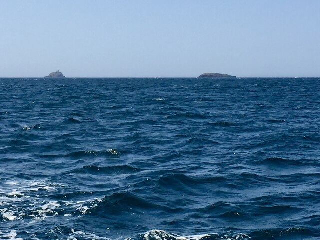
South Bishop is a small island located off the coast of Pembrokeshire, Wales. It is part of the Pembrokeshire Coast National Park and is known for its rugged cliffs, diverse bird population, and historic lighthouse. The island is uninhabited and is only accessible by boat.

South Bishop is a popular spot for birdwatching, with species such as puffins, guillemots, and razorbills nesting on the cliffs. The island is also home to a colony of grey seals, which can often be spotted lounging on the rocky shores.

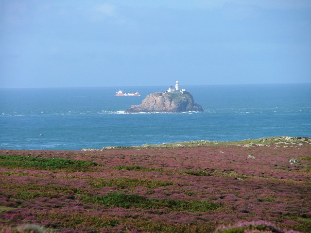
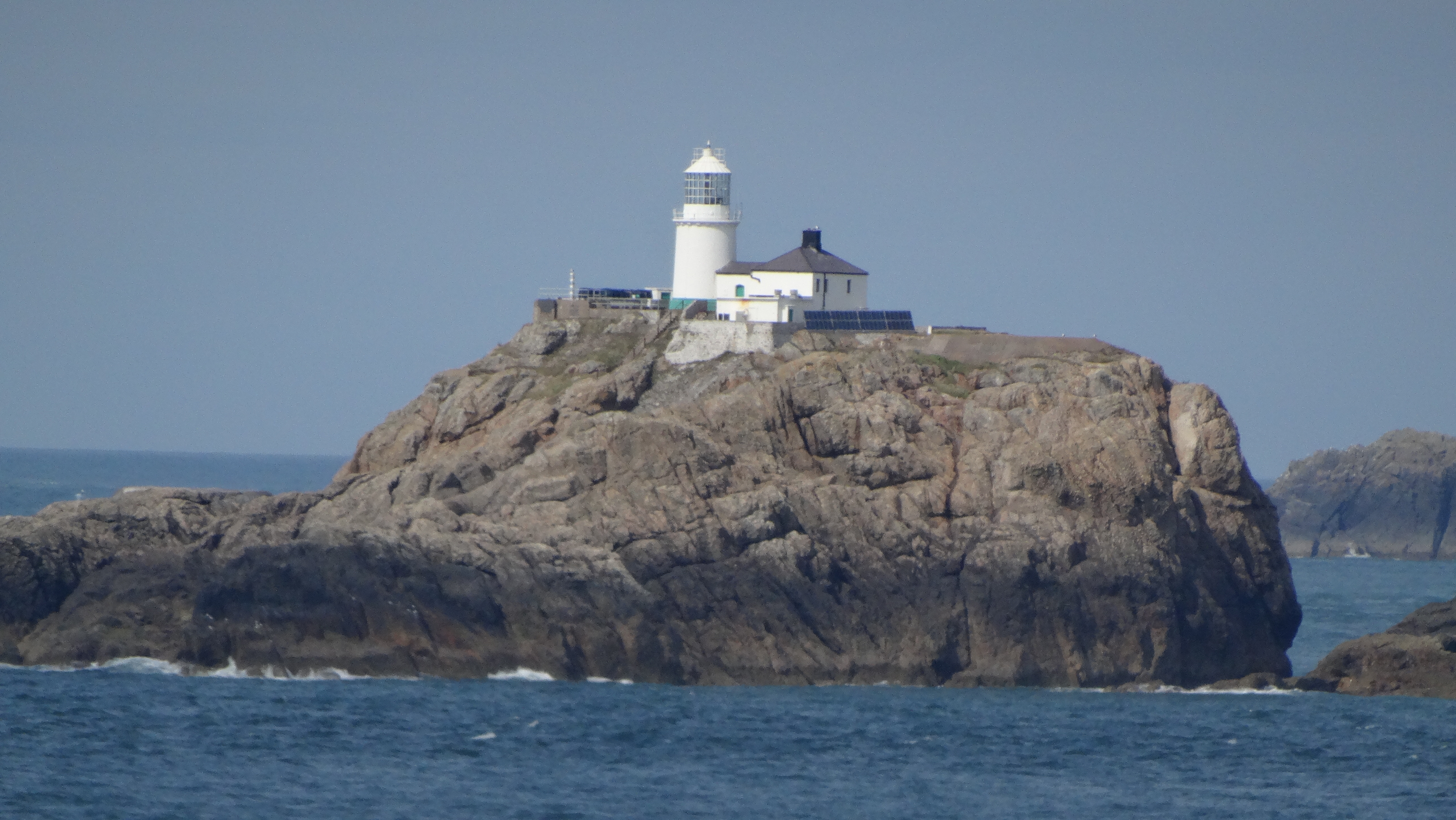
The South Bishop Lighthouse, built in 1839, is a prominent feature on the island. It stands at 33 meters tall and is still in operation today, guiding ships safely through the treacherous waters of St. George's Channel.

Visitors to South Bishop can explore the island on foot, taking in the stunning views of the surrounding coastline and enjoying the peaceful atmosphere of this remote island. It is a popular destination for nature lovers and outdoor enthusiasts looking to experience the beauty of Pembrokeshire's coastal landscape.

If you have any feedback on the listing, please let us know in the comments section below.

South Bishop Images

Images are sourced within 2km of 51.852379/-5.4119036 or Grid Reference SM6522. Thanks to Geograph Open Source API. All images are credited.

South Bishop - Lighthouse South Bishop Lighthouse was built by Trinity House in 1839 as a guide and hazard warning to vessels along the Pembrokeshire coastline. It sits on a rocky outcrop 4¾ miles south west of St. David's Head. Primarily a waymark for vessels navigating offshore, the lighthouse also assists vessels navigating around the Bishops and Clerks chain. 
Taken from Whitesands Bay on a gloomy day. 
<span class="nowrap"><a title="www.trinityhouse.co.uk" rel="nofollow ugc noopener" href="http://www.trinityhouse.co.uk">Link</a><img style="margin-left:2px;" alt="External link" title="External link - shift click to open in new window" src="https://s1.geograph.org.uk/img/external.png" width="10" height="10"/></span>
South Bishop - Lighthouse
South Bishop Lighthouse was built by Trinity House in 1839 as a guide and hazard warning to vessels along the Pembrokeshire coastline. It sits on a rocky outcrop 4¾ miles south west of St. David's Head. Primarily a waymark for vessels navigating offshore, the lighthouse also assists vessels navigating around the Bishops and Clerks chain. Taken from Whitesands Bay on a gloomy day. LinkExternal link
South Bishop and lighthouse from round-Ramsey boat trip Fortunately, the western side of Ramsey was calm (unusually) as the wind was NE.
South Bishop and lighthouse from round-Ramsey boat trip
Fortunately, the western side of Ramsey was calm (unusually) as the wind was NE.
On MV Inishmore - View to South Bishop Lighthouse
Em-sger and Daufraich It is just possible to make out the lighthouse on Em-sger (South Bishop).  To the right, Daufraich.
Em-sger and Daufraich
It is just possible to make out the lighthouse on Em-sger (South Bishop). To the right, Daufraich.
South Bishop Em-sger or South Bishop is the southerly of a group of offshore island known as the Bishops and Clerks. Photo taken from Ramsey Island.
South Bishop
Em-sger or South Bishop is the southerly of a group of offshore island known as the Bishops and Clerks. Photo taken from Ramsey Island.
Show me another place!

South Bishop is located at Grid Ref: SM6522 (Lat: 51.852379, Lng: -5.4119036)

Unitary Authority: Pembrokeshire

Police Authority: Dyfed Powys

Also known as: Em-sger

What 3 Words

///trimming.successive.subsistence. Near St Davids, Pembrokeshire

Nearby Locations

South Bishop Em-sger

Related Wikis

South Bishop Lighthouse

The South Bishop Lighthouse is a lighthouse on South Bishop Island (also known as Emsger), a small rock approximately 5 miles (8 km) west of St Davids...

Emsger

Emsger or South Bishop is an islet situated west of Ramsey Island, Pembrokeshire, Wales. It is the largest of the Bishops and Clerks group of islets and...

Bishops and Clerks

The Bishops and Clerks are a group of rocks and islets, approximately 1+1⁄2 miles (2.4 km) west of Ramsey Island, Pembrokeshire, Wales. == Origins... ==

Carnllundain

Carnllundain or Carn Llundain is the highest elevation of Ramsey Island in Pembrokeshire, Wales. == Geography == The 136-metre (446 ft) high hill stands...

Nearby Amenities

Located within 500m of 51.852379,-5.4119036
Aeroway: helipad
Lat/Long: 51.8525126/-5.4116121
The data included in this document is from www.openstreetmap.org. The data is made available under ODbL.

Have you been to South Bishop?

Leave your review of South Bishop below (or comments, questions and feedback).