Bait Island

Island in Northumberland

England

Bait Island

Access Road and verge, south of Curry's Point
Access Road and verge, south of Curry's Point Credit: Philip Cornwall

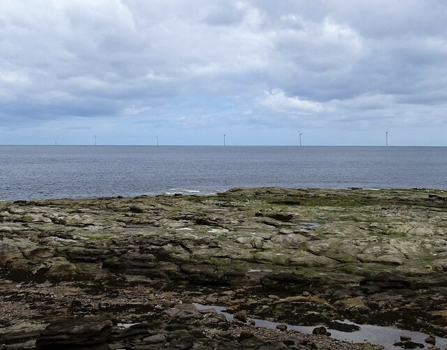
Bait Island is a small island located off the coast of Northumberland, England. It is situated in the North Sea, approximately 3 miles northeast of the village of Beadnell. The island is part of the Farne Islands archipelago, a group of roughly 20 islands known for their rich wildlife and historical significance.

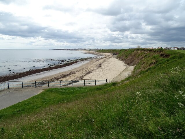
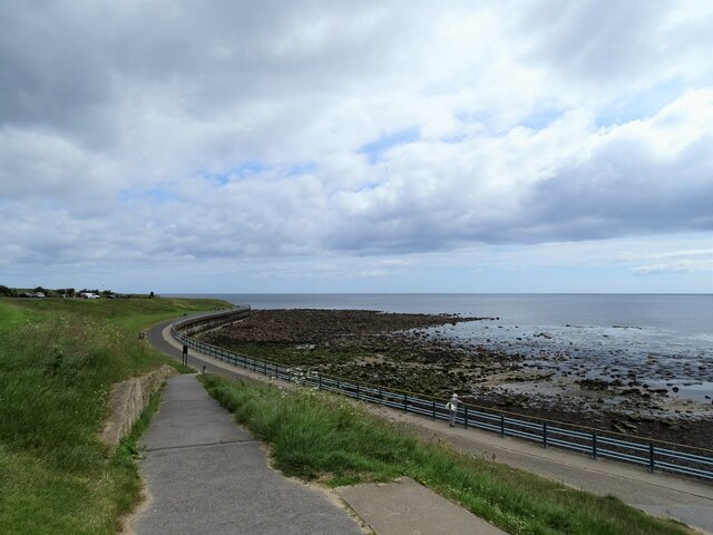
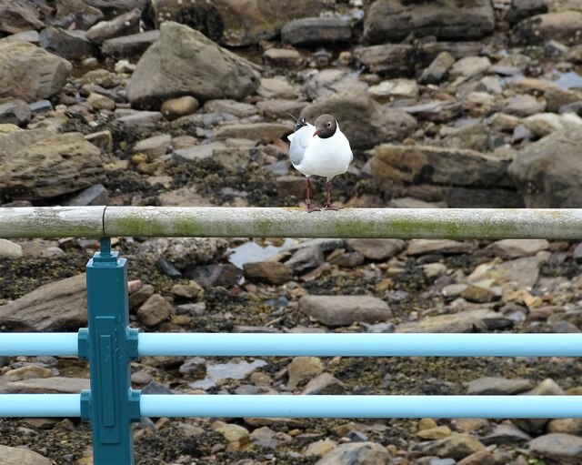
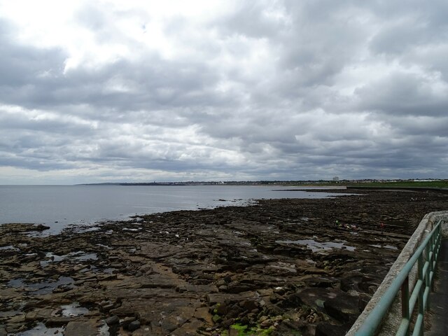
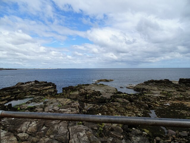
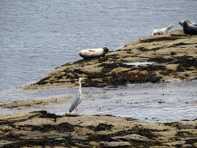
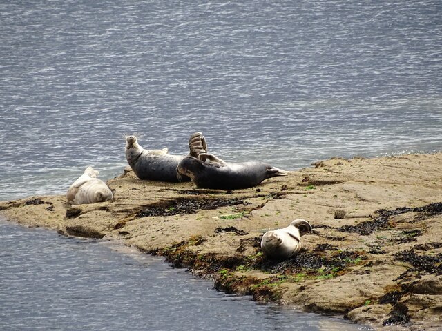
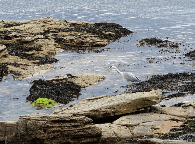
Bait Island spans an area of about 5 acres and is characterized by its rugged and rocky terrain. The island is uninhabited and offers a unique and untouched environment for various species of flora and fauna. The surrounding waters are home to a variety of marine life, including seals, dolphins, and numerous bird species.

The island's name, Bait, is derived from the Old Norse word "beitr," meaning "a place of grazing." This suggests that the island may have been used as a grazing ground for livestock in the past. Today, Bait Island is primarily visited by birdwatchers and wildlife enthusiasts who come to observe the diverse bird colonies that nest on the island's cliffs, including puffins, guillemots, and kittiwakes.

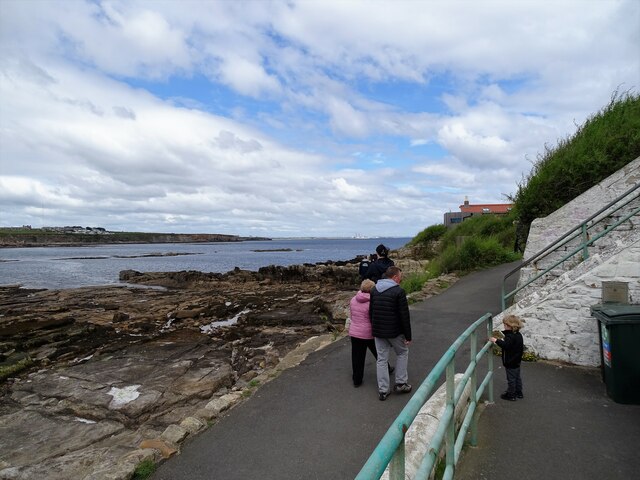
Access to Bait Island is limited, as it is a protected area managed by the National Trust and the Farne Islands Reserve. Visitors can reach the island by boat, with regular tours organized from nearby Seahouses. These tours provide a unique opportunity to explore the island's natural beauty, observe the wildlife, and learn about its historical significance, as Bait Island was once used as a lookout point during conflicts and wars in the region.

Overall, Bait Island offers a captivating experience for those seeking a glimpse into Northumberland's natural wonders and historical heritage.

If you have any feedback on the listing, please let us know in the comments section below.

Bait Island Images

Images are sourced within 2km of 55.071961/-1.4493994 or Grid Reference NZ3575. Thanks to Geograph Open Source API. All images are credited.

Access Road and verge, south of Curry's Point
Promenade north of Whitley Bay
Curry's Point and St Mary's Island Taken shortly after high tide, the causeway connecting the island to the mainland is submerged.
Curry's Point and St Mary's Island
Taken shortly after high tide, the causeway connecting the island to the mainland is submerged.
St Mary's Lighthouse, North of Whitley Bay St Mary's Lighthouse is on the tiny St Mary's (or Bait) Island, just north of Whitley Bay on the coast of North East England. The small rocky tidal island is linked to the mainland by a short concrete causeway which is submerged at high tide. The lighthouse and adjacent keepers' cottages were built in 1898 by the John Miller company of Tynemouth, using 645 blocks of stone and 750,000 bricks. The lighthouse was decommissioned in 1984
St Mary's Lighthouse, North of Whitley Bay
St Mary's Lighthouse is on the tiny St Mary's (or Bait) Island, just north of Whitley Bay on the coast of North East England. The small rocky tidal island is linked to the mainland by a short concrete causeway which is submerged at high tide. The lighthouse and adjacent keepers' cottages were built in 1898 by the John Miller company of Tynemouth, using 645 blocks of stone and 750,000 bricks. The lighthouse was decommissioned in 1984
St Mary's Lighthouse Viewed at low tide when the lighthouse on St Mary's Island can be accessed on the concrete causeway to the right of the photo.
St Mary's Lighthouse
Viewed at low tide when the lighthouse on St Mary's Island can be accessed on the concrete causeway to the right of the photo.
View down the coast Looking south down the length of Whitley Bay from near St Mary's Island. The view is all the down to the Lighthouse on the end of South Shields pier.
View down the coast
Looking south down the length of Whitley Bay from near St Mary's Island. The view is all the down to the Lighthouse on the end of South Shields pier.
Looking along the promenade Looking north along the promenade at the north end of Whitley Bay. The promenade runs to the causeway to St Mary's Island.
Looking along the promenade
Looking north along the promenade at the north end of Whitley Bay. The promenade runs to the causeway to St Mary's Island.
Promenade to Curry's Point The promenade leads to the causeway to St Mary's Island, seen here with its lighthouse. This is the northern point of Whitley Bay.
Promenade to Curry's Point
The promenade leads to the causeway to St Mary's Island, seen here with its lighthouse. This is the northern point of Whitley Bay.
Gull on the railings A Black Headed Gull on the promenade railings near St Mary's Island at Whitley Bay. Note that this bird has been ringed.
Gull on the railings
A Black Headed Gull on the promenade railings near St Mary's Island at Whitley Bay. Note that this bird has been ringed.
View down the coast from St Mary's Island A view south down the coast past Whitley Bay, Tynemouth, South Shields and Marsden.
View down the coast from St Mary's Island
A view south down the coast past Whitley Bay, Tynemouth, South Shields and Marsden.
Across the causeway to the Lighthouse The lighthouse on St Mary's Island is accessible at low tide across the causeway.
Across the causeway to the Lighthouse
The lighthouse on St Mary's Island is accessible at low tide across the causeway.
Looking up the coast from St Mary's Island A good view north past Blyth and Ellington.
Looking up the coast from St Mary's Island
A good view north past Blyth and Ellington.
Grey Seals at St Mary's Island The little island at the north end of Whitley Bay is an excellent place to see close views of Grey Seals. They haul out on the rocks here at low tide. A Heron doing a spot of fishing also.
Grey Seals at St Mary's Island
The little island at the north end of Whitley Bay is an excellent place to see close views of Grey Seals. They haul out on the rocks here at low tide. A Heron doing a spot of fishing also.
Path up to St Mary's Island Access path at the end of the causeway. Good view up the coast from here also.
Path up to St Mary's Island
Access path at the end of the causeway. Good view up the coast from here also.
Basking seals A group of Grey Seals on the rocks at St Mary's Island. This is a great place to see close up views of these animals. Disturbance by unthinking people and their dogs is a problem however. They were quite undisturbed on this occasion, which could be a hopeful sign.
Basking seals
A group of Grey Seals on the rocks at St Mary's Island. This is a great place to see close up views of these animals. Disturbance by unthinking people and their dogs is a problem however. They were quite undisturbed on this occasion, which could be a hopeful sign.
Grey Heron at St Mary's Island This little island is a great place to see birds and seals at close quarters.
Grey Heron at St Mary's Island
This little island is a great place to see birds and seals at close quarters.
View of wind turbines from St Mary's Island Sea view from the island showing some of the turbines of the Blyth Offshore Wind Farm.
View of wind turbines from St Mary's Island
Sea view from the island showing some of the turbines of the Blyth Offshore Wind Farm.
View across the bay from St Mary's Island Looking across to Hartley on the cliff tops, with Seaton Sluice further up the coast.
View across the bay from St Mary's Island
Looking across to Hartley on the cliff tops, with Seaton Sluice further up the coast.
Show me another place!

Bait Island is located at Grid Ref: NZ3575 (Lat: 55.071961, Lng: -1.4493994)

Unitary Authority: North Tyneside

Police Authority: Northumbria

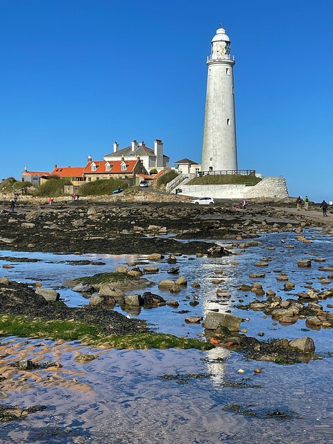
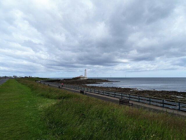
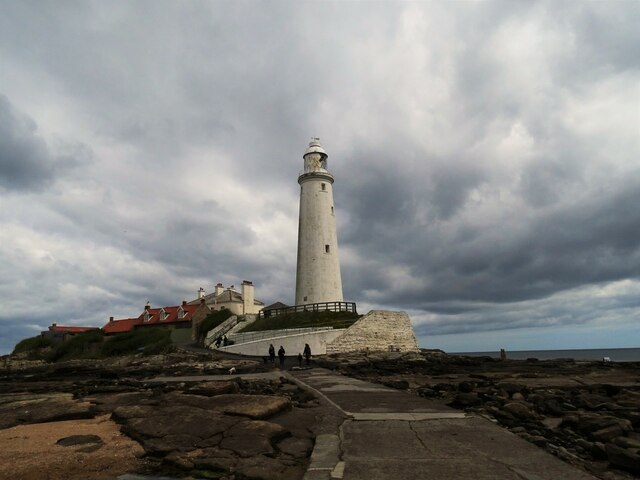
Also known as: St Mary's Island

What 3 Words

///rewarding.gone.tins. Near Whitley Bay, Tyne & Wear

Related Wikis

St Mary's Lighthouse

St Mary's Lighthouse is on the tiny St Mary's (or Bait) Island, just north of Whitley Bay on the coast of North East England. The small rocky tidal island...

St Mary's Island (Tyne and Wear)

St Mary's Island, sometimes referred to as Bait Island is a small sandstone island near the seaside resort of Whitley Bay, Tyne and Wear, England. It is...
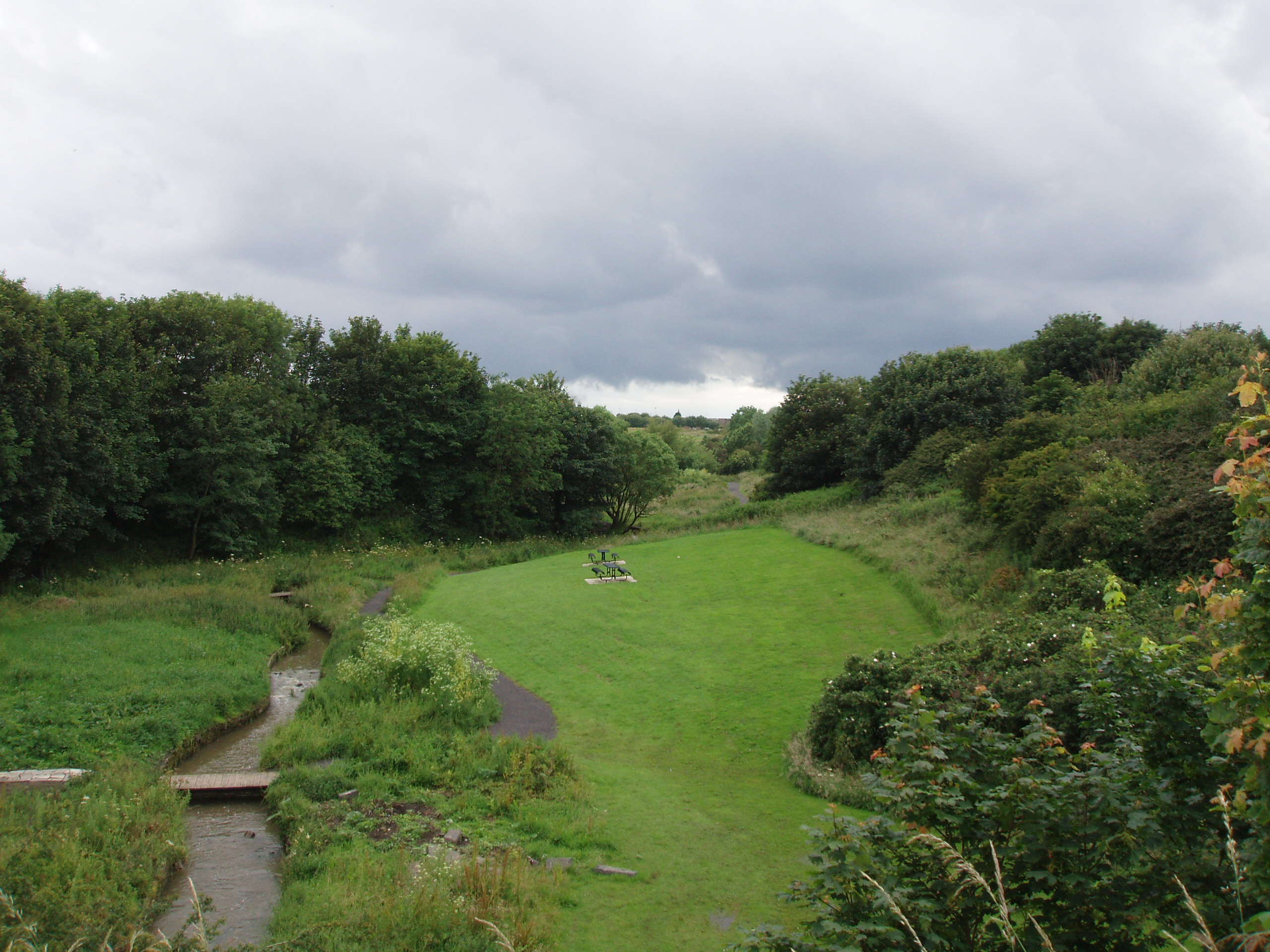
Brierdene

Brierdene or Brier Dene is a small valley through which the Brierdene Burn flows down to its mouth at Whitley Bay. The valley was partly occupied by a...

Brierdene railway station

Brierdene was to have been a railway station on the Collywell Bay Branch Line and construction began in 1913 and was abandoned in 1914. The station was...

Nearby Amenities

Located within 500m of 55.071961,-1.4493994
St Mary's or Bait Island
Alt Name: Bate's Island
Place: locality
Wikidata: Q7594502
Wikipedia: en:St Mary's Island (Tyne and Wear)
Lat/Long: 55.0721062/-1.4494288
Bench
Lat/Long: 55.0698753/-1.4561749
Board Type: nature
Information: board
Tourism: information
Lat/Long: 55.0699857/-1.4515495
Board Type: nature
Information: board
Tourism: information
Lat/Long: 55.0693291/-1.4522509
The data included in this document is from www.openstreetmap.org. The data is made available under ODbL.

Have you been to Bait Island?

Leave your review of Bait Island below (or comments, questions and feedback).