Potton Island

Island in Essex Rochford

England

Potton Island

Shuttlewood's Boatyard, Paglesham Eastend The boatyard fronts Paglesham Reach of the River Roach and since 1895 has been engaged in boatbuilding and maintenance.
Shuttlewood's Boatyard, Paglesham Eastend Credit: David Kemp

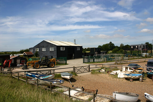
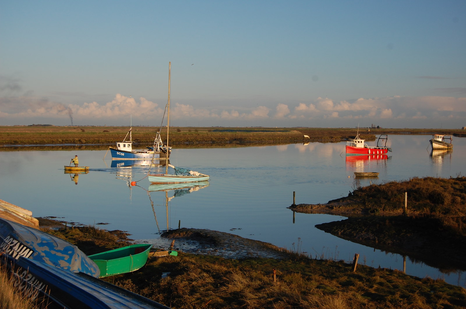
Potton Island is a small, uninhabited island located off the southeastern coast of Essex, England. Situated in the estuary of the River Roach, it is part of the Rochford District and lies about 1.5 miles southeast of the town of Rochford. The island covers an area of approximately 7 hectares and is accessible only by boat.

Potton Island is known for its diverse wildlife and natural beauty. It is home to a variety of bird species, including gulls, waders, and ducks, making it a popular spot for birdwatching enthusiasts. The surrounding waters also offer excellent fishing opportunities for anglers.

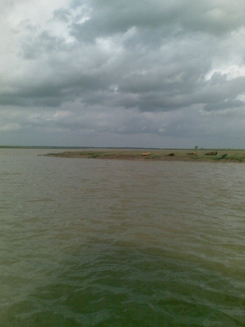
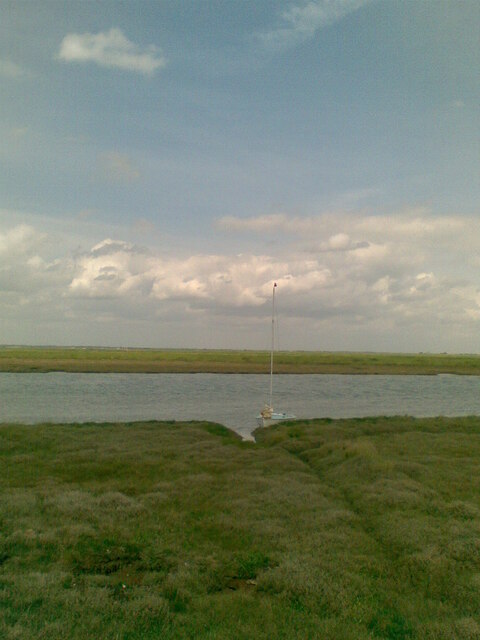
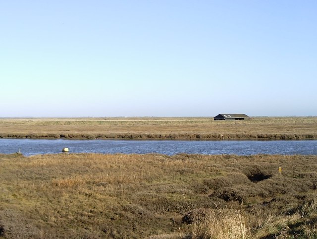
The island's landscape is predominantly marshland and mudflats, with some areas covered in saltmarsh vegetation. It is a designated Site of Special Scientific Interest (SSSI) due to its ecological importance and abundance of rare plant species, such as sea lavender and glasswort.

Historically, Potton Island has had various uses. During World War II, it was utilized by the military as a bombing range. Today, remnants of the war, including unexploded ordnance, can still be found on the island, making it off-limits to the general public for safety reasons.

While Potton Island itself cannot be visited, it can be admired from a distance, either from the nearby coastal paths or by taking a boat tour around the area. Its unspoiled natural beauty and wildlife make it a fascinating destination for nature lovers and those interested in exploring the unique ecosystems of the Essex coast.

If you have any feedback on the listing, please let us know in the comments section below.

Potton Island Images

Images are sourced within 2km of 51.580436/0.82244448 or Grid Reference TQ9590. Thanks to Geograph Open Source API. All images are credited.

Shuttlewood's Boatyard, Paglesham Eastend The boatyard fronts Paglesham Reach of the River Roach and since 1895 has been engaged in boatbuilding and maintenance.
Shuttlewood's Boatyard, Paglesham Eastend
The boatyard fronts Paglesham Reach of the River Roach and since 1895 has been engaged in boatbuilding and maintenance.
Confluence of River Roach & Paglesham Pool (1) Paglesham Pool is the creek that can be seen top left. Taken from the mainland with Wallasea Island (left) and Potton Island (right).
Confluence of River Roach & Paglesham Pool (1)
Paglesham Pool is the creek that can be seen top left. Taken from the mainland with Wallasea Island (left) and Potton Island (right).
Confluence of River Roach & Paglesham Pool (2) Paglesham Pool is the creek nearest the camera while the Roach follows the horizon. Taken from the mainland with Wallsea Island (left) and Potton Island on the right of the horizon.
Confluence of River Roach & Paglesham Pool (2)
Paglesham Pool is the creek nearest the camera while the Roach follows the horizon. Taken from the mainland with Wallsea Island (left) and Potton Island on the right of the horizon.
Borrowdyke at Paglesham Point
A view of River Roach; from top of pillbox
Looking towards Barling Ness Barling Ness is at the far end of the drainage channel. The water on the left is Paglesham Reach of the River Roach and the land just discernible on the horizon is Potton Island.
Looking towards Barling Ness
Barling Ness is at the far end of the drainage channel. The water on the left is Paglesham Reach of the River Roach and the land just discernible on the horizon is Potton Island.
Essex Creeks The land with the farm buildings (just outside the gridsquare in <a href="https://www.geograph.org.uk/gridref/TQ9590">TQ9590</a>) on it is Potton Island to which there is no public access. The part of the mainland across the water to the right of the island is separated from it by Potton Creek. The water on the left is known as The Violet and that on the right is Barlinghall Creek.
Essex Creeks
The land with the farm buildings (just outside the gridsquare in TQ9590) on it is Potton Island to which there is no public access. The part of the mainland across the water to the right of the island is separated from it by Potton Creek. The water on the left is known as The Violet and that on the right is Barlinghall Creek.
Great Potton farm buildings, Potton Island Although Potton Island is owned by the Ministry of Defence, much of the island has been used for farming. Taken from the mainland looking north across Potton Creek.
Great Potton farm buildings, Potton Island
Although Potton Island is owned by the Ministry of Defence, much of the island has been used for farming. Taken from the mainland looking north across Potton Creek.
Yokesfleet Creek The two yachts spent the night in Yokesfleet Creek and found they had got too near the Foulness Island shoreline and are now waiting for the tide to relift off.
Yokesfleet Creek
The two yachts spent the night in Yokesfleet Creek and found they had got too near the Foulness Island shoreline and are now waiting for the tide to relift off.
Seawall footpath, Paglesham Eastend This view looks south-west as the footpath passes close to Paglesham.
Seawall footpath, Paglesham Eastend
This view looks south-west as the footpath passes close to Paglesham.
Pill box, Paglesham Eastend This view shows the approach to this Second World War pill box, built where the seawall footpath turns westward.
Pill box, Paglesham Eastend
This view shows the approach to this Second World War pill box, built where the seawall footpath turns westward.
Seals basking at the entrance to Shelford Creek Photo taken from Wayfarer sailing dinghy belonging to the Hostellers Sailing Club, based at Paglesham. <span class="nowrap"><a title="http://www.btinternet.com/~sail/" rel="nofollow ugc noopener" href="http://www.btinternet.com/~sail/">Link</a><img style="margin-left:2px;" alt="External link" title="External link - shift click to open in new window" src="https://s1.geograph.org.uk/img/external.png" width="10" height="10"/></span>
Seals basking at the entrance to Shelford Creek
Photo taken from Wayfarer sailing dinghy belonging to the Hostellers Sailing Club, based at Paglesham. LinkExternal link
Drainage channel south of Barling Ness The curving drainage channel separates the large landfill site (left) from the sea wall and footpath. The water on the right is known as The Violet through which Barlinghall and Potton Creeks join the River Roach.
Drainage channel south of Barling Ness
The curving drainage channel separates the large landfill site (left) from the sea wall and footpath. The water on the right is known as The Violet through which Barlinghall and Potton Creeks join the River Roach.
The Violet The Violet is the creek through which Barlinghall Creek and Potton Creek reach the River Roach. The land beyond it is Potton Island.
The Violet
The Violet is the creek through which Barlinghall Creek and Potton Creek reach the River Roach. The land beyond it is Potton Island.
A flock of seagulls Gulls above the land-fill site on Barling Marsh
A flock of seagulls
Gulls above the land-fill site on Barling Marsh
Barling Marsh The northern edge of the landfill
Barling Marsh
The northern edge of the landfill
Barling Ness The Violet (to right) enters Paglesham Reach on the River Roach
Barling Ness
The Violet (to right) enters Paglesham Reach on the River Roach
From east shore of Rushley Island across Narrow Cuts towards Havengore Island View east across the saltgrass marshes from near the eastern sea wall of Rushley Island, overlooking the channel known as Narrow Cuts with the western side of Havengore Island in the background.
From east shore of Rushley Island across Narrow Cuts towards Havengore Island
View east across the saltgrass marshes from near the eastern sea wall of Rushley Island, overlooking the channel known as Narrow Cuts with the western side of Havengore Island in the background.
Show me another place!

Potton Island is located at Grid Ref: TQ9590 (Lat: 51.580436, Lng: 0.82244448)

Administrative County: Essex

District: Rochford

Police Authority: Essex

What 3 Words

///riskiest.merit.insisting. Near Great Wakering, Essex

Nearby Locations

Potton Creek Potton Island

Related Wikis

Potton Island

Potton Island is a sparsely populated island west of Foulness in Essex, England. It is connected to the mainland by a swing bridge with a traffic light...

Rushley Island

Rushley Island is a small uninhabited island in Essex, England. It is the smallest of six islands comprising an archipelago in Essex, and is privately...

HMS Beagle

HMS Beagle was a Cherokee-class 10-gun brig-sloop of the Royal Navy, one of more than 100 ships of this class. The vessel, constructed at a cost of £7...

New England Island

New England Island is an uninhabited island in Essex, England. One road crosses the island, connecting it with bridges to Foulness and to the mainland...

Wallasea Island

Wallasea Island lies in Essex, England. It is bounded to the north by the River Crouch, to the south east by the River Roach, and to the west by Paglesham...

Havengore Island

Havengore Island is a low-lying, marshy island in the civil parish of Foulness, in the Rochford district, in the county of Essex, England. It is bounded...

Barling, Essex

Barling is a village and former civil parish, now in the civil parish of Barling Magna in the Rochford district, in the county of Essex, England. It is...
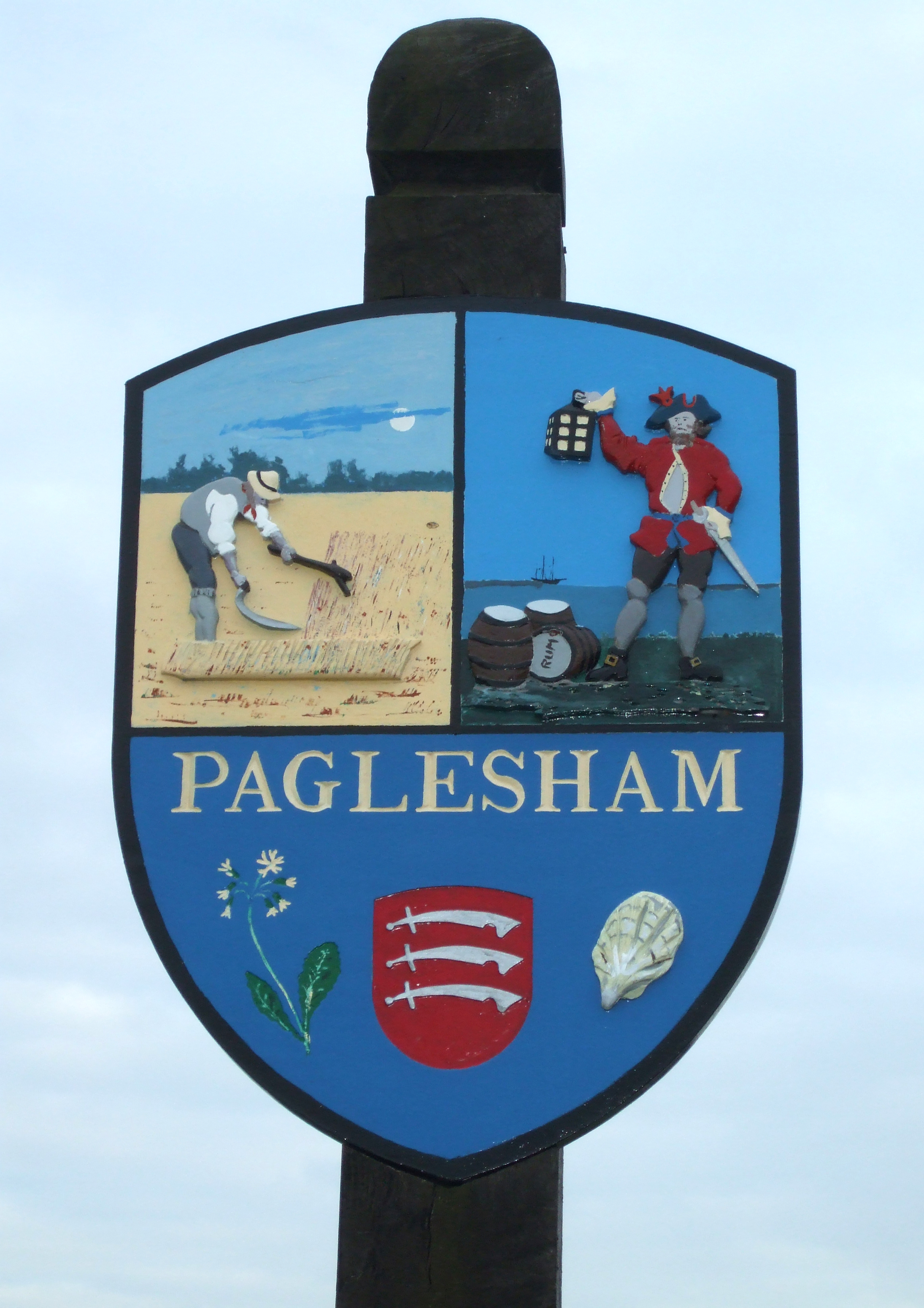
Paglesham

Paglesham ( PAG-əl-shəm) is a village and civil parish in the north east of the Rochford Rural District, Essex. The parish includes two hamlets of Eastend...

Have you been to Potton Island?

Leave your review of Potton Island below (or comments, questions and feedback).