South Benelip

Island in Shetland

Scotland

South Benelip

Housay, Out Skerries, Shetland Housay, Out Skerries, Shetland. Facing south-east.
Housay, Out Skerries, Shetland Credit: martin more

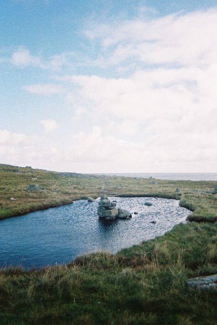
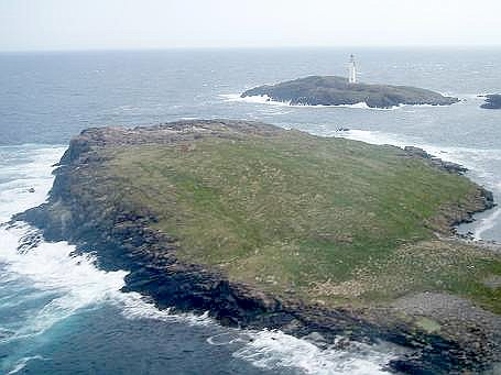
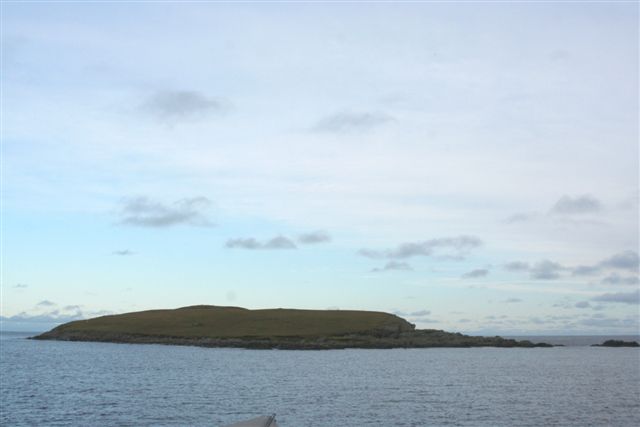
South Benelip is a small and picturesque island located in the Shetland archipelago, off the northern coast of Scotland. It forms part of the larger group of islands known as the South Isles. With a land area of approximately 2.5 square miles, South Benelip is one of the smaller islands in the region.

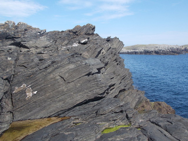
The island boasts stunning natural beauty, characterized by rugged coastal cliffs, rolling hills, and pristine sandy beaches. It is home to a diverse range of flora and fauna, making it a haven for nature enthusiasts and birdwatchers. South Benelip is particularly known for its populations of seabirds, including puffins, guillemots, and kittiwakes.

The island has a rich history, with evidence of human settlement dating back thousands of years. Archaeological sites, such as standing stones and burial mounds, provide glimpses into the island's past. Additionally, remnants of old crofts and abandoned houses can still be found, serving as reminders of former inhabitants.

Despite its small size, South Benelip offers various amenities for visitors. There is a small café and a guesthouse that provide accommodation and dining options. The island is also well-connected to the mainland, with regular ferry services available.

South Benelip is a tranquil and idyllic destination, perfect for those seeking a peaceful retreat or a chance to explore the natural wonders of the Shetland Islands. Its untouched landscapes and rich history make it a truly unique destination within the region.

If you have any feedback on the listing, please let us know in the comments section below.

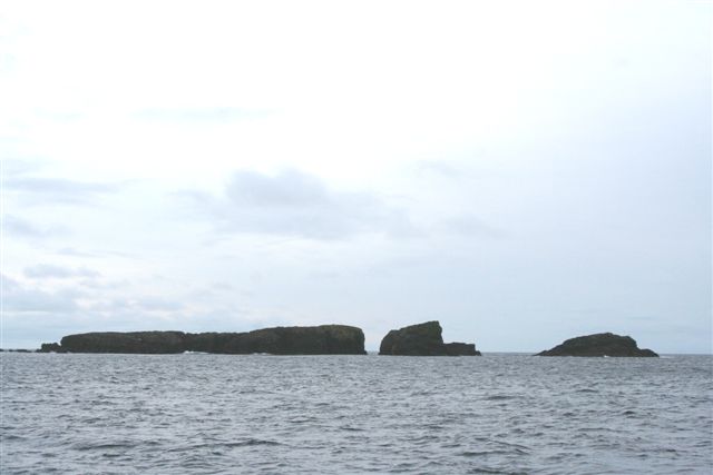
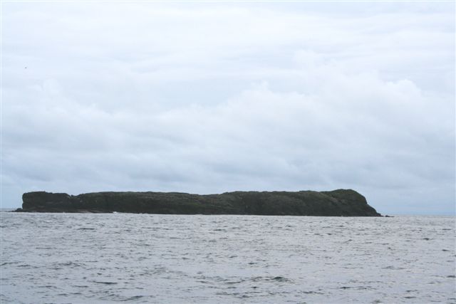
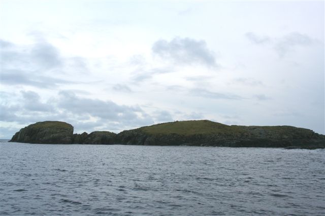
South Benelip Images

Images are sourced within 2km of 60.402844/-0.79423961 or Grid Reference HU6669. Thanks to Geograph Open Source API. All images are credited.

Housay, Out Skerries, Shetland Housay, Out Skerries, Shetland. Facing south-east.
Housay, Out Skerries, Shetland
Housay, Out Skerries, Shetland. Facing south-east.
Collapsed cave on west Out Skerries Da Steig, a collapsed cave separates the island of Mio Ness to the mainland
Collapsed cave on west Out Skerries
Da Steig, a collapsed cave separates the island of Mio Ness to the mainland
Cobbi Geo - West Isle, Out Skerries Looking North along Cobbi Geo on West Isle, Out Skerries, Shetland
Cobbi Geo - West Isle, Out Skerries
Looking North along Cobbi Geo on West Isle, Out Skerries, Shetland
Benelips, Out Skerries The Benelips and small isles and skerries to the south-west of Out Skerries, Shetland.
Benelips, Out Skerries
The Benelips and small isles and skerries to the south-west of Out Skerries, Shetland.
Filla with the Short and the long Guen
Short Guen and the Long Guen
Short Guen
Short Guen
South Benelip
South Benelip
South Benelip
South Benelip
North Benelip
North Benelip
Easter Skerries with Filla behind
Out Skerries: a rocky headland The whole of the land in this square comprises a rocky headland, the venture onto which would be better described as a clamber than a stroll.
Out Skerries: a rocky headland
The whole of the land in this square comprises a rocky headland, the venture onto which would be better described as a clamber than a stroll.
Out Skerries: a stripe in the rocks The whole of the land in this square comprises a rocky headland, the venture onto which would be better described as a clamber than a stroll. At this particular point, a very distinct stripe of white rock cuts through the surrounding grey.
Out Skerries: a stripe in the rocks
The whole of the land in this square comprises a rocky headland, the venture onto which would be better described as a clamber than a stroll. At this particular point, a very distinct stripe of white rock cuts through the surrounding grey.
Out Skerries: a triangular rockpool The whole of the land in this square comprises a rocky headland, the venture onto which would be better described as a clamber than a stroll. This tiny rockpool caught my eye, with its almost perfectly geometrical form.
Out Skerries: a triangular rockpool
The whole of the land in this square comprises a rocky headland, the venture onto which would be better described as a clamber than a stroll. This tiny rockpool caught my eye, with its almost perfectly geometrical form.
Out Skerries: rocks on a headland The whole of the land in this square comprises a rocky headland, the venture onto which would be better described as a clamber than a stroll.
Out Skerries: rocks on a headland
The whole of the land in this square comprises a rocky headland, the venture onto which would be better described as a clamber than a stroll.
Out Skerries: view across an unnamed inlet The whole of the land in this square comprises a rocky headland, the venture onto which would be better described as a clamber than a stroll.
Out Skerries: view across an unnamed inlet
The whole of the land in this square comprises a rocky headland, the venture onto which would be better described as a clamber than a stroll.
Ward of Mioness Climbed down to explore both Geos before climbing back up to bag this interesting TuMP with Tricky Speirs.
Name: Ward of Mioness
Hill number: 104080
Height: 48m / 157ft
Area: 22: Shetland Islands
Class: 0
Grid ref: HU666706 (est)
Drop: 48m
Col: Sea
Ward of Mioness
Climbed down to explore both Geos before climbing back up to bag this interesting TuMP with Tricky Speirs. Name: Ward of Mioness Hill number: 104080 Height: 48m / 157ft Area: 22: Shetland Islands Class: 0 Grid ref: HU666706 (est) Drop: 48m Col: Sea
Show me another place!

South Benelip is located at Grid Ref: HU6669 (Lat: 60.402844, Lng: -0.79423961)

Unitary Authority: Shetland Islands

Police Authority: Highlands and Islands

What 3 Words

///caged.towels.statement. Near Symbister, Shetland Islands

Related Wikis

Out Skerries

The Out Skerries are an archipelago of islets, some inhabited, in Shetland, Scotland, and are the easternmost part of Shetland. Locally, they are usually...

Housay

Housay (Scots: Housay), also known as West Isle, is one of the three islands that form the Out Skerries island group, the most easterly part of the Shetland...

Bruray

Bruray (Scots: Bruray) is one of the three Out Skerries islands of Shetland, and contains Scotland's most easterly settlement. It is separated from Housay...

Grunay

Grunay is an uninhabited island in the Out Skerries group, the most easterly part of Shetland, Scotland. Its area is 55.58 acres, or 22.49 hectares. The...

Bound Skerry

Bound Skerry is part of the Out Skerries group in the Shetland Islands. As well as being the most easterly island of that group, it is also the easternmost...

Outer Holm of Skaw

The Outer Holm of Skaw is a small, uninhabited islet, a rock outlier off the northeast coast of the island of Whalsay, in the Shetland Islands of Scotland...

Inner Holm of Skaw

The Inner Holm of Skaw is a small, uninhabited islet off the northern tip of the island of Whalsay, in the Shetland Islands of Scotland, north of the village...

Nista

Nista is a small islet of the Shetland Islands of Scotland, situated roughly 2 kilometres (1.2 mi) east off the coast of Whalsay. It lies to the north...

Have you been to South Benelip?

Leave your review of South Benelip below (or comments, questions and feedback).