Birka Stack
Island in Shetland
Scotland
Birka Stack

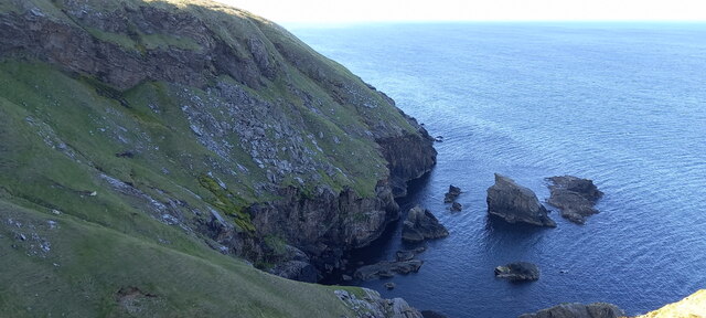
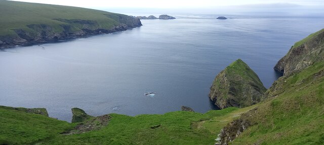
Birka Stack is a small, uninhabited island located in the Shetland archipelago, off the north coast of Scotland. Situated approximately 1.5 miles west of the main island of Fetlar, Birka Stack is part of the Fetlar National Nature Reserve.
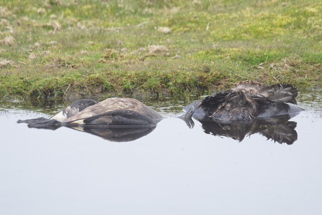
The island is characterized by its distinct rocky stack formation, which rises steeply from the surrounding waters. The stack is composed of volcanic rock and stands at an impressive height of around 46 meters (150 feet). Its jagged cliffs provide nesting sites for a variety of seabirds, including fulmars, guillemots, and puffins.
Access to Birka Stack is limited due to its remote location and lack of facilities. However, it is often visited by birdwatchers and nature enthusiasts, who are drawn to the island's rich birdlife. Boats can be chartered from nearby Fetlar or other surrounding islands for those wishing to explore the area.
The waters surrounding Birka Stack are also known for their biodiversity, with seals and otters often spotted in the vicinity. The island itself is covered in grasses and heather, providing a habitat for a range of plant species.
Birka Stack is not only a picturesque and ecologically significant site but also holds historical importance. The island is named after an ancient Norse trading settlement, indicating the Viking presence in the area during the medieval period.
Overall, Birka Stack offers a unique and captivating natural experience, showcasing the rugged beauty and diverse wildlife of the Shetland Islands.
If you have any feedback on the listing, please let us know in the comments section below.
Birka Stack Images
Images are sourced within 2km of 60.832743/-0.84876141 or Grid Reference HP6217. Thanks to Geograph Open Source API. All images are credited.


Birka Stack is located at Grid Ref: HP6217 (Lat: 60.832743, Lng: -0.84876141)
Unitary Authority: Shetland Islands
Police Authority: Highlands and Islands
What 3 Words
///verve.hood.trickles. Near Haroldswick, Shetland Islands
Nearby Locations
Related Wikis

RAF Saxa Vord
Remote Radar Head Saxa Vord or RRH Saxa Vord (aka RAF Saxa Vord), is a Royal Air Force radar station located on the island of Unst, the most northern of...

Hermaness
Hermaness is the northernmost headland of Unst, the most northerly inhabited island of Shetland, Scotland. It consists of huge sea cliffs and moorland...

Muckle Flugga
Muckle Flugga () is a small rocky island north of Unst in the Shetland Islands, Scotland. It is often described as the northernmost point of the British...

Skaw, Unst
Skaw is a settlement in the Scottish archipelago of Shetland, located on the island of Unst. It is located north of Haroldswick on a peninsula in the northeast...

Out Stack
Out Stack or Ootsta is an island in Shetland, Scotland and the northernmost point of both Scotland and the British Isles. It lies 600 m (2,000 ft) northeast...

Burrafirth
Burrafirth links (Old Norse: Borgarfjorðr, meaning "the fjord with a castle") is a strip of land with a few houses on the island of Unst, Shetland, Scotland...

Saxa Vord distillery
Saxa Vord distillery is a Scotch whisky and gin distillery on the island of Unst, part of the Shetland islands. The distillery takes its name from its...

Valhalla Brewery
The Valhalla Brewery in Unst, Shetland, Scotland, was the northernmost brewery in the United Kingdom. It was opened by the husband and wife team Sonny...
Nearby Amenities
Located within 500m of 60.832743,-0.84876141Have you been to Birka Stack?
Leave your review of Birka Stack below (or comments, questions and feedback).