Hascosay

Island in Shetland

Scotland

Hascosay

Crags, Punds Geo View from Fetlar to a small crag on the coast of Hascosay.
Crags, Punds Geo Credit: Richard Webb

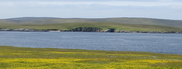
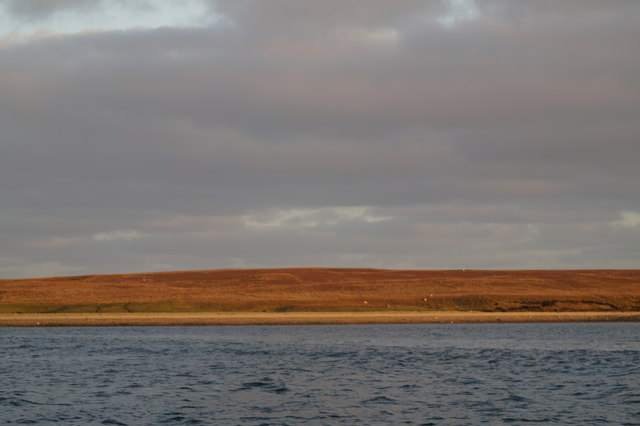
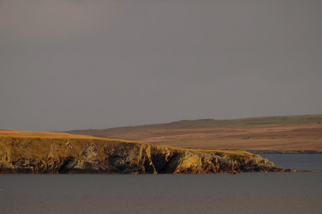
Hascosay is a small island located in the Shetland archipelago, situated off the northeast coast of Scotland. It is one of the many islands that make up the Shetland Islands, which are known for their stunning landscapes and rich cultural heritage. Hascosay covers an area of approximately 90 hectares and is surrounded by the North Sea.

Despite its small size, Hascosay boasts a diverse range of habitats, including rocky shorelines, coastal grasslands, and heathland. The island is home to a variety of bird species, making it a popular spot for birdwatchers. Visitors may catch a glimpse of puffins, razorbills, guillemots, and various seabirds nesting along the cliffs.

The island has a long history, with evidence of human occupation dating back thousands of years. Archaeological finds include remnants of Viking settlements and ancient burial sites. Today, Hascosay is uninhabited, but it still serves as grazing land for sheep and ponies.

Access to Hascosay is limited, as there are no regular ferry services to the island. However, it is possible to arrange private boat trips or join guided tours to explore its natural beauty. Visitors are advised to dress appropriately for the unpredictable Shetland weather and to bring their own supplies, as there are no facilities or services available on the island.

Overall, Hascosay offers a secluded and untouched natural environment, making it an ideal destination for those seeking tranquility and a connection with the rugged landscapes of the Shetland Islands.

If you have any feedback on the listing, please let us know in the comments section below.

Hascosay Images

Images are sourced within 2km of 60.611682/-0.99134925 or Grid Reference HU5592. Thanks to Geograph Open Source API. All images are credited.

Crags, Punds Geo View from Fetlar to a small crag on the coast of Hascosay.
Crags, Punds Geo
View from Fetlar to a small crag on the coast of Hascosay.
Black Guillemot (Cepphus grylle), Djuba Wick, Hascosay A Tystie, as they are known locally, in winter plumage.
Black Guillemot (Cepphus grylle), Djuba Wick, Hascosay
A Tystie, as they are known locally, in winter plumage.
Salmon farm in Djuba Wick, Hascosay
Salmon farm in Djuba Wick, Hascosay The round grey floating structure, known as a 'salmon barge' is basically a huge feed container, the black tubes leading out of it going to feeders in the cages, all controlled by computer and radio relays from on land.
Salmon farm in Djuba Wick, Hascosay
The round grey floating structure, known as a 'salmon barge' is basically a huge feed container, the black tubes leading out of it going to feeders in the cages, all controlled by computer and radio relays from on land.
Headland west of Djuba Wick, Hascosay
Virdi Taing, Hascosay From the salmon farm in Djuba Wick.
Virdi Taing, Hascosay
From the salmon farm in Djuba Wick.
Virdi Taing, Hascosay
Common Eider (Somateria mollissima), Djuba Wick, Hascosay One of a flock feeding around the salmon farm.
Common Eider (Somateria mollissima), Djuba Wick, Hascosay
One of a flock feeding around the salmon farm.
Salmon barge, Djuba Wick, Hascosay The round grey floating structure, known as a 'salmon barge' is basically a huge feed container, the black tubes leading out of it going to feeders in the cages, all controlled by computer and radio relays from on land.
Salmon barge, Djuba Wick, Hascosay
The round grey floating structure, known as a 'salmon barge' is basically a huge feed container, the black tubes leading out of it going to feeders in the cages, all controlled by computer and radio relays from on land.
Salmon farm off Basta Ness
North end of the Bow of Hascosay
MV Norholm in Hascosay Sound
Sunset beyond Hascosay The sun sets behind Yell; taken from the sea south of Linga.
Sunset beyond Hascosay
The sun sets behind Yell; taken from the sea south of Linga.
Herring Gull (Larus argentatus), Djuba Wick, Hascosay A second-winter bird, looking for easy pickings around a salmon-farm.
Herring Gull (Larus argentatus), Djuba Wick, Hascosay
A second-winter bird, looking for easy pickings around a salmon-farm.
Greybearded Man, Hascosay, from the Ness of Vatsetter
Ba Taing, Hascosay, from the Ness of Vatsetter
Looking across Housa Wick towards the west end of Hascosay
Hascosay Sound from Hascosay
Show me another place!

Hascosay is located at Grid Ref: HU5592 (Lat: 60.611682, Lng: -0.99134925)

Unitary Authority: Shetland Islands

Police Authority: Highlands and Islands

What 3 Words

///trying.tunes.balancing. Near Gutcher, Shetland Islands

Nearby Locations

Hascosay

Related Wikis

Hascosay

Hascosay (Scots: Hascosay; Old Norse "Hafskotsey") is a small island lying between Yell and Fetlar in the Shetland Islands, Scotland. == Geography and... ==

Brough Lodge

Brough Lodge is a 19th-century Gothic mansion on Fetlar, one of the Shetland Islands, in northern Scotland. Built by the Nicolson family, who were responsible...

Burra Ness Broch

Burra Ness Broch is an iron-age broch located on the east coast of the island of Yell, Shetland, Scotland. == Location == Burra Ness Broch (grid reference...

Basta, Shetland

Basta is a hamlet on the island of Yell in the Shetland islands of Scotland. It is on the shores of Basta Voe and is in the parish of Yell. == References... ==

Nearby Amenities

Located within 500m of 60.611682,-0.99134925
Marker: yes
Lat/Long: 60.6144639/-0.9846159
The data included in this document is from www.openstreetmap.org. The data is made available under ODbL.

Have you been to Hascosay?

Leave your review of Hascosay below (or comments, questions and feedback).