Whilkie Stack

Island in Shetland

Scotland

Whilkie Stack

Gloup Holm from Valla Field The holm is on the right, with the mainland of Yell to the left.
Gloup Holm from Valla Field Credit: Mike Pennington

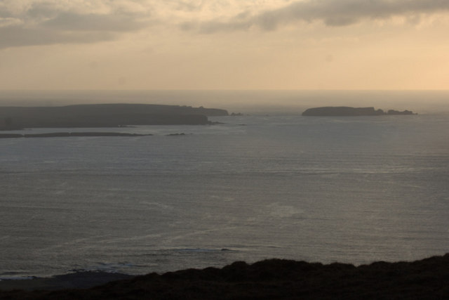
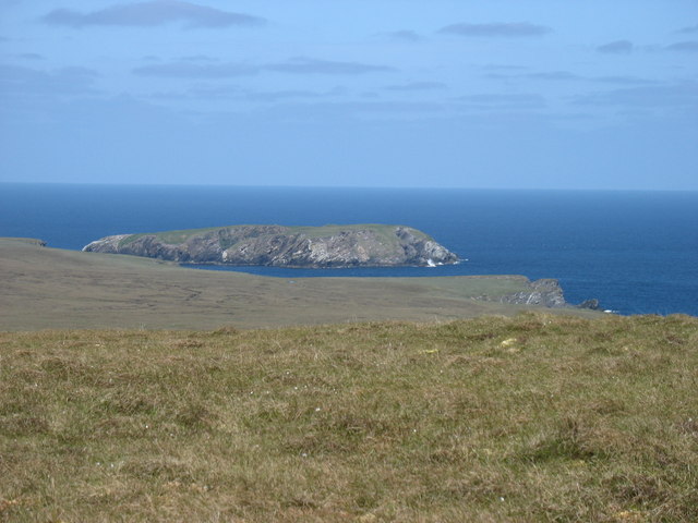
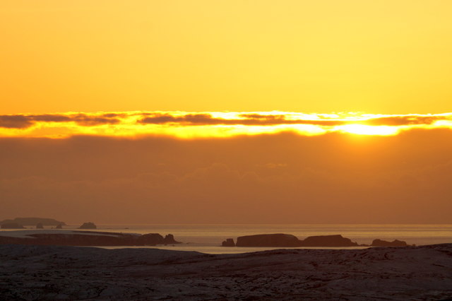
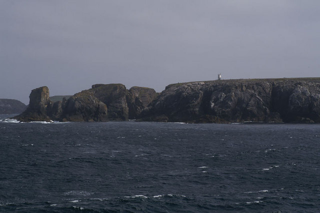
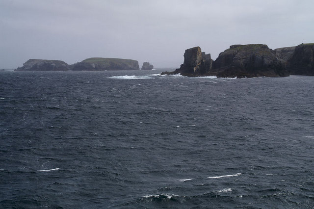
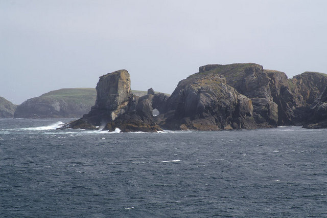
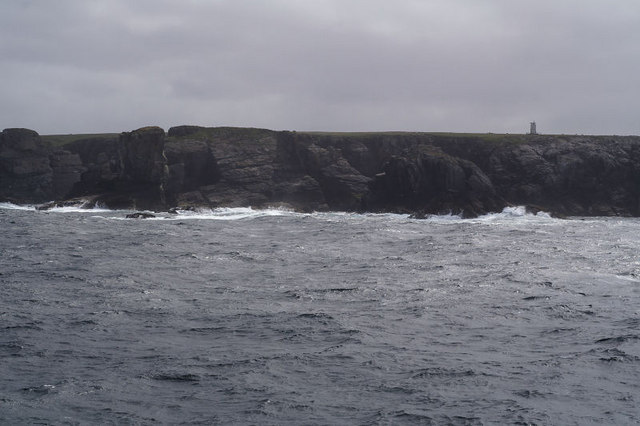
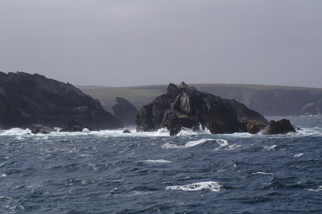
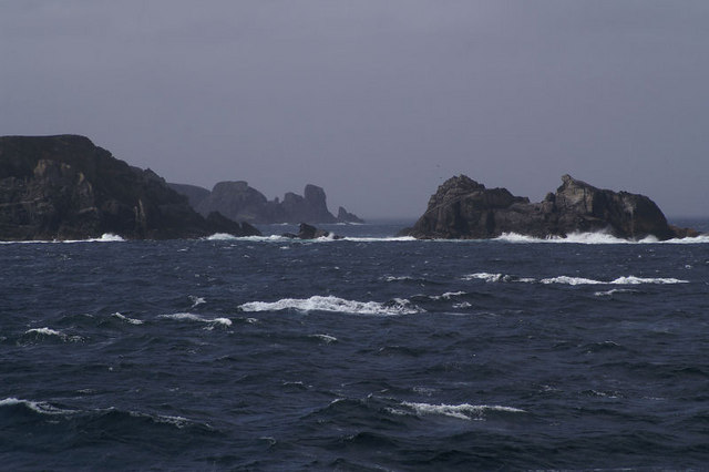
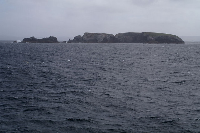
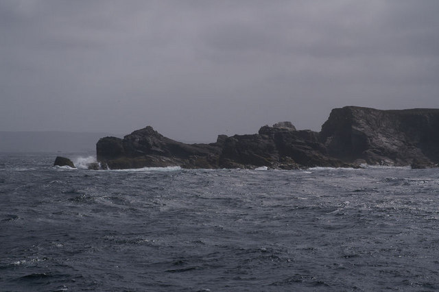
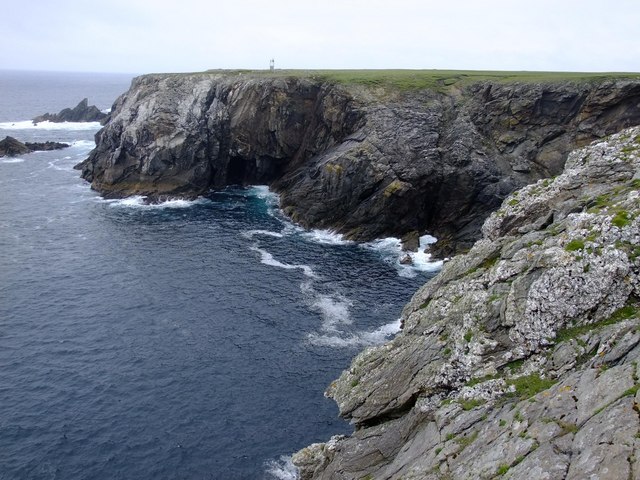
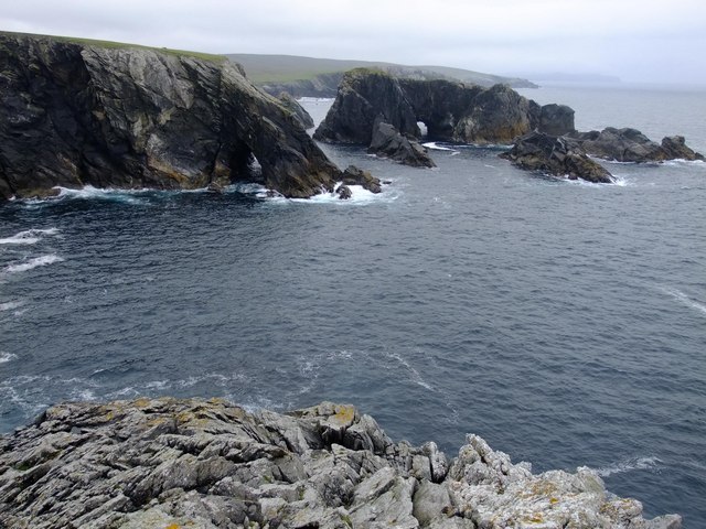
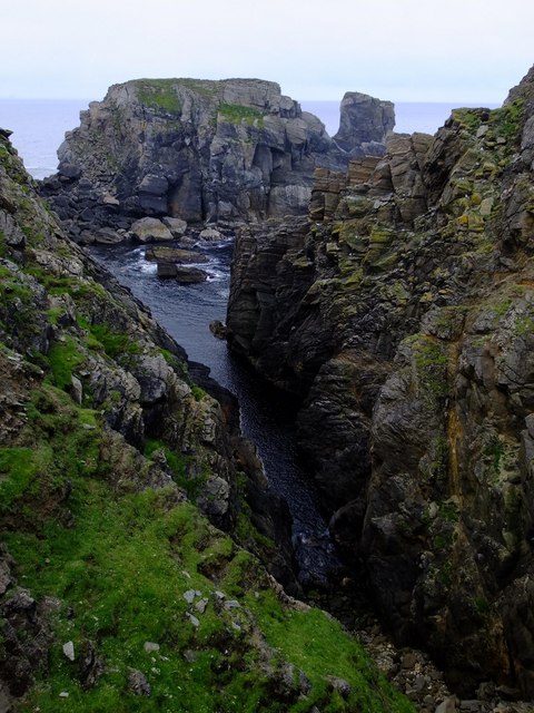
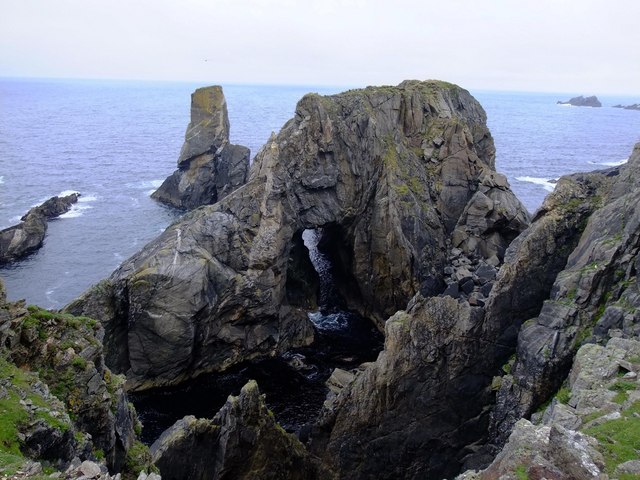
Whilkie Stack is a small rocky island located off the coast of Shetland, an archipelago in the North Atlantic Ocean. It is situated approximately 3 kilometers northeast of the town of Lerwick, the capital of the Shetland Islands, Scotland. The island is known for its distinctive natural formation, a tall, solitary sea stack that rises dramatically from the surrounding waters.

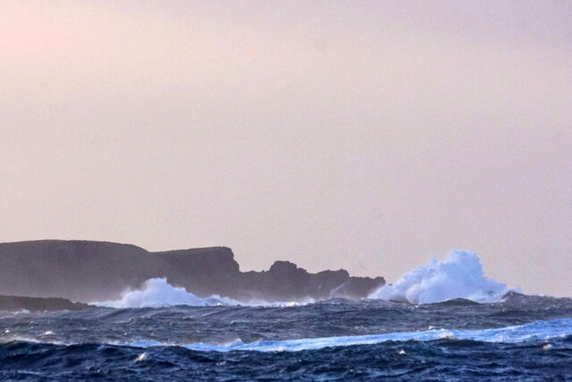
Whilkie Stack is composed of rugged and weathered rocks, showcasing the powerful forces of erosion that have shaped it over centuries. With its steep sides and jagged edges, the sea stack stands at an impressive height of around 30 meters. Its isolated location, combined with the crashing waves and swirling currents, creates a breathtaking sight that attracts photographers, nature enthusiasts, and birdwatchers.

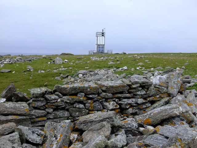
The island itself is uninhabited due to its remote and inaccessible nature. However, Whilkie Stack is a haven for a variety of seabirds, including fulmars, guillemots, and puffins, which nest and breed on its cliffs. The surrounding waters are also home to marine life such as seals, dolphins, and occasionally even whales.

Access to Whilkie Stack is limited, as it can only be reached by boat or from the air. This has helped to preserve its natural beauty and protect the fragile ecosystem that exists on and around the island. Visitors can enjoy the stunning views of the sea stack from viewing points along the coast or take guided boat tours to observe the wildlife and experience the awe-inspiring presence of Whilkie Stack up close.

If you have any feedback on the listing, please let us know in the comments section below.

Whilkie Stack Images

Images are sourced within 2km of 60.73529/-1.1155627 or Grid Reference HP4806. Thanks to Geograph Open Source API. All images are credited.

Gloup Holm from Valla Field The holm is on the right, with the mainland of Yell to the left.
Gloup Holm from Valla Field
The holm is on the right, with the mainland of Yell to the left.
Gloup Holm and waves from Westing
Gloup Holm Seen from Scordaback Hill.
Gloup Holm
Seen from Scordaback Hill.
Sunset beyond Gloup Holm from Sothers Field
Coast between Aastack Geo and Bagi Stack The north-west corner of Yell, with the small light on the un-named headland above Bagi stack. The light is misplaced on both 1:50,000 and 1:25,000 maps, but according to Google Earth, magic.defra.gov.uk (and this photo) it is in this square and on this un-named headland. Taken from one of the Yell Sound ferries on a North Isles cruise.
Coast between Aastack Geo and Bagi Stack
The north-west corner of Yell, with the small light on the un-named headland above Bagi stack. The light is misplaced on both 1:50,000 and 1:25,000 maps, but according to Google Earth, magic.defra.gov.uk (and this photo) it is in this square and on this un-named headland. Taken from one of the Yell Sound ferries on a North Isles cruise.
North-west Yell Bagi Stack and, further out on the left, Gloup Holm. Taken from one of the Yell Sound ferries on a North Isles cruise.
North-west Yell
Bagi Stack and, further out on the left, Gloup Holm. Taken from one of the Yell Sound ferries on a North Isles cruise.
Natural arch off the coast of north-west Yell According to the 1:25,000 map, this may be Grey Stack, although the names of the stacks (and the location of the light) are rather obscure. Taken from one of the Yell Sound ferries on a North Isles cruise.
Natural arch off the coast of north-west Yell
According to the 1:25,000 map, this may be Grey Stack, although the names of the stacks (and the location of the light) are rather obscure. Taken from one of the Yell Sound ferries on a North Isles cruise.
Bagi Stack from the north With the small light on the headland beyond. Taken from one of the Yell Sound ferries on a North Isles cruise.
Bagi Stack from the north
With the small light on the headland beyond. Taken from one of the Yell Sound ferries on a North Isles cruise.
The Clapper, Gloup Holm A stack beside Gloup Holm. Taken from one of the Yell Sound ferries on a North Isles cruise.
The Clapper, Gloup Holm
A stack beside Gloup Holm. Taken from one of the Yell Sound ferries on a North Isles cruise.
The Clapper With Gloup Holm on the left and Bagi Stack through the gap. Taken from one of the Yell Sound ferries on a North Isles cruise.
The Clapper
With Gloup Holm on the left and Bagi Stack through the gap. Taken from one of the Yell Sound ferries on a North Isles cruise.
Gloup Holm With the Clapper on the left. Taken from one of the Yell Sound ferries on a North Isles cruise.
Gloup Holm
With the Clapper on the left. Taken from one of the Yell Sound ferries on a North Isles cruise.
The Clapper A stack off Gloup Holm. Taken from one of the Yell Sound ferries on a North Isles cruise.
The Clapper
A stack off Gloup Holm. Taken from one of the Yell Sound ferries on a North Isles cruise.
Aastack Geo The geograph for this page in fact covers half of HP4705 and half of HP4704, and should in fact have a supplementary classification.  The light-house is shown at a different location on both the 1:50,000 and 1:25,000 maps, but neither are correct as it is at HP47840496 according to my GPS.
Aastack Geo
The geograph for this page in fact covers half of HP4705 and half of HP4704, and should in fact have a supplementary classification. The light-house is shown at a different location on both the 1:50,000 and 1:25,000 maps, but neither are correct as it is at HP47840496 according to my GPS.
Looking south across Aastack Geo
Bagi Stack Light-house This modern, steel-clad metal framework light-house is not at the position shown on either of the 1:50,000 or 1:25,000 maps, but (according to my GPS) is located at HP47840496.  It flashes 4 times every 20 seconds and has a nominal range of 10 nautical miles.
Bagi Stack Light-house
This modern, steel-clad metal framework light-house is not at the position shown on either of the 1:50,000 or 1:25,000 maps, but (according to my GPS) is located at HP47840496. It flashes 4 times every 20 seconds and has a nominal range of 10 nautical miles.
Grey Stack from Bagi Stack
Bagi Stack, North Neaps The huge boulders between the stack and the mainland are probably the result of the collapse of a sea-arch.
Bagi Stack, North Neaps
The huge boulders between the stack and the mainland are probably the result of the collapse of a sea-arch.
Sea stack, Birrier
Sea stack, Birrier
Show me another place!

Whilkie Stack is located at Grid Ref: HP4806 (Lat: 60.73529, Lng: -1.1155627)

Unitary Authority: Shetland Islands

Police Authority: Highlands and Islands

What 3 Words

///blip.blues.musically. Near Gutcher, Shetland Islands

Related Wikis

Gloup Holm

Gloup Holm is an islet in the Shetland Islands, lying to the north of Yell. == Geography and geology == Gloup Holm is near to the part of Yell called North...

Gloup

Note: Gloup is common in Scottish placenames referring to a sea jet. Gloup is a village in the far north of the island of Yell in the Shetland Islands...

Cullivoe

Cullivoe (Old Norse: Kollavágr - Bay of Kolli), is a village on Yell in the Shetland Islands. It is in the north east of the island, near Bluemull Sound...

Brough Holm

Brough Holm is a small island off Unst, in the North Isles of Shetland. It is off Westing, which as the name implies is on the west coast of Unst. The...

St Olaf's Church, Unst

St Olaf's Church, Unst is a ruined medieval church located on the island of Unst, in Shetland, Scotland, UK. The church was built in the Celtic style,...

Society of Our Lady of the Isles

The Society of Our Lady of the Isles (SOLI) is a small Anglican religious order for women, founded in the late 20th century. It is located in Shetland...

Bluemull Sound

Bluemull Sound is the strait between Unst and Yell in Shetland's North Isles. A ferry service crosses it regularly. Cullivoe is on the Yell side, and the...

Gutcher

Gutcher is a settlement on the northeast coast of Yell in the Shetland islands. From here, rollon/roll off ferry services to Belmont on Unst and Hamars...

Have you been to Whilkie Stack?

Leave your review of Whilkie Stack below (or comments, questions and feedback).