Little Herbert's

Settlement in Gloucestershire Cheltenham

England

Little Herbert's

Field corner and gate
Field corner and gate Credit: don cload

Little Herbert's is a picturesque village nestled in the county of Gloucestershire, England. Situated in the heart of the Cotswolds, this charming hamlet offers a delightful blend of natural beauty, historical significance, and a close-knit community.

The village's origins can be traced back to the 12th century, with remnants of its medieval past still visible in the form of quaint cottages and ancient stone walls. The centerpiece of Little Herbert's is its Grade II listed church, St. Mary's, which dates back to the 13th century and boasts stunning stained glass windows and intricate architectural details.

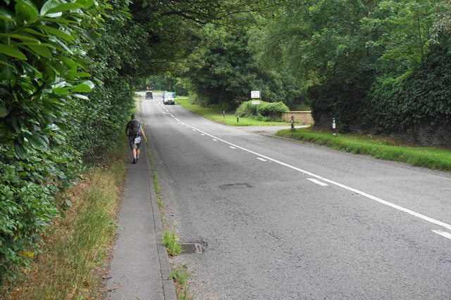
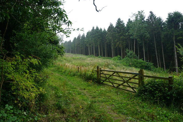
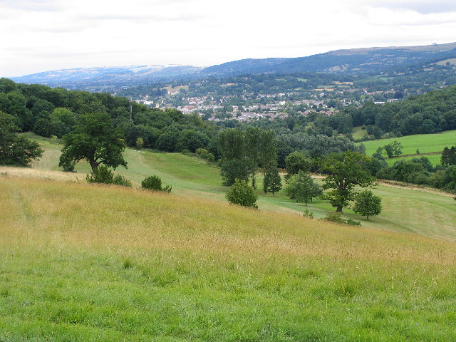
Surrounded by rolling hills and lush countryside, Little Herbert's is a haven for nature enthusiasts. The village is blessed with an abundance of walking and cycling trails, allowing visitors to explore the idyllic landscapes and take in breathtaking views. The nearby Herbert's Woods provides a serene setting for picnics and leisurely strolls.

Despite its small size, Little Herbert's is a vibrant community with a strong sense of camaraderie. The village hosts various events throughout the year, including an annual summer fair and a Christmas market, fostering a warm and welcoming atmosphere for residents and visitors alike.

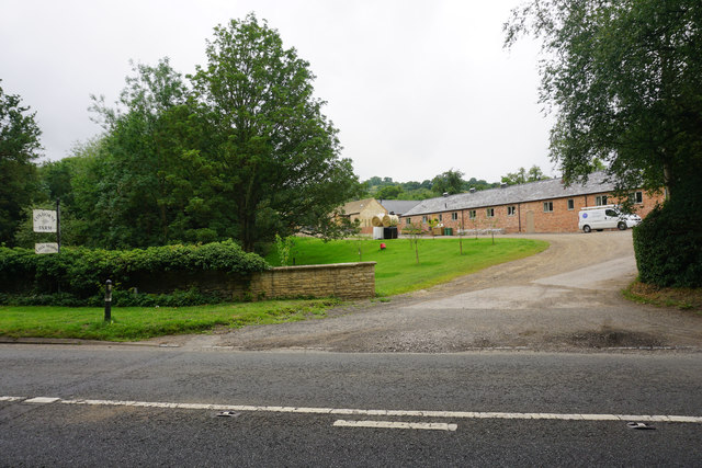
For those seeking a taste of rural life, Little Herbert's offers a handful of local businesses, including a traditional pub and a charming tearoom. These establishments serve as gathering spots for locals, where stories are shared and friendships are forged.

In conclusion, Little Herbert's encapsulates the quintessential English village experience. With its rich history, stunning natural surroundings, and tight-knit community, it is a hidden gem that captures the hearts of all who visit.

If you have any feedback on the listing, please let us know in the comments section below.

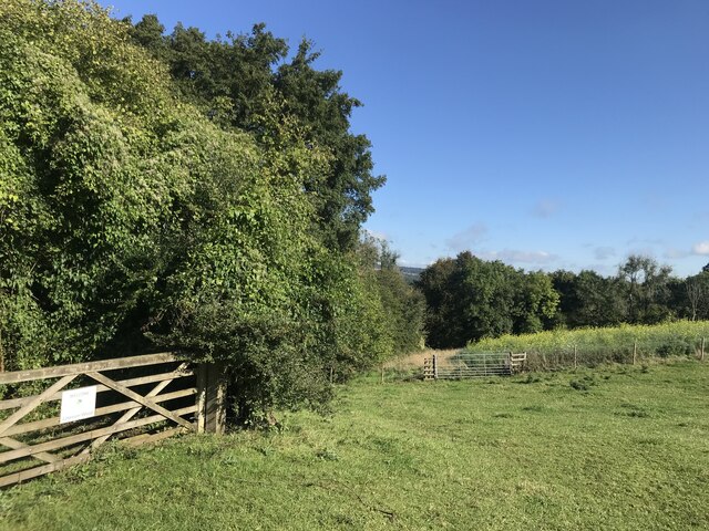
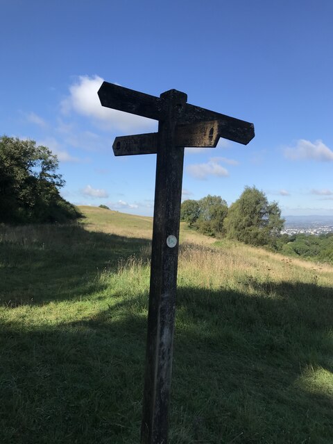
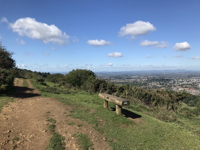
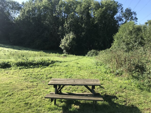
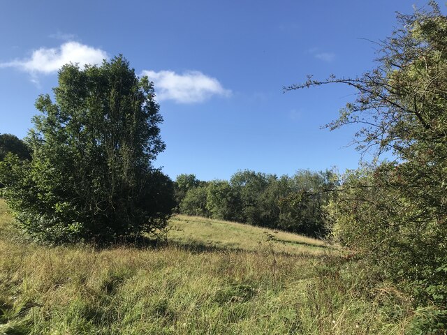
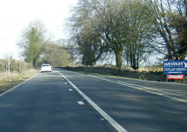
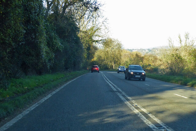
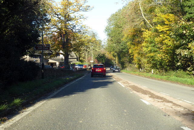
Little Herbert's Images

Images are sourced within 2km of 51.877798/-2.040353 or Grid Reference SO9719. Thanks to Geograph Open Source API. All images are credited.

Field corner and gate
Path junction on Ravensgate Common
Path and fence line
Path and fence line
Seat with a view
Seat with a view
Picnic bench
Picnic bench
Clearing in Lineover Wood
A436 at Wistley Hill
A435 Cirencester Road Towards Cheltenham.
A435 Cirencester Road
Towards Cheltenham.
A435 Cirencester Road Towards Cheltenham.
A435 Cirencester Road
Towards Cheltenham.
The A40 passing Coxhorne Farm This part of the road mercifully still has a pavement to walk on.
The A40 passing Coxhorne Farm
This part of the road mercifully still has a pavement to walk on.
Coxhorne Farm Right on the edge of the Cheltenham conurbation.
Coxhorne Farm
Right on the edge of the Cheltenham conurbation.
Derelict water treatment works below Dowdeswell Reservoir In the valley of the Chelt, which flows just beyond this site.
Derelict water treatment works below Dowdeswell Reservoir
In the valley of the Chelt, which flows just beyond this site.
Small industrial estate below Dowdeswell Right on the edge of the Cheltenham conurbation but well sited on the A40.
Small industrial estate below Dowdeswell
Right on the edge of the Cheltenham conurbation but well sited on the A40.
The Cotswold Way above Dowdeswell A damp day. I hoped for more of a view but the trees prevented that.
The Cotswold Way above Dowdeswell
A damp day. I hoped for more of a view but the trees prevented that.
Trees in Lineover Wood Many trees are young, but there are some mature ones too.
Trees in Lineover Wood
Many trees are young, but there are some mature ones too.
Hillside on Ravensgate Hill Travelling south on the Cotswold Way, this is the first view you get having emerged from Lineover Wood.
Hillside on Ravensgate Hill
Travelling south on the Cotswold Way, this is the first view you get having emerged from Lineover Wood.
Path coming off Wistley Hill This is the gentler side of the hill. The Cotswold Way uses this route to get round Lilley Brook.
Path coming off Wistley Hill
This is the gentler side of the hill. The Cotswold Way uses this route to get round Lilley Brook.
The Cotswold Way on Wistley Hill A pleasant stretch with open views, though a bit grey on this day.
The Cotswold Way on Wistley Hill
A pleasant stretch with open views, though a bit grey on this day.
Show me another place!

Little Herbert's is located at Grid Ref: SO9719 (Lat: 51.877798, Lng: -2.040353)

Administrative County: Gloucestershire

District: Cheltenham

Police Authority: Gloucestershire

What 3 Words

///donor.rents.leaves. Near Charlton Kings, Gloucestershire

Related Wikis

Balcarras School

Balcarras School is an academy school for 11- to 18-year-olds, located in Charlton Kings, Cheltenham, Gloucestershire, England. Since 2016, the school...

A40 road

The A40 is a trunk road which runs between London and Goodwick (Fishguard), Wales, and officially called The London to Fishguard Trunk Road (A40) in all...

Battledown

Battledown is a private residential estate in Cheltenham, Gloucestershire, England. In the 19th century a number of such private estates were established...

DoubleTree by Hilton Cheltenham

DoubleTree by Hilton Cheltenham (earlier known as Cheltenham Park Hotel), Charlton Kings, is a Regency building of historical significance. It was previously...

Charlton Kings railway station

Charlton Kings railway station was a small station in Gloucestershire serving the village of Charlton Kings and the southern outskirts of Cheltenham Spa...

Charlton Kings

Charlton Kings is a contiguous village adjoining Cheltenham in Gloucestershire, England. The area constitutes a civil parish of 10,396 residents (2011...

Oakley, Gloucestershire

Oakley is a district of Cheltenham in Gloucestershire, England. In the Domesday Book of 1086, it is recorded as held by Turstin FitzRolf. Oakley primarily...

Dowdeswell Reservoir

Dowdeswell Reservoir and former water treatment works lie below the parish of Dowdeswell in Gloucestershire. They were originally built by Cheltenham...

Nearby Amenities

Located within 500m of 51.877798,-2.040353
Bus Stop
Maple Drive
Bus: yes
Departures Board: timetable
Naptan AtcoCode: 1600GL350
Naptan Bearing: SE
Naptan CommonName: Maple Drive
Naptan Indicator: Opp
Naptan NaptanCode: glodwgad
Naptan PlusbusZoneRef: CHLTNHM
Naptan Street: Willow Rd
Naptan Verified: no
Public Transport: platform
Shelter: no
Source: naptan_import
Lat/Long: 51.8799852/-2.044684
Bus Stop
Cherry Avenue
Bus: yes
Departures Board: no
Naptan AtcoCode: 1600GLA194
Naptan Bearing: SE
Naptan CommonName: Cherry Ave
Naptan Indicator: Opp
Naptan NaptanCode: glodwgdg
Naptan Street: Willow Rd
Naptan Verified: no
Public Transport: platform
Shelter: no
Source: naptan_import
Lat/Long: 51.8789066/-2.0436621
Bus Stop
Ravensgate Road
Bus: yes
Naptan AtcoCode: 1600GLA501
Naptan Bearing: SE
Naptan CommonName: Ravensgate Rd
Naptan Indicator: Opp
Naptan NaptanCode: glodwdmt
Naptan PlusbusZoneRef: CHLTNHM
Naptan Street: Beeches Rd
Naptan Verified: no
Public Transport: platform
Shelter: no
Source: naptan_import
Lat/Long: 51.8778202/-2.0476206
Bus Stop
Ash Close
Bus: yes
Departures Board: no
Naptan AtcoCode: 1600GLA503
Naptan Bearing: N
Naptan CommonName: Beeches Rd
Naptan Indicator: Opp
Naptan NaptanCode: glodwgam
Naptan Street: Maple Drive
Naptan Verified: no
Public Transport: platform
Shelter: no
Source: naptan_import
Lat/Long: 51.877487/-2.0443326
Bus Stop
Larch Close
Bus: yes
Departures Board: no
Naptan AtcoCode: 1600GLA505
Naptan Bearing: NW
Naptan CommonName: Larch Close
Naptan Indicator: Opp
Naptan NaptanCode: glodwdwj
Naptan Street: Maple Drive
Naptan Verified: no
Public Transport: platform
Shelter: no
Source: naptan_import
Lat/Long: 51.8789646/-2.0454561
Bus Stop
London Rd
Bus: yes
Naptan AtcoCode: 1600GLA696
Naptan Bearing: NW
Naptan CommonName: London Rd
Naptan NaptanCode: glodwgpd
Naptan PlusbusZoneRef: CHLTNHM
Naptan Street: East End Rd
Naptan Verified: no
Public Transport: platform
Shelter: no
Source: naptan_import
Lat/Long: 51.8822575/-2.0394447
Charlton Kings Hotel
Addr City: Cheltenham
Addr Country: GB
Addr Place: Charlton Kings
Addr Postcode: GL52 6UU
Addr Street: London Road
Source: survey
Stars: 3
Tourism: hotel
Website: https://www.charltonkingshotel.co.uk/
Lat/Long: 51.8811339/-2.0371677
Beeches
Place: neighbourhood
Lat/Long: 51.8779143/-2.0461342
Revolution Laundry
Addr City: Cheltenham
Addr Housename: East End Service Station
Addr Postcode: GL52 6YY
Addr Street: London Road
Description: External, self-service machines
Email: contactuk@revolution-laundry.com
Self Service: yes
Shop: laundry
Website: https://www.revolution-laundry.com/
Lat/Long: 51.8821322/-2.0386907
Charging Station
East End Service Station
Access: yes
Capacity: 1
Fee: yes
Motorcar: yes
Operator: InstaVolt
Operator Wikidata: Q111173904
Ref: INS108041
Socket Chademo: 1
Socket Chademo Output: 50 kW
Socket Type2 Combo: 1
Socket Type2 Combo Output: 50 kW
Source: local knowledge
Lat/Long: 51.8821902/-2.038948
Entrance: yes
Lat/Long: 51.8772869/-2.0440123
Entrance: yes
Lat/Long: 51.8773334/-2.0443833
Entrance: yes
Lat/Long: 51.8814591/-2.0375536
Generator Solar Modules: 40
Generator Source: solar
Power: generator
Source: aerial imagery
Lat/Long: 51.881114/-2.0389321
Generator Solar Modules: 40
Generator Source: solar
Power: generator
Source: aerial imagery
Lat/Long: 51.8818673/-2.0386854
Generator Solar Modules: 40
Generator Source: solar
Power: generator
Source: aerial imagery
Lat/Long: 51.8810924/-2.038798
Post Box
Operator: Royal Mail
Operator Wikidata: Q638098
Ref: GL53 347
Lat/Long: 51.8781201/-2.044445
Give Way
Direction: forward
Lat/Long: 51.8784712/-2.0434888
Grit Bin
Lat/Long: 51.8818511/-2.0377674
Bus Stop
Cherry Avenue
Bus: yes
Departures Board: timetable
Naptan AtcoCode: 1600GLA504
Naptan Bearing: S
Naptan CommonName: Cherry Avenue
Naptan Indicator: corner of
Naptan NaptanCode: glodwgaj
Naptan PlusbusZoneRef: CHLTNHM
Naptan Street: Maple Drive
Naptan Verified: no
Public Transport: platform
Shelter: yes
Lat/Long: 51.877969/-2.0444127
Power: pole
Lat/Long: 51.8758673/-2.039548
Location Transition: yes
Power: pole
Lat/Long: 51.8765618/-2.0428475
Power: pole
Lat/Long: 51.8765199/-2.0426658
Power: pole
Lat/Long: 51.8763316/-2.0417639
Power: pole
Lat/Long: 51.8760228/-2.040284
Ashgrove Farm
Power: pole
Transformer: distribution
Voltage Primary: 11000
Lat/Long: 51.8753169/-2.0389938
Power: pole
Lat/Long: 51.8753012/-2.0372786
Power: pole
Lat/Long: 51.8756241/-2.0383555
Power: pole
Lat/Long: 51.8748301/-2.0357806
Location Transition: yes
Power: pole
Lat/Long: 51.8812394/-2.036266
The data included in this document is from www.openstreetmap.org. The data is made available under ODbL.

Have you been to Little Herbert's?

Leave your review of Little Herbert's below (or comments, questions and feedback).