Haywood, Little

Settlement in Staffordshire Stafford

England

Haywood, Little

Cottage by Colwich Lock in Staffordshire Colwich Lock (No 21) is on the Trent and Mersey Canal near Little Haywood. A public footpath crosses the bridge here.
Cottage by Colwich Lock in Staffordshire Credit: Roger D Kidd

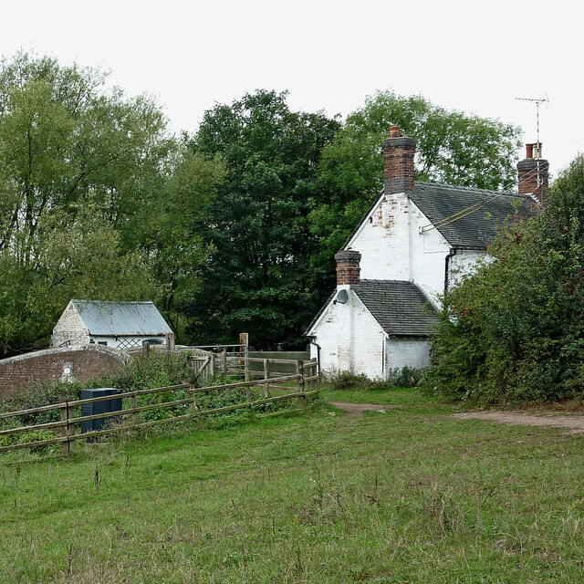
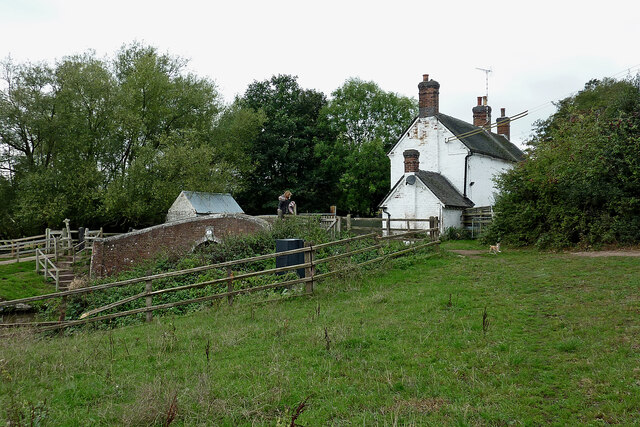
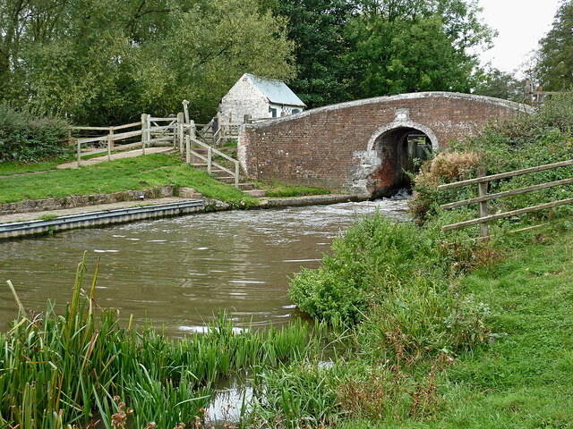
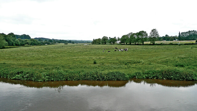
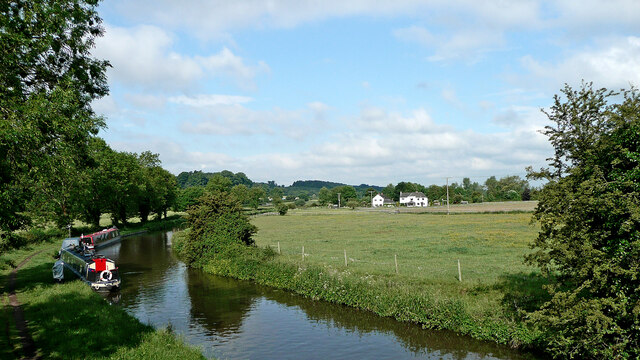
Haywood, Little is a small village located in the county of Staffordshire, England. It is situated approximately 5 miles south of the town of Stafford and is part of the civil parish of Coton Clanford. The village is surrounded by picturesque countryside, with rolling hills and fields making up its landscape.

Haywood, Little is known for its tranquil and rural atmosphere, providing a peaceful retreat from the hustle and bustle of city life. The village is characterized by its charming cottages and traditional architecture, giving it a quintessentially English feel.

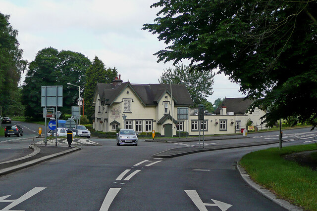
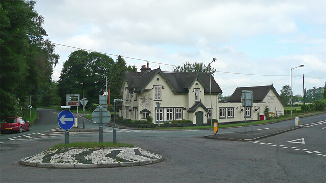
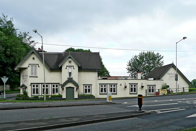
Despite its small size, Haywood, Little offers a range of amenities to its residents. There is a local pub, The Haywood Inn, which is a popular meeting place for locals and visitors alike. The village also has a primary school, providing education for the children of the community.

The surrounding area provides ample opportunities for outdoor activities, with numerous walking and cycling routes available. The nearby Cannock Chase, an Area of Outstanding Natural Beauty, is a popular destination for nature lovers and offers a diverse range of flora and fauna.

Haywood, Little benefits from its close proximity to Stafford, which provides more extensive amenities such as supermarkets, shops, and leisure facilities. The village is well-connected to the wider area through a network of roads, with the M6 motorway being easily accessible.

Overall, Haywood, Little offers a peaceful and idyllic rural lifestyle, with a close-knit community and access to both natural beauty and nearby amenities.

If you have any feedback on the listing, please let us know in the comments section below.

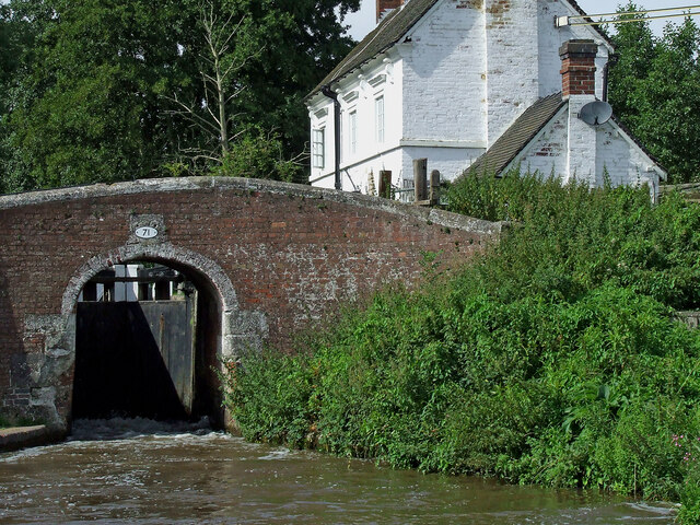
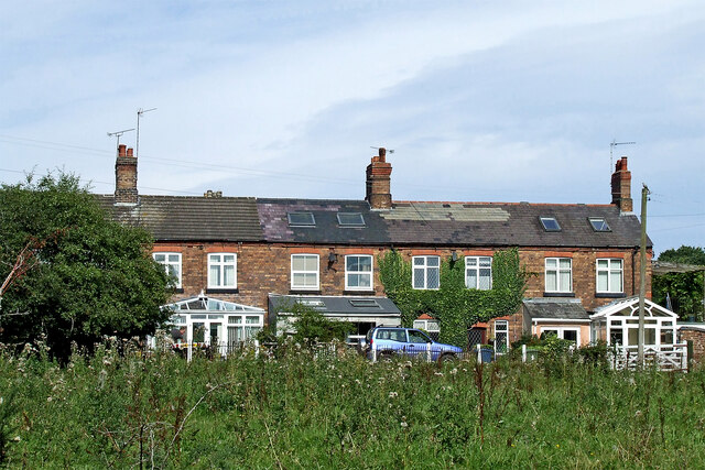
Haywood, Little Images

Images are sourced within 2km of 52.791046/-1.994036 or Grid Reference SK0021. Thanks to Geograph Open Source API. All images are credited.

Cottage by Colwich Lock in Staffordshire Colwich Lock (No 21) is on the Trent and Mersey Canal near Little Haywood. A public footpath crosses the bridge here.
Cottage by Colwich Lock in Staffordshire
Colwich Lock (No 21) is on the Trent and Mersey Canal near Little Haywood. A public footpath crosses the bridge here.
Cottage and canal bridge near Colwich in Staffordshire Colwich Lock (No 21) is on the Trent and Mersey Canal near Little Haywood. A public footpath crosses the bridge here.
Cottage and canal bridge near Colwich in Staffordshire
Colwich Lock (No 21) is on the Trent and Mersey Canal near Little Haywood. A public footpath crosses the bridge here.
Colwich Bridge near Little Haywood in Staffordshire Bridge No 72 across the Trent and Mersey Canal is immediately below Colwich Lock.
Notice the turbulence in the water below the bridge. The lock paddles have bee raised, and water is gushing through. A narrowboat will emerge very soon.

<a href="https://www.geograph.org.uk/photo/2662653">SK0021 : Colwich Bridge near Little Haywood in Staffordshire</a>

The Trent and Mersey Canal is 93.5 miles in length from Derwent Mouth to Preston Brook. The first sod was cut by Josiah Wedgwood in July 1766 at Middleport (Stoke-on-Trent). The eastern section between Derwent Mouth and Shugborough (the junction with the Staffordshire and Worcestershire Canal) was already operational by 1770 and the whole canal through to Preston Brook, where it linked with the Bridgewater Canal was open for business by 1777. James Brindley was the engineer until his death in 1772.
Colwich Bridge near Little Haywood in Staffordshire
Bridge No 72 across the Trent and Mersey Canal is immediately below Colwich Lock. Notice the turbulence in the water below the bridge. The lock paddles have bee raised, and water is gushing through. A narrowboat will emerge very soon. SK0021 : Colwich Bridge near Little Haywood in Staffordshire The Trent and Mersey Canal is 93.5 miles in length from Derwent Mouth to Preston Brook. The first sod was cut by Josiah Wedgwood in July 1766 at Middleport (Stoke-on-Trent). The eastern section between Derwent Mouth and Shugborough (the junction with the Staffordshire and Worcestershire Canal) was already operational by 1770 and the whole canal through to Preston Brook, where it linked with the Bridgewater Canal was open for business by 1777. James Brindley was the engineer until his death in 1772.
Canal south-east of Colwich in Staffordshire This is the Trent and Mersey Canal approaching Wolseley Bridge, No 70.
Canal south-east of Colwich in Staffordshire
This is the Trent and Mersey Canal approaching Wolseley Bridge, No 70.
Canal south-east of Colwich in Staffordshire This is the Trent and Mersey Canal approaching Wolseley Bridge, No 70.
Canal south-east of Colwich in Staffordshire
This is the Trent and Mersey Canal approaching Wolseley Bridge, No 70.
Wolseley Bridge near Colwich in Staffordshire Wolseley Bridge is No 70 across the Trent and Mersey Canal. It carries the A51 between Stone and Rugeley.
Wolseley Bridge near Colwich in Staffordshire
Wolseley Bridge is No 70 across the Trent and Mersey Canal. It carries the A51 between Stone and Rugeley.
Trent and Mersey Canal near Colwich, Staffordshire Looking east on a dull morning from near Wolseley Bridge as the canal meanders towards Rugeley.
Trent and Mersey Canal near Colwich, Staffordshire
Looking east on a dull morning from near Wolseley Bridge as the canal meanders towards Rugeley.
Moored narrowboats near Colwich in Staffordshire This is the Trent and Mersey Canal on a dull morning north-west of Wolseley Bridge, between Great Haywood and Rugeley.
Moored narrowboats near Colwich in Staffordshire
This is the Trent and Mersey Canal on a dull morning north-west of Wolseley Bridge, between Great Haywood and Rugeley.
Moored narrowboats near Colwich in Staffordshire This is the Trent and Mersey Canal north-west of Wolseley Bridge, between Great Haywood and Rugeley.
Moored narrowboats near Colwich in Staffordshire
This is the Trent and Mersey Canal north-west of Wolseley Bridge, between Great Haywood and Rugeley.
London Road near Little Haywood, Staffordshire This is the A51 London Road, looking south-east towards the A513 junction, and Rugeley. The bridge ahead crosses the River Trent.
London Road near Little Haywood, Staffordshire
This is the A51 London Road, looking south-east towards the A513 junction, and Rugeley. The bridge ahead crosses the River Trent.
River Trent near Little Haywood in Staffordshire Looking downstream, north-west from London Road (A51) at Wolseley Bridge.
River Trent near Little Haywood in Staffordshire
Looking downstream, north-west from London Road (A51) at Wolseley Bridge.
Pasture by the River Trent in Staffordshire Looking across the River Trent from Wolseley Bridge, south-east of Colwich. The lin of trees beyond the grazing cattle is by the Trent and Mersey Canal.
Pasture by the River Trent in Staffordshire
Looking across the River Trent from Wolseley Bridge, south-east of Colwich. The lin of trees beyond the grazing cattle is by the Trent and Mersey Canal.
The Wolseley Arms near Colwich in Staffordshire Looking west-north-west along the A51 London Road, this is at the junction with the A513 to Stafford, off to the left.
The Wolseley Arms near Colwich in Staffordshire
Looking west-north-west along the A51 London Road, this is at the junction with the A513 to Stafford, off to the left.
The Wolseley Arms near Colwich in Staffordshire Looking west-north-west on the A51 London Road, this is at the junction with the A513 to Stafford, leading off to the left.
The Wolseley Arms near Colwich in Staffordshire
Looking west-north-west on the A51 London Road, this is at the junction with the A513 to Stafford, leading off to the left.
The Wolseley Arms near Colwich in Staffordshire The Wolseley Arms is south-east of Little haywood and Colwich, by the A51 London Road at the junction with the A513 to Stafford.
The Wolseley Arms near Colwich in Staffordshire
The Wolseley Arms is south-east of Little haywood and Colwich, by the A51 London Road at the junction with the A513 to Stafford.
Canal and pasture near Colwich in Staffordshire This is the Trent and Mersey Canal, looking west from the A51 London Road at Wolseley Bridge, No 70.
Canal and pasture near Colwich in Staffordshire
This is the Trent and Mersey Canal, looking west from the A51 London Road at Wolseley Bridge, No 70.
Colwich Lock and Bridge in Staffordshire Colwich Bridge is No 71 across the Trent and Mersey Canal. It carries a farm track and public footpath. The Lock is No 21 and provides a rise (or fall) of 6ft 6in (two metres).
There is turbulence below the bridge because the paddles have been raised to drain the lock. An approaching boat is in the lock, and a boat is waiting to use it.
Colwich Lock and Bridge in Staffordshire
Colwich Bridge is No 71 across the Trent and Mersey Canal. It carries a farm track and public footpath. The Lock is No 21 and provides a rise (or fall) of 6ft 6in (two metres). There is turbulence below the bridge because the paddles have been raised to drain the lock. An approaching boat is in the lock, and a boat is waiting to use it.
Terraced cottages in Little Haywood, Staffordshire The cottages are by Main Street, and are seen here from the canal below Colwich Lock.
Terraced cottages in Little Haywood, Staffordshire
The cottages are by Main Street, and are seen here from the canal below Colwich Lock.
Show me another place!

Haywood, Little is located at Grid Ref: SK0021 (Lat: 52.791046, Lng: -1.994036)

Administrative County: Staffordshire

District: Stafford

Police Authority: Staffordshire

What 3 Words

///winemaker.indulges.stylist. Near Colwich, Staffordshire

Related Wikis

Little Haywood

Little Haywood is a village in Staffordshire, England. For population details as taken at the 2011 census see under Colwich. It lies beside a main arterial...

St Mary's Abbey, Colwich

Saint Mary's Abbey in Colwich, Staffordshire was an abbey of Roman Catholic nuns of the English Benedictine Congregation, founded in 1623 at Cambrai...

Colwich railway accident

The Colwich rail crash occurred on the evening of Friday 19 September 1986 at Colwich Junction, Staffordshire, England. It was significant in that it...

Colwich railway station

Colwich railway station is a disused railway station in Colwich, Staffordshire, England. The former station is adjacent to Colwich Junction, where the...

Related Videos

Narrowboat Holidays - Hiring A Canal Boat In The UK | Quest Vlog #24

Ever wanted to hire a canal boat and take a leisurely cruise through the UK countryside? We asked Anglo Welsh, our favourite ...

Walking The Staffordshire and Worcestershire Canal (Part 1)

The first part of my walk along the towpath of the Staffordshire and Worcestershire Canal. Starting at the Northerly end at Great ...

He Called My Wife A Slag 😳 Hiking & Cooking Chinese Curry At Shugborough Estate πŸ₯ΎπŸ”₯πŸ›

Welcome back .... In this episode I take you on a hike through the Shugborough Estate in Staffordshire. Along the way, I chat ...

Walking Ambience - Cannock Chase #1 - ASMR

Welcome back to another ASMR walking video! Today, I'm out on a section of Cannock Chase, not far from Stafford (my home ...

Nearby Amenities

Located within 500m of 52.791046,-1.994036
Little Haywood
Place: village
Wikidata: Q6650285
Lat/Long: 52.7904301/-1.9911507
Bus Stop
Lamb & Flag PH
Bus: yes
Naptan AtcoCode: 3800C705900
Naptan Bearing: NW
Naptan CommonName: Lamb & Flag PH
Naptan Indicator: Adj
Naptan Landmark: Lamb & Flag PH
Naptan Street: Main Rd
Naptan Verified: no
Public Transport: platform
Source: naptan_import
Lat/Long: 52.7908868/-1.9937322
Bus Stop
Lamb & Flag PH
Bus: yes
Naptan AtcoCode: 3800C705901
Naptan Bearing: SE
Naptan CommonName: Lamb & Flag PH
Naptan Indicator: Opp
Naptan Landmark: Lamb & Flag PH
Naptan Street: Main Road
Naptan Verified: no
Public Transport: platform
Source: naptan_import
Lat/Long: 52.7909289/-1.9936888
Bus Stop
High Chase Rise
Bus: yes
Naptan AtcoCode: 3800C745401
Naptan Bearing: SE
Naptan BusStopType: CUS
Naptan CommonName: High Chase Rise
Naptan Indicator: Adj
Naptan Landmark: High Chase Rise
Naptan Street: Main Road
Naptan Verified: no
Public Transport: platform
Source: naptan_import
Lat/Long: 52.7904056/-1.9922889
Bus Stop
St Marys Abbey
Bus: yes
Naptan AtcoCode: 3800C748101
Naptan Bearing: SE
Naptan CommonName: St Marys Abbey
Naptan Indicator: Adj
Naptan Landmark: St Marys Abbey
Naptan Street: Main Rd
Naptan Verified: no
Public Transport: platform
Source: naptan_import
Lat/Long: 52.7896144/-1.9906282
Bus Stop
St Marys Abbey
Bus: yes
Naptan AtcoCode: 3800C748201
Naptan Bearing: NW
Naptan CommonName: St Marys Abbey
Naptan Indicator: Opp
Naptan Landmark: St Marys Abbey
Naptan Street: Main Rd
Naptan Verified: no
Public Transport: platform
Source: naptan_import
Lat/Long: 52.7895335/-1.9907617
Noexit: yes
Lat/Long: 52.7929841/-1.9874823
Noexit: yes
Lat/Long: 52.7919436/-1.9936947
Noexit: yes
Lat/Long: 52.7919086/-1.9937804
Post Box
Postal Code: ST18
Ref: ST18 217
Lat/Long: 52.7905118/-1.9928543
Post Box
Postal Code: ST18
Ref: ST18 67
Lat/Long: 52.7935823/-1.9916317
Milestone
Lat/Long: 52.7910617/-1.9939469
Man Made: pumping_station
Pumping Station: wastewater
Lat/Long: 52.7889778/-1.9897695
The Haywoods Hair Studio
Shop: hairdresser
Lat/Long: 52.7901661/-1.9923091
Bench
Lat/Long: 52.7897026/-1.9979807
Bench
Lat/Long: 52.7900367/-1.9983294
Waste Basket
Street Lamp
Lat/Long: 52.7904733/-1.991772
Noexit: yes
Lat/Long: 52.7886278/-1.9937585
The data included in this document is from www.openstreetmap.org. The data is made available under ODbL.

Have you been to Haywood, Little?

Leave your review of Haywood, Little below (or comments, questions and feedback).