Blue Head
Island in Shetland
Scotland
Blue Head
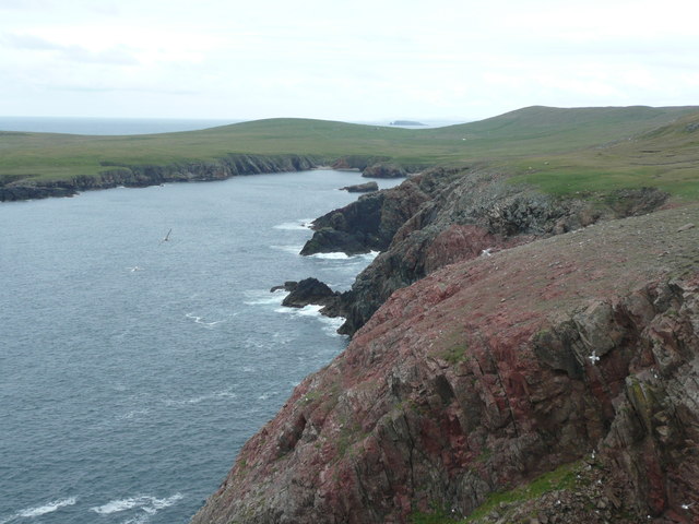
Blue Head is a small headland located on the island of Shetland, situated in the northern part of Scotland. This scenic coastal area is renowned for its stunning natural beauty and rich history. Blue Head is positioned on the northwestern coast of the island, overlooking the North Atlantic Ocean.
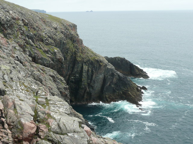
The headland is characterized by its dramatic cliffs, which rise up to 30 meters (98 feet) above sea level. These cliffs provide breathtaking panoramic views of the surrounding rugged coastline, with its jagged rocks and crashing waves. The area is a haven for birdwatchers, as it is home to a variety of seabirds, including puffins, guillemots, and fulmars. Visitors can observe these magnificent creatures nesting and flying along the cliffs.
Blue Head is also known for its historical significance. The headland is home to the ruins of an ancient broch, which is an Iron Age circular stone tower. These brochs were once defensive structures and symbols of power in the region. The remnants of this broch serve as a reminder of the island's ancient past and attract history enthusiasts.
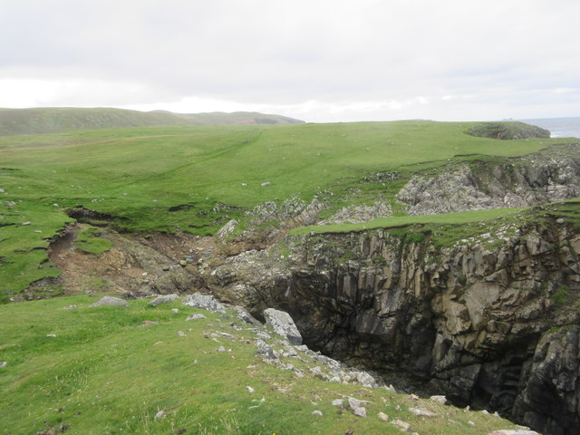
In addition to its natural and historical attractions, Blue Head offers opportunities for outdoor activities such as hiking and photography. The cliff-top paths provide excellent walking routes, allowing visitors to explore the area's stunning landscapes. The ever-changing weather conditions add to the allure of Blue Head, as the dramatic skies and crashing waves create a sense of awe and wonder.
Overall, Blue Head is a captivating destination that offers a unique blend of natural beauty and historical significance. Its stunning cliffs, abundant wildlife, and ancient ruins make it a must-visit location for anyone exploring the Shetland Islands.
If you have any feedback on the listing, please let us know in the comments section below.
Blue Head Images
Images are sourced within 2km of 60.609071/-1.4258204 or Grid Reference HU3191. Thanks to Geograph Open Source API. All images are credited.


Blue Head is located at Grid Ref: HU3191 (Lat: 60.609071, Lng: -1.4258204)
Unitary Authority: Shetland Islands
Police Authority: Highlands and Islands
What 3 Words
///carbonate.mixer.qualifier. Near Ulsta, Shetland Islands
Nearby Locations
Related Wikis

Uyea, Northmavine
Uyea (Scots: Öya in Shetland dialect spelling) is an uninhabited tidal island located to the northwest of Mainland, Shetland. Uyea lies off the Northmavine...

North Roe
North Roe is a village, and protected area at the northern tip in the large Northmavine peninsula of the Mainland of Shetland, Scotland. It is a small...

Fethaland
Fethaland or Fedeland (pronounced [ˈfeɪdələnd]) is an abandoned settlement at the extreme north end of Mainland, Shetland. It was the site of the largest...

Lang Ayre
The Lang Ayre is a beach on the west side of Ronas Hill, Northmavine, Shetland. At 1 kilometre (0.6 mi) in length it is the archipelago's longest. It is...
Have you been to Blue Head?
Leave your review of Blue Head below (or comments, questions and feedback).