Crow Stack

Island in Shetland

Scotland

Crow Stack

Papa Stour and Foula Taken on the B9078 between Burnside and Eshaness, Shetland, I am looking out towards the islands of Papa Stour (left of shot) and Foula beyond.
Papa Stour and Foula Credit: Carroll Pierce

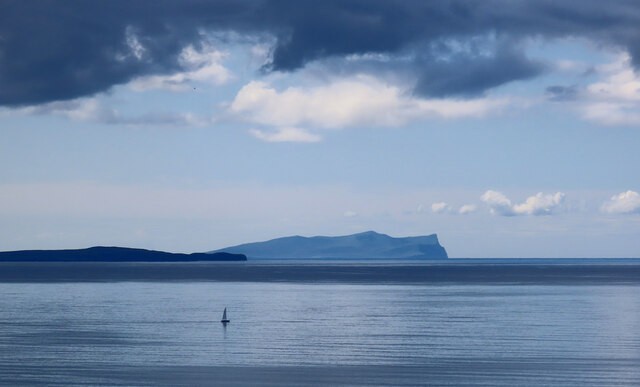
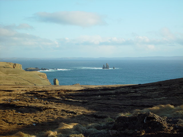
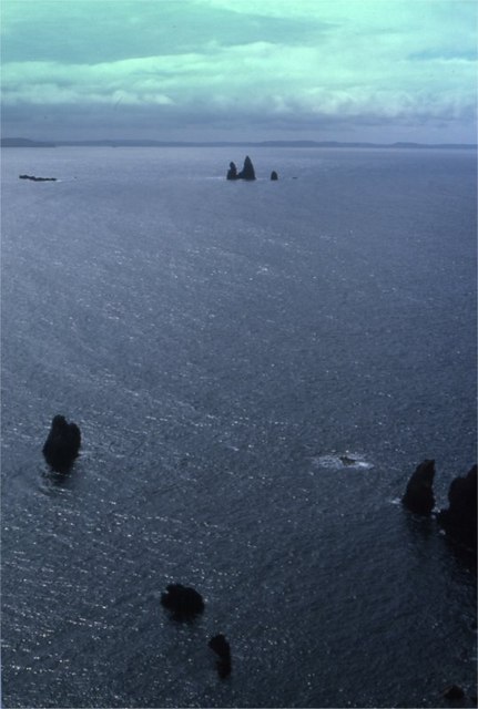
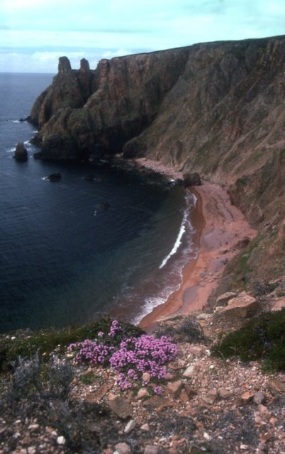
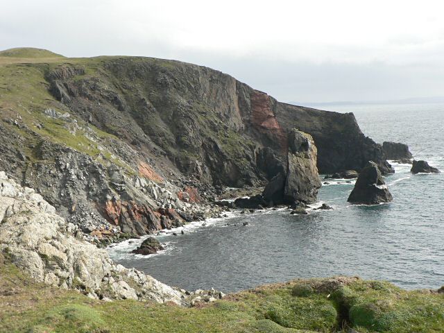
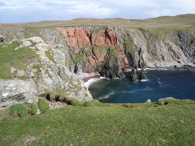
Crow Stack is a small uninhabited island located in the Shetland archipelago, situated off the northeast coast of Scotland. It is part of the group of islands known as the Out Skerries, lying approximately 24 kilometers east of the Shetland mainland. The island is characterized by its rugged and rocky terrain, with steep cliffs rising dramatically from the surrounding North Sea.

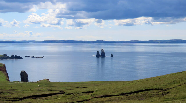
Measuring around 200 meters in length and 100 meters in width, Crow Stack is relatively small in size. Its highest point reaches only 24 meters above sea level. The island is predominantly composed of sandstone, which has been shaped by the powerful forces of erosion over time, resulting in the distinctive cliffs and caves that can be observed.

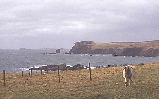
The island is known for its rich birdlife, with large colonies of seabirds including kittiwakes, razorbills, guillemots, and fulmars nesting on the cliffs. The surrounding waters are also home to a variety of marine species, such as seals and seabirds, making Crow Stack an important site for wildlife conservation.

Due to its remote location and lack of facilities, Crow Stack is not accessible to tourists. However, it is often visited by birdwatchers and researchers interested in studying the diverse avian population. The island's isolation and untouched nature make it a unique and valuable ecological site within the Shetland archipelago.

If you have any feedback on the listing, please let us know in the comments section below.

Crow Stack Images

Images are sourced within 2km of 60.48313/-1.5041888 or Grid Reference HU2777. Thanks to Geograph Open Source API. All images are credited.
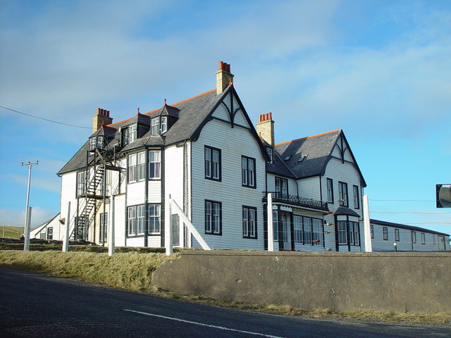
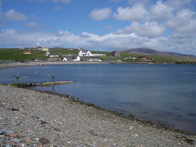
Papa Stour and Foula Taken on the B9078 between Burnside and Eshaness, Shetland, I am looking out towards the islands of Papa Stour (left of shot) and Foula beyond.
Papa Stour and Foula
Taken on the B9078 between Burnside and Eshaness, Shetland, I am looking out towards the islands of Papa Stour (left of shot) and Foula beyond.
The Drongs Taken from the B9078 between Burnside and Eshaness, Shetland, I am looking across Sand Wick to the sea stacks known at The Drongs. Papa Stour can be seen in the distance.
The Drongs
Taken from the B9078 between Burnside and Eshaness, Shetland, I am looking across Sand Wick to the sea stacks known at The Drongs. Papa Stour can be seen in the distance.
St Magnus Bay Hotel, Hillswick, Shetland Built in 1900 by the North of Scotland Ferry company. Still functioning, just [in 2004], but the absentee landlord is clearly not interested in maintaining it as a hotel, which is sad.
St Magnus Bay Hotel, Hillswick, Shetland
Built in 1900 by the North of Scotland Ferry company. Still functioning, just [in 2004], but the absentee landlord is clearly not interested in maintaining it as a hotel, which is sad.
Hillswick Fire Station, Shetland With local retained firefighters the Hillswick Fire Station is little more than a large garage, just big enough to house the small appliance based on a large van.
Hillswick Fire Station, Shetland
With local retained firefighters the Hillswick Fire Station is little more than a large garage, just big enough to house the small appliance based on a large van.
Hillswick, Shetland Large traditionally built houses at Hillswick. In the background is Findlins House and Findlins Farm.
Hillswick, Shetland
Large traditionally built houses at Hillswick. In the background is Findlins House and Findlins Farm.
Hillswick, Shetland Houses at Hillswick, the large two storey house with mansard roof is called Laarsund.
Hillswick, Shetland
Houses at Hillswick, the large two storey house with mansard roof is called Laarsund.
St Magnus Bay Hotel, Hillswick, Shetland This hotel was built as a kit in Norway, dis-assembled and transported to Hillswick where it was constructed on its present site in 1900 by the North of Scotland, Orkney & Shetland Steam Navigation Co.. Sadly it is currently closed (April 2006) although the local community wish to see it opened again. For more information on Hillswick and surrounding area visit <span class="nowrap"><a title="http://www.undiscoveredscotland.co.uk/shetland/hillswick/index.html" rel="nofollow ugc noopener" href="http://www.undiscoveredscotland.co.uk/shetland/hillswick/index.html">Link</a><img style="margin-left:2px;" alt="External link" title="External link - shift click to open in new window" src="https://s1.geograph.org.uk/img/external.png" width="10" height="10"/></span>

UPDATE Oct 07: this hotel is now owned by a local couple and open every day - More information can be found at the official website <span class="nowrap"><a title="http://www.stmagnusbayhotel.co.uk" rel="nofollow ugc noopener" href="http://www.stmagnusbayhotel.co.uk">Link</a><img style="margin-left:2px;" alt="External link" title="External link - shift click to open in new window" src="https://s1.geograph.org.uk/img/external.png" width="10" height="10"/></span>
St Magnus Bay Hotel, Hillswick, Shetland
This hotel was built as a kit in Norway, dis-assembled and transported to Hillswick where it was constructed on its present site in 1900 by the North of Scotland, Orkney & Shetland Steam Navigation Co.. Sadly it is currently closed (April 2006) although the local community wish to see it opened again. For more information on Hillswick and surrounding area visit LinkExternal link UPDATE Oct 07: this hotel is now owned by a local couple and open every day - More information can be found at the official website LinkExternal link
View over Heads of Grocken, Eshaness, Shetland Looking out over the Heads of Grocken with 'The Drongs' the sea stacks in the distance.
View over Heads of Grocken, Eshaness, Shetland
Looking out over the Heads of Grocken with 'The Drongs' the sea stacks in the distance.
Helga water, near Hillswick, Shetland Shetland is unlikely ever to have a hosepipe ban, there are many many lochs and plentiful rainfall. This is Helga Water near the road to Eshaness.
Helga water, near Hillswick, Shetland
Shetland is unlikely ever to have a hosepipe ban, there are many many lochs and plentiful rainfall. This is Helga Water near the road to Eshaness.
Heads of Grocken Looking across the square from above Hillswick on a stormy winter's day. The pony was very inquisitive, and didn't want to be photographed in profile!
Heads of Grocken
Looking across the square from above Hillswick on a stormy winter's day. The pony was very inquisitive, and didn't want to be photographed in profile!
Heads of Grocken Small sea-stacks off the Heads of Grocken, with the Drongs in the distance.
Heads of Grocken
Small sea-stacks off the Heads of Grocken, with the Drongs in the distance.
Beach between Heads of Grocken and the Neap
Entering Eshaness
Entering Eshaness
Cliffs and stack The view south from this point is spectacular.

(The stack and the point to the right lie in this grid square, while the cliff to the left is in <a href="https://www.geograph.org.uk/gridref/HU2775">HU2775</a>).
Cliffs and stack
The view south from this point is spectacular. (The stack and the point to the right lie in this grid square, while the cliff to the left is in HU2775).
The bay at Hillswick Looking across the bay with the main settlement on the far shore.
The bay at Hillswick
Looking across the bay with the main settlement on the far shore.
Conflicting signs A waymarked stile gives access to the coast, while a "beware of the bull" sign warns of danger. We crossed through this field on a clockwise circuit of Ness of Hillswick without seeing any warning in the other direction (or a bull).
Conflicting signs
A waymarked stile gives access to the coast, while a "beware of the bull" sign warns of danger. We crossed through this field on a clockwise circuit of Ness of Hillswick without seeing any warning in the other direction (or a bull).
Opposite a red cliff Looking across the short turf of this promontory at a red cliff across the bay.
Opposite a red cliff
Looking across the short turf of this promontory at a red cliff across the bay.
Marsh marigolds Looking across a marshy area towards Hillswick. The marsh marigolds currently in flower will be succeeded by the yellow flags behind them, not yet in bud.
Marsh marigolds
Looking across a marshy area towards Hillswick. The marsh marigolds currently in flower will be succeeded by the yellow flags behind them, not yet in bud.
Show me another place!

Crow Stack is located at Grid Ref: HU2777 (Lat: 60.48313, Lng: -1.5041888)

Unitary Authority: Shetland Islands

Police Authority: Highlands and Islands

What 3 Words

///pianists.jeering.wildfires. Near Brae, Shetland Islands

Related Wikis

Hillswick

Hillswick is a small village in Northmavine, on the shore of the Atlantic Ocean and lies to the north-north west of Mainland, Shetland, the most northerly...

The Drongs

The Drongs are a group of sea stacks off the coast of Hillswick Ness, Northmavine, Shetland, Scotland. They lie to the west of the Isle of Westerhouse...

Assater

Assater (also spelled Assetter) is a hamlet on Mainland, in Shetland, Scotland. Assater is situated in the parish of Northmaven. It is about 1.3 miles...

Heylor

Heylor is a settlement situated on the south side of Ronas Voe in Northmavine, Shetland, Scotland. It lies directly opposite Ronas Hill, Shetland's tallest...

Nearby Amenities

Located within 500m of 60.48313,-1.5041888
Sand Wick
Natural: bay
Lat/Long: 60.4797458/-1.5033246
Power: pole
Lat/Long: 60.4844523/-1.5121749
Power: pole
Lat/Long: 60.4845054/-1.5103894
Power: pole
Lat/Long: 60.4838761/-1.5099269
Power: pole
Lat/Long: 60.4833235/-1.5095458
Power: pole
Lat/Long: 60.482752/-1.5102672
Power: pole
Lat/Long: 60.4830354/-1.5099125
Power: pole
Lat/Long: 60.4837214/-1.5090329
Power: pole
Lat/Long: 60.4840957/-1.5085608
Power: pole
Lat/Long: 60.4844995/-1.5080671
Power: pole
Lat/Long: 60.4848632/-1.5075901
Power: pole
Lat/Long: 60.4848974/-1.5095841
Power: pole
Lat/Long: 60.485293/-1.5088124
Power: pole
Lat/Long: 60.4856708/-1.5080647
Power: pole
Lat/Long: 60.4860214/-1.5073816
Power: pole
Lat/Long: 60.486463/-1.5064997
Power: pole
Lat/Long: 60.4869412/-1.5055386
Power: pole
Lat/Long: 60.4871383/-1.5042828
Power: pole
Lat/Long: 60.4873697/-1.502701
The data included in this document is from www.openstreetmap.org. The data is made available under ODbL.

Have you been to Crow Stack?

Leave your review of Crow Stack below (or comments, questions and feedback).