Galti Stack

Island in Shetland

Scotland

Galti Stack

The Faither Sea Cliffs in this area are mostly loose and somewhat dangerous, but in places the sea keeps the base 30m or so relatively clean.  The pocketed rock provides perfect nesting locations for Fulmars.
The Faither Credit: Doug Lee

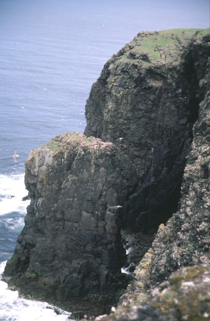
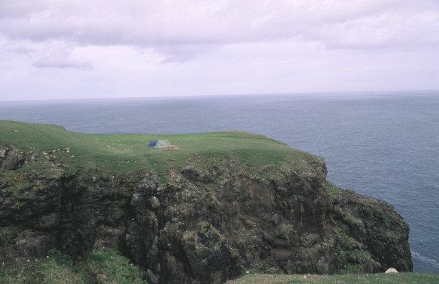
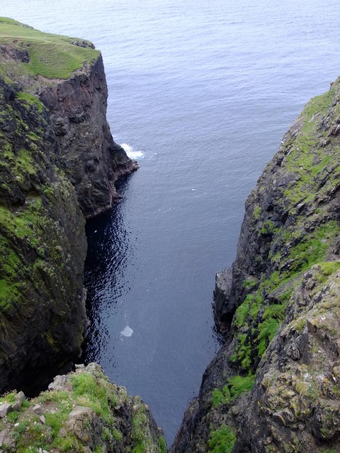
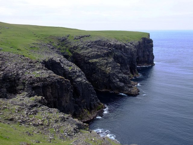
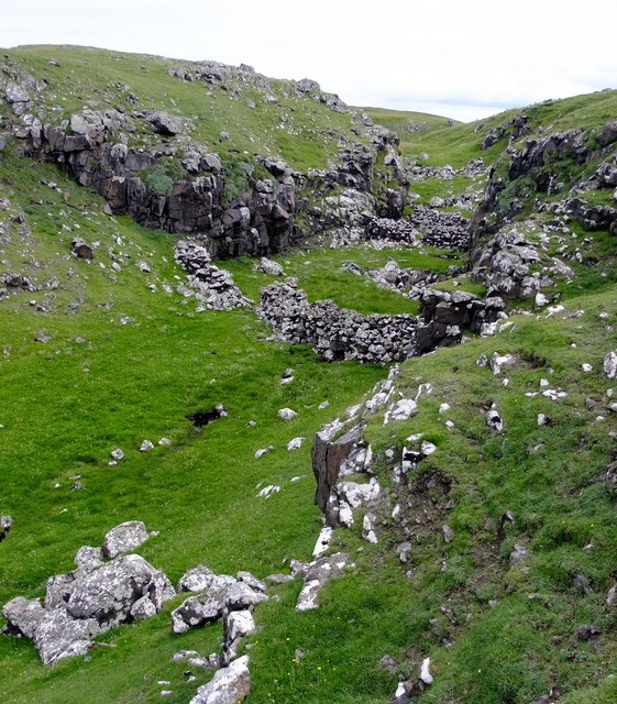
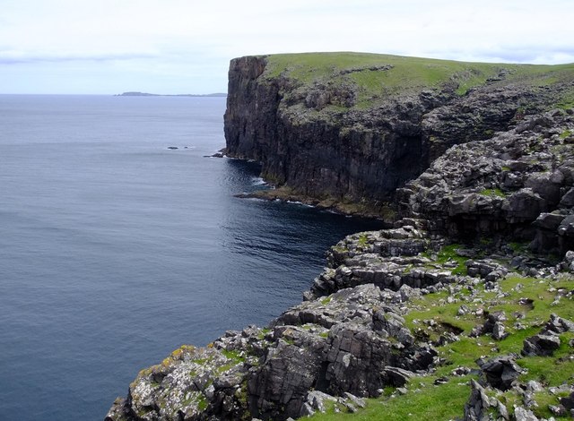
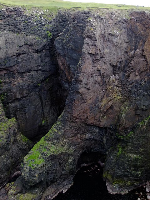
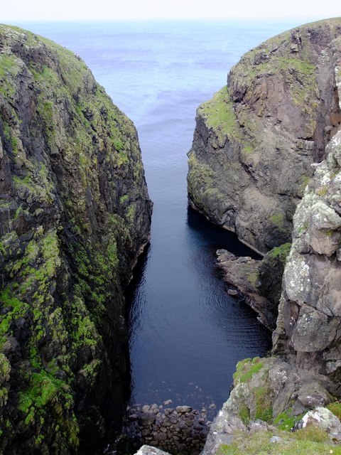
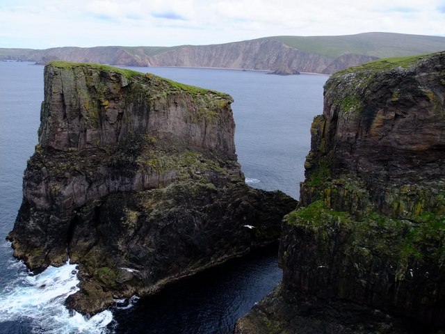
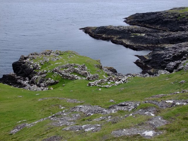
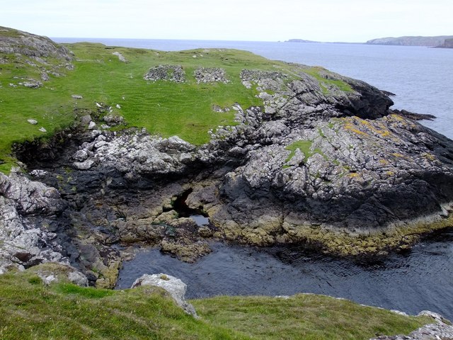
Galti Stack is a small uninhabited island located off the coast of Shetland, Scotland. It is part of the Shetland Islands archipelago and lies approximately 2 miles northeast of the mainland. The island is characterized by its rugged and rocky terrain, with sheer cliffs rising up to 100 meters above sea level.

Galti Stack is known for its rich birdlife, particularly seabirds. The island serves as an important breeding ground for several species, including puffins, razorbills, guillemots, and fulmars. Visitors can witness these birds nesting and raising their young during the breeding season, making it a popular spot for birdwatching enthusiasts.

Access to Galti Stack is limited due to its remote location and lack of facilities. The island is only accessible by boat, and visitors are advised to take caution when navigating the rough waters surrounding it. However, for those who do manage to reach the island, they are rewarded with breathtaking views of the surrounding sea and dramatic cliffs.

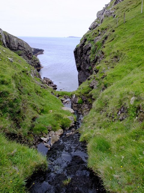
Galti Stack is also home to a variety of marine life, including seals, otters, and numerous species of fish. Its remote and untouched nature makes it an ideal habitat for these creatures. The island's unique geological features, such as sea caves and rock formations, add to its natural beauty and appeal.

Overall, Galti Stack offers a glimpse into the wild and untamed beauty of the Shetland Islands. Its rugged cliffs, abundant birdlife, and diverse marine ecosystem make it a must-visit destination for nature enthusiasts and those seeking a remote and peaceful escape.

If you have any feedback on the listing, please let us know in the comments section below.
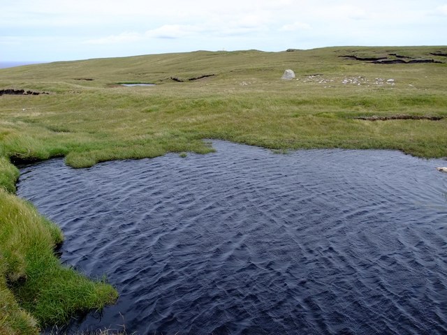
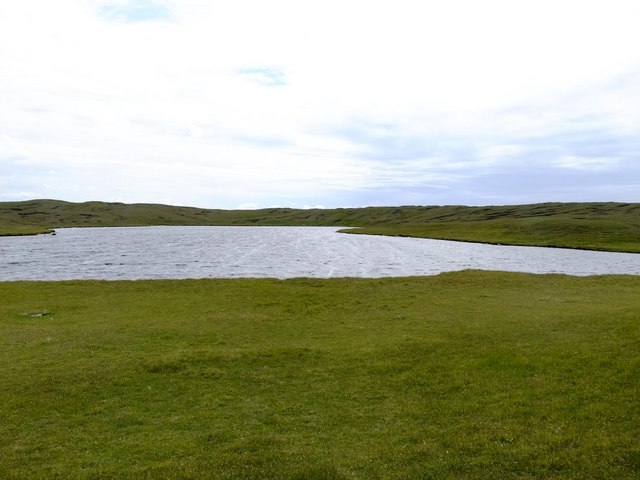
Galti Stack Images

Images are sourced within 2km of 60.555552/-1.5295764 or Grid Reference HU2585. Thanks to Geograph Open Source API. All images are credited.

The Faither Sea Cliffs in this area are mostly loose and somewhat dangerous, but in places the sea keeps the base 30m or so relatively clean.  The pocketed rock provides perfect nesting locations for Fulmars.
The Faither
Sea Cliffs in this area are mostly loose and somewhat dangerous, but in places the sea keeps the base 30m or so relatively clean. The pocketed rock provides perfect nesting locations for Fulmars.
Headland across Galti Geo This land shows signs of recent usage as pasture but is now mostly occupied by a large variety of birdlife.  Many gulls and fulmars can be seen here nesting on the cliffs
Headland across Galti Geo
This land shows signs of recent usage as pasture but is now mostly occupied by a large variety of birdlife. Many gulls and fulmars can be seen here nesting on the cliffs
Gorsendi Geo The cliffs are between 50 and 70 metres high.  The southern slopes had many hundreds of Greylag Geese, grazing on the rich grassland.
Gorsendi Geo
The cliffs are between 50 and 70 metres high. The southern slopes had many hundreds of Greylag Geese, grazing on the rich grassland.
Bay Hevda from Clew Head
Sheep folds, Clew Head These sheep folds use the sides of a narrow ravine to form the edges of the enclosures.  There are similar examples in HU3072, above South Sound in Mangaster.
Sheep folds, Clew Head
These sheep folds use the sides of a narrow ravine to form the edges of the enclosures. There are similar examples in HU3072, above South Sound in Mangaster.
Clew Head from Bay Hevda
Ler Geo These tremendous cliffs at the head of the Geo are about 80 m high.
Ler Geo
These tremendous cliffs at the head of the Geo are about 80 m high.
Ler Geo
Ler Geo
Trig Point  107 m, above The Faither Oddly, this peninsula north of Hamnavoe has no name on any maps, large or small scale.  Local names only cover small areas of terrain (e.g. Villains of Hamnavoe, The Faither, etc.), and locals in Hillswick don't know any names either.  Can anyone out there offer any help or suggestions?
Trig Point 107 m, above The Faither
Oddly, this peninsula north of Hamnavoe has no name on any maps, large or small scale. Local names only cover small areas of terrain (e.g. Villains of Hamnavoe, The Faither, etc.), and locals in Hillswick don't know any names either. Can anyone out there offer any help or suggestions?
Galti Stack
Galti Stack
Lergeo Water
Lergeo Water
Geo Lerradale The stream follows a small fault into Geo Lerradale.  This fault runs parallel to the larger fault on the eastern side of Bratta Beck, about 120 metres to the east.
Geo Lerradale
The stream follows a small fault into Geo Lerradale. This fault runs parallel to the larger fault on the eastern side of Bratta Beck, about 120 metres to the east.
Ruined fishing station, Outer Hole This small, sheltered natural harbour has three ruined fishing stations on its northern side.
Ruined fishing station, Outer Hole
This small, sheltered natural harbour has three ruined fishing stations on its northern side.
Ruined fishing stations, Snuildi Geo Just like the adjacent Outer Hole 400 m to the north, Snuildi Geo is a sheltered natural rocky harbour.  These fishing stations were probably used for summer herring fishing.
Ruined fishing stations, Snuildi Geo
Just like the adjacent Outer Hole 400 m to the north, Snuildi Geo is a sheltered natural rocky harbour. These fishing stations were probably used for summer herring fishing.
Mill Lochs of Ockran outflow There must have been a sluice gate here at one time to control the loch levels and power the mills.
Mill Lochs of Ockran outflow
There must have been a sluice gate here at one time to control the loch levels and power the mills.
Loomi Shun There are many Loomi Shuns, or slight variations on the name, in Shetland .
Loomi Shun
There are many Loomi Shuns, or slight variations on the name, in Shetland .
Show me another place!

Galti Stack is located at Grid Ref: HU2585 (Lat: 60.555552, Lng: -1.5295764)

Unitary Authority: Shetland Islands

Police Authority: Highlands and Islands

What 3 Words

///boast.jammy.collapsed. Near Toft, Shetland Islands

Related Wikis

Tingon

Tingon is a peninsula in the north-west of Northmavine, Shetland. It is delineated on the east by Ronas Voe, and on the west by Hamnavoe. It is designated...

Lang Ayre

The Lang Ayre is a beach on the west side of Ronas Hill, Northmavine, Shetland. At 1 kilometre (0.6 mi) in length it is the archipelago's longest. It is...

Ronas Voe

Ronas Voe (pronounced [ˈrø̞nis ˌvo̞:] Shaetlan: Rønies Voe) is a voe in Northmavine, Shetland. It divides the land between Ronas Hill, Shetland's tallest...

Ronas Hill

Ronas Hill (or Rönies Hill) is a hill in Shetland, Scotland. It is classed as a Marilyn, and is the highest point in the Shetland Islands at an elevation...

Have you been to Galti Stack?

Leave your review of Galti Stack below (or comments, questions and feedback).