Black Rock
Island in Northumberland
England
Black Rock

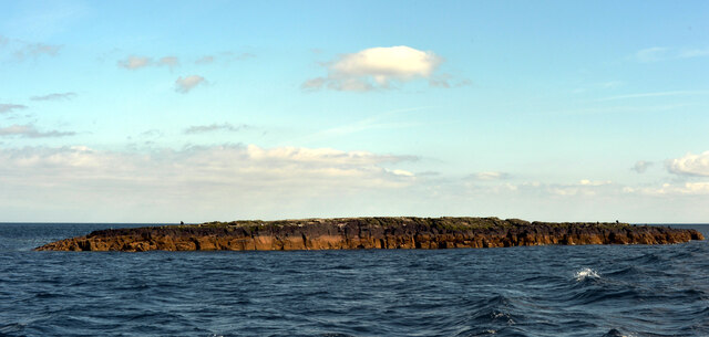
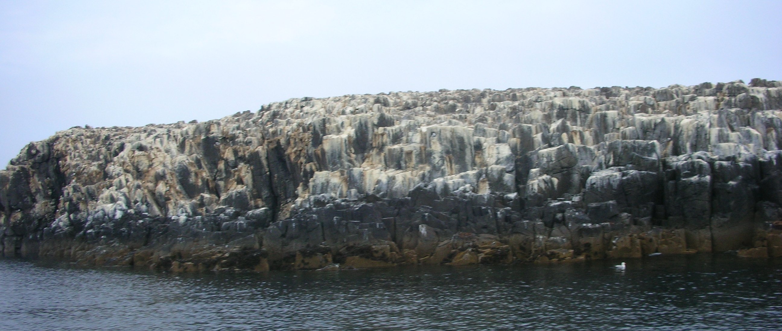
Black Rock is a small island located off the coast of Northumberland, England. It is situated about 1.5 kilometers from the mainland, near the village of Embleton. The island is approximately 500 meters long and 250 meters wide, covering an area of about 5 hectares.
Black Rock is predominantly composed of sandstone and is characterized by its rugged and rocky terrain. It is home to a diverse range of flora and fauna, including various seabirds such as puffins, guillemots, and razorbills. The surrounding waters are also rich in marine life, making it an ideal spot for fishing and birdwatching enthusiasts.
Access to Black Rock is limited due to its status as a National Nature Reserve, managed by the Northumberland Wildlife Trust. Visitors can only land on the island during low tide when a causeway temporarily appears, allowing a short window of time for exploration. It is important to note that care must be taken when crossing the causeway, as the tides can be unpredictable and quickly cut off access to the mainland.
The island is steeped in history, with evidence of human occupation dating back thousands of years. It was once used as a strategic defensive position during times of conflict, with remnants of a gun battery still visible today. Furthermore, Black Rock is also known for its association with smuggling in the 18th century, as the secluded nature of the island made it an ideal location for illicit activities.
Overall, Black Rock offers a unique and picturesque natural setting, combining stunning coastal landscapes with a rich historical and ecological heritage.
If you have any feedback on the listing, please let us know in the comments section below.
Black Rock Images
Images are sourced within 2km of 55.615591/-1.6530614 or Grid Reference NU2135. Thanks to Geograph Open Source API. All images are credited.


Black Rock is located at Grid Ref: NU2135 (Lat: 55.615591, Lng: -1.6530614)
Unitary Authority: Northumberland
Police Authority: Northumbria
What 3 Words
///seaweed.ourselves.invested. Near Seahouses, Northumberland
Nearby Locations
Related Wikis
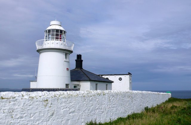
Farne Lighthouse
Farne Lighthouse is a lighthouse on the southern tip of Inner Farne (one of a group of islands off the coast of North Northumberland). Built in the early...
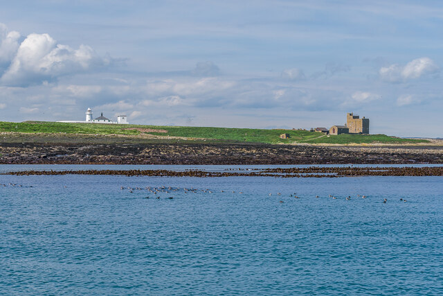
Farne Islands
The Farne Islands are a group of islands off the coast of Northumberland, England. The group has between 15 and 20 islands depending on the level of the...
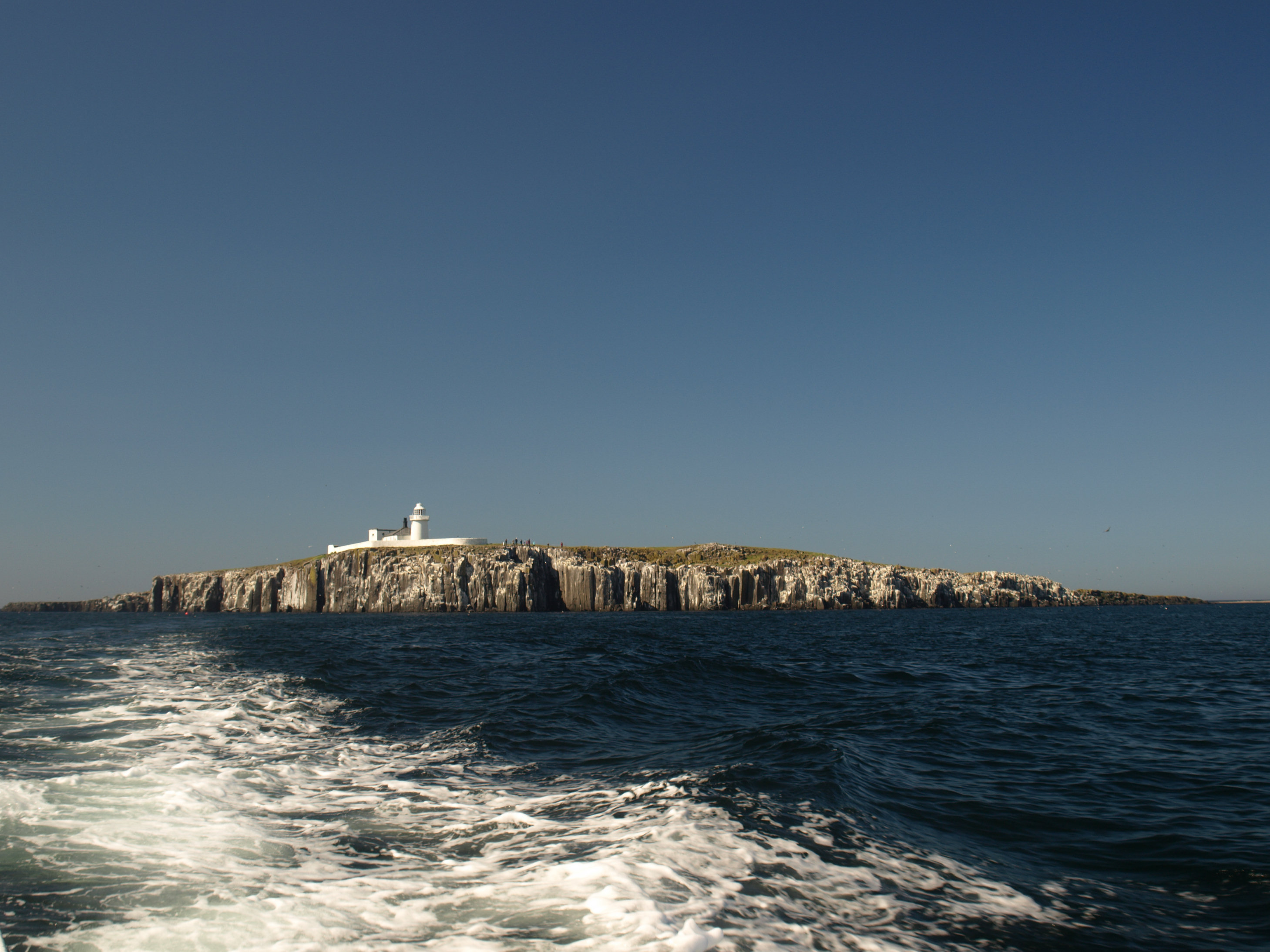
Staple Island
Staple Island is a small rocky island, or skerry, that is one of the Outer Group of the Farne Islands in Northumberland, England. The Farne Islands are...
Northumberland Coast
The Northumberland Coast is a designated Area of Outstanding Natural Beauty (AONB) covering 40 miles (64 km) of coastline from Berwick-Upon-Tweed to the...

Bamburgh Dunes
Bamburgh Dunes are a region of coastal sand dunes with an area of over 40 hectares situated around the village of Bamburgh in Northumberland, England....

Forfarshire (ship)
Forfarshire was a paddle steamer with brigantine rigging, built in Dundee in 1834, and which struck and later foundered on one of the Farne Islands on...
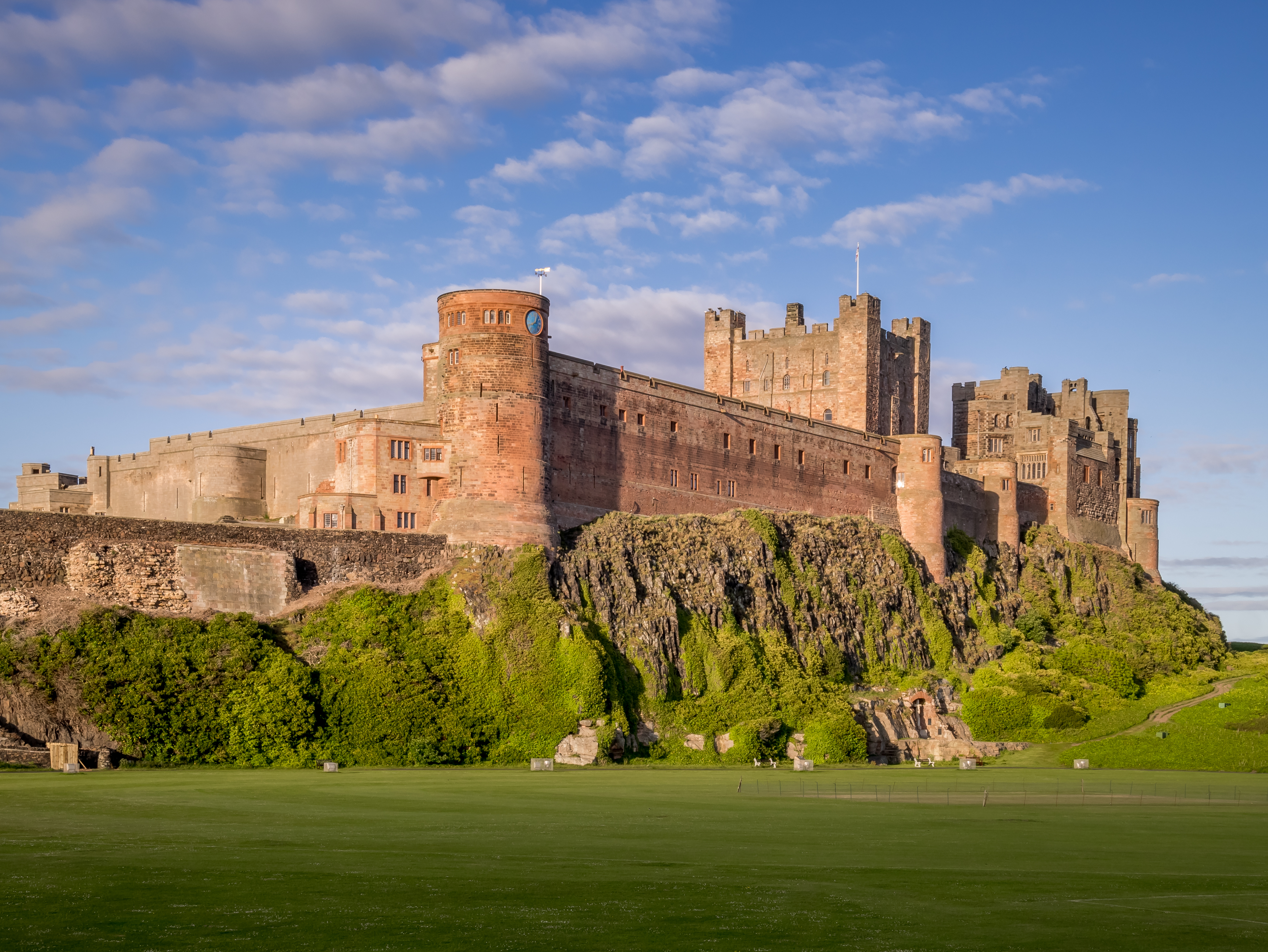
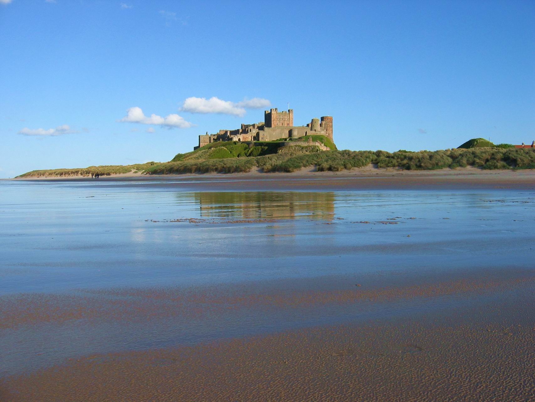
Bamburgh Castle
Bamburgh Castle is a castle on the northeast coast of England, by the village of Bamburgh in Northumberland. It is a Grade I listed building.The site was...

Seahouses
Seahouses is a large village on the North Northumberland coast in England. It is about 20 kilometres (12 mi) north of Alnwick, within the Northumberland...
Nearby Amenities
Located within 500m of 55.615591,-1.6530614Have you been to Black Rock?
Leave your review of Black Rock below (or comments, questions and feedback).