Green, Little

Settlement in Somerset Mendip

England

Green, Little

Stone Stile on Park Hill near Mells A stone stile beside the road on Park Hill near Mells.
The stile leads onto a public footpath that goes down to Mells.
Photograph taken at the bend in the road where Park Hill becomes Conduit Hill.
Stone Stile on Park Hill near Mells Credit: Kevin Pearson

Green, Little, Somerset is a small village located in the county of Somerset, England. Situated in the heart of the picturesque Somerset Levels, the village is surrounded by lush green fields and rolling hills, offering residents and visitors alike a tranquil and idyllic setting.

With a population of around 500, Green, Little is known for its close-knit community and friendly atmosphere. The village is characterized by its charming thatched-roof cottages, many of which date back several centuries, adding to its historical charm. The architecture of the village reflects its rich heritage and traditional English village aesthetic.

Despite its small size, Green, Little boasts a range of amenities for its residents. These include a local pub, The Green Dragon, which serves traditional pub food and acts as a social hub for the village. The village also has a primary school, providing education for children aged five to eleven.

The surrounding countryside offers numerous opportunities for outdoor activities. The nearby Somerset Levels provide ample opportunities for walks, bike rides, and bird-watching, with several nature reserves and wetlands in close proximity. The village also benefits from its proximity to larger towns and cities, such as Taunton and Bridgwater, which offer a wider range of amenities and services.

Overall, Green, Little, Somerset offers a peaceful and picturesque way of life, perfect for those seeking a close community and a connection with nature. With its historic charm and beautiful surroundings, it is a truly delightful place to live or visit.

If you have any feedback on the listing, please let us know in the comments section below.

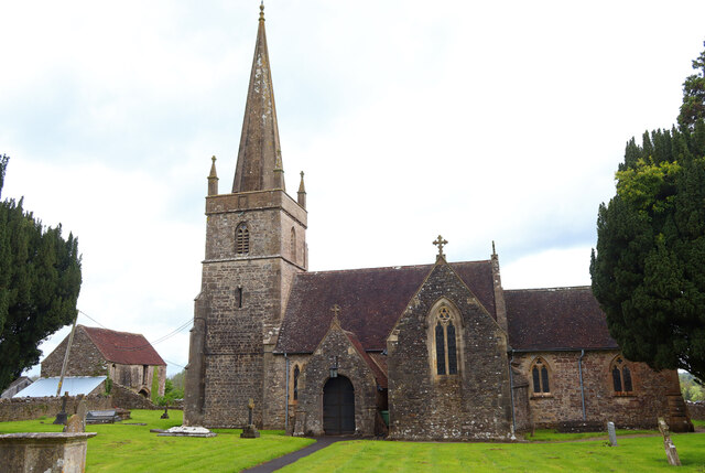
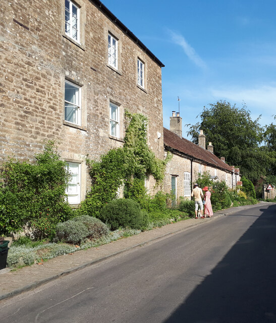
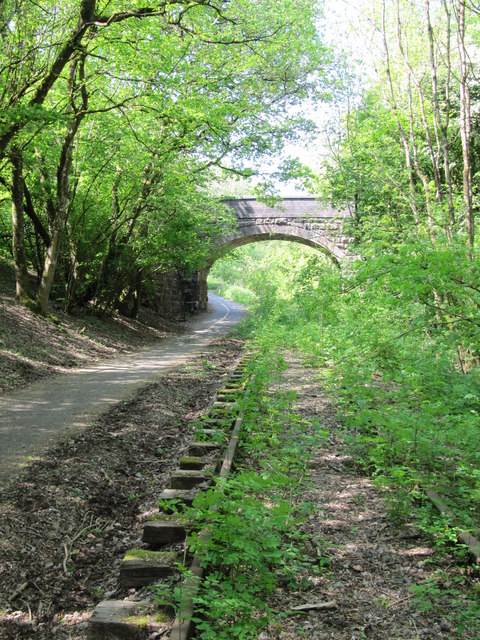
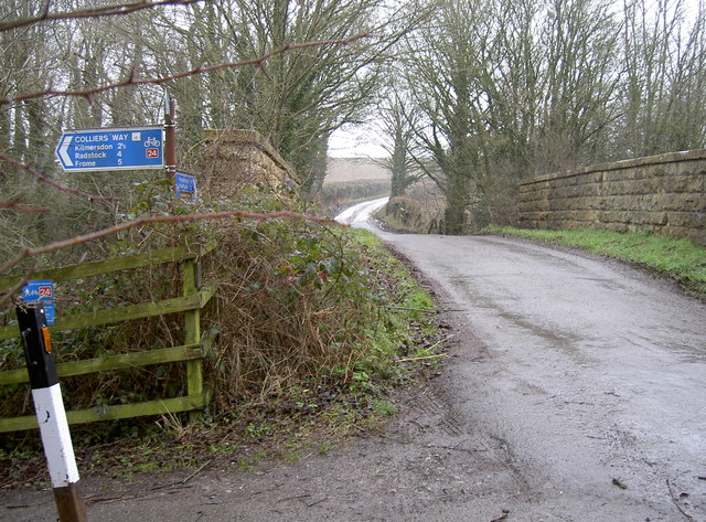
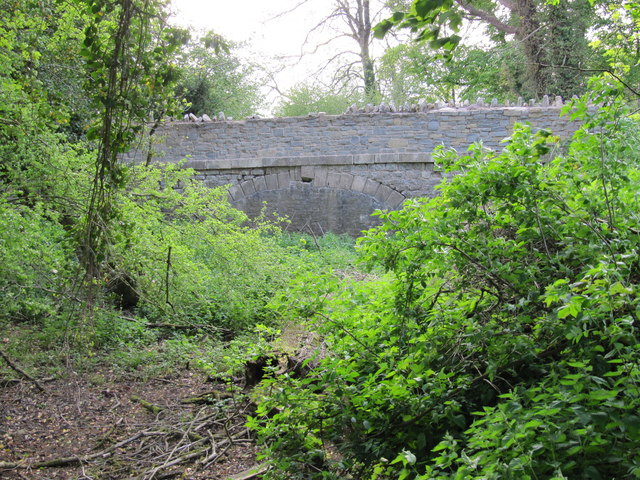
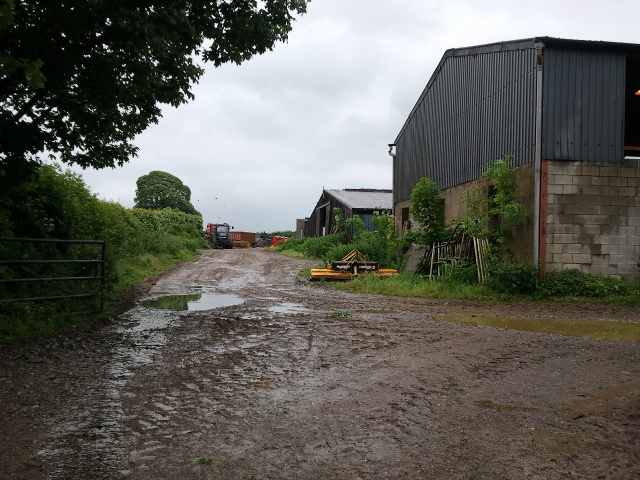
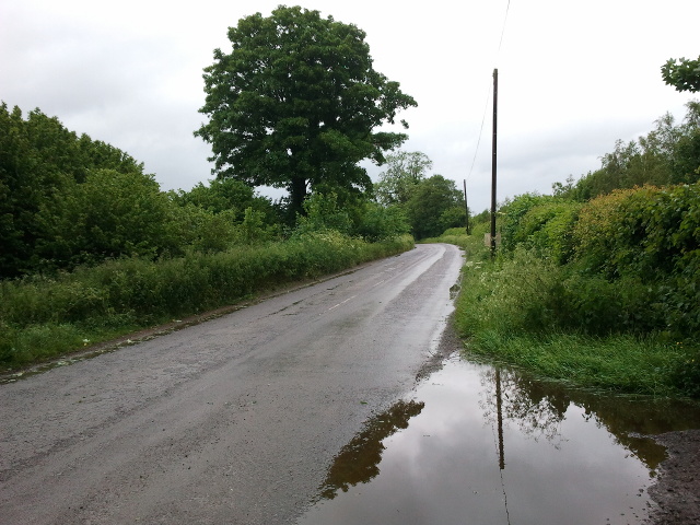
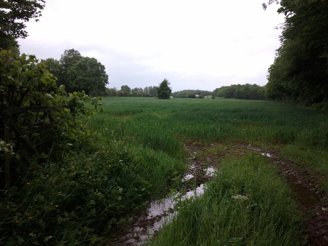
Green, Little Images

Images are sourced within 2km of 51.237022/-2.397178 or Grid Reference ST7248. Thanks to Geograph Open Source API. All images are credited.

Stone Stile on Park Hill near Mells A stone stile beside the road on Park Hill near Mells.
The stile leads onto a public footpath that goes down to Mells.
Photograph taken at the bend in the road where Park Hill becomes Conduit Hill.
Stone Stile on Park Hill near Mells
A stone stile beside the road on Park Hill near Mells. The stile leads onto a public footpath that goes down to Mells. Photograph taken at the bend in the road where Park Hill becomes Conduit Hill.
Whatley Church Church at Whatley.
Whatley Church
Church at Whatley.
Old Milestone West of Whatley Crossroads The Milestone is located on grass verge and hedge on the South of the road.  Parish of Whatley (Mendip District). Metal plate attached to stone post, Frome square iron plate design, erected by the Frome turnpike trust in the 18th Century. An earlier photograph can be found here: <a title="https://www.geograph.org.uk/photo/6051504" href="https://www.geograph.org.uk/photo/6051504">Link</a> 

Inscription reads:-  
FROME / 3 / WELLS / 12 

Grade II listed. List Entry Number: 1295398 <span class="nowrap"><a title="https://historicengland.org.uk/listing/the-list/list-entry/1295398" rel="nofollow ugc noopener" href="https://historicengland.org.uk/listing/the-list/list-entry/1295398">Link</a><img style="margin-left:2px;" alt="External link" title="External link - shift click to open in new window" src="https://s1.geograph.org.uk/img/external.png" width="10" height="10"/></span> 

Milestone Society National ID: SO_FRWL03
Old Milestone West of Whatley Crossroads
The Milestone is located on grass verge and hedge on the South of the road.  Parish of Whatley (Mendip District). Metal plate attached to stone post, Frome square iron plate design, erected by the Frome turnpike trust in the 18th Century. An earlier photograph can be found here: Link  Inscription reads:- FROME / 3 / WELLS / 12 Grade II listed. List Entry Number: 1295398 LinkExternal link Milestone Society National ID: SO_FRWL03
Cottages in Selwood Street
Brick Kiln Farm Bridge Bridge carrying Wanwards Lane across the Frome to Radstock railway (closed to passenger traffic in 1959, and to goods in 1968). It now crosses The Colliers Way (part of National Cycle Network Route 24), though the overgrown railway tracks are still in place.
Brick Kiln Farm Bridge
Bridge carrying Wanwards Lane across the Frome to Radstock railway (closed to passenger traffic in 1959, and to goods in 1968). It now crosses The Colliers Way (part of National Cycle Network Route 24), though the overgrown railway tracks are still in place.
Benchmark on Conduit Bridge An old cutmark, as listed in the Benchmark Database: <span class="nowrap"><a title="http://www.bench-marks.org.uk/bm31101" rel="nofollow ugc noopener" href="http://www.bench-marks.org.uk/bm31101">Link</a><img style="margin-left:2px;" alt="External link" title="External link - shift click to open in new window" src="https://s1.geograph.org.uk/img/external.png" width="10" height="10"/></span> , on the east wall of the old railway bridge. See <a href="https://www.geograph.org.uk/photo/3328696">ST7350 : A choice of routes</a> for a wider view and <a href="https://www.geograph.org.uk/photo/3328700">ST7350 : Lost!</a> for where an old projecting bracket used to be below.
Benchmark on Conduit Bridge
An old cutmark, as listed in the Benchmark Database: LinkExternal link , on the east wall of the old railway bridge. See ST7350 : A choice of routes for a wider view and ST7350 : Lost! for where an old projecting bracket used to be below.
A choice of routes The small road bridge over the old railway not leads down to the cycle path. A benchmark can be found on the eastern wall of the bridge - see <a href="https://www.geograph.org.uk/photo/3328688">ST7350 : Benchmark on Conduit Bridge</a> - but a projecting bracket in the structure of the bridge itself has not enjoyed a similar fate. See <a href="https://www.geograph.org.uk/photo/3328700">ST7350 : Lost!</a>.
A choice of routes
The small road bridge over the old railway not leads down to the cycle path. A benchmark can be found on the eastern wall of the bridge - see ST7350 : Benchmark on Conduit Bridge - but a projecting bracket in the structure of the bridge itself has not enjoyed a similar fate. See ST7350 : Lost!.
Lost! This scar in the stonework of the railway bridge appears to be the remains of an old projecting bracket. It has clearly been removed, by fair means or foul! This part of the old Colliers' Way railway has become a popular cycle path and has a number of these types dotted along it - see <span class="nowrap"><a title="http://www.bench-marks.org.uk/bm2507" rel="nofollow ugc noopener" href="http://www.bench-marks.org.uk/bm2507">Link</a><img style="margin-left:2px;" alt="External link" title="External link - shift click to open in new window" src="https://s1.geograph.org.uk/img/external.png" width="10" height="10"/></span> for the listing in the Benchmark Database and <a href="https://www.geograph.org.uk/photo/3328716">ST7350 : Conduit Bridge</a> for a wider view of the bridge.
Lost!
This scar in the stonework of the railway bridge appears to be the remains of an old projecting bracket. It has clearly been removed, by fair means or foul! This part of the old Colliers' Way railway has become a popular cycle path and has a number of these types dotted along it - see LinkExternal link for the listing in the Benchmark Database and ST7350 : Conduit Bridge for a wider view of the bridge.
Conduit Bridge The Colliers Way - Route 24 of Sustrans National Cycle Network - is part of the route that links Midsomer Norton to Frome. Originally it was the Somersetshire Coal Canal before the railway took over, but today is a popular and peaceful cyclepath. A benchmark used to be in the stonework of the left abutment but has been lost now - see <a href="https://www.geograph.org.uk/photo/3328700">ST7350 : Lost!</a>. 
Also see <span class="nowrap"><a title="http://www.colliersway.co.uk/index.php" rel="nofollow ugc noopener" href="http://www.colliersway.co.uk/index.php">Link</a><img style="margin-left:2px;" alt="External link" title="External link - shift click to open in new window" src="https://s1.geograph.org.uk/img/external.png" width="10" height="10"/></span> for the local information.
Conduit Bridge
The Colliers Way - Route 24 of Sustrans National Cycle Network - is part of the route that links Midsomer Norton to Frome. Originally it was the Somersetshire Coal Canal before the railway took over, but today is a popular and peaceful cyclepath. A benchmark used to be in the stonework of the left abutment but has been lost now - see ST7350 : Lost!. Also see LinkExternal link for the local information.
Join here for Route 24 Conduit Bridge is a handy point to access the cyclepath, or the other way around if you like. Of course, you could always go to the pub.
Join here for Route 24
Conduit Bridge is a handy point to access the cyclepath, or the other way around if you like. Of course, you could always go to the pub.
It's been a while The old coal railway line between Radstock and Frome ran up until 1988; however, the compulsion of Mother Nature won't allow the lines to remain untouched.
It's been a while
The old coal railway line between Radstock and Frome ran up until 1988; however, the compulsion of Mother Nature won't allow the lines to remain untouched.
Anyone know who 'H' is? Stonemasons' marks are common enough, but it seems like one man had put in plenty of work here.
Anyone know who 'H' is?
Stonemasons' marks are common enough, but it seems like one man had put in plenty of work here.
Enamel fingers Route 24 has plenty of artworks along its length, including a series of these fingers on rusty sheets which are high under the bridges. They recreate a bye-gone era when such styles were prevalent. See <a href="https://www.geograph.org.uk/photo/3330196">ST7549 : A curious mixture</a> for another example.
Enamel fingers
Route 24 has plenty of artworks along its length, including a series of these fingers on rusty sheets which are high under the bridges. They recreate a bye-gone era when such styles were prevalent. See ST7549 : A curious mixture for another example.
Former canal bridge near Vobster Infilled arch of a bridge over the course of the abandoned Dorset and Somerset Canal.
Former canal bridge near Vobster
Infilled arch of a bridge over the course of the abandoned Dorset and Somerset Canal.
Lockup, Gay Street, Mells Built in the 17C.
Lockup, Gay Street, Mells
Built in the 17C.
Finger Farm yard
Finger Farm yard
Road to Mells at Finger Farm
A wet field entrance
Show me another place!

Green, Little is located at Grid Ref: ST7248 (Lat: 51.237022, Lng: -2.397178)

Administrative County: Somerset

District: Mendip

Police Authority: Avon and Somerset

What 3 Words

///partner.garages.roughest. Near Frome, Somerset

Related Wikis

Mells, Somerset

Mells is a village and civil parish in Somerset, England, near the town of Frome. == Vobster == The parish includes the village of Vobster, which had a...
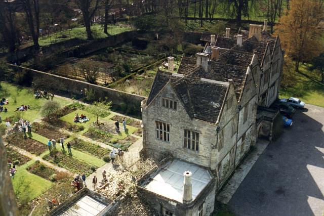
Mells Manor

Mells Manor at Mells, Somerset, England, was built in the 16th century for Edward Horner, altered in the 17th century, partially demolished around 1780...
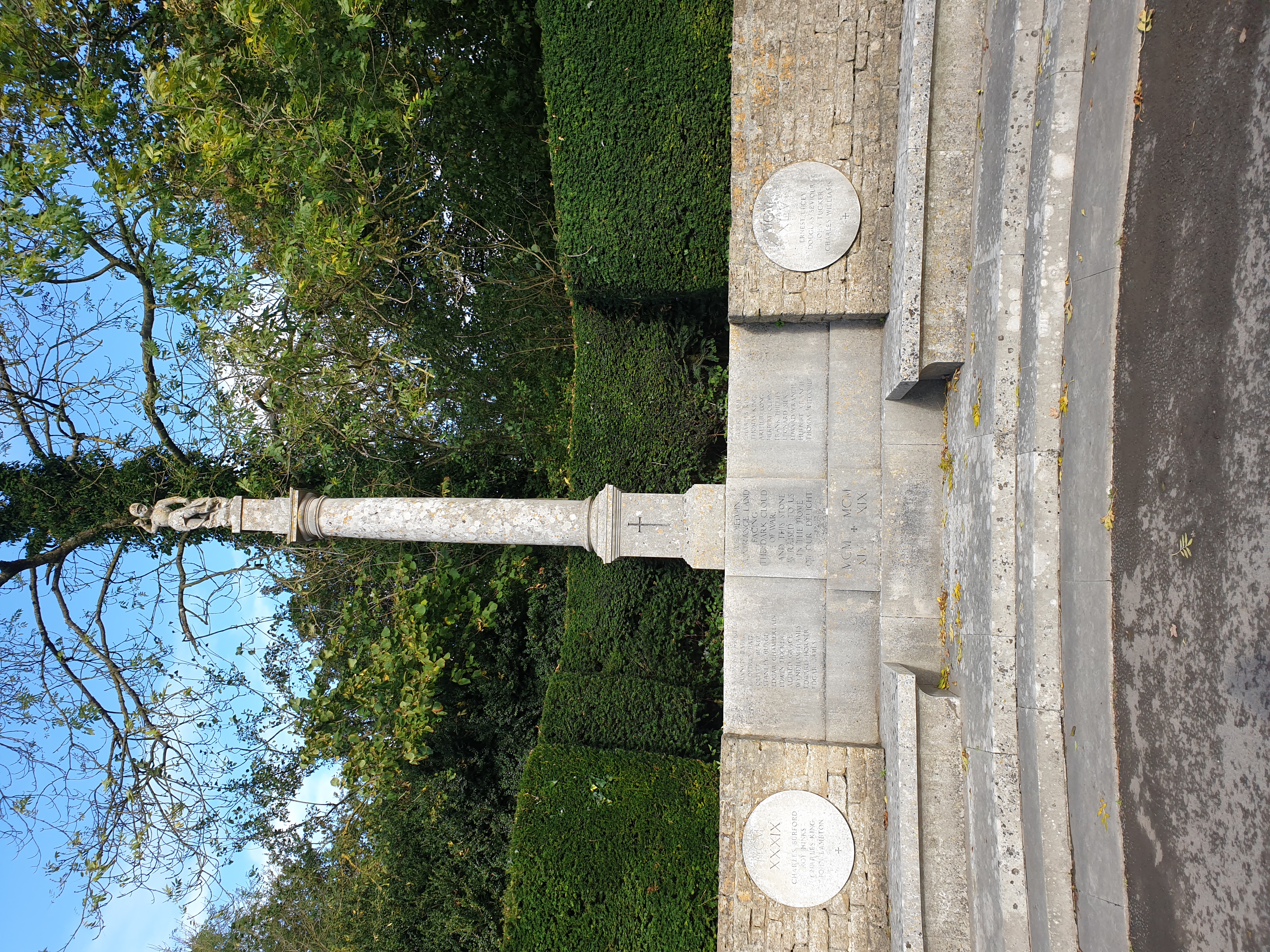
Mells War Memorial

Mells War Memorial is a First World War memorial by Sir Edwin Lutyens in the village of Mells in the Mendip Hills of Somerset, south-western England. Unveiled...
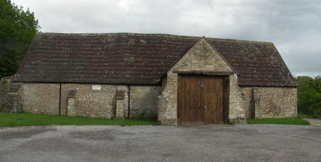
Mells Village Hall

Mells Village Hall in Mells, Somerset, England was built in the 14th century as a tithe barn and now serves as the village hall. It is a Grade II* listed...

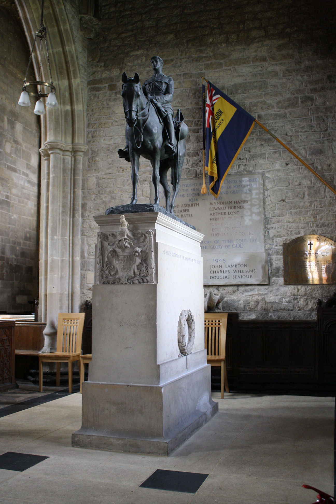
Equestrian statue of Edward Horner

The equestrian statue of Edward Horner stands inside St Andrew's Church in the village of Mells in Somerset, south-western England. It was designed by...

St Andrew's Church, Mells

St Andrew's Church is a Church of England parish church located in the village of Mells in the English county of Somerset. The church is a grade I listed...
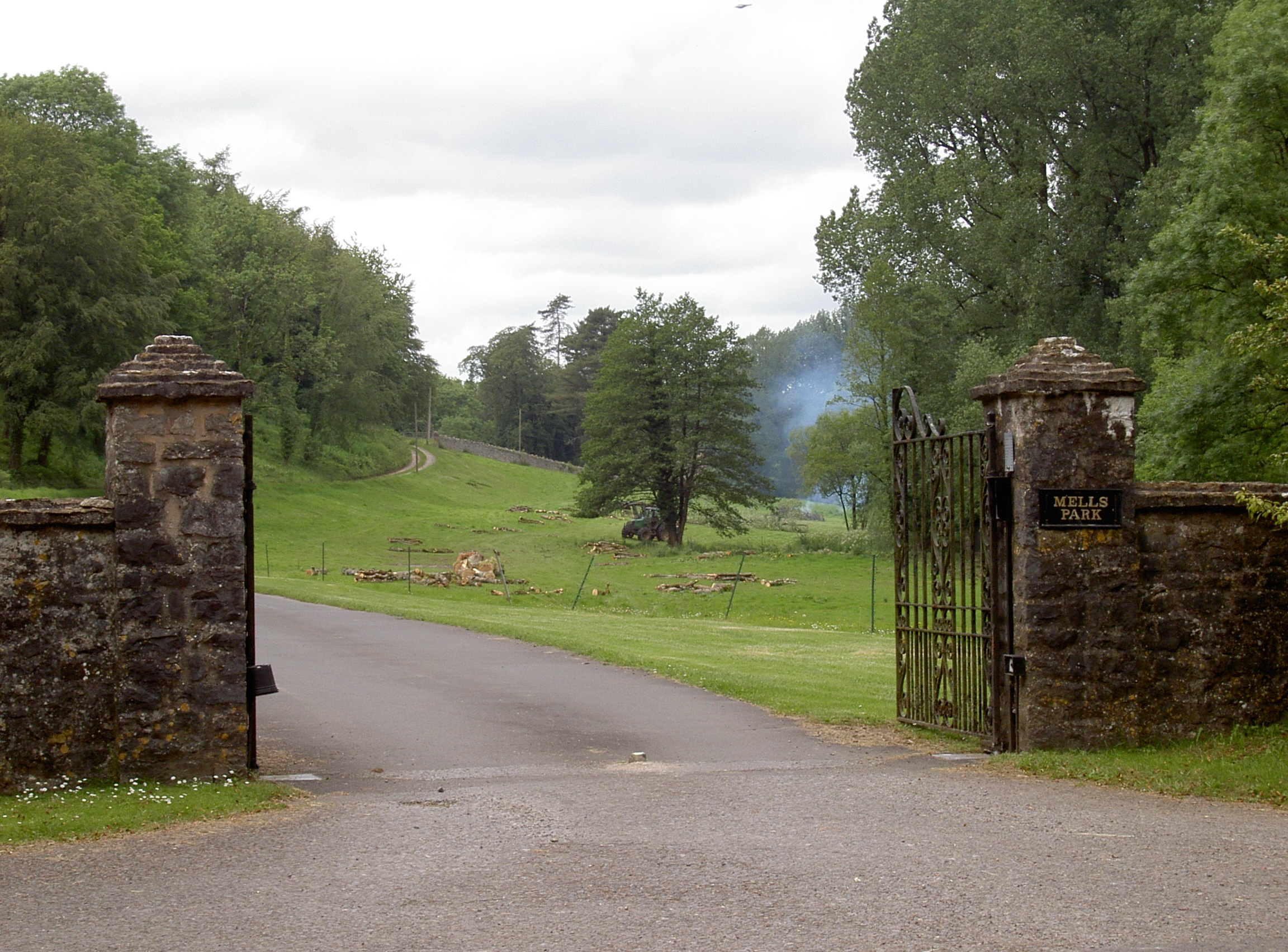
Mells Park

Mells Park is a country estate of 140 hectares (350 acres) near Mells, Somerset, England. It originated as a 17th-century deer park, probably created by...

Whatley Quarry

Whatley Quarry, grid reference ST731479 is a limestone quarry owned by Hanson plc, near the village of Whatley on the Mendip Hills, Somerset, England....

Nearby Amenities

Located within 500m of 51.237022,-2.397178
Power: pole
Lat/Long: 51.2331562/-2.3993701
Power: pole
Lat/Long: 51.2334568/-2.3983428
Power: pole
Lat/Long: 51.2338363/-2.3969963
Power: pole
Lat/Long: 51.2342629/-2.395623
Power: pole
Lat/Long: 51.2347718/-2.3945636
Power: pole
Lat/Long: 51.2351631/-2.3933002
Power: pole
Lat/Long: 51.2354956/-2.3921523
Power: pole
Lat/Long: 51.2358802/-2.390956
Give Way
Direction: forward
Lat/Long: 51.2351068/-2.3998777
Give Way
Direction: backward
Lat/Long: 51.2352337/-2.3999339
Booth: K6
Covered: booth
Man Made: telephone_box
Lat/Long: 51.2350271/-2.4001386
Give Way
Direction: backward
Lat/Long: 51.234978/-2.4000075
Information: guidepost
Tourism: information
Lat/Long: 51.2349151/-2.4000939
Post Box
Mapillary: 477468136698184
Operator: Royal Mail
Operator Wikidata: Q638098
Post Box Mounting: pier
Post Box Type: lamp
Lat/Long: 51.2369525/-2.3953418
The data included in this document is from www.openstreetmap.org. The data is made available under ODbL.

Have you been to Green, Little?

Leave your review of Green, Little below (or comments, questions and feedback).