Old Harry

Island in Dorset

England

Old Harry

Trig Point on Ballard Down, Swanage
Trig Point on Ballard Down, Swanage Credit: Colin Park

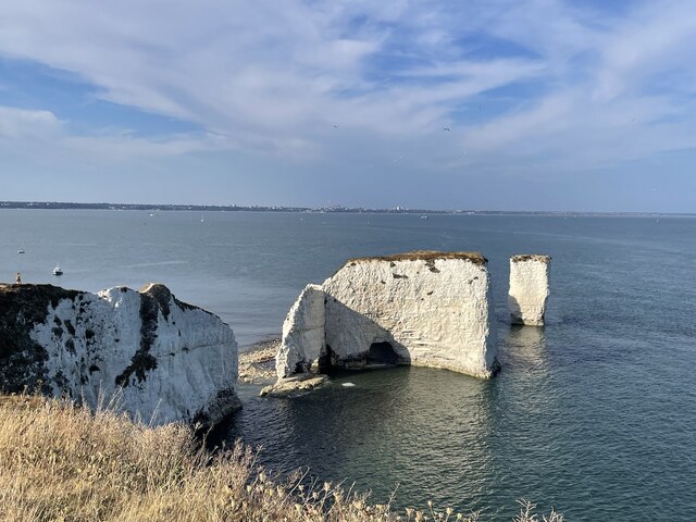
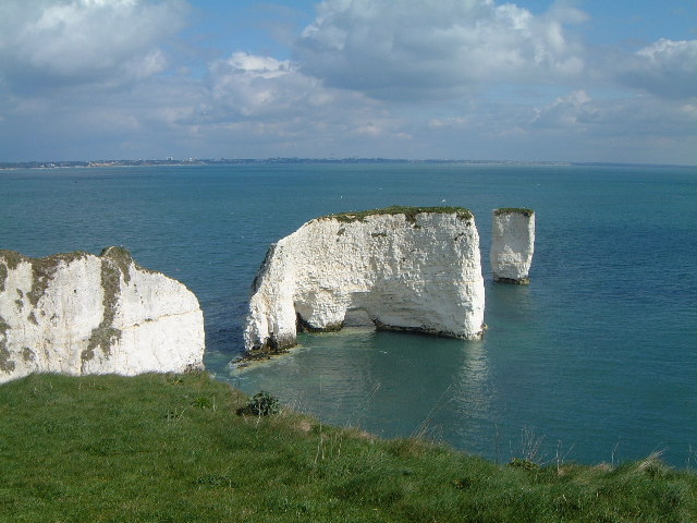
Old Harry is a famous natural landmark located in Dorset, England. It is a collection of chalk stacks that have been eroded from the mainland cliffs over thousands of years. Old Harry is situated at the eastern end of the Jurassic Coast, a UNESCO World Heritage Site renowned for its geological importance.

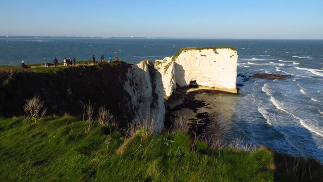
Comprising three chalk formations, Old Harry stands tall and proud, serving as a striking visual attraction for visitors. The tallest stack reaches a height of approximately 100 feet, making it an impressive sight against the backdrop of the English Channel. The stacks have distinct features, with their white chalk contrasting against the azure waters below.

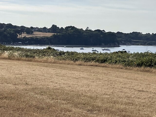
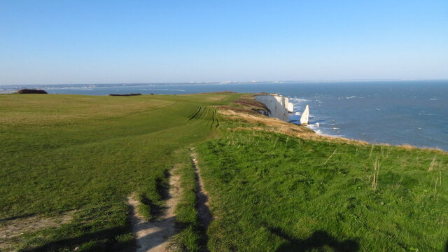
Access to Old Harry is possible by foot, with a scenic walking trail leading visitors from the nearby village of Studland. The path offers breathtaking views of the coastline and the stacks themselves, providing excellent photo opportunities for nature enthusiasts and photographers. The area surrounding Old Harry is also a popular spot for birdwatching, as it is home to various species of seabirds, including gulls and cormorants.

Old Harry has become an iconic symbol of Dorset and is considered one of its most recognizable landmarks. Its geological significance and stunning beauty attract tourists from all over the world, who come to appreciate and marvel at the natural wonders created by erosion and time.

If you have any feedback on the listing, please let us know in the comments section below.

Old Harry Images

Images are sourced within 2km of 50.642281/-1.9231548 or Grid Reference SZ0582. Thanks to Geograph Open Source API. All images are credited.

Trig Point on Ballard Down, Swanage
Old Harry Rocks
Old Harry Rocks
Track/Bridleway to Ballard Down
Cloudy on the Purbeck Way
Triangulation Point on the Purbeck Way
On Purbeck Way near Old Harry's Rocks
Near to Old Harry
Near to Old Harry
Bridleway to Studland
Pillbox at Redend Point
Direction Sign – Signpost on Church Road in Studland Located on the east side of the junction of Church Road and School Lane, in Studland parish. 4 arms and annulus finial. See also <a title="https://www.geograph.org.uk/photo/6293306" href="https://www.geograph.org.uk/photo/6293306">Link</a>.

Milestone Society National ID: DO_SZ0382
Direction Sign – Signpost on Church Road in Studland
Located on the east side of the junction of Church Road and School Lane, in Studland parish. 4 arms and annulus finial. See also Link. Milestone Society National ID: DO_SZ0382
The Bankes Arms Popular pub and restaurant close to South Beach in Studland.
The pub is named after the Bankes family, prominent Dorset landed gentry, who had a summer house built nearby.
The Bankes Arms
Popular pub and restaurant close to South Beach in Studland. The pub is named after the Bankes family, prominent Dorset landed gentry, who had a summer house built nearby.
Cliff top path The path runs between Studland and Handfast Point where Old Harry Rocks come into view <a href="https://www.geograph.org.uk/photo/7251240">SZ0582 : Old Harry Rocks</a>.
Cliff top path
The path runs between Studland and Handfast Point where Old Harry Rocks come into view SZ0582 : Old Harry Rocks.
Old Harry Rocks Chalk stacks at Handfast Point
Old Harry Rocks
Chalk stacks at Handfast Point
The Pinnacles Chalk stacks to the south of Headfast Point and Old Harry Rocks
The Pinnacles
Chalk stacks to the south of Headfast Point and Old Harry Rocks
Coast path descending E towards Ballard Point
Coast path between Ballard Point & Handfast Point
Chalk cliffs towards Old Harry Rocks
Old Harry Rocks from beach at Studland
Show me another place!

Old Harry is located at Grid Ref: SZ0582 (Lat: 50.642281, Lng: -1.9231548)

Unitary Authority: Dorset

Police Authority: Dorset

What 3 Words

///goes.joked.comfort. Near Swanage, Dorset

Related Wikis

Old Harry Rocks

Old Harry Rocks are three chalk formations, including a stack and a stump, located at Handfast Point, on the Isle of Purbeck in Dorset, southern England...
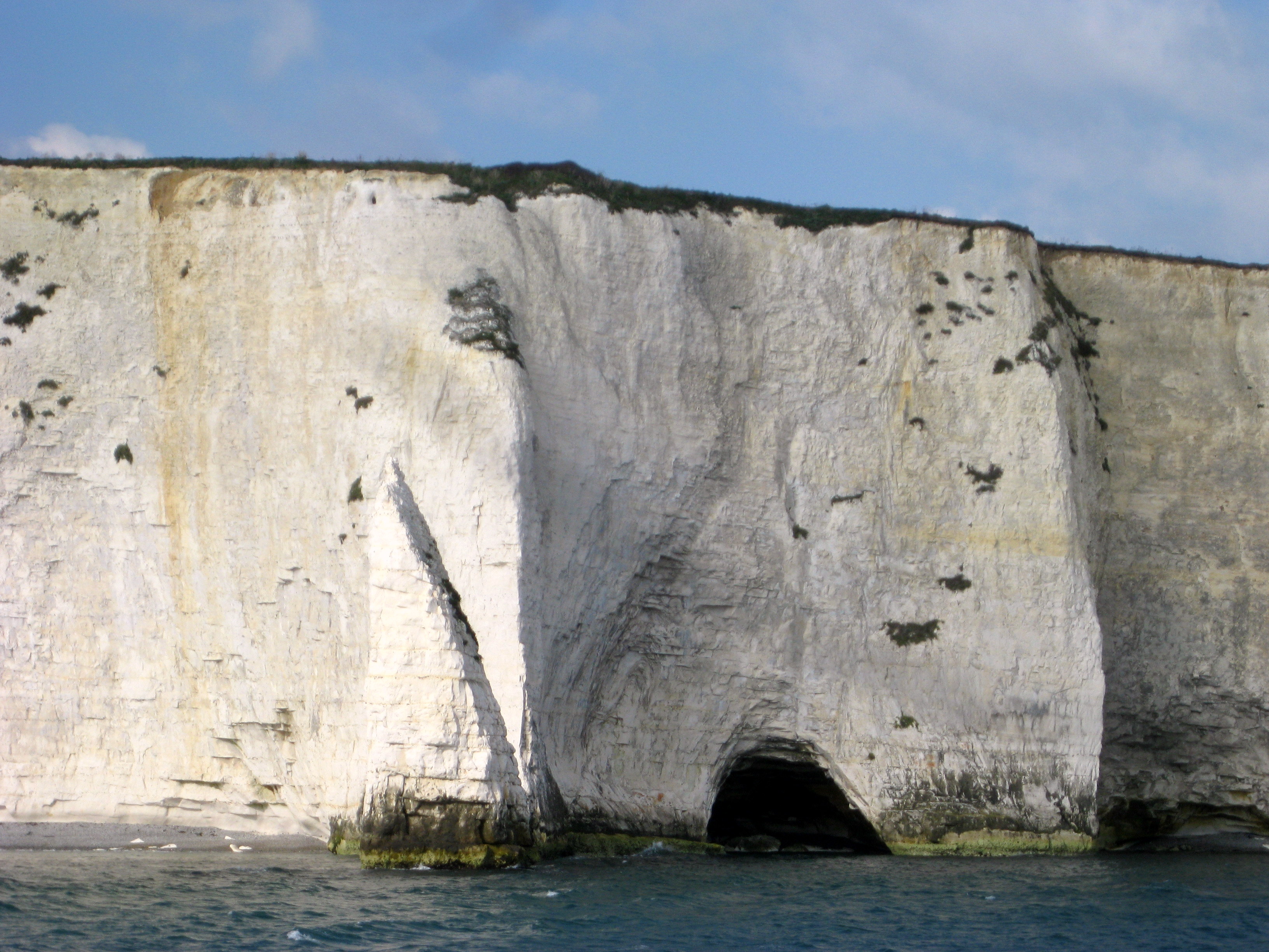
Parson's Barn

Parson's Barn is a large sea-level cavern below the Ballard Point cliffs, between Studland and Swanage bays in the English Channel. Ballard Point is the...

The Pinnacles (Dorset)

The Pinnacles are two chalk formations, including a stack and a stump, located near Handfast Point, on the Isle of Purbeck in Dorset, southern England...

Ballard Cliff

Ballard Cliff is part of the Jurassic Coast near Swanage in the Isle of Purbeck in Dorset, England. The steeply dipping Cretaceous chalk that marks the...

Nearby Amenities

Located within 500m of 50.642281,-1.9231548
Source: PGS
Lat/Long: 50.6386666/-1.9270167
Source: PGS
Lat/Long: 50.6390254/-1.9261178
Source: PGS
Lat/Long: 50.6401178/-1.9252049
Source: PGS
Lat/Long: 50.6403426/-1.9257608
Source: PGS
Lat/Long: 50.6410005/-1.9251781
Source: PGS
Lat/Long: 50.6415353/-1.9246076
Source: PGS
Lat/Long: 50.641634/-1.924525
Source: PGS
Lat/Long: 50.642734/-1.9226565
Source: PGS
Lat/Long: 50.641948/-1.9262856
Created By: almien_coastlines
Source: PGS
Lat/Long: 50.6417708/-1.9267708
Source: PGS
Lat/Long: 50.6421083/-1.9287647
Source: PGS
Lat/Long: 50.6419518/-1.9295037
Source: PGS
Lat/Long: 50.6420831/-1.9295935
Source: PGS
Lat/Long: 50.6421165/-1.929972
Old Harry Rocks
Addr Postcode: BH19 3AN
Tourism: attraction
Wikidata: Q571659
Wikipedia: en:Old Harry Rocks
Lat/Long: 50.6424216/-1.9233902
The Foreland
Alt Name: Handfast Point
Place: locality
Source: NLS - OS 1-inch 7th Series 1955-61
Lat/Long: 50.6426533/-1.9223438
Bench
Backrest: no
Lat/Long: 50.6418714/-1.9254948
Source: PGS
Lat/Long: 50.6417708/-1.9267708
Viewpoint to Old Harry Rocks
Tourism: viewpoint
Lat/Long: 50.6420336/-1.9287525
The data included in this document is from www.openstreetmap.org. The data is made available under ODbL.

Have you been to Old Harry?

Leave your review of Old Harry below (or comments, questions and feedback).