Western Patches

Island in Dorset

England

Western Patches

Footpath gateway on Golden Cap, Dorset Footpath gateway near the summit of Golden Cap on the Dorset coast.
Footpath gateway on Golden Cap, Dorset Credit: Alex Passmore

Western Patches is a small island located off the coast of Dorset, England. With a total area of approximately 0.5 square kilometers, it is one of the several islands that make up the Dorset archipelago. The island is situated in the English Channel, around 5 kilometers south of the mainland.

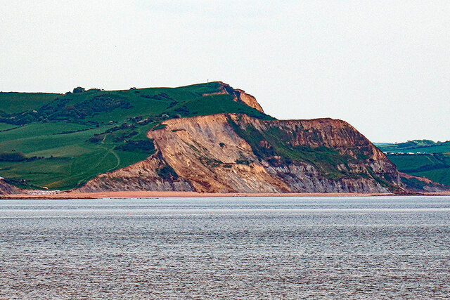
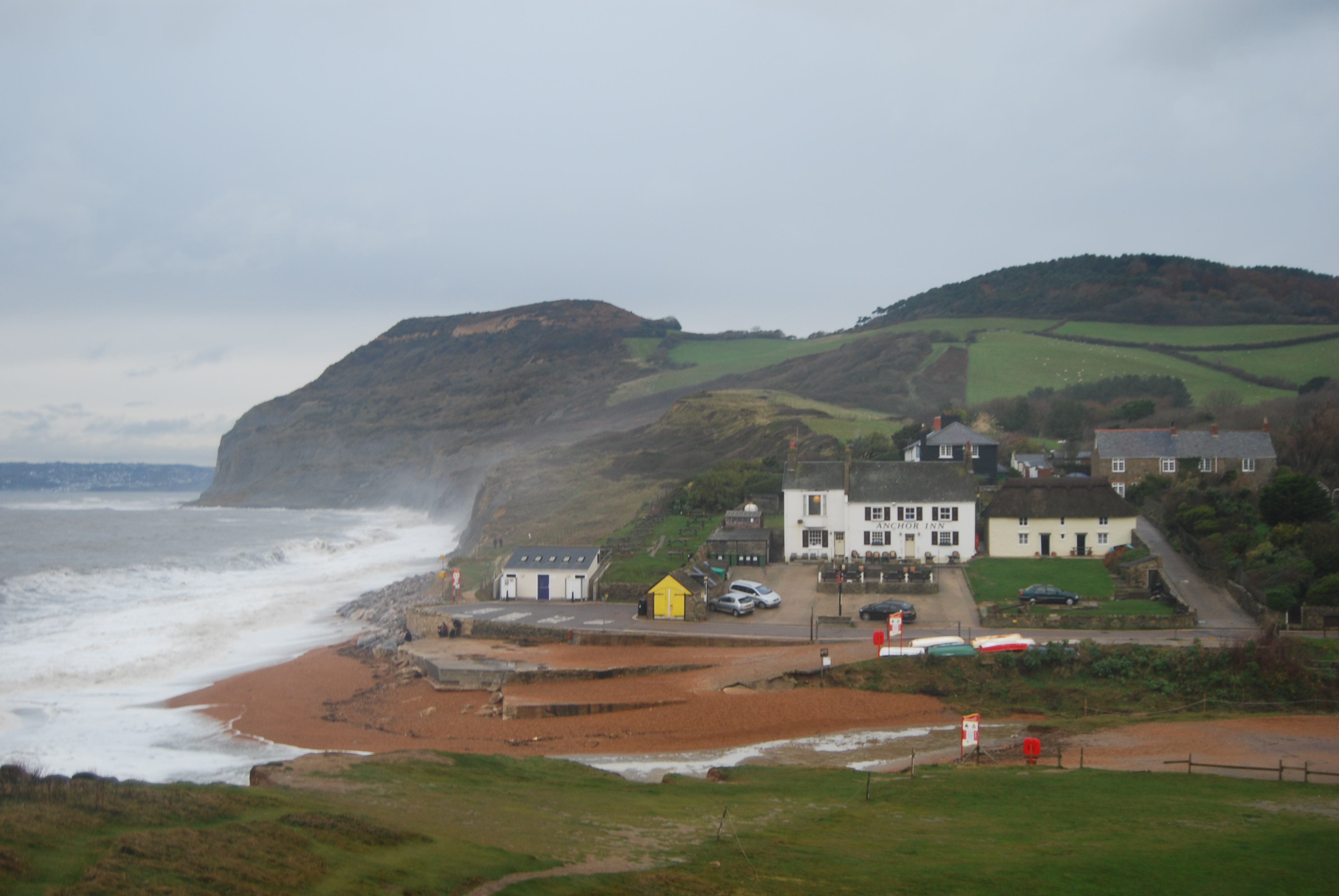
Western Patches is characterized by its rugged and rocky terrain, with steep cliffs lining its coastline. The island is uninhabited and lacks any permanent structures or facilities. It is primarily used as a nature reserve, providing a sanctuary for a variety of bird species, including puffins, gannets, and cormorants. The island is also home to a diverse range of plant life, with wildflowers and grasses covering its landscape.

Access to Western Patches is limited due to its remote location and lack of infrastructure. There are no scheduled ferry services to the island, and visitors typically reach it through private boats or organized wildlife tours. However, it is important to note that landing on the island is restricted during the breeding season to protect the nesting birds.

The isolation and natural beauty of Western Patches make it a popular destination for birdwatchers, nature enthusiasts, and photographers. Its stunning cliffs and abundant wildlife offer a unique and unspoiled experience for those seeking a tranquil escape in the Dorset region.

If you have any feedback on the listing, please let us know in the comments section below.

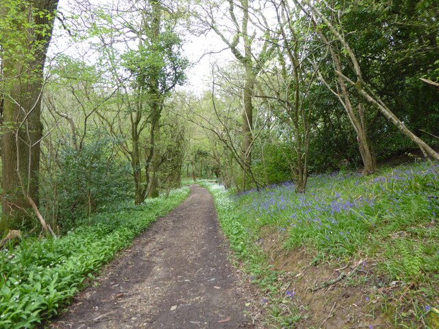
Western Patches Images

Images are sourced within 2km of 50.722523/-2.846328 or Grid Reference SY4091. Thanks to Geograph Open Source API. All images are credited.

Footpath gateway on Golden Cap, Dorset Footpath gateway near the summit of Golden Cap on the Dorset coast.
Footpath gateway on Golden Cap, Dorset
Footpath gateway near the summit of Golden Cap on the Dorset coast.
Seatown Beach Seatown Beach, with the River Winniford running into the sea, and Ridge Cliff in the background.
Photograph taken from the Anchor Inn, looking east.
Seatown Beach
Seatown Beach, with the River Winniford running into the sea, and Ridge Cliff in the background. Photograph taken from the Anchor Inn, looking east.
Triangulation pillar, Golden Cap The triangulation pillar on the summit of Golden Cap.
The flush bracket benchmark number S3752 on the east face of the pillar marks a height of 190.9487m above sea level (Ordnance Datum Newlyn) last levelled in 1953 (photograph <a href="https://www.geograph.org.uk/photo/7095474">SY4092 : Flush Bracket benchmark, Golden Cap</a>).
This triangulation pillar is on the route of the England Coast Path.
Triangulation pillar, Golden Cap
The triangulation pillar on the summit of Golden Cap. The flush bracket benchmark number S3752 on the east face of the pillar marks a height of 190.9487m above sea level (Ordnance Datum Newlyn) last levelled in 1953 (photograph SY4092 : Flush Bracket benchmark, Golden Cap). This triangulation pillar is on the route of the England Coast Path.
Flush Bracket benchmark, Golden Cap Detail of the Ordnance Survey flush bracket benchmark on the triangulation pillar on the summit of Golden Cap (photograph <a href="https://www.geograph.org.uk/photo/7095263">SY4092 : Triangulation pillar, Golden Cap</a>).  The benchmark marks a height of 190.9487m above sea level (Ordnance Datum Newlyn) last levelled in 1953.
Flush Bracket benchmark, Golden Cap
Detail of the Ordnance Survey flush bracket benchmark on the triangulation pillar on the summit of Golden Cap (photograph SY4092 : Triangulation pillar, Golden Cap). The benchmark marks a height of 190.9487m above sea level (Ordnance Datum Newlyn) last levelled in 1953.
Path through St Gabriel's Wood, May Day 2023
Seatown: May Day 2023
On the beach at Seatown
Golden Cap Viewed from Lyme Regis.
Golden Cap
Viewed from Lyme Regis.
Seatown houses
Seatown houses
Sea defences
Sea defences
View to Chardown Hill  From Felicity's Farm Shop
View to Chardown Hill
From Felicity's Farm Shop
The Dorset coast east of Charmouth In the foreground is Westhay Farm. Conspicuous beyond the farm is the flat-topped Golden Cap, at 191m the highest point on the south coast of England. Though a few argue that as the cliff is not vertical, the summit is about 250m inland from the sea itself. I have been known to be pedantic, but this must be pedantry gone mad! 

On the horizon, right, is the outline of Portland Bill.
The Dorset coast east of Charmouth
In the foreground is Westhay Farm. Conspicuous beyond the farm is the flat-topped Golden Cap, at 191m the highest point on the south coast of England. Though a few argue that as the cliff is not vertical, the summit is about 250m inland from the sea itself. I have been known to be pedantic, but this must be pedantry gone mad! On the horizon, right, is the outline of Portland Bill.
Seatown
Seatown
Golden Cap The trig point at the highest point on the south coast, looking east over Seatown towards Doghouse Hill
Golden Cap
The trig point at the highest point on the south coast, looking east over Seatown towards Doghouse Hill
Golden Cap from the west As the highest point on the southern coast of England, Golden Cap gets lots of visitors.  Most walk up from Seatown and miss out on this great view of the hill from the west.
Golden Cap from the west
As the highest point on the southern coast of England, Golden Cap gets lots of visitors. Most walk up from Seatown and miss out on this great view of the hill from the west.
Anchor Inn, Seatown A wonderful seaside pub, right on the beach. The South West Coast Path climbs up over Golden Cap in the middle distance with Lyme Regis beyond.
Anchor Inn, Seatown
A wonderful seaside pub, right on the beach. The South West Coast Path climbs up over Golden Cap in the middle distance with Lyme Regis beyond.
St. Gabriel's Mouth
St. Gabriel's Mouth
Cliff and seashore below Golden Cap
Show me another place!

Western Patches is located at Grid Ref: SY4091 (Lat: 50.722523, Lng: -2.846328)

Unitary Authority: Dorset

Police Authority: Dorset

What 3 Words

///snowboard.drilled.blossom. Near Charmouth, Dorset

Related Wikis

Golden Cap

Golden Cap is a hill and cliff situated on the English Channel coast between Bridport and Charmouth in Dorset, England. At 191 metres (627 ft), it is arguably...

Stanton St Gabriel

Stanton St Gabriel is a civil parish in west Dorset, England. It lies approximately midway between the towns of Lyme Regis and Bridport on the Jurassic...

Seatown

Seatown is a coastal hamlet in Dorset, England, on the English Channel approximately 3 miles (4.8 km) west-southwest of Bridport. It lies within the civil...

Chardown Hill

Chardown Hill is a prominent, rounded hill, 194 metres (636 ft) high, just to the southwest of the village of Morcombelake in the county of Dorset in southern...

Nearby Amenities

Located within 500m of 50.722523,-2.846328
Earl of Antrim Memorial
Historic: memorial
Lat/Long: 50.7258223/-2.8432751
Barrier: kissing_gate
Lat/Long: 50.7260316/-2.8460927
Bench
Lat/Long: 50.7260062/-2.8462014
Bench
Lat/Long: 50.725712/-2.8444938
Direction: 360
Ele: 189
Tourism: viewpoint
Lat/Long: 50.7256667/-2.843173
The data included in this document is from www.openstreetmap.org. The data is made available under ODbL.

Have you been to Western Patches?

Leave your review of Western Patches below (or comments, questions and feedback).