Swona

Island in Orkney

Scotland

Swona

West Winni Skerry on Swona
West Winni Skerry on Swona Credit: John Ferguson

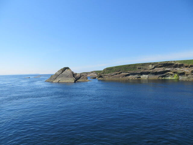
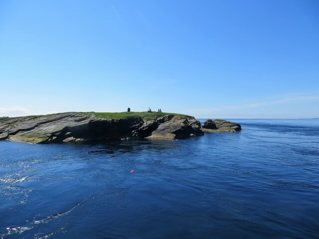
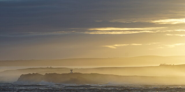
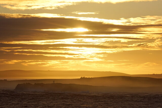
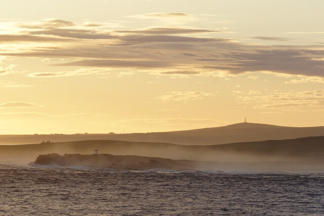
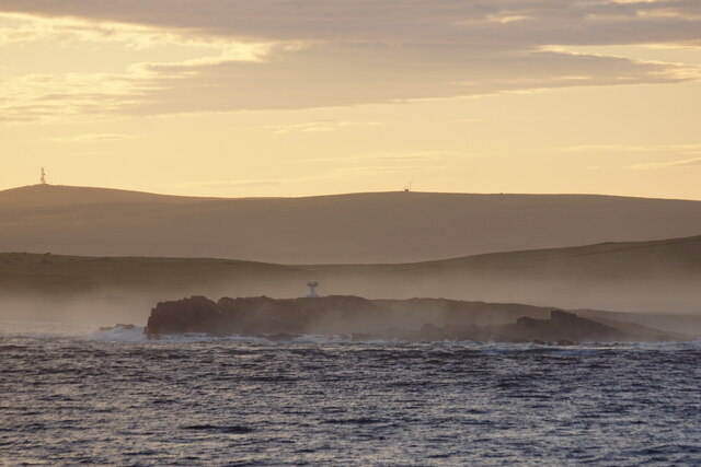
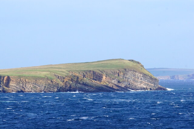
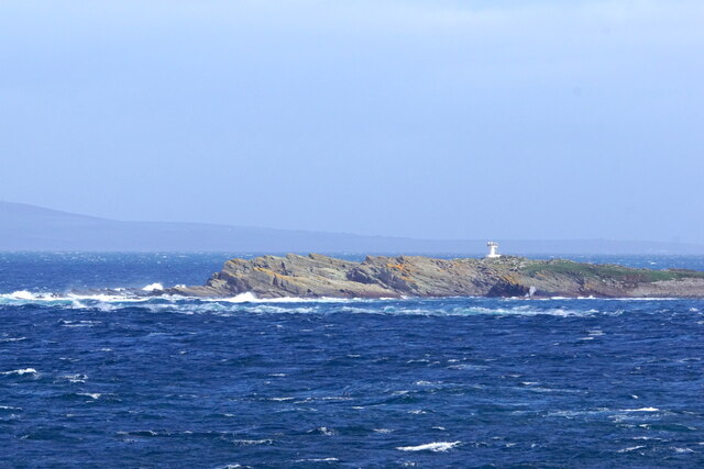
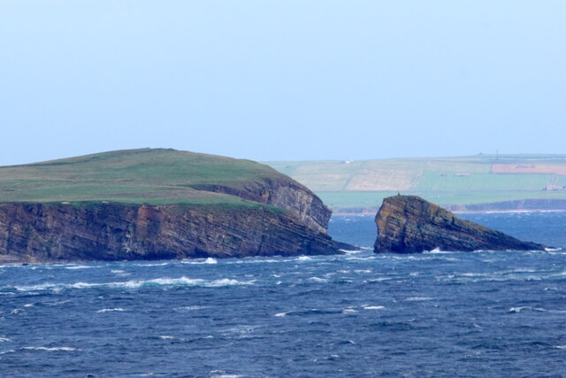
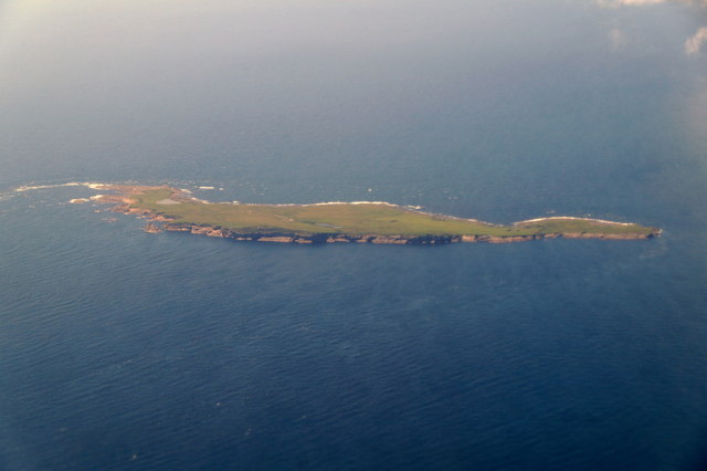
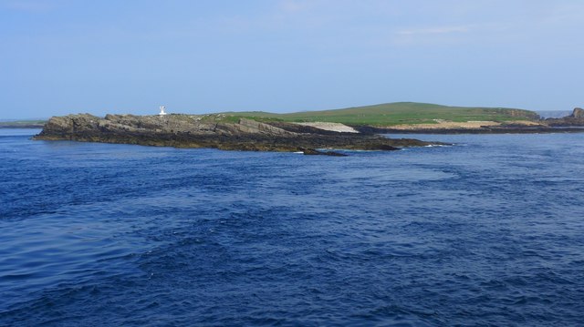
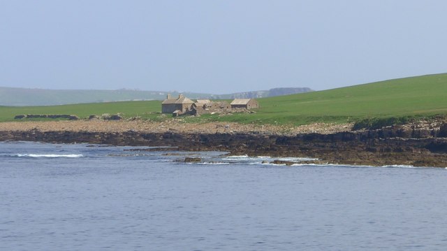
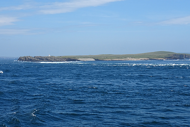
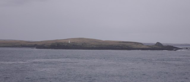
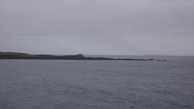
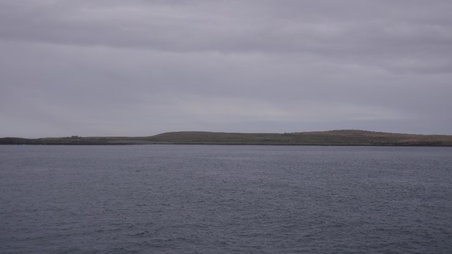
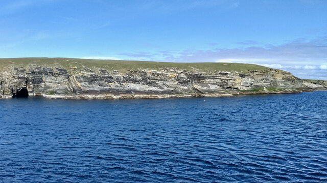
Swona is a small uninhabited island located in the Orkney archipelago, off the northeastern coast of Scotland. Situated between Mainland Orkney and Hoy, this remote island covers an area of approximately 122 hectares. Swona is known for its rugged and wild landscapes, with steep cliffs and rocky shores that provide a habitat for a variety of bird species.

The island has a unique history and was once inhabited by a small farming community until 1974 when the last residents left due to the challenging living conditions and lack of modern amenities. Today, Swona is primarily used for grazing sheep during the summer months, with a small number of livestock brought over by local farmers.

The island boasts a diverse ecosystem, with a significant population of seabirds such as puffins, fulmars, and guillemots. Visitors can witness these magnificent creatures nesting on the cliffs, along with a range of other wildlife including seals and dolphins that can occasionally be spotted offshore.

Access to Swona is limited, and there are no public ferry services to the island. However, it is possible to arrange private boat trips to explore the island's natural beauty and witness its unique wildlife. It is important to note that due to the fragile ecosystem and nesting birds, visitors are encouraged to respect the island's wildlife and follow designated paths to minimize disturbance.

In summary, Swona is a remote and uninhabited island in the Orkney archipelago, offering visitors a chance to experience the untamed beauty of its rugged landscapes and observe a diverse array of bird species.

If you have any feedback on the listing, please let us know in the comments section below.

Swona Images

Images are sourced within 2km of 58.741524/-3.0621286 or Grid Reference ND3884. Thanks to Geograph Open Source API. All images are credited.

West Winni Skerry on Swona
The North Head, Swona
Beacon on Swona, Pentland Firth, at dawn
Dawn over Swona, Pentland Firth
Dawn over Swona, Pentland Firth South Ronaldsay in the background.
Dawn over Swona, Pentland Firth
South Ronaldsay in the background.
Beacon on the Tarf, Swona, Pentland Firth
Swona from the south Taken from about ND 3922
Swona from the south
Taken from about ND 3922
The Tarf, Swona, from the south
Sooth Clett, Swona, from the sea Taken from about ND 3681
Sooth Clett, Swona, from the sea
Taken from about ND 3681
Swona, Orkney, from the air
Skerries at SW tip of Swona The navigation light visible in the background.

Photo taken from "Pentalina" ferry between Gills Bay and St Margaret's Hope.
Skerries at SW tip of Swona
The navigation light visible in the background. Photo taken from "Pentalina" ferry between Gills Bay and St Margaret's Hope.
Buildings on Swona
Buildings on Swona
Tails of the Tarf The disturbed water shows some of the dangers of the Pentland Firth for small vessels. Only a small part of the tip of the island of Swona is in this square.
Tails of the Tarf
The disturbed water shows some of the dangers of the Pentland Firth for small vessels. Only a small part of the tip of the island of Swona is in this square.
The Tarf, Swona A navigation beacon at the southern end of the island.
The Tarf, Swona
A navigation beacon at the southern end of the island.
Tails of the Tarf Skerries on the southern tip of Swona, Pentland Firth.
Tails of the Tarf
Skerries on the southern tip of Swona, Pentland Firth.
Swona View from the Pentland Ferries boat passing to the west.
Swona
View from the Pentland Ferries boat passing to the west.
Swona The island is situated in the Pentland Firth where it creates an obstruction to the strong tides producing tidal races, over-falls and whirlpools. One of these whirlpools is known as the ‘Wells of Swona’, and legend has it is caused by a witch struggling to save herself. To quote directly from Westwood and Kingshill’s book “The Lore of Scotland: A guide to Scottish legends”:

"A witch once took a fancy to a dark and handsome young man and wanted him for her lover. When she asked him to go to the beach with her, however, he refused, as his sweetheart was at that moment on her way to join him. Concealing her anger, the witch persuaded the young man and his girl to come out with her in her boat. As they approached Swona, she worked a spell on the boat and it overturned. The young man caught his girl’s hand in an attempt to save her, but at the same moment the witch caught hold of his to drag him under the waves and into her power. The three were so entangled that they could not be pulled apart. The young man and his sweetheart were drowned, but the witch is still struggling to get free, and it is her frantic churning of the waters that causes the Wells of Swona."

Adapted from my daily photo diary <span class="nowrap"><a title="http://www.fhithich.uk/?p=25760" rel="nofollow ugc noopener" href="http://www.fhithich.uk/?p=25760">Link</a><img style="margin-left:2px;" alt="External link" title="External link - shift click to open in new window" src="https://s1.geograph.org.uk/img/external.png" width="10" height="10"/></span>
Swona
The island is situated in the Pentland Firth where it creates an obstruction to the strong tides producing tidal races, over-falls and whirlpools. One of these whirlpools is known as the ‘Wells of Swona’, and legend has it is caused by a witch struggling to save herself. To quote directly from Westwood and Kingshill’s book “The Lore of Scotland: A guide to Scottish legends”: "A witch once took a fancy to a dark and handsome young man and wanted him for her lover. When she asked him to go to the beach with her, however, he refused, as his sweetheart was at that moment on her way to join him. Concealing her anger, the witch persuaded the young man and his girl to come out with her in her boat. As they approached Swona, she worked a spell on the boat and it overturned. The young man caught his girl’s hand in an attempt to save her, but at the same moment the witch caught hold of his to drag him under the waves and into her power. The three were so entangled that they could not be pulled apart. The young man and his sweetheart were drowned, but the witch is still struggling to get free, and it is her frantic churning of the waters that causes the Wells of Swona." Adapted from my daily photo diary LinkExternal link
Show me another place!

Swona is located at Grid Ref: ND3884 (Lat: 58.741524, Lng: -3.0621286)

Unitary Authority: Orkney Islands

Police Authority: Highlands and Islands

What 3 Words

///data.apes.erase. Near St Margaret's Hope, Orkney Islands

Related Wikis

Swona

Swona is an uninhabited privately owned island in the Pentland Firth off the north coast of Scotland. It has a herd of feral cattle resulting from the...

MV Cemfjord

The Cemfjord was a Cyprus-registered cargo ship which foundered in the Pentland Firth off the north-east coast of Scotland on 2 January 2015. Built as...

SM U-29 (Germany)

SM U-29 was a Type U-27 U-boat of the Imperial German Navy. She served during the First World War. U-29's last commander was Captain Otto Weddigen. U-29...

Burwick, Orkney

Burwick () is a small harbour on the island of South Ronaldsay in the Orkney Islands, Scotland. It is the closest Orkney harbour to the Scottish mainland...

Nearby Amenities

Located within 500m of 58.741524,-3.0621286
Created By: almien_coastlines mod
Lat/Long: 58.737503/-3.061224
Created By: almien_coastlines mod
Lat/Long: 58.739426/-3.054582
Created By: almien_coastlines mod
Lat/Long: 58.739297/-3.054827
Created By: almien_coastlines mod
Lat/Long: 58.739677/-3.064921
Created By: almien_coastlines mod
Lat/Long: 58.739421/-3.065413
Created By: almien_coastlines mod
Lat/Long: 58.737375/-3.061471
Created By: almien_coastlines mod
Lat/Long: 58.740189/-3.06443
Created By: almien_coastlines mod
Lat/Long: 58.745822/-3.059761
Keefa Hill
Place: locality
Source: OS map
Lat/Long: 58.7430212/-3.0571041
Warbister Hill
Place: locality
Lat/Long: 58.7412286/-3.0538264
The data included in this document is from www.openstreetmap.org. The data is made available under ODbL.

Have you been to Swona?

Leave your review of Swona below (or comments, questions and feedback).