Fara

Island in Orkney

Scotland

Fara

Pelamis Wave Energy Convertor For information on the P2-002 wave machine see <span class="nowrap"><a title="https://www.emec.org.uk/about-us/wave-clients/pelamis-wave-power/" rel="nofollow ugc noopener" href="https://www.emec.org.uk/about-us/wave-clients/pelamis-wave-power/">Link</a><img style="margin-left:2px;" alt="External link" title="External link - shift click to open in new window" src="https://s1.geograph.org.uk/img/external.png" width="10" height="10"/></span>
Pelamis Wave Energy Convertor Credit: Graeme Yuill

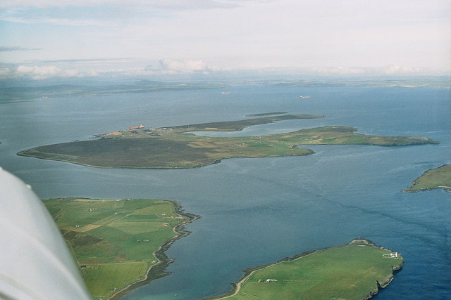
Fara is a small island located in the Orkney archipelago, situated off the northeastern coast of mainland Scotland. It is one of the uninhabited islands in the group and covers an area of around 80 hectares. Fara is the most northerly of the Orkney isles and lies about 1.5 kilometers northeast of the larger island of Stronsay.

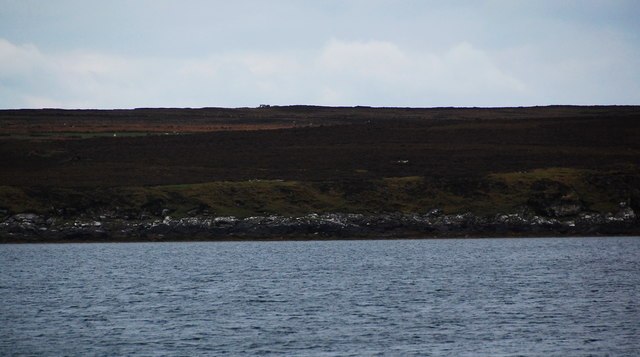
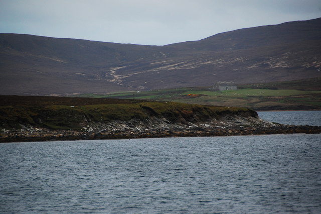
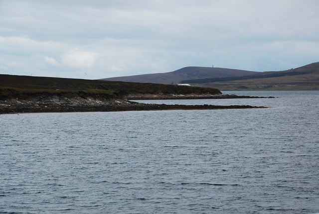
The island is characterized by its rugged and picturesque landscape, with steep cliffs and grassy slopes. Fara is home to a diverse range of bird species, including puffins, guillemots, and razorbills, making it a popular spot for birdwatching enthusiasts. It also serves as a breeding ground for grey seals, which can often be spotted basking on the rocky shores.

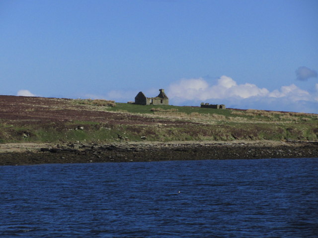
Although Fara is uninhabited, it has historical significance as it was once home to a small population. The island is dotted with ancient remains, including a broch (a circular stone tower), a chambered cairn, and a number of Viking burial mounds. These archaeological sites provide insights into the island's past and offer visitors a glimpse into its rich history.

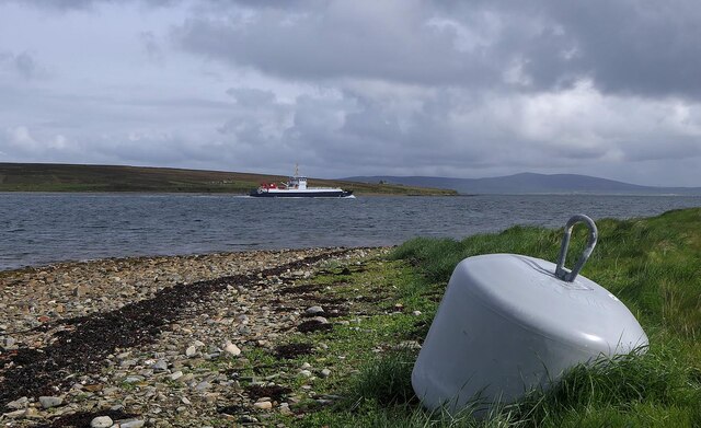
Access to Fara is limited, as there are no scheduled ferry services to the island. However, it is possible to arrange private boat trips from Stronsay or other nearby islands. Visitors to Fara are advised to wear appropriate footwear and clothing due to the challenging terrain and unpredictable weather conditions.

If you have any feedback on the listing, please let us know in the comments section below.
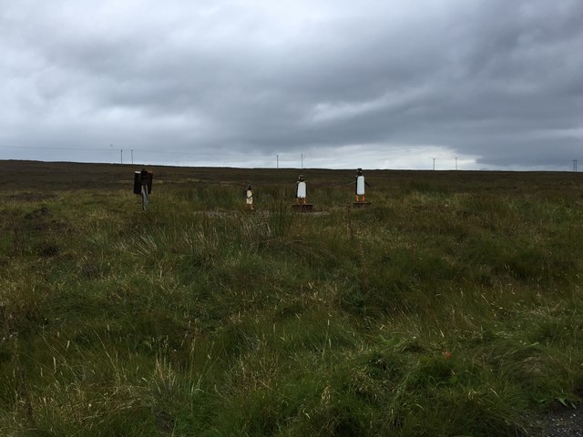
Fara Images

Images are sourced within 2km of 58.844388/-3.1651934 or Grid Reference ND3295. Thanks to Geograph Open Source API. All images are credited.

Pelamis Wave Energy Convertor For information on the P2-002 wave machine see <span class="nowrap"><a title="https://www.emec.org.uk/about-us/wave-clients/pelamis-wave-power/" rel="nofollow ugc noopener" href="https://www.emec.org.uk/about-us/wave-clients/pelamis-wave-power/">Link</a><img style="margin-left:2px;" alt="External link" title="External link - shift click to open in new window" src="https://s1.geograph.org.uk/img/external.png" width="10" height="10"/></span>
Pelamis Wave Energy Convertor
For information on the P2-002 wave machine see LinkExternal link
Lyness Ferry Terminal
Oystercatcher sculpture, Flotta, Orkney The oystercatchers are enjoying the view across Weddel Sound to Fara.

Since Matthew visited 14 years ago, <a href="https://www.geograph.org.uk/photo/882445">ND3494 : Oystercatchers on Flotta</a>, the chick has stopped riding its scooter and taken up the bagpipes.

This is one of several sculptures made of recycled materials which can be found on Flotta. See also <a href="https://www.geograph.org.uk/photo/7198657">ND3693 : Penny farthing sculpture, Flotta, Orkney</a> and <a href="https://www.geograph.org.uk/photo/1864035">ND3793 : Doodlebug</a>.
Oystercatcher sculpture, Flotta, Orkney
The oystercatchers are enjoying the view across Weddel Sound to Fara. Since Matthew visited 14 years ago, ND3494 : Oystercatchers on Flotta, the chick has stopped riding its scooter and taken up the bagpipes. This is one of several sculptures made of recycled materials which can be found on Flotta. See also ND3693 : Penny farthing sculpture, Flotta, Orkney and ND3793 : Doodlebug.
Weddel Sound, Flotta, Orkney Weddel Sound is the stretch of water between Flotta and Fara, an uninhabited island.  The ferry is Orkney Ferries' Hoy Head travelling between Hoy and Houton via Flotta.
Weddel Sound, Flotta, Orkney
Weddel Sound is the stretch of water between Flotta and Fara, an uninhabited island. The ferry is Orkney Ferries' Hoy Head travelling between Hoy and Houton via Flotta.
A Pelamis prototype wave energy machine This is now owned by Orkney Isles Council and is parked here until they decide what to do with it! See: <span class="nowrap"><a title="https://www.emec.org.uk/press-release-council-takes-ownership-of-pelamis-device/" rel="nofollow ugc noopener" href="https://www.emec.org.uk/press-release-council-takes-ownership-of-pelamis-device/">Link</a><img style="margin-left:2px;" alt="External link" title="External link - shift click to open in new window" src="https://s1.geograph.org.uk/img/external.png" width="10" height="10"/></span>
A Pelamis prototype wave energy machine
This is now owned by Orkney Isles Council and is parked here until they decide what to do with it! See: LinkExternal link
Lyness: offshore works Presumably something connected with the oil industry, although I confess I don't know for sure.
Lyness: offshore works
Presumably something connected with the oil industry, although I confess I don't know for sure.
Lyness: view over village from Wee Fea Looking east from this marvellous viewpoint, with the industrial workings at Lyness and, beyond, the oil works on Flotta.
Lyness: view over village from Wee Fea
Looking east from this marvellous viewpoint, with the industrial workings at Lyness and, beyond, the oil works on Flotta.
Pier at Lyness The ferry from Houton approaches Lyness
Pier at Lyness
The ferry from Houton approaches Lyness
Approaching the pier at Lyness On the ferry from Houton.
Approaching the pier at Lyness
On the ferry from Houton.
On board ferry from Houton to Lyness - view to Fara
Flotta; Airstrip terminal
Flotta: Oystercatcher sculptures
Low cliffs and wave-cut platform, Fara Looking ashore near Whiting Point, Fara. Building called "Whitingpoint" on the skyline.
Low cliffs and wave-cut platform, Fara
Looking ashore near Whiting Point, Fara. Building called "Whitingpoint" on the skyline.
North Point, Fara Looking towards North Point, with the buildings at Muckle Rysa (<a href="https://www.geograph.org.uk/gridref/ND306967">ND306967</a>) on Hoy beyond.
North Point, Fara
Looking towards North Point, with the buildings at Muckle Rysa (ND306967) on Hoy beyond.
North Point, Fara North point, with Peat point beyond. In the distance is the mast at Binga Fea, Hoy (ND280925).
North Point, Fara
North point, with Peat point beyond. In the distance is the mast at Binga Fea, Hoy (ND280925).
Lyness Ferry Terminal
The oystercatchers at Flotta These interesting metallic oystercatchers can be found to the north of the disused airstrip.
The oystercatchers at Flotta
These interesting metallic oystercatchers can be found to the north of the disused airstrip.
Waiting to Disembark the 'Hoy Head' has arrived at Lyness and raised her bow door. The complement of vehicles (3 cars containing 6 tourists and 4 vans containing workmen on their way to do their jobs) waits for the ramp to be lowered.
Waiting to Disembark
the 'Hoy Head' has arrived at Lyness and raised her bow door. The complement of vehicles (3 cars containing 6 tourists and 4 vans containing workmen on their way to do their jobs) waits for the ramp to be lowered.
Show me another place!

Fara is located at Grid Ref: ND3295 (Lat: 58.844388, Lng: -3.1651934)

Unitary Authority: Orkney Islands

Police Authority: Highlands and Islands

What 3 Words

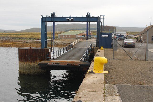
///strict.drips.jammy. Near Lyness, Orkney Islands

Related Wikis

Fara, Orkney

Fara (, Old Norse: Færey ) is a small island in Orkney, Scotland, lying in Scapa Flow between the islands of Flotta and Hoy. It has been uninhabited since...

Gutter Sound

Gutter Sound is a sound in Orkney, Scotland, part of Scapa Flow. It lies to the west of the main harbour between the internal islands of Cava and Fara...

Scapa Flow Museum

Scapa Flow Museum is a war museum in Lyness on the Island of Hoy, Orkney, Scotland. Housed within a refurbished Romney hut and oil fuel pump house at the...

Crockness Martello tower

Crockness Martello Tower is a Martello Tower on Hoy, Orkney, Scotland. It was built during the Napoleonic Wars, at the same time as the Martello Tower...

Rysa Little

Rysa Little, commonly referred to as Rysa, is an uninhabited island in the Orkney archipelago in Scotland. It is approximately 32 hectares (79 acres) in...

Lyness

Lyness is a village on the east coast of the island of Hoy, Orkney, Scotland. The village is within the parish of Walls and Flotta, and is situated at...

Flotta

Flotta () is a small island in Orkney, Scotland, lying in Scapa Flow. The island is known for its large oil terminal and is linked by Orkney Ferries to...

HMS Vanguard (1909)

HMS Vanguard was one of three St Vincent-class dreadnought battleships built for the Royal Navy in the first decade of the 20th century. She spent her...

Nearby Amenities

Located within 500m of 58.844388,-3.1651934
Upper Quoy
Place: locality
Lat/Long: 58.8459339/-3.1678118
Thomson's Hill
Place: locality
Lat/Long: 58.8439245/-3.1684984
Mucklehouse
Place: locality
Lat/Long: 58.8446128/-3.161353
Upper House
Place: locality
Lat/Long: 58.8453899/-3.1653441
The data included in this document is from www.openstreetmap.org. The data is made available under ODbL.

Have you been to Fara?

Leave your review of Fara below (or comments, questions and feedback).