Barabhas Iarach

Settlement in Ross-shire

Scotland

Barabhas Iarach

Galson Motors Large bus depot at Barvas / Barabhas, in the north of Lewis.
Galson Motors Credit: Colin Smith

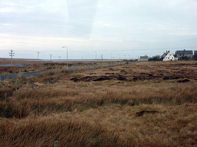
Barabhas Iarach is a small and picturesque village located in the county of Ross-shire, in the Highland region of Scotland. Situated on the western coast of the Scottish mainland, it is nestled between the stunning mountains of Torridon and the scenic Loch Torridon.

Home to a close-knit community, Barabhas Iarach is known for its tranquil and idyllic setting. The village is surrounded by breathtaking natural beauty, with lush greenery, rolling hills, and a rugged coastline. The crystal-clear waters of Loch Torridon are a prominent feature, providing residents and visitors alike with opportunities for various water-based activities such as fishing, sailing, and kayaking.

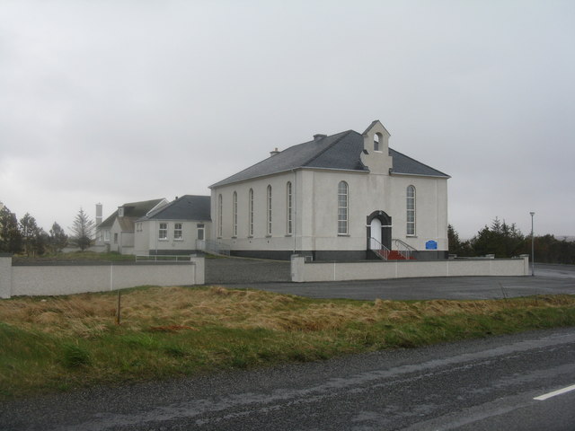
The village itself is characterized by its charming traditional Scottish architecture, with stone cottages and whitewashed buildings dotting the landscape. Barabhas Iarach is also home to a small but vibrant local economy, with a few shops, cafes, and pubs serving the needs of both locals and tourists.

For nature enthusiasts, the area offers ample opportunities for outdoor exploration. There are numerous walking and hiking trails that wind through the surrounding mountains, providing spectacular views of the rugged landscape. Wildlife lovers will also be delighted to spot various species, including red deer and golden eagles.

Overall, Barabhas Iarach offers a peaceful and serene escape from the hustle and bustle of city life, making it an ideal destination for those seeking tranquility, natural beauty, and a taste of traditional Scottish village life.

If you have any feedback on the listing, please let us know in the comments section below.

Barabhas Iarach Images

Images are sourced within 2km of 58.349116/-6.5310646 or Grid Reference NB3549. Thanks to Geograph Open Source API. All images are credited.

Galson Motors Large bus depot at Barvas / Barabhas, in the north of Lewis.
Galson Motors
Large bus depot at Barvas / Barabhas, in the north of Lewis.
The A857 entering Barabhas Iarach
Post Office at Barabhas A smart new building, presumably with other functions, as the PO is only open two half-days a week, and I did not find a post box.
Post Office at Barabhas
A smart new building, presumably with other functions, as the PO is only open two half-days a week, and I did not find a post box.
Ionad Coimhearsnachd Bharabhais agus Bhrù A new community centre for Barabhas and Brù, adjacent to the Post Office.
Ionad Coimhearsnachd Bharabhais agus Bhrù
A new community centre for Barabhas and Brù, adjacent to the Post Office.
Filling station and village shop at Barabhas Conveniently placed at the junction of the A857, south to Stornoway and north to Port Nis and the Butt of Lewis, and the A858 west to Carloway and Callanish.
Filling station and village shop at Barabhas
Conveniently placed at the junction of the A857, south to Stornoway and north to Port Nis and the Butt of Lewis, and the A858 west to Carloway and Callanish.
Church of Scotland at Barabhas/Barvas It has had a makeover since Donald Lawson was there in 2006 <a href="https://www.geograph.org.uk/photo/207097">NB3549 : Barvas Church of Scotland</a> and Google Street View went past in 2009, and now looks very smart.
Church of Scotland at Barabhas/Barvas
It has had a makeover since Donald Lawson was there in 2006 NB3549 : Barvas Church of Scotland and Google Street View went past in 2009, and now looks very smart.
The A857 at Barabhas Bungalow and derelict 1932 house, and post-box, which is protected from the elements by a lift-up flap covering the slot.
The A857 at Barabhas
Bungalow and derelict 1932 house, and post-box, which is protected from the elements by a lift-up flap covering the slot.
Sheds at Barabhas On a side road leading to the croft land.
Sheds at Barabhas
On a side road leading to the croft land.
Unoccupied house at Barabhas With a date of 1932 over the door.
Unoccupied house at Barabhas
With a date of 1932 over the door.
Church of Scotland, Barabhas
The new school at Barvas
Eaglais na h-Alba, Barabhas / Barvas Church of Scotland The sign on the outside of the large parish church <a href="https://www.geograph.org.uk/photo/3708565">NB3549 : Church of Scotland, Barabhas</a> also advertises services in the <a href="https://www.geograph.org.uk/photo/210298">NB3854 : Siadar Meeting House</a> meeting house at Shader (Siadar) in the northern end of the parish.
Eaglais na h-Alba, Barabhas / Barvas Church of Scotland
The sign on the outside of the large parish church NB3549 : Church of Scotland, Barabhas also advertises services in the NB3854 : Siadar Meeting House meeting house at Shader (Siadar) in the northern end of the parish.
Corncrake by Loch Mòr Bharabhais, Isle of Lewis Corncrakes are generally considered to be shy and retiring.  Not this one!  I spent over an hour watching and photographing him as he moved from perch to perch.
Corncrake by Loch Mòr Bharabhais, Isle of Lewis
Corncrakes are generally considered to be shy and retiring. Not this one! I spent over an hour watching and photographing him as he moved from perch to perch.
Moorland near Barvas
Lower Barvas
Lower Barvas
Tractors working the fields at Lower Barvas
A857 at Lower Barvas Barvas (Scottish Gaelic: Barabhas or Barbhas) is a settlement developed around the road junction where the A857 and A858 meet at Lower Barvas. North (A857) is the road to Ness; the A857 southwards is the road to Stornoway; the A858 to the west is the road to Carloway and the West Side of the island.
A857 at Lower Barvas
Barvas (Scottish Gaelic: Barabhas or Barbhas) is a settlement developed around the road junction where the A857 and A858 meet at Lower Barvas. North (A857) is the road to Ness; the A857 southwards is the road to Stornoway; the A858 to the west is the road to Carloway and the West Side of the island.
Abhainn Bharabhais The Barvas River (Abhainn Bharabhais) flows through the settlement of Barvas towards Loch Mòr Bharabhais and the sea on the west coast of the island.
Abhainn Bharabhais
The Barvas River (Abhainn Bharabhais) flows through the settlement of Barvas towards Loch Mòr Bharabhais and the sea on the west coast of the island.
Show me another place!

Barabhas Iarach is located at Grid Ref: NB3549 (Lat: 58.349116, Lng: -6.5310646)

Unitary Authority: Na h-Eileanan an Iar

Police Authority: Highlands and Islands

Also known as: Lower Barvas

What 3 Words

///beans.dull.peroxide. Near Carloway, Na h-Eileanan Siar

Related Wikis

West Side, Lewis

The West Side (Scottish Gaelic: An Taobh Siar) is the name used for the (predominantly Gaelic-speaking) settlements along the NW coast of the Isle of Lewis...

Brue

Brue (Scottish Gaelic: Brù) is a village on the Isle of Lewis in the West Side district, in the Outer Hebrides, Scotland. It is a crofting township and...

Barvas

Barvas (Scottish Gaelic: Barabhas or Barbhas, pronounced [baravəs]) is a settlement, community and civil parish on the Isle of Lewis in Scotland. It developed...

Arnol

Arnol (Scottish Gaelic: Àrnol) is a small village typical of many settlements of the west coast of the Isle of Lewis, in the Outer Hebrides, Scotland....

Mullen Bridge

Mullen Bridge is an old bridge crossing the Royal Canal in Maynooth in County Kildare, Ireland. It was built between 1790 and 1800.The bridge used to carry...
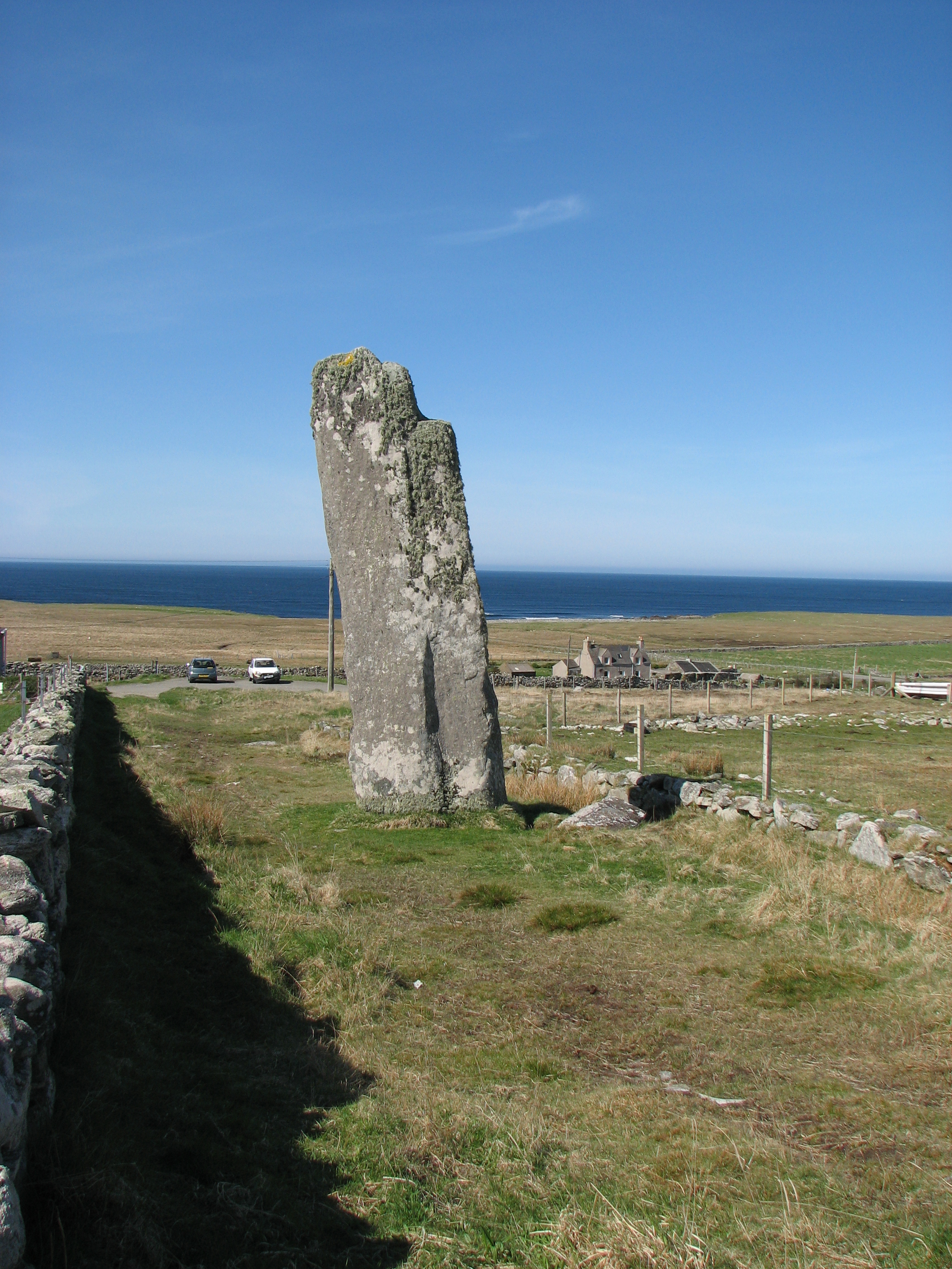
Clach an Trushal

Clach an Trushal (Scottish Gaelic: Clach an Truiseil, Scottish Gaelic pronunciation: [kʰl̪ˠax ən̪ˠ ˈt̪ʰɾuʃal], translated to English "Stone of Compassion...

Baile an Truiseil

Ballantrushal (Scottish Gaelic: Baile an Truiseil) is a village on the Isle of Lewis in the West Side district, in the Outer Hebrides, Scotland. Ballantrushal...

Bragar

Bragar (Scottish Gaelic: Bràgar, pronounced [braːgər]) is a village on the west side of the Isle of Lewis in the Outer Hebrides, Scotland, 14 miles (23...

Nearby Amenities

Located within 500m of 58.349116,-6.5310646
Barrier: cattle_grid
Lat/Long: 58.3513332/-6.5316197
Power: pole
Lat/Long: 58.3500771/-6.5229419
Power: pole
Lat/Long: 58.3492284/-6.5309322
Power: pole
Lat/Long: 58.3488822/-6.5293121
Power: pole
Lat/Long: 58.3485521/-6.5277565
Power: pole
Lat/Long: 58.3476787/-6.523599
Power: pole
Lat/Long: 58.3479321/-6.5247551
Power: pole
Lat/Long: 58.3482333/-6.5262544
Power: pole
Lat/Long: 58.3494922/-6.5391717
Power: pole
Lat/Long: 58.34954/-6.5373751
Power: pole
Lat/Long: 58.3495918/-6.5354751
Power: pole
Lat/Long: 58.3496513/-6.5334789
Power: pole
Lat/Long: 58.3496836/-6.5314778
Power: pole
Lat/Long: 58.3518327/-6.5328899
Power: pole
Lat/Long: 58.3507452/-6.5331881
The data included in this document is from www.openstreetmap.org. The data is made available under ODbL.

Have you been to Barabhas Iarach?

Leave your review of Barabhas Iarach below (or comments, questions and feedback).