Cramond Island

Island in Midlothian

Scotland

Cramond Island

Cramond Island looking Southeast
Cramond Island looking Southeast Credit: Snaik

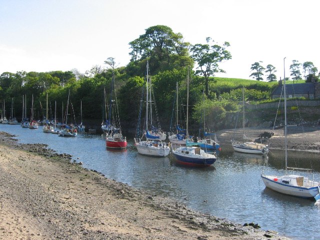
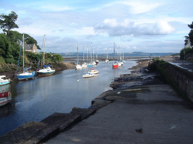
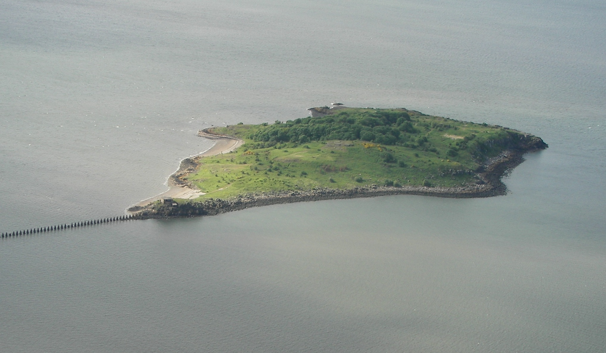
Cramond Island is a small tidal island located in the Firth of Forth, near the village of Cramond in Midlothian, Scotland. Accessible only during low tide, this island attracts visitors with its rich history, scenic beauty, and recreational opportunities.

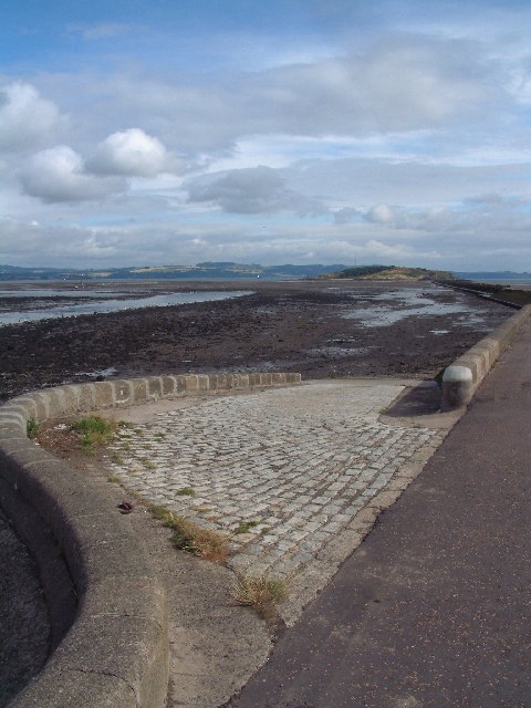
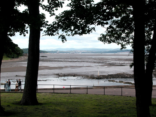
The island is approximately 19 acres in size and is dominated by rugged cliffs, rock formations, and a sandy beach. It is a popular destination for nature lovers, offering stunning views of the surrounding coastline and opportunities for birdwatching. The island is home to a variety of bird species, including cormorants, gulls, and oystercatchers.

Cramond Island is also steeped in history, with evidence of human habitation dating back to the Roman times. The island features the remains of a World War II coastal defense battery, complete with gun emplacements and underground tunnels. Exploring these structures provides visitors with a glimpse into the island's military past.

To reach Cramond Island, visitors must time their visit carefully, as the island is accessible by a causeway during low tide. It is important to consult tide timetables to ensure a safe crossing, as the causeway becomes submerged during high tide. Local signage and warnings should be observed to avoid becoming stranded on the island.

Overall, Cramond Island offers a unique and memorable experience for those who venture to explore its natural beauty and historical significance. Visitors are encouraged to plan their visit accordingly and respect the island's fragile ecosystem and heritage.

If you have any feedback on the listing, please let us know in the comments section below.

Cramond Island Images

Images are sourced within 2km of 55.993285/-3.2900352 or Grid Reference NT1978. Thanks to Geograph Open Source API. All images are credited.

Cramond Island looking Southeast
Old pipeline to Cramond Island Cramond island was fortified during WW2. A pipeline supplied water to the troops manning the guns protecting Rosyth Docks. This is now the line of a causeway to the island.
Old pipeline to Cramond Island
Cramond island was fortified during WW2. A pipeline supplied water to the troops manning the guns protecting Rosyth Docks. This is now the line of a causeway to the island.
River Almond, Cramond This is the estuary of the Almond, the river that divides the counties of Midlothian and West Lothian (Modern local authority areas differ). 
Cramond is popular tourist hangout in Edinburgh. Until 2001 there was a ferry here allowing you to walk to Queensferry, but the access hostile estate opposite closed it during the foot and mouth and quietly did not reopen it again.
River Almond, Cramond
This is the estuary of the Almond, the river that divides the counties of Midlothian and West Lothian (Modern local authority areas differ). Cramond is popular tourist hangout in Edinburgh. Until 2001 there was a ferry here allowing you to walk to Queensferry, but the access hostile estate opposite closed it during the foot and mouth and quietly did not reopen it again.
River Almond at Cramond The slipway for the Cramond Boat Club leads down to the river.  Steps for the former passenger ferry can be seen in the middle distance.
River Almond at Cramond
The slipway for the Cramond Boat Club leads down to the river. Steps for the former passenger ferry can be seen in the middle distance.
Towards Cramond Island The River Almond at low tide, with Cramond Island at the end of the causeway
Towards Cramond Island
The River Almond at low tide, with Cramond Island at the end of the causeway
Eagle Rock Just across the Almond, this is reputed to be a Roman carving.  Shame about the plaque right by it, and BOLTED to the living rock. Vandals come in all shapes and sizes.
Eagle Rock
Just across the Almond, this is reputed to be a Roman carving. Shame about the plaque right by it, and BOLTED to the living rock. Vandals come in all shapes and sizes.
Black and White Beach near Snab Point. The white are shells, and the black, lumps of sea coal. Is the coal weathered naturally  (it does outcrop beneath the Forth) or washed from human activities?
Black and White
Beach near Snab Point. The white are shells, and the black, lumps of sea coal. Is the coal weathered naturally (it does outcrop beneath the Forth) or washed from human activities?
The Long Walk On the causeway, built on the course of a pipeline from Cramond Island to Cramond and vice versa - of course.
The Long Walk
On the causeway, built on the course of a pipeline from Cramond Island to Cramond and vice versa - of course.
Mouth of the Almond The River Almond enters the Forth near Cramond.
Mouth of the Almond
The River Almond enters the Forth near Cramond.
Cramond Island Dangerous sand banks filling as tide turns. Causeway covered at high tide often catches out visitors to the island.
Cramond Island
Dangerous sand banks filling as tide turns. Causeway covered at high tide often catches out visitors to the island.
Treasure Hunt Anneka Rice runs to the helicopter for an ITV Telethon Appeal, "Treasure Hunt" special at the promenade, Cramond.  Despite some secrecy around the locations a large crowd was there to look on.  The week before they did a trial run (different helicopter and no Anneka) which gave the game away a bit.  As I recall, on the day there were several "takes", which ruins the race-against-the-clock feeling from the show.  I seem to remember seeing this episode on TV later - it was rubbish!
Treasure Hunt
Anneka Rice runs to the helicopter for an ITV Telethon Appeal, "Treasure Hunt" special at the promenade, Cramond. Despite some secrecy around the locations a large crowd was there to look on. The week before they did a trial run (different helicopter and no Anneka) which gave the game away a bit. As I recall, on the day there were several "takes", which ruins the race-against-the-clock feeling from the show. I seem to remember seeing this episode on TV later - it was rubbish!
Sea Pink, Cramond Island Armeria maritima, <span class="nowrap"><a title="http://www.reticule.co.uk/flora/content/species.asp?1352" rel="nofollow ugc noopener" href="http://www.reticule.co.uk/flora/content/species.asp?1352">Link</a><img style="margin-left:2px;" alt="External link" title="External link - shift click to open in new window" src="https://s1.geograph.org.uk/img/external.png" width="10" height="10"/></span>  also known as Thrift, grows in profusion on Cramond Island.
Sea Pink, Cramond Island
Armeria maritima, LinkExternal link also known as Thrift, grows in profusion on Cramond Island.
Cramond Kirk A view of the church from the rear.  A Roman fort was discovered here when workmen were digging to build a car park for the church hall.  The lines of the fort walls are marked by lines of pink gravel.  Not much is left of the fort, some of it is buried, some of the stone was used in other buildings including the church.
Cramond Kirk
A view of the church from the rear. A Roman fort was discovered here when workmen were digging to build a car park for the church hall. The lines of the fort walls are marked by lines of pink gravel. Not much is left of the fort, some of it is buried, some of the stone was used in other buildings including the church.
Cramond Riverside caff.
Cramond
Riverside caff.
Cramond Cramond is a popular sailing centre.
Cramond
Cramond is a popular sailing centre.
The Causeway line at high tide This was a neap tide, so no doubt a spring tide would be a couple of metres higher. There is an amazing contrast between this view and the low tide expanse of mud and shingle - see Bob Jones' photo posted for NT1877 <a title="https://www.geograph.org.uk/photo/25132" href="https://www.geograph.org.uk/photo/25132">Link</a>
The Causeway line at high tide
This was a neap tide, so no doubt a spring tide would be a couple of metres higher. There is an amazing contrast between this view and the low tide expanse of mud and shingle - see Bob Jones' photo posted for NT1877 Link
Looking back from the end of the breakwater At high tide. The mouth of the River Almond is on the right.
Looking back from the end of the breakwater
At high tide. The mouth of the River Almond is on the right.
Looking west, up the Firth Taken from the end of the breakwater in NT1977. Barnbougle Castle is visible right of centre.
Looking west, up the Firth
Taken from the end of the breakwater in NT1977. Barnbougle Castle is visible right of centre.
Show me another place!

Cramond Island is located at Grid Ref: NT1978 (Lat: 55.993285, Lng: -3.2900352)

Unitary Authority: City of Edinburgh

Police Authority: Edinburgh

What 3 Words

///income.that.sits. Near Dalgety Bay, Fife

Related Wikis

Cramond Island

Cramond Island (Scottish Gaelic: Eilean Chair Amain) is one of several islands in the Firth of Forth in eastern Scotland, near Edinburgh. It lies off the...

Cramond

Cramond Village (; Scottish Gaelic: Cair Amain) is a village and suburb in the north-west of Edinburgh, Scotland, at the mouth of the River Almond where...

River Almond, Lothian

The River Almond (Scottish Gaelic: Abhainn Amain) is a river in Lothian, Scotland. It is approximately 28 miles (45 km) long, rising at Hirst Hill in...

Cramond Roman Fort

Cramond Roman Fort is a Roman-Era archaeological site at Cramond, Edinburgh, Scotland. The settlement may be the "Rumabo" listed in the 7th-century Ravenna...
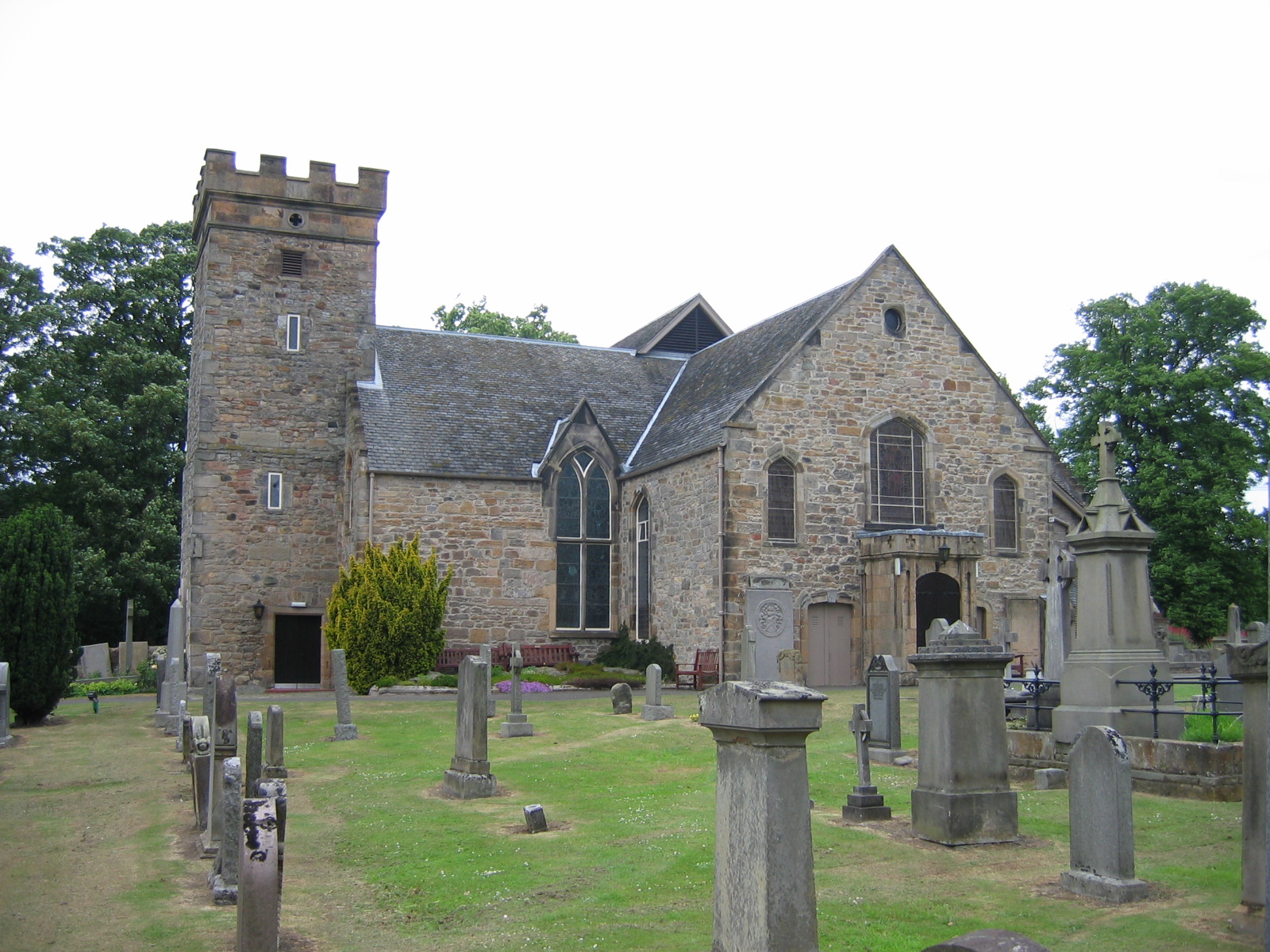
Cramond Kirk

Cramond Kirk is a church situated in the middle area Cramond parish, in the north west of Edinburgh, Scotland. Built on the site of an old Roman fort,...
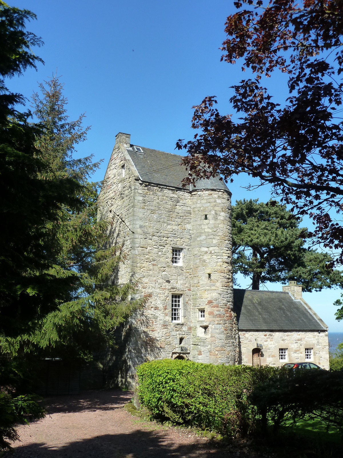
Cramond Tower

Cramond Tower is a fifteenth-century tower house in the village of Cramond to the north-west of Edinburgh, Scotland. == History == The area around the...
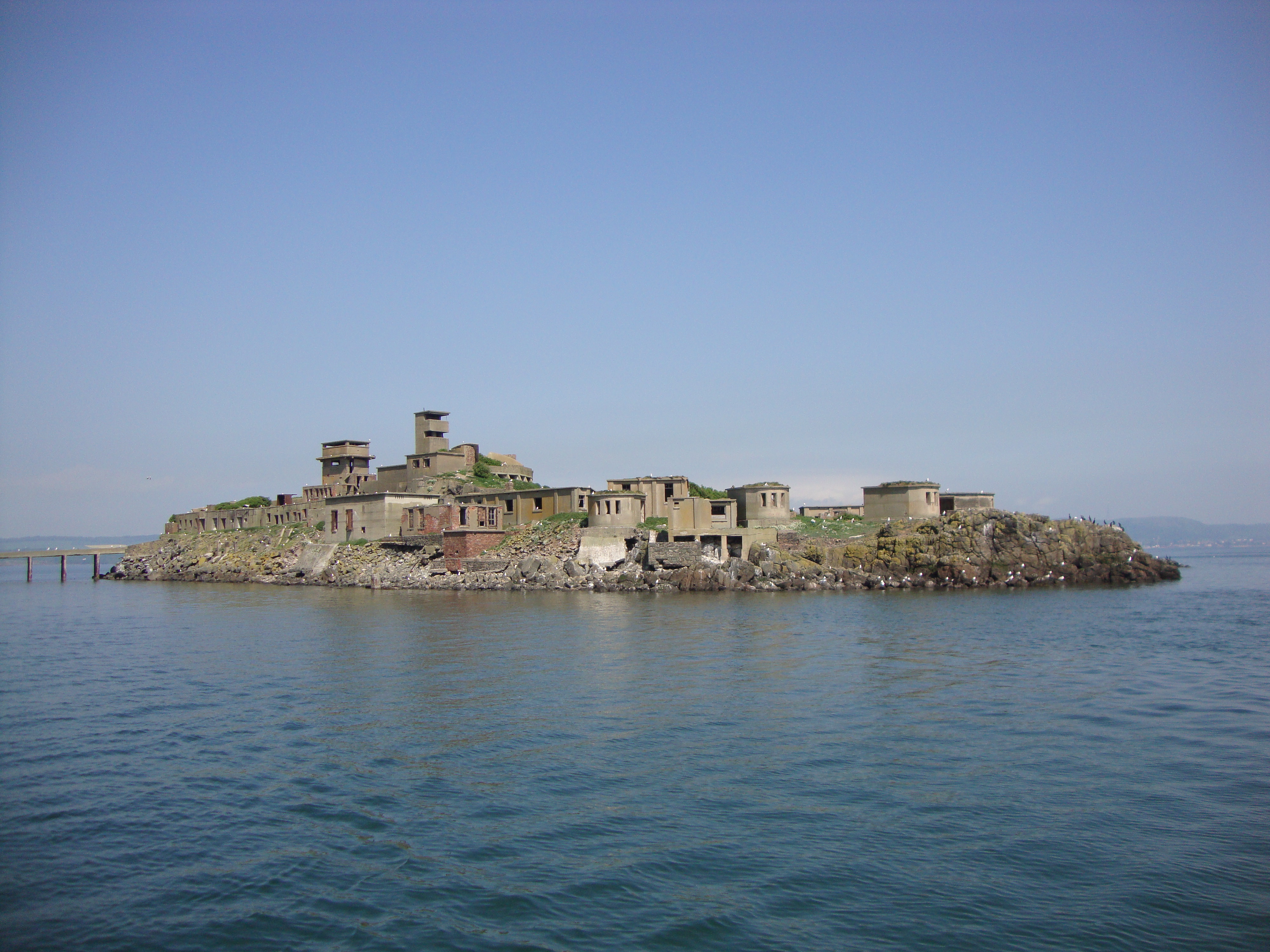
Inchmickery

Inchmickery is a small island in the Firth of Forth in Scotland. It is about two miles (3.2 km) north of Edinburgh. Its name comes from the Scottish Gaelic...

Granton Shrimp Bed

The Granton Shrimp Bed is a fossil-bearing deposit exposed on the southern shore of the Firth of Forth near Edinburgh, in Scotland. It is classified as...

Nearby Amenities

Located within 500m of 55.993285,-3.2900352
Historic: ruins
Lat/Long: 55.9930959/-3.2899656
The Knoll
Place: locality
Lat/Long: 55.9903891/-3.2908014
The Binks
Place: locality
Lat/Long: 55.994877/-3.2875398
The data included in this document is from www.openstreetmap.org. The data is made available under ODbL.

Have you been to Cramond Island?

Leave your review of Cramond Island below (or comments, questions and feedback).