Downham, Little

Settlement in Cambridgeshire East Cambridgeshire

England

Downham, Little

Dirty business Resting by High Road in Little Downham
Dirty business Credit: David Howard

Downham, Little is a small village located in the county of Cambridgeshire, England. Situated approximately 12 miles south-west of the city of Cambridge, it falls within the district of South Cambridgeshire. With a population of around 300 residents, Downham, Little is a close-knit rural community that offers a peaceful and picturesque environment.

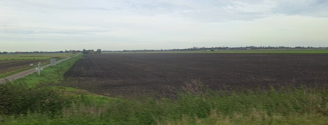
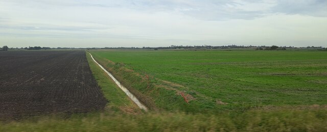
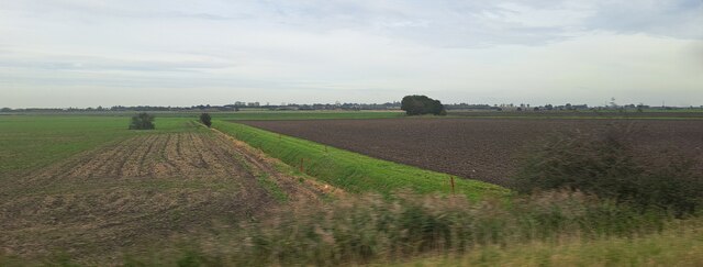
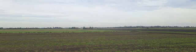
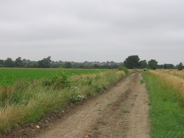
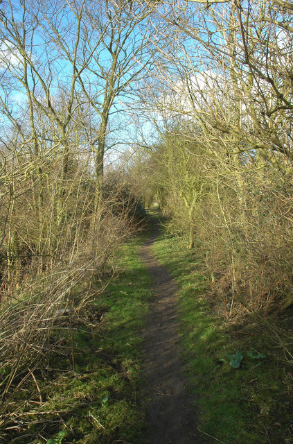
The village is characterized by its charming thatched cottages, traditional English architecture, and rolling countryside views. It is surrounded by farmland, providing a tranquil setting for residents and visitors alike. The River Cam runs nearby, adding to the natural beauty of the area.

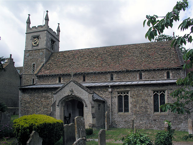
Despite its small size, Downham, Little boasts a strong sense of community. The village has a church, St. Leonard's, which dates back to the 13th century and serves as a focal point for local gatherings and events. Additionally, there is a village hall that hosts various activities and social gatherings throughout the year.

While Downham, Little does not have its own primary school, there are excellent educational facilities in nearby villages, ensuring that children have access to quality education. The village is well-connected to surrounding areas by road, with easy access to major transportation routes such as the A428 and A14.

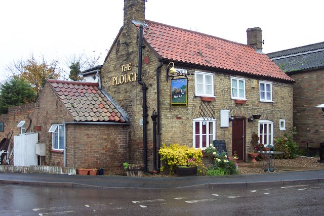
Although Downham, Little may lack the amenities of a larger town, its residents appreciate the tranquility and close community spirit that the village offers. It provides an idyllic countryside escape while still being within reach of the nearby city of Cambridge and other urban centers in Cambridgeshire.

If you have any feedback on the listing, please let us know in the comments section below.

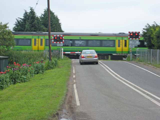
Downham, Little Images

Images are sourced within 2km of 52.431796/0.2387223 or Grid Reference TL5283. Thanks to Geograph Open Source API. All images are credited.

Dirty business Resting by High Road in Little Downham
Dirty business
Resting by High Road in Little Downham
Farmland by Westmoor Common, Little Downham The barn and conifer have been added since 2011, but the bungalow and hedge were there already.
Farmland by Westmoor Common, Little Downham
The barn and conifer have been added since 2011, but the bungalow and hedge were there already.
North Fen Drove, from the railway line
Ditch in North Fen, from the railway
Ditch in Wood Fen, from the railway
Beild Drove and Wood Fen, from the railway
North Fen, from the railway line North Fen Drove can just been seen running from the right of the picture towards the central distance.
North Fen, from the railway line
North Fen Drove can just been seen running from the right of the picture towards the central distance.
Little Downham, St Leonard <span class="nowrap"><a title="http://www.druidic.org/camchurch/churches/ltdownham.htm" rel="nofollow ugc noopener" href="http://www.druidic.org/camchurch/churches/ltdownham.htm">Link</a><img style="margin-left:2px;" alt="External link" title="External link - shift click to open in new window" src="https://s1.geograph.org.uk/img/external.png" width="10" height="10"/></span>
Little Downham, St Leonard
The Plough at Little Downham For a traditional Thai meal!
The Plough at Little Downham
For a traditional Thai meal!
Farm buildings near Little Downham
Barn at Guildacre Farm
The Hereward Way at West Fen The Hereward Way at West Fen leading into Little Downham.
The Hereward Way at West Fen
The Hereward Way at West Fen leading into Little Downham.
Hereward Way Hereward Way footpath near Little Downham, Cambridgeshire.
Hereward Way
Hereward Way footpath near Little Downham, Cambridgeshire.
Farm on Bield Drove Bield Drove is one of the many cul-de-sac "droves" in this part of the Fens.
Farm on Bield Drove
Bield Drove is one of the many cul-de-sac "droves" in this part of the Fens.
Level crossing on Black Bank Road Over the Ely to Peterborough line, served by Central Trains.
Level crossing on Black Bank Road
Over the Ely to Peterborough line, served by Central Trains.
Bield Drove, Wood Fen This farm road carries the status of "Byway open to all traffic".
Bield Drove, Wood Fen
This farm road carries the status of "Byway open to all traffic".
Disused mill near Little Downham A partially-dismantled windmill, about half a mile from the village centre, on the road towards Ely.
Disused mill near Little Downham
A partially-dismantled windmill, about half a mile from the village centre, on the road towards Ely.
Road to Orwell Pit Farm
Show me another place!

Downham, Little is located at Grid Ref: TL5283 (Lat: 52.431796, Lng: 0.2387223)

Division: Isle of Ely

Administrative County: Cambridgeshire

District: East Cambridgeshire

Police Authority: Cambridgeshire

What 3 Words

///ideal.stilted.hence. Near Ely, Cambridgeshire

Related Wikis

Little Downham

Situated in the east of Cambridgeshire, the village of Little Downham is located just 3 miles (5 km) north of the city of Ely. The Parish of Downham comprises...

Little Downham Local Nature Reserve

Little Downham Local Nature Reserve is a 6.6 hectare Local Nature Reserve in Little Downham in Cambridgeshire. It is owned by Little Downham Parish Council...

Black Bank railway station

Black Bank railway station was a railway station in Black Bank, Cambridgeshire which is now closed. The station platforms have been demolished but the...

Chettisham Meadow

Chettisham Meadow is a 0.7-hectare (1.7-acre) biological Site of Special Scientific Interest west of Chettisham, 3 km (2 mi) north of Ely in Cambridgeshire...

Nearby Amenities

Located within 500m of 52.431796,0.2387223
Little Downham
Is In: Cambridgeshire
Place: village
Source Ref Name: survey
Wikidata: Q1994525
Lat/Long: 52.4336745/0.2429403
Public Building
pavilion
Lat/Long: 52.4349922/0.2401788
Leisure: playground
Lat/Long: 52.4346625/0.2403346
Leisure: playground
Lat/Long: 52.4305467/0.2390206
Fraser's Fishery
Landuse: industrial
Lat/Long: 52.4298104/0.2384532
Post Box
Post Box Type: lamp
Ref: CB6 92
Royal Cypher: EIIR
Royal Cypher Wikidata: Q33102113
Lat/Long: 52.4312772/0.2345811
Post Box
Collection Times: Mo-Fr 09:00, Sa 07:00
Post Box Design: type_l
Post Box Type: lamp
Ref: CB6 86
Royal Cypher: EIIR
Royal Cypher Wikidata: Q33102113
Lat/Long: 52.4338732/0.2426736
Recycling
Lat/Long: 52.434052/0.2419436
Fuel
ALS Autos
Lat/Long: 52.433158/0.241601
Booth: K6
Removed Amenity: telephone
Lat/Long: 52.4331685/0.2413416
Fast Food
My Fish Bar
Addr Housenumber: 29
Addr Postcode: CB6 2ST
Addr Street: Main Street
Cuisine: fish_and_chips
Fhrs Id: 1149672
Lat/Long: 52.4328834/0.241143
Uppercutz Hairdressers
Addr City: Ely
Addr Housenumber: 52A
Addr Postcode: CB6 2ST
Addr Street: Main Street
Addr Village: Little Downham
Opening Hours: Tu 09:00-19:00,Th 09:00-17:00, Fr 09:00-18:00, Sa 08:00-16:00
Phone: +44 1353 699412
Shop: hairdresser
Lat/Long: 52.4324501/0.2398029
Field View House
Building: yes
Lat/Long: 52.4346449/0.2330922
Post Box
Post Box Type: pillar
Ref: CB6 90
Royal Cypher: EIIR
Royal Cypher Wikidata: Q33102113
Lat/Long: 52.4316363/0.2377362
Costcutter
Brand: Costcutter
Brand Wikidata: Q5175072
Shop: convenience
Lat/Long: 52.4316114/0.2378588
Bus Stop
Matthew Wren Close
Bench: yes
Lit: no
Naptan AtcoCode: 0500ELITD001
Naptan Bearing: SW
Naptan CommonName: Matthew Wren Close
Naptan Indicator: opp
Naptan Landmark: Matthew Wren Close
Naptan NaptanCode: cmbdgwpd
Naptan ShortCommonName: Matthew Wren Close
Naptan Street: Cannon Street
Naptan Verified: no
Shelter: yes
Source: naptan_import
Tactile Paving: no
Lat/Long: 52.432652/0.2454935
Bus Stop
White Horse Lane
Naptan AtcoCode: 0500ELITD003
Naptan Bearing: W
Naptan CommonName: White Horse Lane
Naptan Indicator: near
Naptan Landmark: White Horse Lane
Naptan NaptanCode: cmbdgwpj
Naptan ShortCommonName: White Horse Lane
Naptan Street: Cannon Street
Naptan Verified: no
Source: naptan_import
Lat/Long: 52.4299675/0.2362657
Bus Stop
School Lane
Bench: yes
Lit: no
Naptan AtcoCode: 0500ELITD004
Naptan Bearing: NE
Naptan CommonName: School Lane
Naptan Indicator: near
Naptan Landmark: School Lane
Naptan NaptanCode: cmbdgwpm
Naptan ShortCommonName: School Lane
Naptan Street: Main Street
Naptan Verified: no
Shelter: yes
Source: naptan_import
Tactile Paving: no
Lat/Long: 52.4338995/0.2427763
Bus Stop
Hurst Lane
Naptan AtcoCode: 0500ELITD006
Naptan Bearing: SW
Naptan CommonName: Hurst Lane
Naptan Indicator: near
Naptan Landmark: Hurst Lane
Naptan NaptanCode: cmbdgwpw
Naptan ShortCommonName: Hurst Lane
Naptan Street: Cannon Street
Naptan Verified: no
Source: naptan_import
Lat/Long: 52.4307638/0.2412195
Bus Stop
Townsend
Naptan AtcoCode: 0500ELITD007
Naptan Bearing: E
Naptan CommonName: Townsend
Naptan Indicator: opp
Naptan Landmark: opp Townsend
Naptan NaptanCode: cmbdgwta
Naptan ShortCommonName: Townsend
Naptan Street: Main Street
Naptan Verified: no
Source: naptan_import
Lat/Long: 52.4315649/0.2350079
Bus Stop
Chapel Lane
Naptan AtcoCode: 0500ELITD008
Naptan Bearing: NE
Naptan CommonName: Chapel Lane
Naptan Indicator: opp
Naptan Landmark: Chapel Lane
Naptan NaptanCode: cmbdgwtd
Naptan ShortCommonName: Chapel Lane
Naptan Street: Main Street
Naptan Verified: no
Source: naptan_import
Lat/Long: 52.4323307/0.2396808
Bus Stop
School Lane
Bench: no
Lit: yes
Naptan AtcoCode: 0500ELITD020
Naptan Bearing: SW
Naptan BusStopType: CUS
Naptan CommonName: School Lane
Naptan Indicator: opp
Naptan Landmark: School Lane
Naptan NaptanCode: cmbgjawg
Naptan ShortCommonName: School Lane
Naptan Street: Main Street
Naptan Verified: no
Shelter: no
Source: naptan_import
Tactile Paving: no
Lat/Long: 52.4337993/0.2428448
Bus Stop
Matthew Wren Close
Bench: no
Lit: yes
Naptan AtcoCode: 0500ELITD021
Naptan Bearing: NE
Naptan BusStopType: CUS
Naptan CommonName: Matthew Wren Close
Naptan Indicator: near
Naptan Landmark: Matthew Wren Close
Naptan NaptanCode: cmbgjatw
Naptan ShortCommonName: Matthew Wren Close
Naptan Street: Cannon Street
Naptan Verified: no
Shelter: no
Source: naptan_import
Tactile Paving: no
Lat/Long: 52.4326896/0.2454071
Power: pole
Lat/Long: 52.4333346/0.234269
Power: pole
Lat/Long: 52.4337465/0.2367438
Power: pole
Lat/Long: 52.4339337/0.2376879
Power: pole
Lat/Long: 52.4331489/0.2333455
Power: pole
Lat/Long: 52.4336565/0.2362302
Power: pole
Lat/Long: 52.4334922/0.2352337
Power: pole
Lat/Long: 52.4330498/0.2323672
Post Office
Little Downham Post Office
Addr City: Ely
Addr Housename: Little Downham Community Rooms
Addr Postcode: CB6 2SX
Addr Street: Main Street
Addr Village: Little Downham
Opening Hours: Mo-We 09:00-13:30; Fr 12:00-13:30
Ref Pol Id: 110071
Source Addr: pol_branch_list_2018-02
Lat/Long: 52.4316375/0.2348283
Waste Basket
Waste: dog_excrement
Lat/Long: 52.4300375/0.24063
Waste Basket
Lat/Long: 52.4292159/0.2409933
Crossing
Crossing: uncontrolled
Crossing Markings: yes
Lat/Long: 52.4333498/0.2417471
Library
Lat/Long: 52.4339032/0.2425828
Bench
Lat/Long: 52.4338544/0.2426239
The data included in this document is from www.openstreetmap.org. The data is made available under ODbL.

Have you been to Downham, Little?

Leave your review of Downham, Little below (or comments, questions and feedback).