Big Island

Island in Perthshire

Scotland

Big Island

Willie Birrell Memorial The roadside memorial to Willie Birrell at West Banald.
Willie Birrell Memorial Credit: Scott Cormie

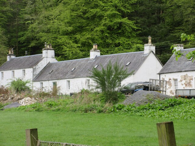
Big Island, Perthshire, also known as Inchaffray Abbey Island, is a small island located in the River Earn, near the village of Madderty, in Perth and Kinross, Scotland. This picturesque island covers an area of approximately 0.6 hectares and is accessible by a footbridge from the mainland.

The island is most notable for being the site of the ruins of Inchaffray Abbey, a former Augustinian monastery that was founded in the 12th century. The abbey played a significant role in the religious and cultural history of Scotland, with its monks being involved in various religious and educational activities.

Today, the island and its ruins are a popular tourist attraction, drawing visitors from near and far. The remains of the abbey include the base of the tower, the chapter house, and parts of the cloister and domestic buildings. Visitors can explore the island and admire the architectural features that have survived over the centuries.

The island itself is a haven for wildlife, with a variety of bird species nesting and foraging in the surrounding trees and water. Swans, ducks, and other waterfowl are often spotted in the river, adding to the island's natural beauty.

Big Island, Perthshire offers visitors a serene and tranquil experience, allowing them to step back in time and immerse themselves in the rich history and natural surroundings. Whether it's exploring the ruins, enjoying a picnic by the river, or simply taking in the peaceful ambiance, this island provides a unique and enjoyable experience for all.

If you have any feedback on the listing, please let us know in the comments section below.

Big Island Images

Images are sourced within 2km of 56.625332/-3.6443788 or Grid Reference NN9949. Thanks to Geograph Open Source API. All images are credited.

Willie Birrell Memorial The roadside memorial to Willie Birrell at West Banald.
Willie Birrell Memorial
The roadside memorial to Willie Birrell at West Banald.
Railway bridge over the River Tay
A9, Strath Tay The A9 is a strategic link between the Highlands of Scotland and the Central Belt. It runs 279 miles from junction 5 of the M9 at Polmont to Scrabster. Originally it ran from Edinburgh.
<span class="nowrap"><a title="https://www.sabre-roads.org.uk/wiki/index.php?title=A9" rel="nofollow ugc noopener" href="https://www.sabre-roads.org.uk/wiki/index.php?title=A9">Link</a><img style="margin-left:2px;" alt="External link" title="External link - shift click to open in new window" src="https://s1.geograph.org.uk/img/external.png" width="10" height="10"/></span>
A9, Strath Tay
The A9 is a strategic link between the Highlands of Scotland and the Central Belt. It runs 279 miles from junction 5 of the M9 at Polmont to Scrabster. Originally it ran from Edinburgh. LinkExternal link
A9, northbound The A9 is a strategic link between the Highlands of Scotland and the Central Belt. It runs 279 miles from junction 5 of the M9 at Polmont to Scrabster. Originally it ran from Edinburgh.
<span class="nowrap"><a title="https://www.sabre-roads.org.uk/wiki/index.php?title=A9" rel="nofollow ugc noopener" href="https://www.sabre-roads.org.uk/wiki/index.php?title=A9">Link</a><img style="margin-left:2px;" alt="External link" title="External link - shift click to open in new window" src="https://s1.geograph.org.uk/img/external.png" width="10" height="10"/></span>
A9, northbound
The A9 is a strategic link between the Highlands of Scotland and the Central Belt. It runs 279 miles from junction 5 of the M9 at Polmont to Scrabster. Originally it ran from Edinburgh. LinkExternal link
Dalguise Viaduct Constructed in 1863 using two lattice girders. It was designed by one Joseph Mitchell. It incorporates Castellated Abutments supposedly to please the Duke of Atholl.
Dalguise Viaduct
Constructed in 1863 using two lattice girders. It was designed by one Joseph Mitchell. It incorporates Castellated Abutments supposedly to please the Duke of Atholl.
Signage - A9 northbound
Kinnaird House & Grounds Looking north from the B898 to Kinnaird House.
Kinnaird House & Grounds
Looking north from the B898 to Kinnaird House.
Sheep near Kincraigie Sheep with lambs in a field on the west side of the River Tay at Kincraigie.
Sheep near Kincraigie
Sheep with lambs in a field on the west side of the River Tay at Kincraigie.
Cottages at Dalguise White-washed cottages viewed from the B898 at Dalguise.
Cottages at Dalguise
White-washed cottages viewed from the B898 at Dalguise.
Ruined stone building with slate roof No idea what this building was used for.  First thoughts are a small dwelling for humans but the rooms are all tiny.  Out of view are 3 rooms each 2m x 2m, each with a small 'garden' area in front.  Maybe kennels?  OS Maps labels an area south of this building as Sophia.
Ruined stone building with slate roof
No idea what this building was used for. First thoughts are a small dwelling for humans but the rooms are all tiny. Out of view are 3 rooms each 2m x 2m, each with a small 'garden' area in front. Maybe kennels? OS Maps labels an area south of this building as Sophia.
Ruined kennels - stone building A ruined stone building thought to be a dog kennel located in Craigvinean Forest.  The building has 3 side-by-side lime-washed rooms each approx 2m x 2m and each with an open area in front. OS Maps marks the area as Sophia and Sophia Forest.  There are 2 other small rooms - out of view right - neither of which suggests human occupation.
Ruined kennels - stone building
A ruined stone building thought to be a dog kennel located in Craigvinean Forest. The building has 3 side-by-side lime-washed rooms each approx 2m x 2m and each with an open area in front. OS Maps marks the area as Sophia and Sophia Forest. There are 2 other small rooms - out of view right - neither of which suggests human occupation.
Ruined stone dwelling What looks to be a ruined stone house located in Craigvinean Forest in an area OS Maps mark as Sophia Wood.
Ruined stone dwelling
What looks to be a ruined stone house located in Craigvinean Forest in an area OS Maps mark as Sophia Wood.
Clydesdale horse, Kindallachan For information on the Clydesdale horse <span class="nowrap"><a title="http://www.clydesdalehorsesociety.com/index.html" rel="nofollow ugc noopener" href="http://www.clydesdalehorsesociety.com/index.html">Link</a><img style="margin-left:2px;" alt="External link" title="External link - shift click to open in new window" src="https://s1.geograph.org.uk/img/external.png" width="10" height="10"/></span>
Clydesdale horse, Kindallachan
For information on the Clydesdale horse LinkExternal link
Memorial to Willie Birrell I have been unable to find out who Willie Birrell (1909-1995) was, however he will be missed by his many friends.
Memorial to Willie Birrell
I have been unable to find out who Willie Birrell (1909-1995) was, however he will be missed by his many friends.
Road to Tullimet A single track road on a terrace above Strath Tay.
Road to Tullimet
A single track road on a terrace above Strath Tay.
Minor road near Kilmorich
Minor road from Tullimet to Guay The view of the minor road from Tullimet to Guay near Kilmorich,
Minor road from Tullimet to Guay
The view of the minor road from Tullimet to Guay near Kilmorich,
Show me another place!

Big Island is located at Grid Ref: NN9949 (Lat: 56.625332, Lng: -3.6443788)

Unitary Authority: Perth and Kinross

Police Authority: Tayside

What 3 Words

///downcast.quiz.rental. Near Pitlochry, Perth & Kinross

Nearby Locations

Kindallachan Big Island

Related Wikis

Guay railway station

Guay railway station, Dunkeld, Perth and Kinross, Scotland, was located near the hamlet of Guay next to the A9 road and close to the River Tay. The station...

Dalguise Viaduct

The Dalguise Viaduct is a lattice girder viaduct in Dalguise, Perth and Kinross, Scotland. It carries the Highland Main Line railway across the River Tay...

Dowally

Dowally is a village and parish in Perth and Kinross, Scotland. It lies 3+1⁄2 miles (5.6 km) north of Dunkeld on the A9 road.The village has a parish church...

Dalguise

Dalguise (Scottish Gaelic Dàil Ghiuthais) is a settlement in Perth and Kinross, Scotland. It is situated on the western side of the River Tay on the B898...

Related Videos

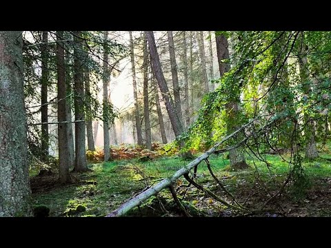
Dalguise Mountain Forest Walk, Scottish Countryside 4K

https://www.buymeacoffee.com/Daveswalks All support is hugely appreciated and it helps me keep the channel going! No talking ...

PGL Vlog

Dalguise was not ready for me and my mandem “Haunt me you spooky cunt” - Ebon Parkin.

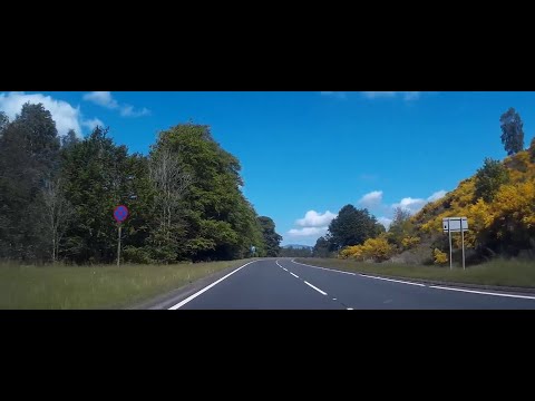
Spring Road Trip To Visit Dowally Highland Perthshire Scotland

Tour Scotland Spring travel video of a road trip drive, with Scottish bagpipes and drums music, North on the A9 road on visit to ...

Early Winter Road Trip With Music To Visit Dowally Highland Perthshire Scotland

Tour Scotland 4K early Winter travel video of a road trip drive, with Scottish music, North on the A9 road on ancestry, genealogy, ...

Nearby Amenities

Located within 500m of 56.625332,-3.6443788
Bus Stop
Bench: yes
Bin: no
Check Date Shelter: 2022-10-12
Layby: yes
Shelter: yes
Tactile Paving: no
Lat/Long: 56.6285849/-3.6405408
Bus Stop
Bench: yes
Bin: no
Check Date Shelter: 2023-02-17
Layby: yes
Naptan AtcoCode: 64801289
Naptan NaptanCode: 73724573
Shelter: yes
Tactile Paving: no
Lat/Long: 56.6276724/-3.6394452
Material: wood
Power: pole
Lat/Long: 56.6244713/-3.6368904
Material: wood
Power: pole
Lat/Long: 56.6250423/-3.6374348
Material: wood
Power: pole
Lat/Long: 56.625724/-3.6380947
Material: wood
Power: pole
Lat/Long: 56.6263172/-3.6386848
Material: wood
Power: pole
Lat/Long: 56.626931/-3.6392534
Material: wood
Power: pole
Lat/Long: 56.6274739/-3.639771
Material: wood
Power: pole
Lat/Long: 56.6281423/-3.6404094
Material: wood
Power: pole
Lat/Long: 56.6288461/-3.6410907
Material: wood
Power: pole
Lat/Long: 56.6295218/-3.6417344
Power: pole
Lat/Long: 56.6230749/-3.6513372
Power: pole
Lat/Long: 56.6226279/-3.6509066
Material: wood
Power: pole
Switch: yes
Lat/Long: 56.6270819/-3.6387676
Power: pole
Lat/Long: 56.6274377/-3.6374125
The data included in this document is from www.openstreetmap.org. The data is made available under ODbL.

Have you been to Big Island?

Leave your review of Big Island below (or comments, questions and feedback).