A' Ghualann

Island in Sutherland

Scotland

A' Ghualann

Totegan Remote hamlet on the far north coast of Scotland
Totegan Credit: Peter Moore

A' Ghualann is a small island located off the coast of Sutherland, a county in the Highlands of Scotland. It is situated in the North Atlantic Ocean, offering stunning views of the surrounding waters and rugged landscapes.

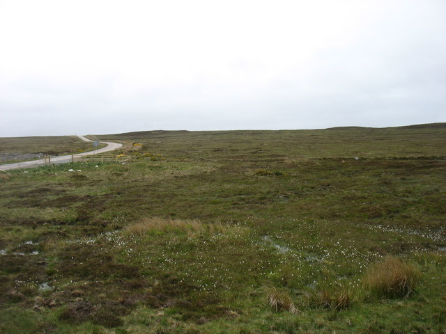
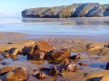
Covering an area of approximately 10 square miles, A' Ghualann is known for its diverse wildlife and unspoiled natural beauty. The island is characterized by its rocky shores, towering cliffs, and rolling hills, providing a haven for various species of birds, seals, and marine life.

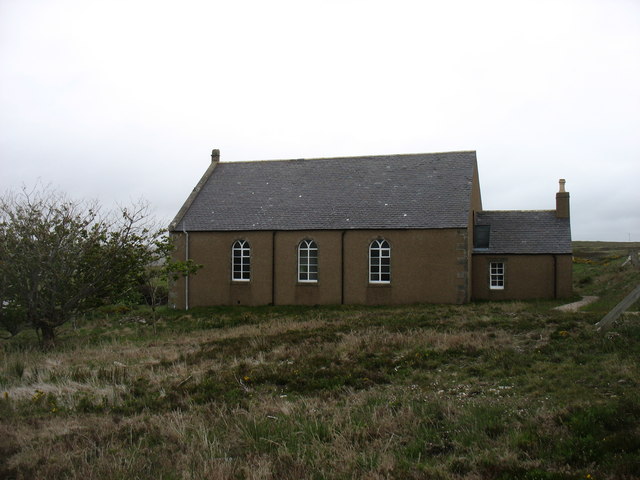
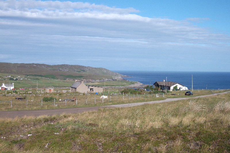
The island is sparsely populated, with only a handful of residents living in the small village of A' Ghualann. The village consists of traditional stone houses, adding to the charm and authenticity of the island. Most of the inhabitants are involved in fishing or agriculture, making a living from the rich resources of the surrounding waters and fertile land.

A' Ghualann offers a peaceful and remote escape for nature lovers and outdoor enthusiasts. Visitors can explore the island's rugged coastline, enjoy long walks along its many trails, or take part in activities such as birdwatching, fishing, and kayaking. The island is also home to several historical sites, including ancient ruins and standing stones, providing a glimpse into its rich heritage.

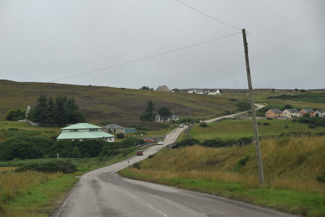
Due to its remote location, A' Ghualann is accessible primarily by boat, making it a secluded destination for those seeking tranquility and a true escape from the hustle and bustle of everyday life.

If you have any feedback on the listing, please let us know in the comments section below.
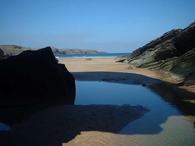
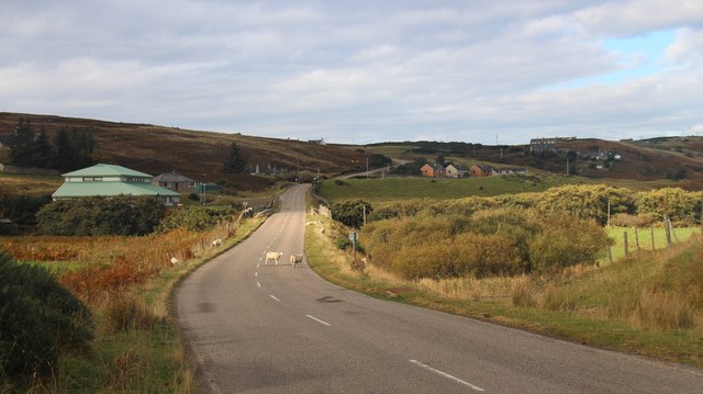
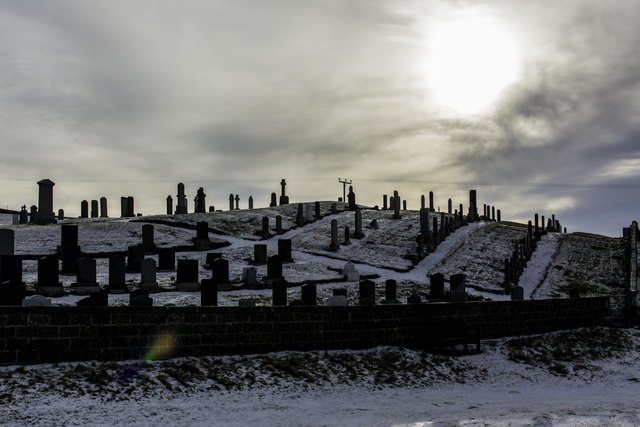
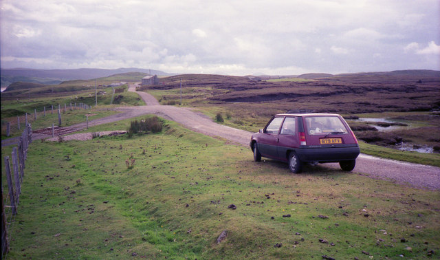
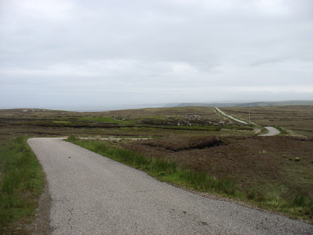
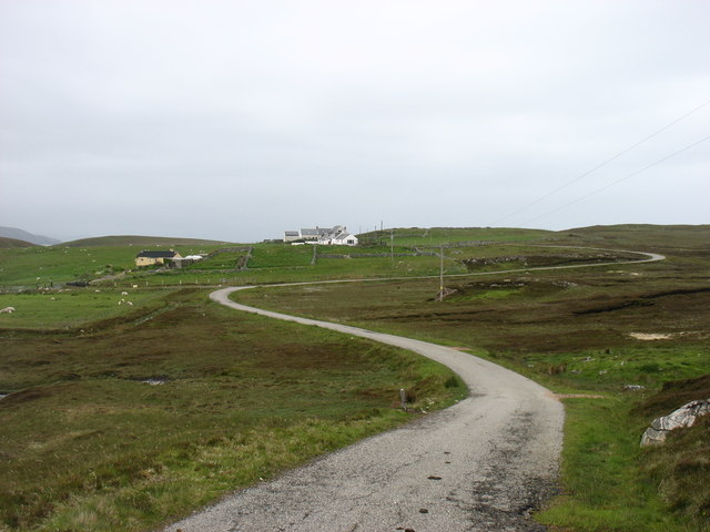
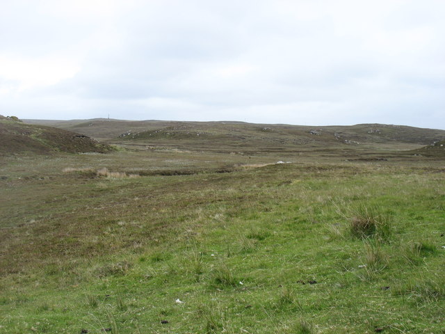
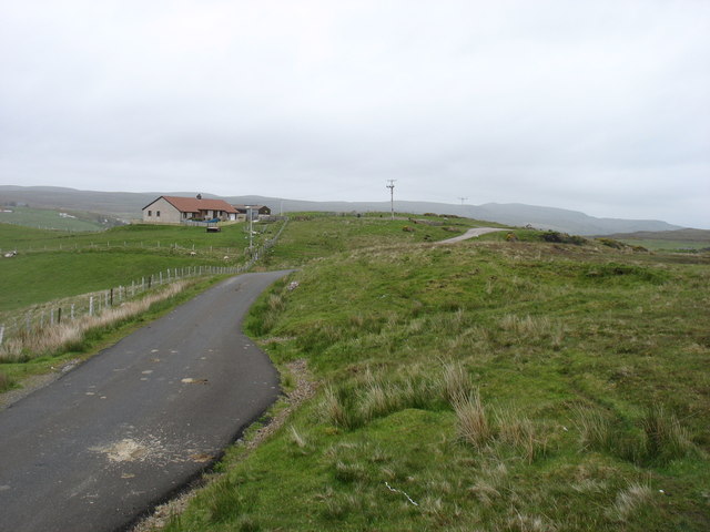
A' Ghualann Images

Images are sourced within 2km of 58.575432/-4.0082719 or Grid Reference NC8367. Thanks to Geograph Open Source API. All images are credited.

Totegan Remote hamlet on the far north coast of Scotland
Totegan
Remote hamlet on the far north coast of Scotland
Strathy Bay East Taken at the east end of Strathy Bay, looking towards Strathy Point
Strathy Bay East
Taken at the east end of Strathy Bay, looking towards Strathy Point
Approaching Strathy from the east
Strathy Graveyard
Strathy Graveyard
The road back from Strathy Point
Minor hills near Strathy Point
The lane to Aultivullin Looking back towards the Strathy Point road. This is not a lane on which you would wish to meet other traffic, as passing places are few and far between.
The lane to Aultivullin
Looking back towards the Strathy Point road. This is not a lane on which you would wish to meet other traffic, as passing places are few and far between.
Aultivullin, Strathy Point This small complex of cottages offers self-catering accommodation. Supplies are some distance away!
Aultivullin, Strathy Point
This small complex of cottages offers self-catering accommodation. Supplies are some distance away!
Rough country near Strathy Point
The lane to Strathy Point Looking back towards Strathy and the main A836.
The lane to Strathy Point
Looking back towards Strathy and the main A836.
Country by the A836 The road, here with two lanes (though it changes to 'single track with passing places' a few miles ahead), is seen on the left.
Country by the A836
The road, here with two lanes (though it changes to 'single track with passing places' a few miles ahead), is seen on the left.
Strathy Presbyterian church
Geodh' a' Chnuic Ghlais Inlet on the Pentland Firth
Geodh' a' Chnuic Ghlais
Inlet on the Pentland Firth
Fenceline at the edge of the cliffs on Geodh' a' Chnuic Ghlais
Strathy Bridge The A836 runs 122 miles from Dornoch Bridge to John O' Groats <a href="https://www.geograph.org.uk/photo/7086916">ND3872 : A836, John O' Groats</a>. Much of it is still single track.
<span class="nowrap"><a title="https://www.sabre-roads.org.uk/wiki/index.php?title=A836" rel="nofollow ugc noopener" href="https://www.sabre-roads.org.uk/wiki/index.php?title=A836">Link</a><img style="margin-left:2px;" alt="External link" title="External link - shift click to open in new window" src="https://s1.geograph.org.uk/img/external.png" width="10" height="10"/></span>
Strathy Bridge
The A836 runs 122 miles from Dornoch Bridge to John O' Groats ND3872 : A836, John O' Groats. Much of it is still single track. LinkExternal link
NC500 The North Coast 500 is a 516 mile scenic route around the north coast of Scotland, starting and ending at Inverness Castle. The route is also known as the NC500 and was launched in 2015, linking many features in the north Highlands of Scotland in one touring route.
The route has increased visitor numbers to parts of the north of Scotland, which has brought economic benefits to some areas. The increase in traffic has also led to more instances of bad and dangerous driving, as well as damage to the roads and concerns about the environmental impact. 
Apparently the route was amended in 2022 with detours etc being removed.
Wikipedia: <span class="nowrap"><a title="https://en.wikipedia.org/wiki/North_Coast_500" rel="nofollow ugc noopener" href="https://en.wikipedia.org/wiki/North_Coast_500">Link</a><img style="margin-left:2px;" alt="External link" title="External link - shift click to open in new window" src="https://s1.geograph.org.uk/img/external.png" width="10" height="10"/></span> 
Original route map: <span class="nowrap"><a title="https://en.wikipedia.org/wiki/North_Coast_500#/media/File:North_Coast_500,_Scotland.svg" rel="nofollow ugc noopener" href="https://en.wikipedia.org/wiki/North_Coast_500#/media/File:North_Coast_500,_Scotland.svg">Link</a><img style="margin-left:2px;" alt="External link" title="External link - shift click to open in new window" src="https://s1.geograph.org.uk/img/external.png" width="10" height="10"/></span> 
Latest route map: <span class="nowrap"><a title="https://www.northcoast500.com/explore-the-route/" rel="nofollow ugc noopener" href="https://www.northcoast500.com/explore-the-route/">Link</a><img style="margin-left:2px;" alt="External link" title="External link - shift click to open in new window" src="https://s1.geograph.org.uk/img/external.png" width="10" height="10"/></span>
NC500
The North Coast 500 is a 516 mile scenic route around the north coast of Scotland, starting and ending at Inverness Castle. The route is also known as the NC500 and was launched in 2015, linking many features in the north Highlands of Scotland in one touring route. The route has increased visitor numbers to parts of the north of Scotland, which has brought economic benefits to some areas. The increase in traffic has also led to more instances of bad and dangerous driving, as well as damage to the roads and concerns about the environmental impact. Apparently the route was amended in 2022 with detours etc being removed. Wikipedia: LinkExternal link Original route map: LinkExternal link Latest route map: LinkExternal link
Strathy Village Hall Hard to miss when driving by
Strathy Village Hall
Hard to miss when driving by
Strathy War Memorial Set above the road
Strathy War Memorial
Set above the road
Show me another place!

A' Ghualann is located at Grid Ref: NC8367 (Lat: 58.575432, Lng: -4.0082719)

Unitary Authority: Highland

Police Authority: Highlands and Islands

What 3 Words

///swells.guidebook.deflated. Near Reay, Highland

Related Wikis

Totegan

Totegan is a hamlet in Sutherland, Scotland and is one of the most northerly settlements in mainland Scotland. The nearest main road to the hamlet is the...

Strathy

Strathy (from Scottish Gaelic Srathaidh 'place of the strath') is a scattered community in Sutherland in the Scottish Highlands. The settlement emerged...

Aultiphurst

Aultiphurst (Scottish Gaelic: Allt a' Phuirt), in Strathy, Sutherland, is a village in the Scottish HighlandsThe name Aultiphurst is a misspelling of Allt...

Lednagullin

Lednagullin is a village on the south east shore of Armadale Bay in Sutherland, Scottish Highlands and is in the Scottish council area of Highland....

Nearby Amenities

Located within 500m of 58.575432,-4.0082719
Created By: almien_coastlines
Source: PGS
Lat/Long: 58.571422/-4.006881
Created By: almien_coastlines
Source: PGS
Lat/Long: 58.572194/-4.006413
Created By: almien_coastlines
Source: PGS
Lat/Long: 58.572449/-4.006421
Created By: almien_coastlines
Source: PGS
Lat/Long: 58.572702/-4.006918
Created By: almien_coastlines
Source: PGS
Lat/Long: 58.573213/-4.006933
Source: PGS
Lat/Long: 58.5737898/-4.0060798
Source: PGS
Lat/Long: 58.5749998/-4.0062515
Source: PGS
Lat/Long: 58.5754629/-4.0065261
Source: PGS
Lat/Long: 58.5754076/-4.007555
Source: PGS
Lat/Long: 58.5749036/-4.0087008
Source: PGS
Lat/Long: 58.5755194/-4.0077739
Created By: almien_coastlines
Source: PGS
Lat/Long: 58.575767/-4.00774
Source: PGS
Lat/Long: 58.5758338/-4.007967
Source: PGS
Lat/Long: 58.5753757/-4.0089144
Source: PGS
Lat/Long: 58.5760861/-4.0081451
Source: PGS
Lat/Long: 58.5761504/-4.0079058
Source: PGS
Lat/Long: 58.5763635/-4.0076226
Source: PGS
Lat/Long: 58.5774587/-4.0076977
Source: PGS
Lat/Long: 58.5785656/-4.008703
Created By: almien_coastlines
Source: PGS
Lat/Long: 58.578438/-4.009778
Created By: almien_coastlines
Source: PGS
Lat/Long: 58.578175/-4.01075
Created By: almien_coastlines
Source: PGS
Lat/Long: 58.578043/-4.011237
Created By: almien_coastlines
Source: PGS
Lat/Long: 58.578813/-4.011015
Created By: almien_coastlines
Source: PGS
Lat/Long: 58.579329/-4.010539
Power: pole
Lat/Long: 58.5714443/-4.0117323
Power: pole
Lat/Long: 58.5723683/-4.0119399
Power: pole
Lat/Long: 58.5732935/-4.0123889
Power: pole
Lat/Long: 58.5742489/-4.012838
Power: pole
Lat/Long: 58.5749978/-4.0132073
Power: pole
Lat/Long: 58.5757618/-4.0135839
Power: pole
Lat/Long: 58.5768153/-4.0140861
Power: pole
Lat/Long: 58.5775315/-4.014441
Power: pole
Lat/Long: 58.5782665/-4.014791
The data included in this document is from www.openstreetmap.org. The data is made available under ODbL.

Have you been to A' Ghualann?

Leave your review of A' Ghualann below (or comments, questions and feedback).