Ynys Tywyn

Island in Caernarfonshire

Wales

Ynys Tywyn

Tremadog Market Square, Tremadog.
Tremadog Credit: Colin Kinnear

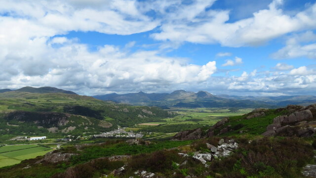
Ynys Tywyn is a small island located off the coast of Caernarfonshire in Wales. The island is situated in the Menai Strait, which separates the Isle of Anglesey from the mainland of Wales. Ynys Tywyn is known for its rugged coastline, sandy beaches, and stunning views of the surrounding mountains.

The island is home to a variety of wildlife, including seabirds, seals, and dolphins, making it a popular destination for nature lovers and birdwatchers. The waters around Ynys Tywyn are also known for their rich marine life, making it a great spot for fishing and diving.

Ynys Tywyn is accessible by boat or kayak, and visitors can explore the island's walking trails, beaches, and historic sites. The island is also home to a small community of residents, who rely on fishing and tourism for their livelihood.

Overall, Ynys Tywyn is a picturesque and tranquil island that offers visitors a chance to escape the hustle and bustle of everyday life and immerse themselves in the natural beauty of the Welsh coast.

If you have any feedback on the listing, please let us know in the comments section below.

Ynys Tywyn Images

Images are sourced within 2km of 52.924227/-4.1268571 or Grid Reference SH5738. Thanks to Geograph Open Source API. All images are credited.
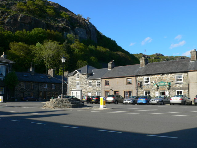
Tremadog Market Square, Tremadog.
Tremadog
Market Square, Tremadog.
Study in grey (Dublin Street, Tremadog) An exceptionally grey day even for the vicinity and I have lightened the photo as much as I dare. Each house in the terrace has a separate Cadw grade-II listing, with No. 15 as an example (85316 <span class="nowrap"><a title="https://cadwpublic-api.azurewebsites.net/reports/listedbuilding/FullReport?lang=&id=85316" rel="nofollow ugc noopener" href="https://cadwpublic-api.azurewebsites.net/reports/listedbuilding/FullReport?lang=&id=85316">Link</a><img style="margin-left:2px;" alt="External link" title="External link - shift click to open in new window" src="https://s1.geograph.org.uk/img/external.png" width="10" height="10"/></span> ), which notes that the terrace is probably the earliest surviving structure in Tremadog. Note the 'raked half dormer' roofs and huge chimney breasts.  The name Dublin Street refers to the hope in the early 19th Century that this would be on the route to Dublin (via Porth Dinllaen) although Holyhead eventually took that prize.
Study in grey (Dublin Street, Tremadog)
An exceptionally grey day even for the vicinity and I have lightened the photo as much as I dare. Each house in the terrace has a separate Cadw grade-II listing, with No. 15 as an example (85316 LinkExternal link ), which notes that the terrace is probably the earliest surviving structure in Tremadog. Note the 'raked half dormer' roofs and huge chimney breasts. The name Dublin Street refers to the hope in the early 19th Century that this would be on the route to Dublin (via Porth Dinllaen) although Holyhead eventually took that prize.
The Golden Fleece Inn, Tremadog Compare the same building taken in bright sunshine... <a title="https://www.geograph.org.uk/photo/5627105" href="https://www.geograph.org.uk/photo/5627105">Link</a> .   The inn was built ca. 1810 and is grade-II listed by Cadw: 85353 <span class="nowrap"><a title="https://cadwpublic-api.azurewebsites.net/reports/listedbuilding/FullReport?lang=&id=85353" rel="nofollow ugc noopener" href="https://cadwpublic-api.azurewebsites.net/reports/listedbuilding/FullReport?lang=&id=85353">Link</a><img style="margin-left:2px;" alt="External link" title="External link - shift click to open in new window" src="https://s1.geograph.org.uk/img/external.png" width="10" height="10"/></span> .
The Golden Fleece Inn, Tremadog
Compare the same building taken in bright sunshine... Link . The inn was built ca. 1810 and is grade-II listed by Cadw: 85353 LinkExternal link .
On Moel-y-Gest - view to Tremadog, Cnicht & Moelwyn Mawr
Ordnance Survey 1GL Bolt This OS Bolt can be found on the west face of the church. It marks a point 5.467m above mean sea level.
Ordnance Survey 1GL Bolt
This OS Bolt can be found on the west face of the church. It marks a point 5.467m above mean sea level.
Ordnance Survey Flush Bracket (G2621) This OS Flush Bracket can be found on the Madoc Hotel behind the BT Box.
Ordnance Survey Flush Bracket (G2621)
This OS Flush Bracket can be found on the Madoc Hotel behind the BT Box.
Y Sgwar, Tremadog Tremadog, an exceptionally fine example of a planned town, was founded by William Alexander Madocks, who bought the land in 1798. At that time, the flat area surrounding the Glaslyn River was all salt marsh. Madocks was well aware of the possibilities of draining fenland, and set about building an embankment to separate the land from the sea. His first embankment built in 1800 won the area where Tremadog now stands. By 1805, the first cottages for workers were built in what he called "Pentre Gwaelod" or "Bottom Village". Within the year he had changed the name of the village to Tre Madoc or Madocks' Town. <span class="nowrap"><a title="http://www.tremadog.org.uk/content/14.php" rel="nofollow ugc noopener" href="http://www.tremadog.org.uk/content/14.php">Link</a><img style="margin-left:2px;" alt="External link" title="External link - shift click to open in new window" src="https://s1.geograph.org.uk/img/external.png" width="10" height="10"/></span>
Y Sgwar, Tremadog
Tremadog, an exceptionally fine example of a planned town, was founded by William Alexander Madocks, who bought the land in 1798. At that time, the flat area surrounding the Glaslyn River was all salt marsh. Madocks was well aware of the possibilities of draining fenland, and set about building an embankment to separate the land from the sea. His first embankment built in 1800 won the area where Tremadog now stands. By 1805, the first cottages for workers were built in what he called "Pentre Gwaelod" or "Bottom Village". Within the year he had changed the name of the village to Tre Madoc or Madocks' Town. LinkExternal link
Public Conveniences on Main Street
Gateway to the former church of St Mary Both church and gateway date from circa 1811 during the period when Tremadog was being developed on reclaimed land. What appears to be a rather finely carved stone gateway and arch is actually an example of 'Coadestone', an artificial stone produced by the use of moulds. Coadestone was invented in the late 18th century, the company being owned by a Mrs Eleanor Coade who had showrooms in London and who produced stonework, sculptures etc by a secret process. Work was done for George III and included stonework at Buckingham Palace. The gateway is grade two listed and is described as an 'eclectic composition'.
Gateway to the former church of St Mary
Both church and gateway date from circa 1811 during the period when Tremadog was being developed on reclaimed land. What appears to be a rather finely carved stone gateway and arch is actually an example of 'Coadestone', an artificial stone produced by the use of moulds. Coadestone was invented in the late 18th century, the company being owned by a Mrs Eleanor Coade who had showrooms in London and who produced stonework, sculptures etc by a secret process. Work was done for George III and included stonework at Buckingham Palace. The gateway is grade two listed and is described as an 'eclectic composition'.
Centre of Tremadog village At the centre of Tremadog the road widens into a square [Y Sgwar] with the Market Hall dominating the scene. Tremadog was built on reclaimed land by the Madocks family and was intended as a post town on the route from London to Dublin via a new port at Porth Dinllaen - a development that never happened. The Market Hall originally had open arches on the ground floor. These were infilled with ironwork designed by Clough Williams Ellis in the early 20thC, but in the 1970's there was a further change when the windows were added.
Centre of Tremadog village
At the centre of Tremadog the road widens into a square [Y Sgwar] with the Market Hall dominating the scene. Tremadog was built on reclaimed land by the Madocks family and was intended as a post town on the route from London to Dublin via a new port at Porth Dinllaen - a development that never happened. The Market Hall originally had open arches on the ground floor. These were infilled with ironwork designed by Clough Williams Ellis in the early 20thC, but in the 1970's there was a further change when the windows were added.
Businesses in Stryd y Llan, Tremadog
The Golden Fleece Inn, Tremadog This is known in Welsh as Tafarn y Cnu Aur.
The Golden Fleece Inn, Tremadog
This is known in Welsh as Tafarn y Cnu Aur.
Sgwar Tremadog Square Craig y Castell scar towers above the former Town Hall building.
Sgwar Tremadog Square
Craig y Castell scar towers above the former Town Hall building.
Houses and businesses on the east side of Sgwar Tremadog Square In the centre of the terrace is the Union Inn.
Houses and businesses on the east side of Sgwar Tremadog Square
In the centre of the terrace is the Union Inn.
St Mary's Church
St Mary's Church
Church Street Looking along Church Street in Tremadog.
Church Street
Looking along Church Street in Tremadog.
Church Street meets High Street Looking from Church Street onto High Street in Tremadog.
Church Street meets High Street
Looking from Church Street onto High Street in Tremadog.
Church Street near High Street Looking across the wide square at the top of Church Street.
Church Street near High Street
Looking across the wide square at the top of Church Street.
Show me another place!

Ynys Tywyn is located at Grid Ref: SH5738 (Lat: 52.924227, Lng: -4.1268571)

Unitary Authority: Gwynedd

Police Authority: North Wales

What 3 Words

///sharpen.warp.tripling. Near Porthmadog, Gwynedd

Nearby Locations

Llyn Bach Ynys Tywyn

Related Wikis

Ffestiniog Railway

The Ffestiniog Railway (Welsh: Rheilffordd Ffestiniog) is a heritage railway based on 1 ft 11+1⁄2 in (597 mm) narrow-gauge, located in Gwynedd, Wales....

Porthmadog cross town link

The Porthmadog cross town link is a section of the 1 ft 11+1⁄2 in (597 mm) narrow gauge Welsh Highland Railway, specifically built to link with the Ffestiniog...

Porthmadog Harbour railway station

Porthmadog Harbour railway station (formerly known as Portmadoc Harbour railway station) in Porthmadog (formerly Portmadoc), Gwynedd (formerly Merioneth...

Porthmadog

Porthmadog (Welsh: [pɔrθˈmadɔɡ] ), originally Portmadoc until 1974 and locally as "Port", is a coastal town and community in the Eifionydd area of Gwynedd...

Nearby Amenities

Located within 500m of 52.924227,-4.1268571
Crossing: informal
Lat/Long: 52.9234638/-4.1306069
Give Way
Direction: forward
Lat/Long: 52.9265161/-4.1307838
Source: PGS
Lat/Long: 52.9205467/-4.1284554
Source: PGS
Lat/Long: 52.9208395/-4.1276083
Source: PGS
Lat/Long: 52.9206557/-4.127014
Source: PGS
Lat/Long: 52.9205268/-4.1268633
Source: PGS
Lat/Long: 52.9198648/-4.126786
Source: PGS
Lat/Long: 52.9204877/-4.1302651
Source: PGS
Lat/Long: 52.9213649/-4.1299609
Source: PGS
Lat/Long: 52.9222947/-4.1298851
Source: PGS
Lat/Long: 52.9226768/-4.1299899
Source: PGS
Lat/Long: 52.9229854/-4.1299426
Source: PGS
Lat/Long: 52.9236587/-4.1300078
Source: PGS
Lat/Long: 52.9249618/-4.1269756
Source: PGS
Lat/Long: 52.9258212/-4.1272753
Source: PGS
Lat/Long: 52.9262132/-4.1271766
Source: PGS
Lat/Long: 52.926386/-4.1271223
Source: PGS
Lat/Long: 52.9267647/-4.1268593
Source: PGS
Lat/Long: 52.9278979/-4.1267961
Source: PGS
Lat/Long: 52.9286754/-4.1270561
Source: PGS
Lat/Long: 52.9281879/-4.1235545
Source: PGS
Lat/Long: 52.9278721/-4.1233426
Source: PGS
Lat/Long: 52.927329/-4.1233485
Source: PGS
Lat/Long: 52.926972/-4.1235116
Source: PGS
Lat/Long: 52.9257043/-4.1246789
Source: PGS
Lat/Long: 52.9255089/-4.1262696
Source: PGS
Lat/Long: 52.9254458/-4.1267201
Source: PGS
Lat/Long: 52.9252529/-4.1268951
Source: PGS
Lat/Long: 52.9245458/-4.1243281
Source: PGS
Lat/Long: 52.9252664/-4.1249644
Source: PGS
Lat/Long: 52.9255202/-4.1246405
Source: PGS
Lat/Long: 52.9257215/-4.1228346
Source: PGS
Lat/Long: 52.9260828/-4.1238394
Source: PGS
Lat/Long: 52.9265604/-4.1235518
Source: PGS
Lat/Long: 52.9270409/-4.1229675
Created By: dmgroom_coastlines
Source: PGS
Lat/Long: 52.9266922/-4.1225138
Created By: dmgroom_coastlines
Source: PGS
Lat/Long: 52.9264661/-4.1218624
Created By: dmgroom_coastlines
Source: PGS
Lat/Long: 52.9263182/-4.12166
Created By: dmgroom_coastlines
Source: PGS
Lat/Long: 52.9258106/-4.1214154
Created By: dmgroom_coastlines
Source: PGS
Lat/Long: 52.925521/-4.120656
Created By: dmgroom_coastlines
Source: PGS
Lat/Long: 52.9250243/-4.1204025
Created By: dmgroom_coastlines
Source: PGS
Lat/Long: 52.9250976/-4.1210958
Created By: dmgroom_coastlines
Source: PGS
Lat/Long: 52.9252799/-4.1214337
Created By: dmgroom_coastlines
Source: PGS
Lat/Long: 52.925253/-4.121845
Created By: dmgroom_coastlines
Source: PGS
Lat/Long: 52.924997/-4.121915
Created By: dmgroom_coastlines
Source: PGS
Lat/Long: 52.924912/-4.121634
Created By: dmgroom_coastlines
Source: PGS
Lat/Long: 52.9245195/-4.1212871
Created By: dmgroom_coastlines
Source: PGS
Lat/Long: 52.924368/-4.120626
Porthmadog
Name Br: Porthmadog
Name Cy: Porthmadog
Name Ru: Портмадог
Place: town
Population: 4764
Source Name Br: proper translation
Wikidata: Q950671
Wikipedia: en:Porthmadog
Lat/Long: 52.9256029/-4.129694
Railway: crossing
Lat/Long: 52.9255503/-4.127704
Crossing Barrier: no
Railway: level_crossing
Lat/Long: 52.9285394/-4.1279243
Barrier: stile
Lat/Long: 52.9248329/-4.1269435
Covered: no
Leisure: picnic_table
Lat/Long: 52.9269731/-4.1272997
Covered: no
Leisure: picnic_table
Lat/Long: 52.9270664/-4.1272849
Covered: no
Leisure: picnic_table
Lat/Long: 52.9271555/-4.1272703
Crossing Barrier: no
Railway: crossing
Lat/Long: 52.9248372/-4.1276922
Barrier: bollard
Lat/Long: 52.9256121/-4.1287327
Traffic Signals
Crossing: traffic_signals
Crossing Ref: pelican
Lat/Long: 52.9268651/-4.1314888
Traffic Signals
Crossing: traffic_signals
Crossing Ref: pelican
Kerb: lowered
Lat/Long: 52.9252864/-4.1287371
Addr Housenumber: 27
Lat/Long: 52.92654/-4.1287764
Addr Housenumber: 1
Lat/Long: 52.925872/-4.1285018
Addr Housenumber: 25
Lat/Long: 52.9264788/-4.128755
Barrier: lift_gate
Lat/Long: 52.9262444/-4.1280148
Post Box
Brand: Royal Mail
Brand Wikidata: Q638098
Collection Times: Mo-Fr 15:30; Sa 11:30
Mapillary: 730261479236190
Operator: Royal Mail
Operator Wikidata: Q638098
Post Box Mounting: pier
Post Box Type: lamp
Ref: LL49 17
Survey Date: 2024-03-01
Lat/Long: 52.924652/-4.126958
Cob Records
Shop: music
Lat/Long: 52.9244932/-4.1264777
Crossing Barrier: no
Railway: crossing
Lat/Long: 52.9243936/-4.126697
Bench
Backrest: yes
Lat/Long: 52.9260031/-4.1273232
Crossing Barrier: no
Railway: level_crossing
Lat/Long: 52.9280296/-4.1276201
Barrier: bollard
Lat/Long: 52.9246618/-4.1298579
Railway: buffer_stop
Lat/Long: 52.9237401/-4.1268711
Direction: 180
Tourism: viewpoint
Lat/Long: 52.9249489/-4.1258035
Railway: switch
Lat/Long: 52.9237187/-4.1247982
Railway: buffer_stop
Lat/Long: 52.9236502/-4.1245292
Crossing Barrier: no
Railway: level_crossing
Lat/Long: 52.9245/-4.1269042
Railway: buffer_stop
Lat/Long: 52.9234297/-4.1273929
Railway: buffer_stop
Lat/Long: 52.923444/-4.127418
Railway: switch
Lat/Long: 52.923721/-4.1270097
Railway: switch
Lat/Long: 52.923708/-4.127103
Railway: switch
Lat/Long: 52.923794/-4.1268921
Railway: buffer_stop
Lat/Long: 52.923417/-4.1273647
Railway: switch
Lat/Long: 52.9239346/-4.1256551
Railway: switch
Lat/Long: 52.9237802/-4.1250484
Atm
Cash In: no
Check Date: 2023-08-12
Operator: HSBC UK
Lat/Long: 52.9261514/-4.1305275
Porthmadog Harbour
Name Ru: Портмадог-Порт
Naptan AtcoCode: 9100PRTHHBR
Old Name: Portmadoc Harbour
Operator: Ffestiniog Railway
Public Transport: station
Railway: station
Train: yes
Usage: tourism
Wheelchair: yes
Wikidata: Q7231785
Wikipedia: en:Porthmadog Harbour railway station
Lat/Long: 52.9240121/-4.1266708
Crossing
Crossing: marked
Crossing Markings: zebra
Tactile Paving: yes
Lat/Long: 52.9240441/-4.1249004
South Snowdon Wharf
Place: locality
Lat/Long: 52.9230615/-4.1278078
Telephone
Booth: KX100
Covered: booth
Lat/Long: 52.9255718/-4.1294916
Bus Stop
Bench: yes
Bin: yes
Bus: yes
Departures Board: yes
Local Ref: A
Naptan AtcoCode: 5400AWD70274
Naptan NaptanCode: gwnjptj
Public Transport: platform
Shelter: yes
Tactile Paving: no
Lat/Long: 52.9256127/-4.1294719
Leisure: slipway
Lat/Long: 52.9235972/-4.1298561
Railway: switch
Lat/Long: 52.9232507/-4.1225149
Railway: switch
Lat/Long: 52.9233604/-4.122948
Railway: switch
Lat/Long: 52.9236748/-4.1245243
Railway: switch
Lat/Long: 52.9238609/-4.1253587
Railway: switch
Lat/Long: 52.9242369/-4.1262005
Railway: buffer_stop
Lat/Long: 52.9234659/-4.1274619
Railway: switch
Lat/Long: 52.923656/-4.1272104
Cafe
The Port Cafe, Deli & Restaurant
Addr City: Porthmadog
Addr Housenumber: 8-12
Addr Postcode: LL49 9LP
Addr Street: High Street
Cuisine: regional
Fhrs Id: 96054
Internet Access: no
Outdoor Seating: no
Lat/Long: 52.9250549/-4.1287726
Source: PGS
Lat/Long: 52.9204408/-4.128672
Crossing Barrier: no
Railway: level_crossing
Lat/Long: 52.9246957/-4.1274972
Barrier: bollard
Lat/Long: 52.9258082/-4.1282492
Barrier: bollard
Lat/Long: 52.925711/-4.1282803
Bench
Lat/Long: 52.9261951/-4.1280627
Bench
Lat/Long: 52.926188/-4.1281321
Barrier: bollard
Lat/Long: 52.9261657/-4.1279875
Barrier: bollard
Lat/Long: 52.9261174/-4.1280244
Bench
Lat/Long: 52.9261468/-4.1281141
Barrier: bollard
Lat/Long: 52.9262329/-4.1283389
Barrier: bollard
Lat/Long: 52.9262365/-4.1283033
Barrier: bollard
Lat/Long: 52.9256989/-4.1282954
Barrier: bollard
Lat/Long: 52.9256896/-4.1283155
Barrier: bollard
Lat/Long: 52.9256821/-4.1283363
Barrier: bollard
Lat/Long: 52.925682/-4.1283568
Barrier: bollard
Lat/Long: 52.9256635/-4.1283893
Barrier: bollard
Lat/Long: 52.9256753/-4.1283778
Barrier: bollard
Lat/Long: 52.9256507/-4.1283965
Barrier: bollard
Lat/Long: 52.9256214/-4.1284031
Barrier: bollard
Lat/Long: 52.9255951/-4.1284097
Barrier: bollard
Lat/Long: 52.9255773/-4.1284115
Barrier: bollard
Lat/Long: 52.9257625/-4.1282032
Craft Cymru
Addr City: Porthmadog
Addr Housenumber: 6
Addr Postcode: LL49 9LP
Addr Street: High Street
Opening Hours: Mo-Su 10:00-16:00
Payment Cash: yes
Payment Credit Cards: yes
Shop: craft
Lat/Long: 52.9249564/-4.1285646
Source: PGS
Lat/Long: 52.9247092/-4.1277769
Barrier: bollard
Lat/Long: 52.9247792/-4.1279342
Barrier: bollard
Lat/Long: 52.92476/-4.1279466
Barrier: bollard
Lat/Long: 52.9247392/-4.127959
Barrier: bollard
Lat/Long: 52.9247194/-4.1279696
Bench
Lat/Long: 52.9240485/-4.1295774
Bench
Lat/Long: 52.9239443/-4.1296346
Bench
Lat/Long: 52.9238662/-4.1297186
Bench
Lat/Long: 52.9237902/-4.1295704
Bench
Lat/Long: 52.9239359/-4.1293077
Man Made: flagpole
Lat/Long: 52.9240823/-4.1293357
Man Made: flagpole
Lat/Long: 52.9239714/-4.1291162
Historic: monument
Lat/Long: 52.9239915/-4.1291483
Bench
Lat/Long: 52.9240742/-4.1292639
Noexit: yes
Lat/Long: 52.9241869/-4.1299022
Historic: monument
Lat/Long: 52.9234768/-4.1304846
Power: substation
Lat/Long: 52.926127/-4.128578
Power: substation
Lat/Long: 52.925093/-4.129268
Power: substation
Lat/Long: 52.923362/-4.131946
Power: substation
Lat/Long: 52.923561/-4.127292
Street Lamp
Ref: 29
Lat/Long: 52.9271148/-4.1320509
Barrier: kerb
Tactile Paving: yes
Lat/Long: 52.9263702/-4.1310591
Street Lamp
Lat/Long: 52.9266329/-4.1305207
Street Lamp
Lat/Long: 52.9265505/-4.1310914
Give Way
Direction: backward
Lat/Long: 52.9264421/-4.1308848
Access: no
Barrier: bollard
Bicycle: yes
Foot: yes
Horse: yes
Material: plastic
Motor Vehicle: no
Lat/Long: 52.926376/-4.1310628
Street Lamp
Ref: 30
Lat/Long: 52.926888/-4.1316459
Street Lamp
Ref: 2
Lat/Long: 52.9260335/-4.1313683
Fire Hydrant
Emergency: fire_hydrant
Fire Hydrant Type: underground
Lat/Long: 52.9260282/-4.1315249
Give Way
Lat/Long: 52.9260454/-4.1315172
Street Lamp
Ref: 33
Lat/Long: 52.9264191/-4.1306093
Street Lamp
Lat/Long: 52.9262998/-4.1309995
Pharmacy
Rowlands Pharmacy
Brand: Rowlands Pharmacy
Brand Wikidata: Q62663235
Healthcare: pharmacy
Opening Hours: Mo-Sa 08:00-18:00
Operator: Rowlands Pharmacies
Website: https://rowlandspharmacy.co.uk/find-local-pharmacy#!/l/porthmadog/bank-place,-the-old-post-office/1020
Lat/Long: 52.926274/-4.1309237
Give Way
Direction: forward
Lat/Long: 52.9252016/-4.1284842
Barrier: height_restrictor
Maxheight: 2.0
Lat/Long: 52.9279009/-4.1283554
Bus Stop
Bench: yes
Bin: yes
Bus: yes
Departures Board: yes
Local Ref: C
Naptan AtcoCode: 5400GYX17609
Naptan NaptanCode: gwnjptm
Public Transport: platform
Shelter: yes
Tactile Paving: no
Lat/Long: 52.925807/-4.1298249
Vending Machine
Opening Hours: 24/7
Payment Coins: yes
Vending: parking_tickets
Lat/Long: 52.9265606/-4.1279295
Barrier: kerb
Tactile Paving: yes
Lat/Long: 52.9263281/-4.1309751
Crossing
Crossing: unmarked
Crossing Island: no
Crossing Markings: no
Tactile Paving: yes
Lat/Long: 52.9263493/-4.1310173
Access: no
Barrier: bollard
Bicycle: yes
Foot: yes
Horse: yes
Material: plastic
Motor Vehicle: no
Lat/Long: 52.9263647/-4.1310794
Access: no
Barrier: bollard
Bicycle: yes
Foot: yes
Horse: yes
Material: plastic
Motor Vehicle: no
Lat/Long: 52.9263182/-4.1309785
Access: no
Barrier: bollard
Bicycle: yes
Foot: yes
Horse: yes
Material: plastic
Motor Vehicle: no
Lat/Long: 52.9263273/-4.1309662
Vending Machine
Opening Hours: 24/7
Payment Coins: yes
Vending: parking_tickets
Lat/Long: 52.9274615/-4.1283729
Bus Stop
Bench: yes
Bin: yes
Bus: yes
Departures Board: yes
Local Ref: B
Naptan AtcoCode: 5400WDB48318
Naptan NaptanCode: gwntpwa
Public Transport: platform
Shelter: yes
Tactile Paving: no
Lat/Long: 52.9257029/-4.1296402
Bus Stop
Bench: yes
Bin: yes
Bus: yes
Departures Board: yes
Local Ref: D
Public Transport: platform
Shelter: yes
Tactile Paving: no
Lat/Long: 52.9257188/-4.1293586
Bus Stop
Bench: no
Bin: no
Bus: yes
Local Ref: E
Public Transport: platform
Shelter: no
Tactile Paving: no
Lat/Long: 52.9256138/-4.1291656
Defibrillator
Access: yes
Emergency: defibrillator
Indoor: no
Lat/Long: 52.9231027/-4.1303446
Barrier: height_restrictor
Maxheight: 2.0
Lat/Long: 52.9263751/-4.1281522
Post Box
Brand: Royal Mail
Brand Wikidata: Q638098
Collection Times: Mo-Fr 09:00; Sa 07:00; Su off
Drive Through: no
Operator: Royal Mail
Operator Wikidata: Q638098
Post Box Type: wall
Ref: LL49 2D
Royal Cypher: GVIR
Royal Cypher Wikidata: Q33102169
Source: survey
Lat/Long: 52.9232871/-4.1313846
Artwork Type: statue
Material: wood
Subject: William Madocks
Tourism: artwork
Lat/Long: 52.9240661/-4.1247505
Bench
Backrest: yes
Lat/Long: 52.9276245/-4.1231403
Bench
Backrest: yes
Lat/Long: 52.9271359/-4.1232839
Bench
Backrest: yes
Lat/Long: 52.9267852/-4.1235382
Bench
Backrest: yes
Lat/Long: 52.9262224/-4.1240578
Bench
Backrest: yes
Material: metal
Lat/Long: 52.9262621/-4.1240221
Bench
Backrest: yes
Lat/Long: 52.9259656/-4.1243185
Bench
Backrest: yes
Material: metal
Lat/Long: 52.9260044/-4.1242891
Barrier: bollard
Lat/Long: 52.9256346/-4.1283989
Barrier: bollard
Lat/Long: 52.9256079/-4.1284056
Barrier: bollard
Lat/Long: 52.9257217/-4.12831
Barrier: bollard
Lat/Long: 52.9257293/-4.128317
Barrier: bollard
Lat/Long: 52.9257434/-4.1283466
Barrier: bollard
Lat/Long: 52.9257211/-4.1282646
Barrier: bollard
Lat/Long: 52.9257324/-4.1282493
Barrier: bollard
Lat/Long: 52.925741/-4.1282339
Barrier: bollard
Lat/Long: 52.925736/-4.1282249
Barrier: bollard
Lat/Long: 52.925753/-4.1282182
Barrier: bollard
Lat/Long: 52.9258179/-4.1282106
Direction: 255
Generator Method: photovoltaic
Generator Output Electricity: yes
Generator Solar Modules: 13
Generator Source: solar
Generator Type: solar_photovoltaic_panel
Location: roof
Power: generator
Lat/Long: 52.9283089/-4.1289201
Direction: 125
Generator Method: photovoltaic
Generator Output Electricity: yes
Generator Solar Modules: 12
Generator Source: solar
Generator Type: solar_photovoltaic_panel
Location: roof
Power: generator
Lat/Long: 52.9259482/-4.1290677
Direction: 215
Generator Method: photovoltaic
Generator Output Electricity: yes
Generator Solar Modules: 8
Generator Source: solar
Generator Type: solar_photovoltaic_panel
Location: roof
Power: generator
Lat/Long: 52.9272587/-4.1306542
Direction: 215
Generator Method: photovoltaic
Generator Output Electricity: yes
Generator Solar Modules: 8
Generator Source: solar
Generator Type: solar_photovoltaic_panel
Location: roof
Power: generator
Lat/Long: 52.927291/-4.1307192
Direction: 215
Generator Method: photovoltaic
Generator Output Electricity: yes
Generator Solar Modules: 8
Generator Source: solar
Generator Type: solar_photovoltaic_panel
Location: roof
Power: generator
Lat/Long: 52.9273214/-4.1307803
Direction: 215
Generator Method: photovoltaic
Generator Output Electricity: yes
Generator Solar Modules: 8
Generator Source: solar
Generator Type: solar_photovoltaic_panel
Location: roof
Power: generator
Lat/Long: 52.9273545/-4.1308419
Direction: 215
Generator Method: photovoltaic
Generator Output Electricity: yes
Generator Solar Modules: 8
Generator Source: solar
Generator Type: solar_photovoltaic_panel
Location: roof
Power: generator
Lat/Long: 52.927382/-4.1309009
Direction: 215
Generator Method: photovoltaic
Generator Output Electricity: yes
Generator Solar Modules: 8
Generator Source: solar
Generator Type: solar_photovoltaic_panel
Location: roof
Power: generator
Lat/Long: 52.9274163/-4.130972
Give Way
Direction: backward
Lat/Long: 52.924626/-4.1307863
Entrance: main
Lat/Long: 52.9242506/-4.1250223
Charging Station
Capacity: 6
Lat/Long: 52.9242823/-4.1253608
Crossing
Crossing: marked
Crossing Markings: zebra
Tactile Paving: yes
Lat/Long: 52.9241597/-4.1250859
Bicycle Parking
Bicycle Parking: stands
Capacity: 4
Lat/Long: 52.924755/-4.1279785
The data included in this document is from www.openstreetmap.org. The data is made available under ODbL.

Have you been to Ynys Tywyn?

Leave your review of Ynys Tywyn below (or comments, questions and feedback).