Half Tide Rock
Island in Anglesey
Wales
Half Tide Rock

Half Tide Rock is a small rocky outcrop located off the coast of Anglesey, an island in northwest Wales. Situated in the Irish Sea, it lies approximately 3 miles to the east of the town of Amlwch. The rock is named after its unique characteristic of being exposed only during half-tide, when the water level drops significantly.
Measuring around 100 meters in length and 50 meters in width, Half Tide Rock is composed of rugged, weathered cliffs with sharp edges and occasional patches of seaweed. The rock's surface is mostly uneven, with numerous crevices and small caves formed by centuries of erosion by the relentless sea. Its stark beauty attracts nature enthusiasts, photographers, and those seeking a serene coastal experience.
Due to its remote location, Half Tide Rock is not easily accessible and can only be reached by boat or during low-tide when it is possible to walk across the exposed seabed. The rock provides a habitat for a variety of marine life, including sea birds, crustaceans, and mollusks. It is also a popular spot for fishing, with anglers often gathering to catch cod, mackerel, and other local species.
Half Tide Rock stands as a reminder of the powerful forces of nature and the ever-changing dynamics of the coastline. Its secluded nature and unique scenery make it a hidden gem for those who venture to explore this picturesque part of Anglesey.
If you have any feedback on the listing, please let us know in the comments section below.
Half Tide Rock Images
Images are sourced within 2km of 53.222592/-4.1604933 or Grid Reference SH5571. Thanks to Geograph Open Source API. All images are credited.


Half Tide Rock is located at Grid Ref: SH5571 (Lat: 53.222592, Lng: -4.1604933)
Unitary Authority: Isle of Anglesey
Police Authority: North Wales
What 3 Words
///convinced.umpires.tenses. Near Menai Bridge, Isle of Anglesey
Nearby Locations
Related Wikis

Victoria Hotel, Menai Bridge
The Victoria Hotel is a Grade II listed building in Menai Bridge, Anglesey. == References ==
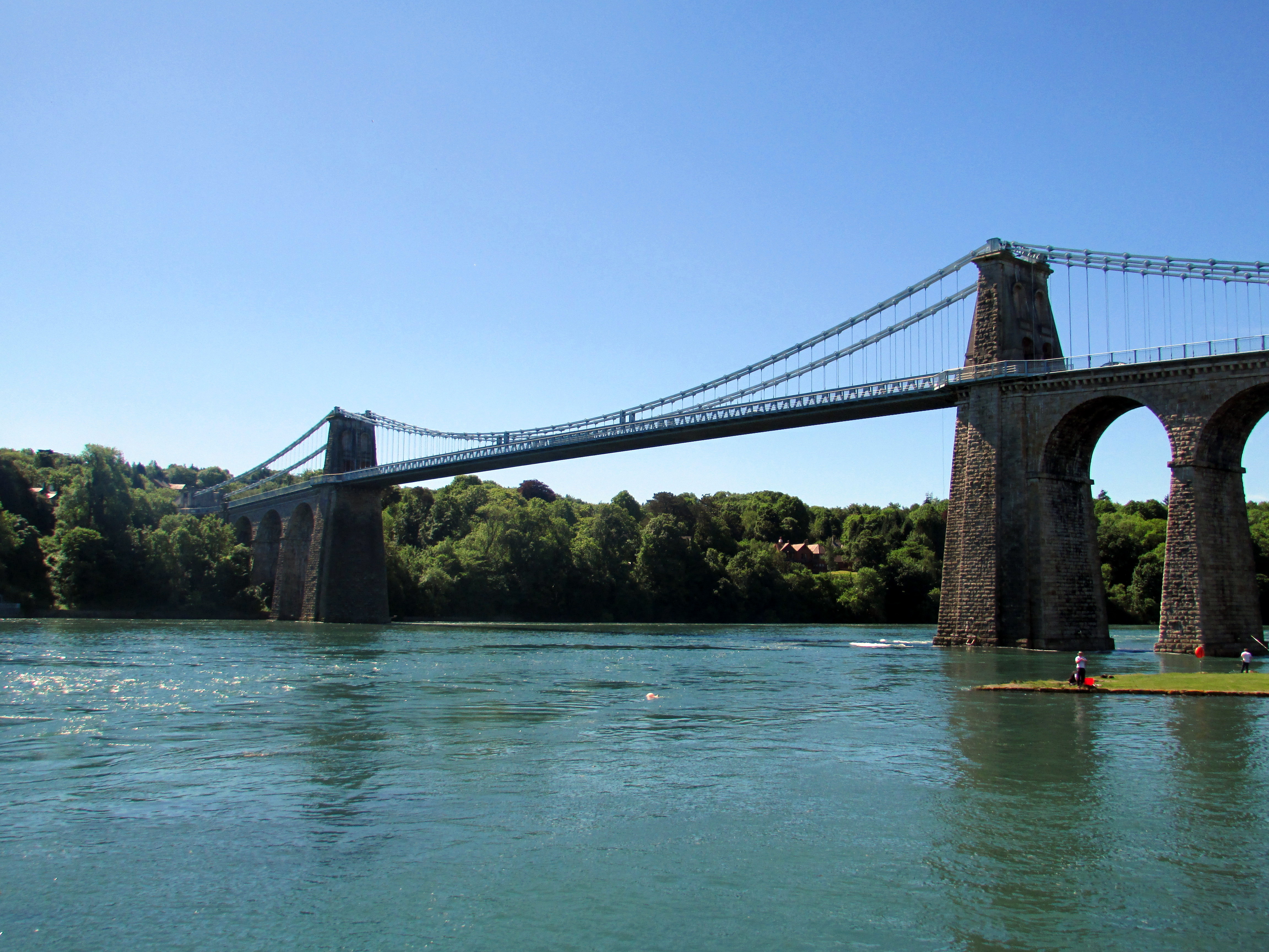
Menai Suspension Bridge
The Menai Suspension Bridge (Welsh: Pont y Borth or Pont Grog y Borth) is a suspension bridge spanning the Menai Strait between the island of Anglesey...
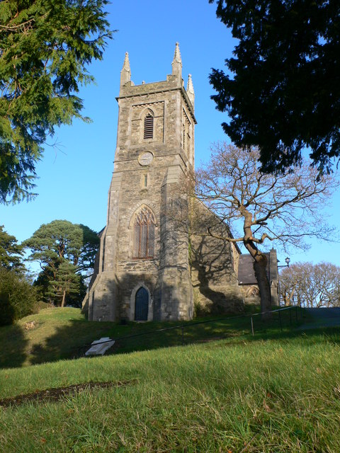
St Mary's Church, Menai Bridge
St Mary's Church is a Grade II listed church in Menai Bridge, Anglesey serving the parish of Bro Tysilio, in the Diocese of St Davids of the Church in...
Hawthorn House, Menai Bridge
Hawthorn House is a Grade II listed building located on the main street in the town of Menai Bridge, on the Isle of Anglesey. == References ==
Nearby Amenities
Located within 500m of 53.222592,-4.1604933Have you been to Half Tide Rock?
Leave your review of Half Tide Rock below (or comments, questions and feedback).