Carreg Dôl-y-frân

Island in Cardiganshire

Wales

Carreg Dôl-y-frân

Carreg Bica From the headland coastal path
Carreg Bica Credit: Kevin Waterhouse

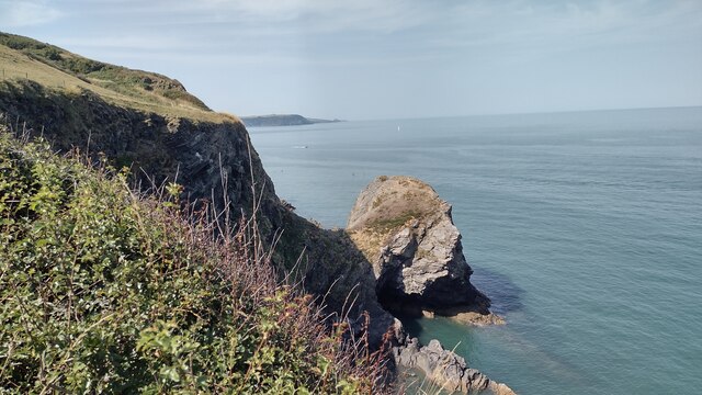
Carreg Dôl-y-frân is a small island located off the coast of Cardiganshire, Wales. This uninhabited island is situated in Cardigan Bay, approximately 1.5 miles from the mainland. The name Carreg Dôl-y-frân translates to "rock of the meadow of the crow" in English.

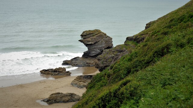
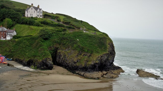
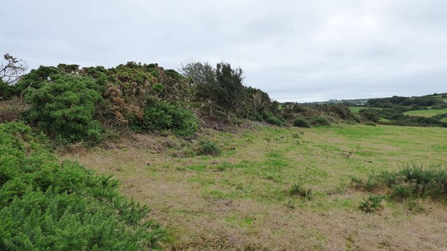
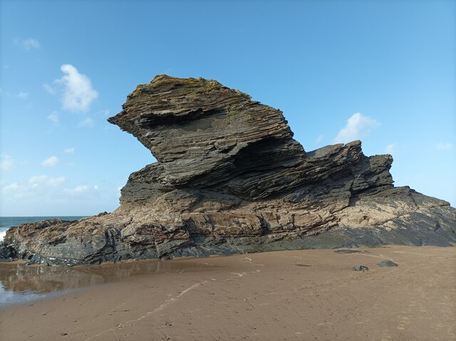
The island is known for its rugged and rocky terrain, characterized by steep cliffs and jagged rocks. It has a total area of around 6 acres, making it quite small in size. Despite its small size, Carreg Dôl-y-frân is home to a variety of bird species, including cormorants, gulls, and puffins, making it a popular spot for birdwatching enthusiasts.

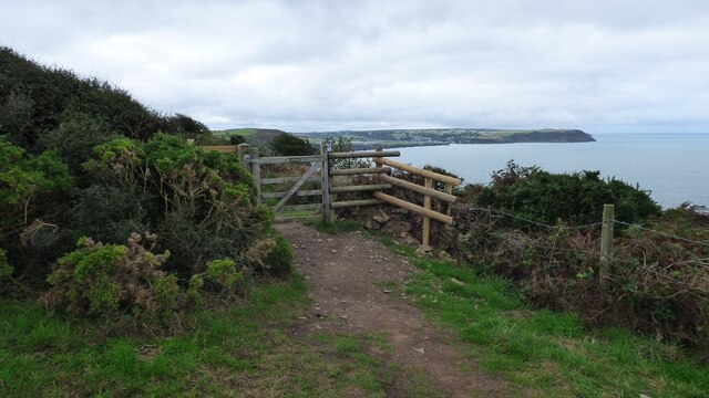
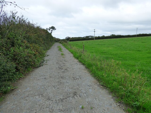
Access to Carreg Dôl-y-frân is limited as there are no regular boat services to the island. However, during low tide, it is possible to walk across a causeway from the mainland to explore the island. It is important to check the tides before attempting to visit, as the causeway can become submerged during high tide.

The island's rocky shoreline is also popular among fishermen, who often visit Carreg Dôl-y-frân in search of mackerel and other sea fish. The surrounding waters are known for their rich marine life, attracting divers and snorkelers as well.

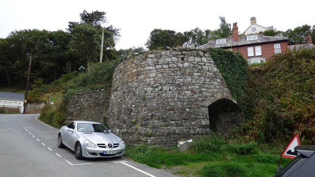
Despite its lack of human habitation, Carreg Dôl-y-frân holds historical significance. The island is believed to have been used as a lookout point during World War II to monitor enemy movements along the coast.

In conclusion, Carreg Dôl-y-frân is a small and uninhabited island off the coast of Cardiganshire, offering stunning natural beauty, diverse birdlife, and recreational opportunities for visitors who are able to access this secluded spot.

If you have any feedback on the listing, please let us know in the comments section below.

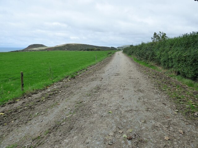
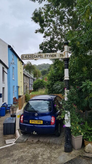
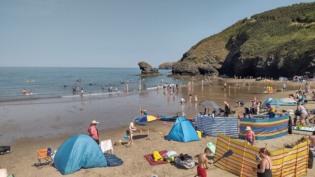
Carreg Dôl-y-frân Images

Images are sourced within 2km of 52.159648/-4.4759634 or Grid Reference SN3054. Thanks to Geograph Open Source API. All images are credited.

Carreg Bica From the headland coastal path
Carreg Bica
From the headland coastal path
The West Headland View across the small bay. The west headland has a statue of St Carannog above the cliff
The West Headland
View across the small bay. The west headland has a statue of St Carannog above the cliff
Gate on the Ceredigion Coast Path
Capel Penmorfa <span class="nowrap"><a title="https://coflein.gov.uk/en/site/7397/" rel="nofollow ugc noopener" href="https://coflein.gov.uk/en/site/7397/">Link</a><img style="margin-left:2px;" alt="External link" title="External link - shift click to open in new window" src="https://s1.geograph.org.uk/img/external.png" width="10" height="10"/></span>
Capel Penmorfa
Southern rampart of Castell Bach Promontory Fort <span class="nowrap"><a title="https://coflein.gov.uk/en/site/93914/" rel="nofollow ugc noopener" href="https://coflein.gov.uk/en/site/93914/">Link</a><img style="margin-left:2px;" alt="External link" title="External link - shift click to open in new window" src="https://s1.geograph.org.uk/img/external.png" width="10" height="10"/></span>
Southern rampart of Castell Bach Promontory Fort
Lime Kiln at Llangrannog
Llangrannog Village View from the cliff south of the village.
Llangrannog Village
View from the cliff south of the village.
Footpath leading towards Eisteddfa
Footpath leading north from Eisteddfa
Llangrannog Village View from hill to the north of the village.
Llangrannog Village
View from hill to the north of the village.
Ynys-Lochtyn Island and Promontory Fort The fort overlooks the small tidal island and has a single rampart and ditch on the landward side <span class="nowrap"><a title="https://coflein.gov.uk/en/site/408279/" rel="nofollow ugc noopener" href="https://coflein.gov.uk/en/site/408279/">Link</a><img style="margin-left:2px;" alt="External link" title="External link - shift click to open in new window" src="https://s1.geograph.org.uk/img/external.png" width="10" height="10"/></span>
Ynys-Lochtyn Island and Promontory Fort
The fort overlooks the small tidal island and has a single rampart and ditch on the landward side LinkExternal link
Pendinaslochdyn Iron Age Hillfort <span class="nowrap"><a title="https://www.megalithic.co.uk/article.php?sid=17596" rel="nofollow ugc noopener" href="https://www.megalithic.co.uk/article.php?sid=17596">Link</a><img style="margin-left:2px;" alt="External link" title="External link - shift click to open in new window" src="https://s1.geograph.org.uk/img/external.png" width="10" height="10"/></span>
Pendinaslochdyn Iron Age Hillfort
Llangrannog Dry Ski Slope Not really the sort of thing you expect to see when walking along a coastal path.
Llangrannog Dry Ski Slope
Not really the sort of thing you expect to see when walking along a coastal path.
Rock formation in Llangrannog An interesting formation of rocks on the beach in Llangrannog.
Rock formation in Llangrannog
An interesting formation of rocks on the beach in Llangrannog.
Direction Sign – Signpost on the B4321 in Llangrannog Located on the southeast of the junction of the B4321 and the B4334 near the bridge over Nant Hawen. Llangrannog community. 2 arms and ogee finial. 

Milestone Society National ID: CRD_SN3154
Direction Sign – Signpost on the B4321 in Llangrannog
Located on the southeast of the junction of the B4321 and the B4334 near the bridge over Nant Hawen. Llangrannog community. 2 arms and ogee finial. Milestone Society National ID: CRD_SN3154
Llangrannog Beach A busy Llangrannog beach
Llangrannog Beach
A busy Llangrannog beach
Carreg Dol-y-Fran. From the coast path looking to Carreg Dol-y -Fran
Carreg Dol-y-Fran.
From the coast path looking to Carreg Dol-y -Fran
Carreg-y-ty and sandy beach From coast path looking down to  Carreg-y-ty and the sandy beach
Carreg-y-ty and sandy beach
From coast path looking down to Carreg-y-ty and the sandy beach
Show me another place!

Carreg Dôl-y-frân is located at Grid Ref: SN3054 (Lat: 52.159648, Lng: -4.4759634)

Unitary Authority: Ceredigion

Police Authority: Dyfed Powys

What 3 Words

///applies.apples.clinking. Near Aberporth, Ceredigion

Related Wikis

River Hawen

The River Hawen (Welsh: Nant Hawen) is the main stream that flows through Llangrannog, Ceredigion, Wales into Cardigan Bay. It falls as a waterfall near...
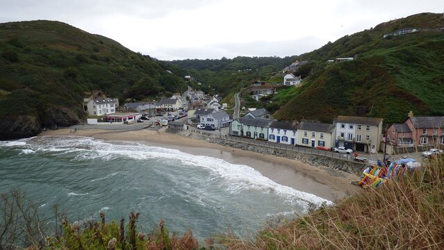
Llangrannog

Llangrannog (sometimes spelt as Llangranog) is both a village and a community in Ceredigion, Wales, 6 miles (10 km) southwest of New Quay. It lies in...

Pigeon's Ford

Pigeon's Ford is a hamlet in the community of Llangrannog, Ceredigion, Wales, which is 71.8 miles (115.5 km) from Cardiff and 189.9 miles (305.5 km) from...

Penmorfa

Penmorfa is the name of two villages in Wales. One is a small village in the community of Penbryn, Ceredigion, Wales. Penmorfa is represented in the Senedd...

St Michael's Church, Penbryn

The Church of St Michael at present (October 2023) holds services every Sunday at 11.15am. It is a Grade I listed church in Penbryn, Ceredigion, Wales...

Penbryn

Penbryn (grid reference SN296520) is a small coastal village and community in Ceredigion, Wales, about 8 miles (13 km) from Cardigan. == History == �...

Dyffryn-bern

Dyffryn-bern is a small village in the community of Penbryn, Ceredigion, Wales, which is 72.4 miles (116.5 km) from Cardiff and 191.8 miles (308.6 km...

Brynhoffnant

Brynhoffnant is a small village in the community of Penbryn, Ceredigion, Wales, which is 70.4 miles (113.3 km) from Cardiff and 189.1 miles (304.3 km)...

Nearby Amenities

Located within 500m of 52.159648,-4.4759634
Source: PGS
Lat/Long: 52.1616923/-4.4702556
Source: PGS
Lat/Long: 52.1613003/-4.4713955
Source: PGS
Lat/Long: 52.1605547/-4.4709079
Source: PGS
Lat/Long: 52.16047/-4.4708305
Source: PGS
Lat/Long: 52.1602534/-4.4726054
Source: PGS
Lat/Long: 52.1601333/-4.4738128
Source: PGS
Lat/Long: 52.1595633/-4.4749316
Source: PGS
Lat/Long: 52.1597122/-4.4750787
Source: PGS
Lat/Long: 52.1596201/-4.475257
Source: PGS
Lat/Long: 52.159822/-4.4754502
Source: PGS
Lat/Long: 52.1594687/-4.4762723
Source: PGS
Lat/Long: 52.159291/-4.4764333
Source: PGS
Lat/Long: 52.1590656/-4.477436
Source: PGS
Lat/Long: 52.1589077/-4.4775541
Source: PGS
Lat/Long: 52.1587365/-4.4779617
Source: PGS
Lat/Long: 52.1587365/-4.4775004
Source: PGS
Lat/Long: 52.1581461/-4.478027
Source: PGS
Lat/Long: 52.1578414/-4.4788952
Source: PGS
Lat/Long: 52.1574136/-4.479968
Source: PGS
Lat/Long: 52.1572358/-4.4802899
Source: PGS
Lat/Long: 52.1572819/-4.4806654
Source: PGS
Lat/Long: 52.1570252/-4.4812019
Source: PGS
Lat/Long: 52.1569528/-4.4809551
Source: PGS
Lat/Long: 52.1567505/-4.4809382
Source: PGS
Lat/Long: 52.1565525/-4.4807905
Source: PGS
Lat/Long: 52.1564101/-4.4806572
Post Box
Post Box Type: lamp
Royal Cypher: EIIR
Royal Cypher Wikidata: Q33102113
Lat/Long: 52.1597452/-4.4705915
Telephone
Booth: KX100
Covered: booth
Lat/Long: 52.1597201/-4.4706325
Parking
Note: Open to non-pub customers as a pay and display
Operator: The Ship Inn
Lat/Long: 52.1598081/-4.4702512
Waste Basket
Lat/Long: 52.1599242/-4.4708011
Life Ring
Emergency: life_ring
Source: photograph
Lat/Long: 52.1600081/-4.4710351
Waste Basket
Lat/Long: 52.1599554/-4.4708728
Information: board
Tourism: information
Lat/Long: 52.1599878/-4.4709899
Waste Basket
Lat/Long: 52.1599863/-4.4710512
Bus Stop
Lat/Long: 52.1598169/-4.470516
Waste Basket
Lat/Long: 52.1599723/-4.4709125
Waste Basket
Lat/Long: 52.1597777/-4.4704219
Bench
Backrest: yes
Lat/Long: 52.159766/-4.4703942
Saint Carannog
Artist Name: Sebastien Boyesen
Artwork Type: statue
Material: bronze
Name Cy: Carannog Sant
Name En: Saint Carannog
Start Date: 2012-05-12
Tourism: artwork
Wikimedia Commons: File:Statue of St Carannog, Llangrannog, Wales.jpg
Lat/Long: 52.1601344/-4.4730737
Carreg Bica
Name Cy: Carreg Bica
Natural: rock
Lat/Long: 52.1614338/-4.4716979
Tourism: viewpoint
Lat/Long: 52.1613015/-4.4706413
Tourism: viewpoint
Lat/Long: 52.1601786/-4.4730475
Addr Housename: Manorafon Isaf
Lat/Long: 52.1594179/-4.4689303
Addr Housename: Manorafon Uchaf
Lat/Long: 52.1593809/-4.4688579
Addr Housename: Cilrhiw
Lat/Long: 52.159677/-4.4695834
Cilborth Beach
Natural: beach
Wikidata: Q107356898
Lat/Long: 52.1619103/-4.4705114
Tourism: viewpoint
Lat/Long: 52.1614297/-4.4707141
The data included in this document is from www.openstreetmap.org. The data is made available under ODbL.

Have you been to Carreg Dôl-y-frân?

Leave your review of Carreg Dôl-y-frân below (or comments, questions and feedback).