Carreg y Nodwydd

Island in Cardiganshire

Wales

Carreg y Nodwydd

Carreg Bica From the headland coastal path
Carreg Bica Credit: Kevin Waterhouse

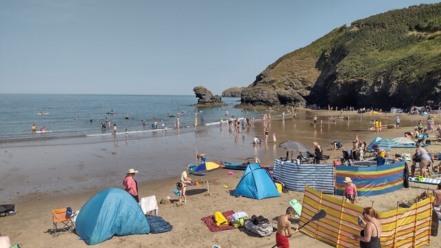
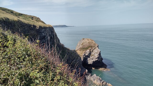
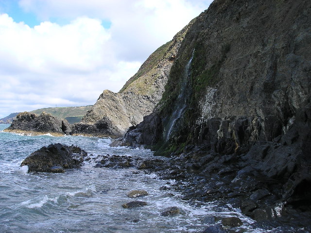
Carreg y Nodwydd is a small island located off the coast of Cardiganshire, Wales. It is a rocky outcrop that measures around 1.5 hectares in size. The island is situated in Cardigan Bay, approximately 2 kilometers from the mainland.

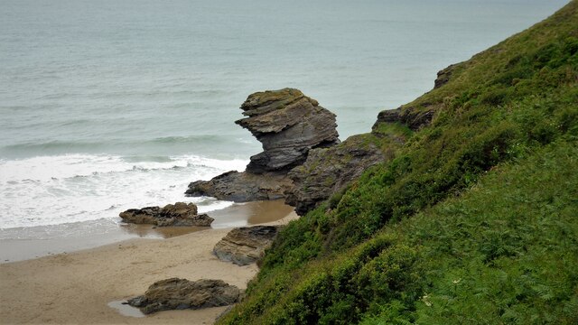
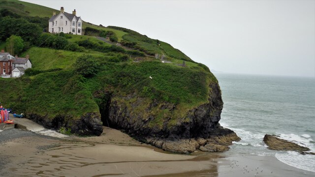
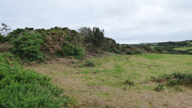
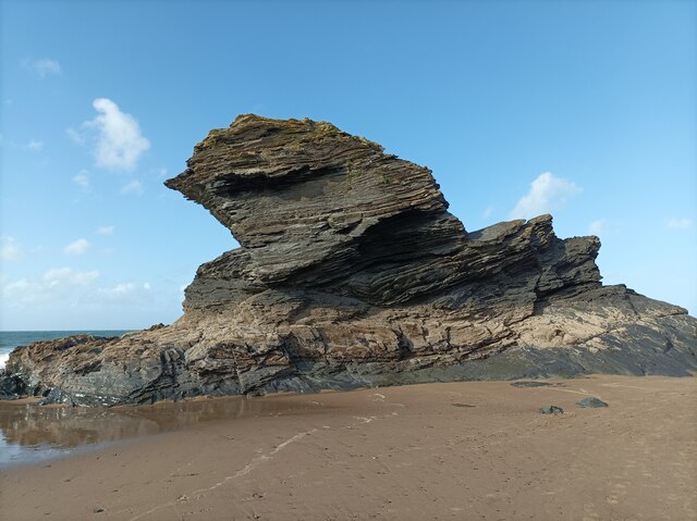
The name Carreg y Nodwydd translates to "Slate Rock" in English, indicating the predominant geological feature of the island. Its rocky terrain is characterized by jagged cliffs and boulders, with little vegetation present. The island is uninhabited and lacks any significant infrastructure or facilities.

Carreg y Nodwydd is a popular destination for wildlife enthusiasts and birdwatchers, as it serves as a nesting site for various seabird species. Visitors can observe colonies of puffins, guillemots, razorbills, and kittiwakes, among others. The island's inaccessible cliffs provide a safe haven for these birds, ensuring their conservation and protection.

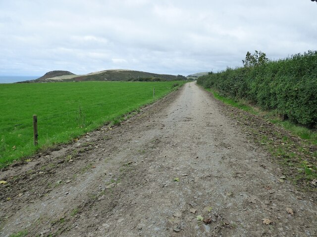
Access to Carreg y Nodwydd is limited due to its remote location and lack of regular transportation services. However, it is possible to reach the island by boat or kayak from nearby coastal towns. Visitors are advised to take caution when navigating the surrounding waters, as strong currents and rough seas are common in this area.

Overall, Carreg y Nodwydd offers a unique opportunity to experience the rugged beauty of the Cardiganshire coastline and observe a diverse range of seabirds in their natural habitat.

If you have any feedback on the listing, please let us know in the comments section below.

Carreg y Nodwydd Images

Images are sourced within 2km of 52.153337/-4.4886683 or Grid Reference SN2953. Thanks to Geograph Open Source API. All images are credited.

Carreg Bica From the headland coastal path
Carreg Bica
From the headland coastal path
The West Headland View across the small bay. The west headland has a statue of St Carannog above the cliff
The West Headland
View across the small bay. The west headland has a statue of St Carannog above the cliff
Ceredigion Coastal Path
The road to Traeth-Penbryn The road on the right takes you to the beach at Penbryn.
The road to Traeth-Penbryn
The road on the right takes you to the beach at Penbryn.
St Michael's Church on the Hill, Penbryn Stands in the centre of a circular graveyard. The church building itself may date to the 12th century, but almost certainly has earlier origins.
St Michael's Church on the Hill, Penbryn
Stands in the centre of a circular graveyard. The church building itself may date to the 12th century, but almost certainly has earlier origins.
Gate on the Ceredigion Coast Path
Approach to Maesglas Caravan Park
Capel Penmorfa <span class="nowrap"><a title="https://coflein.gov.uk/en/site/7397/" rel="nofollow ugc noopener" href="https://coflein.gov.uk/en/site/7397/">Link</a><img style="margin-left:2px;" alt="External link" title="External link - shift click to open in new window" src="https://s1.geograph.org.uk/img/external.png" width="10" height="10"/></span>
Capel Penmorfa
Southern rampart of Castell Bach Promontory Fort <span class="nowrap"><a title="https://coflein.gov.uk/en/site/93914/" rel="nofollow ugc noopener" href="https://coflein.gov.uk/en/site/93914/">Link</a><img style="margin-left:2px;" alt="External link" title="External link - shift click to open in new window" src="https://s1.geograph.org.uk/img/external.png" width="10" height="10"/></span>
Southern rampart of Castell Bach Promontory Fort
Lime Kiln at Llangrannog
Llangrannog Village View from the cliff south of the village.
Llangrannog Village
View from the cliff south of the village.
Footpath leading towards Eisteddfa
Footpath leading north from Eisteddfa
Llangrannog Village View from hill to the north of the village.
Llangrannog Village
View from hill to the north of the village.
Rock formation in Llangrannog An interesting formation of rocks on the beach in Llangrannog.
Rock formation in Llangrannog
An interesting formation of rocks on the beach in Llangrannog.
Direction Sign – Signpost on the B4321 in Llangrannog Located on the southeast of the junction of the B4321 and the B4334 near the bridge over Nant Hawen. Llangrannog community. 2 arms and ogee finial. 

Milestone Society National ID: CRD_SN3154
Direction Sign – Signpost on the B4321 in Llangrannog
Located on the southeast of the junction of the B4321 and the B4334 near the bridge over Nant Hawen. Llangrannog community. 2 arms and ogee finial. Milestone Society National ID: CRD_SN3154
Llangrannog Beach A busy Llangrannog beach
Llangrannog Beach
A busy Llangrannog beach
Carreg Dol-y-Fran. From the coast path looking to Carreg Dol-y -Fran
Carreg Dol-y-Fran.
From the coast path looking to Carreg Dol-y -Fran
Show me another place!

Carreg y Nodwydd is located at Grid Ref: SN2953 (Lat: 52.153337, Lng: -4.4886683)

Unitary Authority: Ceredigion

Police Authority: Dyfed Powys

What 3 Words

///upholding.footpath.pokers. Near Aberporth, Ceredigion

Nearby Locations

Carreg y Nodwydd

Related Wikis

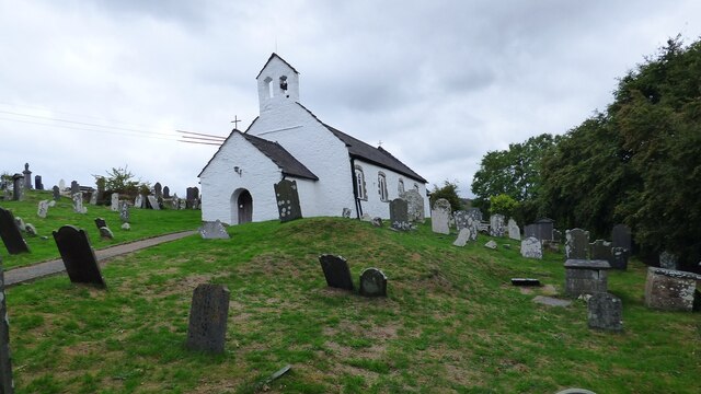
St Michael's Church, Penbryn

The Church of St Michael at present (October 2023) holds services every Sunday at 11.15am. It is a Grade I listed church in Penbryn, Ceredigion, Wales...

River Hawen

The River Hawen (Welsh: Nant Hawen) is the main stream that flows through Llangrannog, Ceredigion, Wales into Cardigan Bay. It falls as a waterfall near...

Penmorfa

Penmorfa is the name of two villages in Wales. One is a small village in the community of Penbryn, Ceredigion, Wales. Penmorfa is represented in the Senedd...

Penbryn

Penbryn (grid reference SN296520) is a small coastal village and community in Ceredigion, Wales, about 8 miles (13 km) from Cardigan. == History == �...

Llangrannog

Llangrannog (sometimes spelt as Llangranog) is both a village and a community in Ceredigion, Wales, 6 miles (10 km) southwest of New Quay. It lies in...

Dyffryn-bern

Dyffryn-bern is a small village in the community of Penbryn, Ceredigion, Wales, which is 72.4 miles (116.5 km) from Cardiff and 191.8 miles (308.6 km...

Pigeon's Ford

Pigeon's Ford is a hamlet in the community of Llangrannog, Ceredigion, Wales, which is 71.8 miles (115.5 km) from Cardiff and 189.9 miles (305.5 km) from...
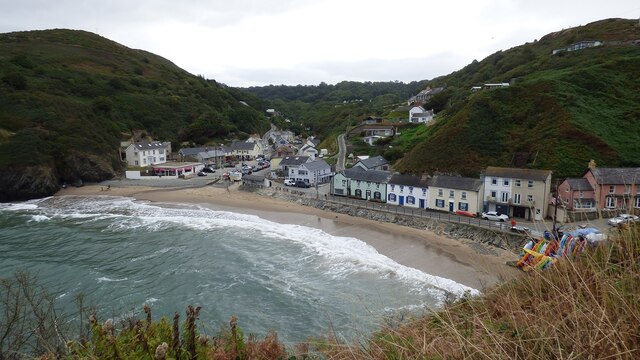
Tresaith

Tresaith (until recently, Treathsaith) is a coastal village in Ceredigion, Wales, between Aberporth and Llangranog. It is linked to the former by a two...

Nearby Amenities

Located within 500m of 52.153337,-4.4886683
Source: PGS
Lat/Long: 52.1554604/-4.4826437
Source: PGS
Lat/Long: 52.1549007/-4.4848532
Source: PGS
Lat/Long: 52.1547137/-4.4847781
Source: PGS
Lat/Long: 52.1541476/-4.4849712
Source: PGS
Lat/Long: 52.1538777/-4.4847674
Source: PGS
Lat/Long: 52.153621/-4.4848103
Source: PGS
Lat/Long: 52.1532192/-4.4855513
Source: PGS
Lat/Long: 52.1531955/-4.4858886
Source: PGS
Lat/Long: 52.1531426/-4.4862234
Source: PGS
Lat/Long: 52.153296/-4.486513
Source: PGS
Lat/Long: 52.153458/-4.4866851
Source: PGS
Lat/Long: 52.1535486/-4.4869024
Source: PGS
Lat/Long: 52.1539567/-4.4872135
Source: PGS
Lat/Long: 52.1537263/-4.4880826
Source: PGS
Lat/Long: 52.153384/-4.4881791
Source: PGS
Lat/Long: 52.1532853/-4.4883079
Source: PGS
Lat/Long: 52.1525085/-4.4888336
Source: PGS
Lat/Long: 52.152074/-4.4887907
Source: PGS
Lat/Long: 52.1517581/-4.4891018
Source: PGS
Lat/Long: 52.1514026/-4.4903893
Man Made: tower
Tower Construction: lattice
Tower Type: communication
Lat/Long: 52.1498172/-4.4874647
The data included in this document is from www.openstreetmap.org. The data is made available under ODbL.

Have you been to Carreg y Nodwydd?

Leave your review of Carreg y Nodwydd below (or comments, questions and feedback).