Carreg y Trothwy

Island in Cardiganshire

Wales

Carreg y Trothwy

The coast near Aberporth Viewed from a lay-by on the A487 road.
The coast near Aberporth Credit: John Lucas

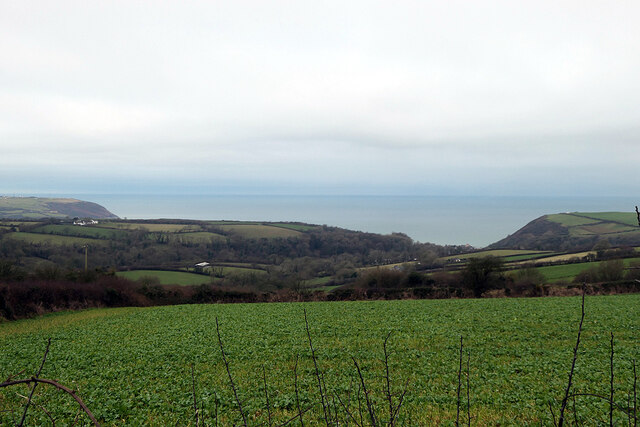
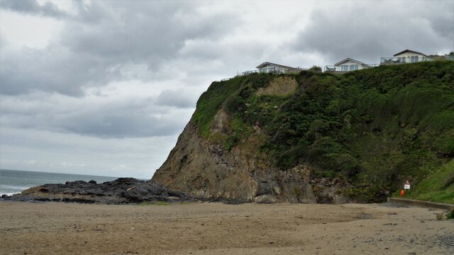
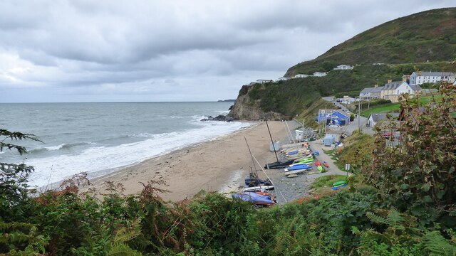
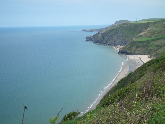
Carreg y Trothwy, also known as the "Island," is a unique geological formation located in Cardiganshire, Wales. Situated in the Irish Sea, it is a small rocky outcrop that emerges from the water during low tide, creating the appearance of an island.

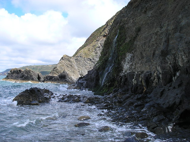
The Island is composed of rugged, metamorphic rocks, formed by intense pressure and heat over millions of years. It is approximately 150 meters long and 50 meters wide, with a maximum elevation of around 10 meters above sea level. Its jagged cliffs and crevices provide a habitat for various marine life, such as barnacles, limpets, and seaweed.

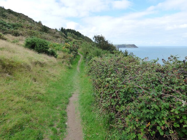
Access to Carreg y Trothwy is only possible during low tide when a rocky causeway appears, allowing visitors to reach the island on foot. However, caution must be exercised as the causeway can become submerged quickly, leaving people stranded if they fail to return before the tide rises again.

The Island has historical significance, as it is believed to have served as a lookout point during medieval times. There are remnants of a stone structure on its highest point, suggesting the presence of a defensive tower or a watchtower. Its strategic location offered a vantage point to observe and protect the coastline.

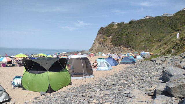
Carreg y Trothwy is a popular attraction for nature enthusiasts, geologists, and photographers who appreciate its unique landscape. It offers breathtaking views of the surrounding sea and coastline, making it a perfect spot for capturing stunning sunsets and dramatic seascapes.

Overall, Carreg y Trothwy is a fascinating geological feature and historical landmark that showcases the beauty and diversity of the Cardiganshire coastline.

If you have any feedback on the listing, please let us know in the comments section below.

Carreg y Trothwy Images

Images are sourced within 2km of 52.13729/-4.5147219 or Grid Reference SN2751. Thanks to Geograph Open Source API. All images are credited.

The coast near Aberporth Viewed from a lay-by on the A487 road.
The coast near Aberporth
Viewed from a lay-by on the A487 road.
Tresaith Sands With a caravan park very close to the cliff
Tresaith Sands
With a caravan park very close to the cliff
Converted Railway Carriage Known as Wendy
Tresaith Beach
Tresaith Beach
Corbalengi Stone Standing stone with the Roman inscription 'CORBALENGI IACIT ORDOVS' which translates to here lies Corbalengi the Ordovician. <span class="nowrap"><a title="https://www.megalithic.co.uk/article.php?sid=11054" rel="nofollow ugc noopener" href="https://www.megalithic.co.uk/article.php?sid=11054">Link</a><img style="margin-left:2px;" alt="External link" title="External link - shift click to open in new window" src="https://s1.geograph.org.uk/img/external.png" width="10" height="10"/></span>
Corbalengi Stone
Standing stone with the Roman inscription 'CORBALENGI IACIT ORDOVS' which translates to here lies Corbalengi the Ordovician. LinkExternal link
Ceredigion Coastal Path
The road to Traeth-Penbryn The road on the right takes you to the beach at Penbryn.
The road to Traeth-Penbryn
The road on the right takes you to the beach at Penbryn.
St Michael's Church on the Hill, Penbryn Stands in the centre of a circular graveyard. The church building itself may date to the 12th century, but almost certainly has earlier origins.
St Michael's Church on the Hill, Penbryn
Stands in the centre of a circular graveyard. The church building itself may date to the 12th century, but almost certainly has earlier origins.
Pen y Craig, Aberporth
B4333 to Newcastle Emlyn
B4333 near Maesgwyn
B4333 near Maesgwyn
Tresaith Beach Located in Tresaith, Ceredigion, West Wales
The main coast road about 2 miles from the village Tresaith/Tresaith Beach is the A487 which goes 30 miles North to Aberystwyth and 7 miles South to Cardigan/Abertifi.
Tresaith Beach
Located in Tresaith, Ceredigion, West Wales The main coast road about 2 miles from the village Tresaith/Tresaith Beach is the A487 which goes 30 miles North to Aberystwyth and 7 miles South to Cardigan/Abertifi.
Penbryn Beach Sandy Penbryn Beach
Penbryn Beach
Sandy Penbryn Beach
Coast Path Coast path from Tresaith to Penbryn passing below one of the Aberporth range control points
Coast Path
Coast path from Tresaith to Penbryn passing below one of the Aberporth range control points
Tresaith Beach A busy Tresaith Beach
Tresaith Beach
A busy Tresaith Beach
Glandwr Country House
Penbryn beach taken from Wales coastal path
Tresaith looking toward Aberporth
Show me another place!

Carreg y Trothwy is located at Grid Ref: SN2751 (Lat: 52.13729, Lng: -4.5147219)

Unitary Authority: Ceredigion

Police Authority: Dyfed Powys

What 3 Words

///joins.ghosts.lawns. Near Aberporth, Ceredigion

Related Wikis

Tresaith

Tresaith (until recently, Treathsaith) is a coastal village in Ceredigion, Wales, between Aberporth and Llangranog. It is linked to the former by a two...

Dyffryn-bern

Dyffryn-bern is a small village in the community of Penbryn, Ceredigion, Wales, which is 72.4 miles (116.5 km) from Cardiff and 191.8 miles (308.6 km...

Penbryn

Penbryn (grid reference SN296520) is a small coastal village and community in Ceredigion, Wales, about 8 miles (13 km) from Cardigan. == History == �...

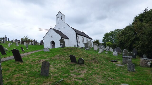
St Michael's Church, Penbryn

The Church of St Michael at present (October 2023) holds services every Sunday at 11.15am. It is a Grade I listed church in Penbryn, Ceredigion, Wales...

Nearby Amenities

Located within 500m of 52.13729,-4.5147219
Tresaith
Is In: Ceredigion, Wales, UK
Name Cy: Tresaith
Place: village
Source: NPE
Wikidata: Q7838747
Wikipedia: en:Tresaith
Lat/Long: 52.1349052/-4.5137276
Cafe
Lat/Long: 52.1353466/-4.5169078
Parking
Lat/Long: 52.1331734/-4.5151966
Toilets
Lat/Long: 52.135052/-4.517042
Bench
Backrest: no
Lat/Long: 52.134716/-4.5199541
Bench
Source: GPS, observation
Lat/Long: 52.1344584/-4.5187923
Bench
Source: GPS, observation
Lat/Long: 52.1346362/-4.5196836
Bench
Source: GPS, observation
Lat/Long: 52.134738/-4.5191267
Information: board
Source: GPS, observation
Tourism: information
Lat/Long: 52.1352001/-4.5173539
Tresaith Falls
Height: 30
Waterway: waterfall
Wikimedia Commons: File:Waterfall on Tresaith Beach - geograph.org.uk - 1535125.jpg
Lat/Long: 52.1365475/-4.5156127
Pub
Ship Inn
Addr City: Tresaith
Addr Housename: Ship Inn
Addr Postcode: SA43 2JL
Addr Street: Ffordd Tresaith
Email: shipinn@sabrain.com
Fhrs Id: 863536
Name Cy: Tafarn y Llong
Opening Hours: Mo-Sa 08:30-23:00; Su 08:30-22:30
Operator: S.A. Brain & Co
Phone: +44 1239 811 816
Source Addr Postcode: FHRS Open Data
Website: https://www.sabrain.com/pubs-and-hotels/mid-west-wales/ceredigion/the-ship-inn
Wikidata: Q80856070
Lat/Long: 52.135384/-4.5161054
Direction: 95
Generator Method: photovoltaic
Generator Output Electricity: yes
Generator Solar Modules: 8
Generator Source: solar
Generator Type: solar_photovoltaic_panel
Location: roof
Power: generator
Lat/Long: 52.1330538/-4.5171529
Direction: SSW
Generator Method: photovoltaic
Generator Output Electricity: yes
Generator Solar Modules: 16
Generator Source: solar
Generator Type: solar_photovoltaic_panel
Location: roof
Power: generator
Lat/Long: 52.1330904/-4.5128489
Direction: 215
Generator Method: photovoltaic
Generator Output Electricity: yes
Generator Solar Modules: 7
Generator Source: solar
Generator Type: solar_photovoltaic_panel
Location: roof
Power: generator
Lat/Long: 52.1349891/-4.5152528
Direction: 125
Generator Method: photovoltaic
Generator Output Electricity: yes
Generator Solar Modules: 9
Generator Source: solar
Generator Type: solar_photovoltaic_panel
Location: roof
Power: generator
Lat/Long: 52.1349969/-4.5153118
Direction: 105
Generator Method: photovoltaic
Generator Output Electricity: yes
Generator Solar Modules: 15
Generator Source: solar
Generator Type: solar_photovoltaic_panel
Location: roof
Power: generator
Lat/Long: 52.1332361/-4.5159468
The data included in this document is from www.openstreetmap.org. The data is made available under ODbL.

Have you been to Carreg y Trothwy?

Leave your review of Carreg y Trothwy below (or comments, questions and feedback).