Little Chesterford

Settlement in Essex Uttlesford

England

Little Chesterford

Little Chesterford church
Little Chesterford church Credit: mym

Little Chesterford is a village located in the county of Essex, in the eastern part of England. Situated on the River Cam, it lies approximately 12 miles south of the city of Cambridge and 6 miles north of the town of Saffron Walden. The village is part of the Uttlesford district, known for its picturesque countryside and historic charm.

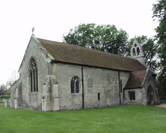
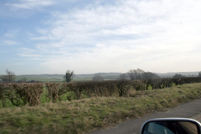
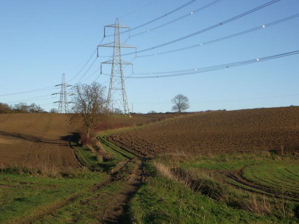
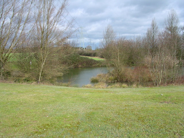
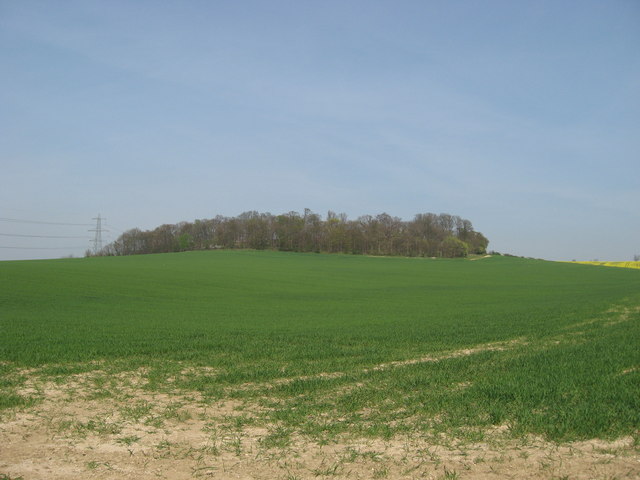
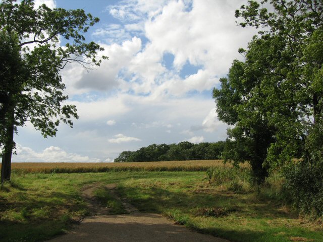
With a population of around 1,000 residents, Little Chesterford has a close-knit community and a tranquil atmosphere. The village is characterized by its traditional English architecture, with many charming cottages and houses dating back several centuries. It offers a peaceful and idyllic setting, surrounded by rolling fields and green landscapes.

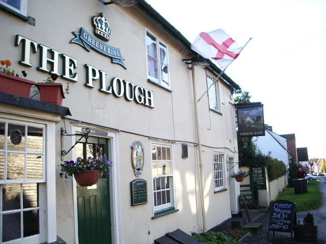
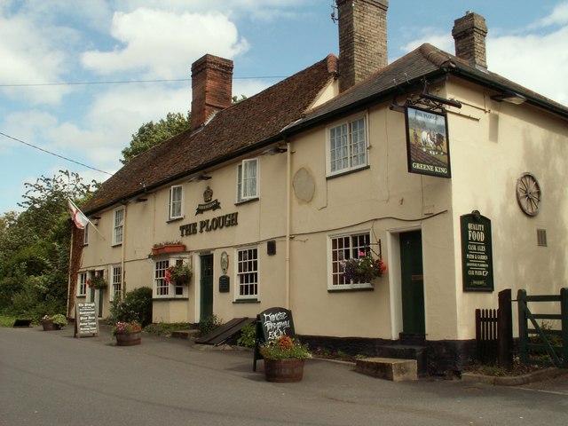
Little Chesterford boasts a variety of amenities for its residents, including a primary school, a village hall, and a local pub. The primary school, St. Mary's, caters to children from the village and the surrounding areas. The village hall serves as a hub for community activities and events, hosting various clubs and classes throughout the year.

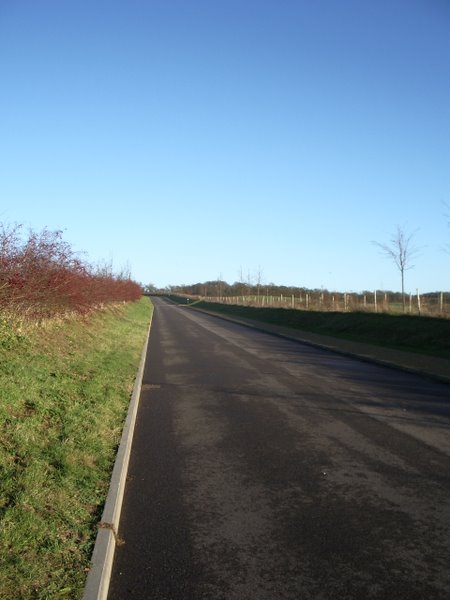
The village is well-connected to nearby towns and cities, with good transport links. The M11 motorway can be easily accessed from Little Chesterford, providing convenient routes to London and other major cities. The nearby Audley End railway station offers regular train services to London Liverpool Street and Cambridge.

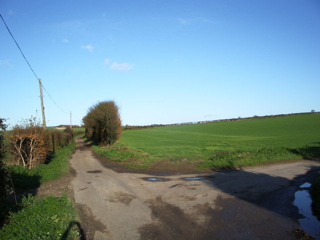
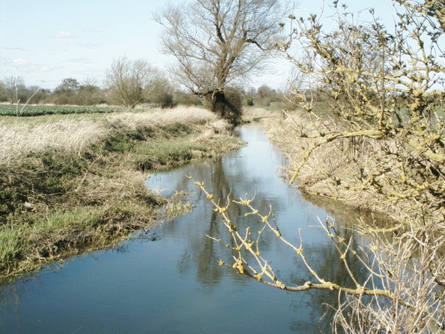
Surrounded by beautiful countryside, Little Chesterford offers plenty of opportunities for outdoor activities. The River Cam provides a scenic spot for walks, picnics, and fishing. Additionally, the village is close to the Audley End House and Gardens, a historic English Heritage site that attracts visitors from far and wide.

Overall, Little Chesterford is a charming and peaceful village, offering a tranquil escape from the hustle and bustle of nearby urban areas.

If you have any feedback on the listing, please let us know in the comments section below.

Little Chesterford Images

Images are sourced within 2km of 52.054248/0.214037 or Grid Reference TL5141. Thanks to Geograph Open Source API. All images are credited.

Little Chesterford church
Milestone north of Littlebury, Essex. The LONDON 41 miles milestone was restored in 2005. On the east side of the B1383 (former A11). It functioned as a milestone on the Essex & Herts (Hockerill Highway) Turnpike Trust that ran from Harlow to Great Chesterford.
Milestone north of Littlebury, Essex.
The LONDON 41 miles milestone was restored in 2005. On the east side of the B1383 (former A11). It functioned as a milestone on the Essex & Herts (Hockerill Highway) Turnpike Trust that ran from Harlow to Great Chesterford.
Great Chesterford Church Some of my antecedents are buried in the family plot to the left of this picture
Great Chesterford Church
Some of my antecedents are buried in the family plot to the left of this picture
The Green, Great Chesterford, Essex
Hills near Little Chesterford
Junction of Cow Lane and Little Cow Lane
The Plough at Great Chesterford
Field track and pylons
New Road to Chesterford Research Park
Gateway to Chesterford Research Park
Severe Storms On The Motorways Today's strong winds (Thursday 18 January 2007) have caused this lorry to overturn on the M11 in Essex. Within 50 metres behind this lorry is yet another overturned see <a title="https://www.geograph.org.uk/photo/314970" href="https://www.geograph.org.uk/photo/314970">Link</a>
Severe Storms On The Motorways
Today's strong winds (Thursday 18 January 2007) have caused this lorry to overturn on the M11 in Essex. Within 50 metres behind this lorry is yet another overturned see Link
Severe Storms On The Motorways Today's strong winds (Thursday 18 January 2007) have caused this lorry to overturn on the M11 in Essex. Within 50 metres in front of this lorry is yet another overturned you can just make out the other lorry in my car's mirror. Other lorry see <a title="https://www.geograph.org.uk/photo/314960" href="https://www.geograph.org.uk/photo/314960">Link</a>
Severe Storms On The Motorways
Today's strong winds (Thursday 18 January 2007) have caused this lorry to overturn on the M11 in Essex. Within 50 metres in front of this lorry is yet another overturned you can just make out the other lorry in my car's mirror. Other lorry see Link
The River Cam (or Granta) The River Cam (or Granta) near Little Chesterford, Essex
The River Cam (or Granta)
The River Cam (or Granta) near Little Chesterford, Essex
Electric pond
Electric pond
Farmland on the Audley Estate Farmland on the Audley Estate. High Balks copse at the top of the hill.
Farmland on the Audley Estate
Farmland on the Audley Estate. High Balks copse at the top of the hill.
'The Plough' inn This has been an inn at Great Chesterford since the 18th century.
'The Plough' inn
This has been an inn at Great Chesterford since the 18th century.
Back to grass roots? View through a gap in the hedgerow adjacent to the access road to the Chesterford Research Park (private).
Back to grass roots?
View through a gap in the hedgerow adjacent to the access road to the Chesterford Research Park (private).
Great Chesterford station The station was built in 1845 by the Eastern Counties Railway, and is still in mainline passenger service.  A branch line was opened by the Newmarket & Chesterford Railway in 1848, and closed in 1851.  The buildings on No.2 (Cambridge) platform have been demolished, along with the signal box at the north end of the London platform, but the station building itself survives, it is currently used as offices.  A new ticket office has recently been opened.  

The picture was taken from the footbridge, looking southwards towards London.
Great Chesterford station
The station was built in 1845 by the Eastern Counties Railway, and is still in mainline passenger service. A branch line was opened by the Newmarket & Chesterford Railway in 1848, and closed in 1851. The buildings on No.2 (Cambridge) platform have been demolished, along with the signal box at the north end of the London platform, but the station building itself survives, it is currently used as offices. A new ticket office has recently been opened. The picture was taken from the footbridge, looking southwards towards London.
Show me another place!

Little Chesterford is located at Grid Ref: TL5141 (Lat: 52.054248, Lng: 0.214037)

Administrative County: Essex

District: Uttlesford

Police Authority: Essex

What 3 Words

///bravest.much.driveways. Near Great Chesterford, Essex

Related Wikis

Little Chesterford

Little Chesterford is a small village and civil parish in Uttlesford, Essex, in the East of England. Close to the Cambridgeshire border, it is built principally...

Great Chesterford

Great Chesterford is a village and civil parish in the Uttlesford district of Essex, England. The village is 13 miles (20 km) north from Bishop's Stortford...

Great Chesterford railway station

Great Chesterford railway station is on the West Anglia Main Line serving the village of Great Chesterford in Essex, England. It is 45 miles 56 chains...

Littlebury

Littlebury is a village and civil parish in the Uttlesford district, north-west Essex, England. The village is approximately a mile and a half from the...

Little Walden

Little Walden is a small settlement in the Uttlesford district, in the English county of Essex. It lies about 3 miles (5 km) north of the market town of...

St Mary Magdalene Church, Ickleton

St Mary Magdalene Church is the Church of England parish church in the village of Ickleton in Cambridgeshire. The church is a Grade I listed building....

Wellcome Sanger Institute

The Wellcome Sanger Institute, previously known as The Sanger Centre and Wellcome Trust Sanger Institute, is a non-profit British genomics and genetics...

Ickleton

Ickleton is a village and civil parish about 9 miles (14 km) south of Cambridge in Cambridgeshire, England. The village is beside the River Cam, close...

Nearby Amenities

Located within 500m of 52.054248,0.214037
Little Chesterford
Is In: Essex,England,UK
Place: village
Wikidata: Q4899946
Lat/Long: 52.0538716/0.2105189
Post Box
Collection Times: Mo-Fr 16:30; Sa 11:30
Operator: Royal Mail
Post Box Mounting: pier
Post Box Type: lamp
Ref: CB10 58
Royal Cypher: EIIR
Royal Cypher Wikidata: Q33102113
Source: survey
Lat/Long: 52.053472/0.2086635
Bus Stop
Park Road Turn
Naptan AtcoCode: 1500CHESTERF
Naptan Bearing: N
Naptan BusStopType: CUS
Naptan CommonName: Park Road Turn
Naptan Crossing: High Street
Naptan Indicator: N-bound
Naptan Landmark: Park Road Turn
Naptan NaptanCode: esxgmtmj
Naptan Street: Walden Road
Naptan Verified: no
Public Transport: platform
Source: naptan;make_stop.py
Lat/Long: 52.0535446/0.2145563
Bus Stop
Park Road Turn
Naptan AtcoCode: 1500IM1957
Naptan Bearing: S
Naptan CommonName: Park Road Turn
Naptan Crossing: High Street
Naptan Indicator: S-bound
Naptan Landmark: Park Road Turn
Naptan NaptanCode: esxdaptd
Naptan PlusbusZoneRef: CAMBDGE
Naptan Street: Walden Road
Public Transport: platform
Source: naptan_import
Lat/Long: 52.0554456/0.2142261
Power: pole
Lat/Long: 52.0586219/0.2141582
Power: pole
Lat/Long: 52.0584035/0.213212
Power: pole
Lat/Long: 52.0583121/0.2128741
Power: pole
Lat/Long: 52.0574812/0.2121865
Power: pole
Lat/Long: 52.0566658/0.2114853
Power: pole
Lat/Long: 52.0558809/0.2108456
Power: pole
Lat/Long: 52.0551428/0.2102143
Power: pole
Lat/Long: 52.0554009/0.2083361
Power: pole
Lat/Long: 52.0552753/0.2092185
Power: pole
Lat/Long: 52.0549444/0.211632
The data included in this document is from www.openstreetmap.org. The data is made available under ODbL.

Have you been to Little Chesterford?

Leave your review of Little Chesterford below (or comments, questions and feedback).