Graig Ddu

Island in Anglesey

Wales

Graig Ddu

Class 67 locomotive at Holyhead The setting sun sees 67025 on the rear of the recently arrived 'Premier Service' from Cardiff Central. The Premier Service runs from Holyhead - Cardiff in the morning, returning in the evening, and gives an increased level of comfort (and prior to suspension due to Covid-19 an increased dining provision) for travel between North Wales and the Welsh Capital using locomotive hauled coaching stock rather than Diesel Multiple Units. the coaching stock is currently being upgraded with ex LNER Mark IV coaches replacing the Mk III coaches previously in use.
Class 67 locomotive at Holyhead Credit: David Robinson

The requested URL returned error: 429 Too Many Requests

If you have any feedback on the listing, please let us know in the comments section below.
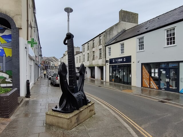
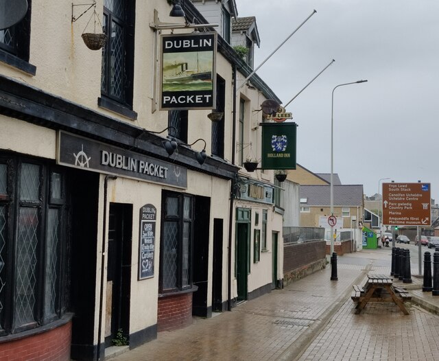
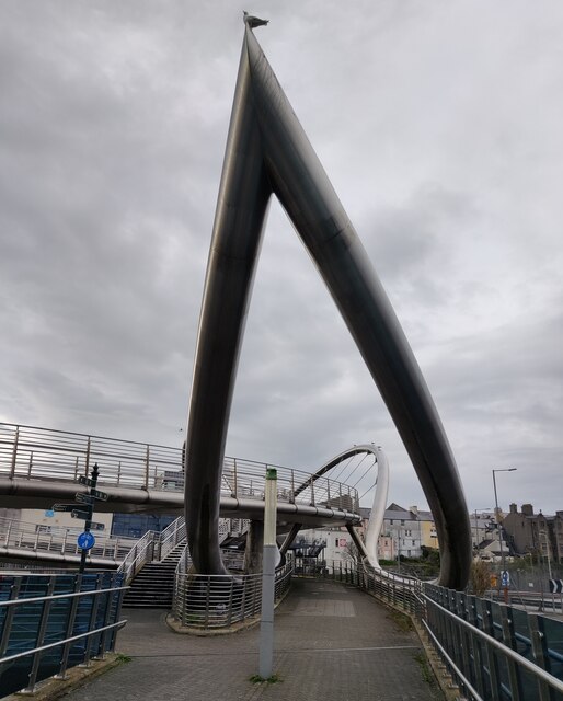
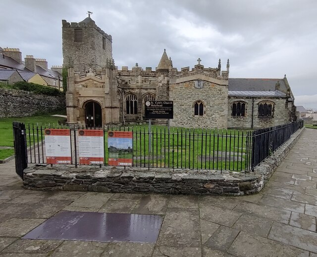
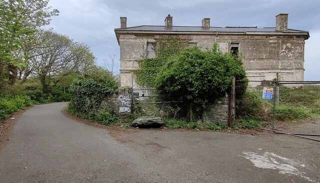
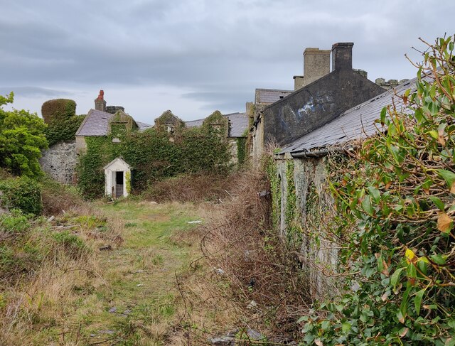
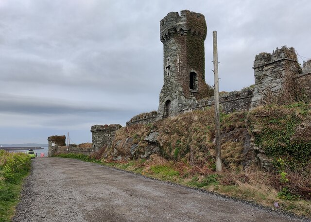
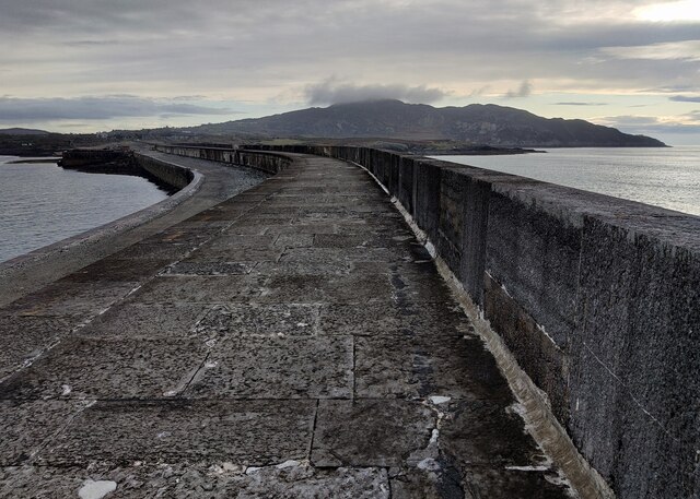
Graig Ddu Images

Images are sourced within 2km of 53.316433/-4.6280424 or Grid Reference SH2583. Thanks to Geograph Open Source API. All images are credited.

Class 67 locomotive at Holyhead The setting sun sees 67025 on the rear of the recently arrived 'Premier Service' from Cardiff Central. The Premier Service runs from Holyhead - Cardiff in the morning, returning in the evening, and gives an increased level of comfort (and prior to suspension due to Covid-19 an increased dining provision) for travel between North Wales and the Welsh Capital using locomotive hauled coaching stock rather than Diesel Multiple Units. the coaching stock is currently being upgraded with ex LNER Mark IV coaches replacing the Mk III coaches previously in use.
Class 67 locomotive at Holyhead
The setting sun sees 67025 on the rear of the recently arrived 'Premier Service' from Cardiff Central. The Premier Service runs from Holyhead - Cardiff in the morning, returning in the evening, and gives an increased level of comfort (and prior to suspension due to Covid-19 an increased dining provision) for travel between North Wales and the Welsh Capital using locomotive hauled coaching stock rather than Diesel Multiple Units. the coaching stock is currently being upgraded with ex LNER Mark IV coaches replacing the Mk III coaches previously in use.
Holyhead Maritime Museum Former lifeboat house, circa 1850s. A Grade II Listed Building.
Rubble with freestone dressings and copings (but mainly rendered and painted), slate roof. Aligned roughly N-S with gable and facing sea. Shaped gables (similar to Holyhead market hall) with ball finials; former broad doorways covered during conversion to restaurant (added bay window to N). Long shallow extension to W side; attached gabled range to NE. Some remains of slipway mechanism to seaward side.
Believed to be the oldest surviving lifeboat house in Wales.
** Courtesy British Listed Buildings.
Holyhead Maritime Museum
Former lifeboat house, circa 1850s. A Grade II Listed Building. Rubble with freestone dressings and copings (but mainly rendered and painted), slate roof. Aligned roughly N-S with gable and facing sea. Shaped gables (similar to Holyhead market hall) with ball finials; former broad doorways covered during conversion to restaurant (added bay window to N). Long shallow extension to W side; attached gabled range to NE. Some remains of slipway mechanism to seaward side. Believed to be the oldest surviving lifeboat house in Wales. ** Courtesy British Listed Buildings.
Derelict Jetty Below Porth-y-felin House
Holyhead Breakwater
Holyhead Breakwater
War memorial in Holyhead At the junction of Victoria Road and Market Street.
War memorial in Holyhead
At the junction of Victoria Road and Market Street.
Anchor along Market Street in Holyhead This anchor was presented to the town of Holyhead by the Stena Sealink Line in 1992.
Anchor along Market Street in Holyhead
This anchor was presented to the town of Holyhead by the Stena Sealink Line in 1992.
Two pubs in Holyhead The Dublin Packet and the Holland Inn on Rhos-y-Gaer Terrace.
Two pubs in Holyhead
The Dublin Packet and the Holland Inn on Rhos-y-Gaer Terrace.
The Celtic Gateway The Celtic Gateway is a stainless steel pedestrian and cycle bridge, it was opened on 19th October 2006. It connects Holyhead's railway station and ferry terminal with the Market Street in the town centre. It crosses the Old Holyhead Harbour, the North Wales coastal railway line and the A5154 road, it is 160-metre (520 feet) in length.
The Celtic Gateway
The Celtic Gateway is a stainless steel pedestrian and cycle bridge, it was opened on 19th October 2006. It connects Holyhead's railway station and ferry terminal with the Market Street in the town centre. It crosses the Old Holyhead Harbour, the North Wales coastal railway line and the A5154 road, it is 160-metre (520 feet) in length.
Part of the Celtic Gateway The Celtic Gateway is a stainless steel pedestrian and cycle bridge, it was opened on 19th October 2006. It connects Holyhead's railway station and ferry terminal with the Market Street in the town centre. It crosses the Old Holyhead Harbour, the North Wales coastal railway line and the A5154 road, it is 160-metre (520 feet) in length.
Part of the Celtic Gateway
The Celtic Gateway is a stainless steel pedestrian and cycle bridge, it was opened on 19th October 2006. It connects Holyhead's railway station and ferry terminal with the Market Street in the town centre. It crosses the Old Holyhead Harbour, the North Wales coastal railway line and the A5154 road, it is 160-metre (520 feet) in length.
Artwork on the Celtic Gateway The Celtic Gateway is a stainless steel pedestrian and cycle bridge, it was opened on 19th October 2006. It connects Holyhead's railway station and ferry terminal with the Market Street in the town centre. It crosses the Old Holyhead Harbour, the North Wales coastal railway line and the A5154 road, it is 160-metre (520 feet) in length.
Artwork on the Celtic Gateway
The Celtic Gateway is a stainless steel pedestrian and cycle bridge, it was opened on 19th October 2006. It connects Holyhead's railway station and ferry terminal with the Market Street in the town centre. It crosses the Old Holyhead Harbour, the North Wales coastal railway line and the A5154 road, it is 160-metre (520 feet) in length.
St. Cybi's Church in Holyhead
Dutch navy memorial The memorial overlooks the Outer Harbour at Newry Beach. The memorial, created in 2014, commemorates the presence of a section of the Dutch Navy in Holyhead during the Second World War.
Dutch navy memorial
The memorial overlooks the Outer Harbour at Newry Beach. The memorial, created in 2014, commemorates the presence of a section of the Dutch Navy in Holyhead during the Second World War.
Rocky shoreline at Porth-y-Felin
Derelict Porth-y-felin House Porth-y-felin House, originally known as Government House, was built in about 1849, it was used by the resident engineer of Holyhead breakwater. It was also used for some years as the harbourmasters residence. It is a Grade II listed building.
Derelict Porth-y-felin House
Porth-y-felin House, originally known as Government House, was built in about 1849, it was used by the resident engineer of Holyhead breakwater. It was also used for some years as the harbourmasters residence. It is a Grade II listed building.
Derelict Soldier's Point House Built in 1849, the Soldier's Point House was formerly the residence of the Government contractor for the construction of the nearby Holyhead breakwater. In about 1950 it became a hotel but then fell into disuse around the turn of the twenty-first century, and was then seriously damaged by a fire in 2011. It has been Grade II listed since July 1994.
<a href="https://www.geograph.org.uk/photo/2602243">SH2383 : Soldier's Point House</a>, same view of the house before the fire in 2011.
Derelict Soldier's Point House
Built in 1849, the Soldier's Point House was formerly the residence of the Government contractor for the construction of the nearby Holyhead breakwater. In about 1950 it became a hotel but then fell into disuse around the turn of the twenty-first century, and was then seriously damaged by a fire in 2011. It has been Grade II listed since July 1994. SH2383 : Soldier's Point House, same view of the house before the fire in 2011.
Derelict outbuildings at Soldier's Point House Built in 1849, the Soldier's Point House was formerly the residence of the Government contractor for the construction of the nearby Holyhead breakwater. In about 1950 it became a hotel but then fell into disuse around the turn of the twenty-first century, and was then seriously damaged by a fire in 2011. It has been Grade II listed since July 1994.
Derelict outbuildings at Soldier's Point House
Built in 1849, the Soldier's Point House was formerly the residence of the Government contractor for the construction of the nearby Holyhead breakwater. In about 1950 it became a hotel but then fell into disuse around the turn of the twenty-first century, and was then seriously damaged by a fire in 2011. It has been Grade II listed since July 1994.
Castellated screen wall and tower at Soldier's Point House Built in 1849, the Soldier's Point House was formerly the residence of the Government contractor for the construction of the nearby Holyhead breakwater. In about 1950 it became a hotel but then fell into disuse around the turn of the twenty-first century, and was then seriously damaged by a fire in 2011. It has been Grade II listed since July 1994.
Castellated screen wall and tower at Soldier's Point House
Built in 1849, the Soldier's Point House was formerly the residence of the Government contractor for the construction of the nearby Holyhead breakwater. In about 1950 it became a hotel but then fell into disuse around the turn of the twenty-first century, and was then seriously damaged by a fire in 2011. It has been Grade II listed since July 1994.
Holyhead Breakwater and Mountain At 1.7 miles long, it is the longest breakwater in the United Kingdom. Work began in 1845 and it was completed in 1873.
Holyhead Mountain is 722 feet high.
Holyhead Breakwater and Mountain
At 1.7 miles long, it is the longest breakwater in the United Kingdom. Work began in 1845 and it was completed in 1873. Holyhead Mountain is 722 feet high.
Show me another place!

Graig Ddu is located at Grid Ref: SH2583 (Lat: 53.316433, Lng: -4.6280424)

Unitary Authority: Isle of Anglesey

Police Authority: North Wales

What 3 Words

///stick.hands.pollution. Near Holyhead, Isle of Anglesey

Related Wikis

Salt Island, Anglesey

Salt Island (Welsh: Ynys yr Halen) is joined to Holy Island, Anglesey, in North Wales. It is a natural provider of shelter for the town's Old Harbour from...

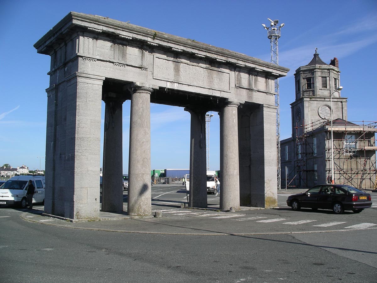
Admiralty Arch, Holyhead

Admiralty Arch, in Holyhead, Anglesey, was built in 1824 to mark the end of Thomas Telford's Holyhead road. The arch was designed by Thomas Harrison and...

Holyhead Town Hall

Holyhead Town Hall (Welsh: Neuadd y Dref Caergybi) is a municipal structure in Newry Street, Holyhead, Wales. The town hall is the meeting place of Holyhead...

Holyhead Mail Pier Lighthouse

Holyhead Mail Pier or Admiralty Pier Lighthouse on Salt Island, Anglesey, is an inactive lighthouse which was designed by the civil engineer John Rennie...

Nearby Amenities

Located within 500m of 53.316433,-4.6280424
Source: PGS
Lat/Long: 53.3183795/-4.6251288
Source: PGS
Lat/Long: 53.318559/-4.6249907
Source: PGS
Lat/Long: 53.3187945/-4.6247895
Source: PGS
Lat/Long: 53.3189532/-4.6246353
Source: PGS
Lat/Long: 53.3191534/-4.6246634
Source: PGS
Lat/Long: 53.319267/-4.624786
Source: PGS
Lat/Long: 53.319385/-4.624874
Source: PGS
Lat/Long: 53.3195772/-4.6249303
Source: PGS
Lat/Long: 53.3196325/-4.6248592
Source: PGS
Lat/Long: 53.3196397/-4.6247385
Source: PGS
Lat/Long: 53.3194739/-4.6244784
Source: PGS
Lat/Long: 53.3190813/-4.6240854
Source: PGS
Lat/Long: 53.3173073/-4.6338291
Source: PGS
Lat/Long: 53.3172476/-4.6334777
Source: PGS
Lat/Long: 53.3167714/-4.6323104
Source: PGS
Lat/Long: 53.3165872/-4.6318645
Source: PGS
Lat/Long: 53.3163932/-4.6310263
Source: PGS
Lat/Long: 53.3161896/-4.6309552
Source: PGS
Lat/Long: 53.3159132/-4.6304432
Source: PGS
Lat/Long: 53.3157209/-4.6294818
Source: PGS
Lat/Long: 53.3154862/-4.6292851
Source: PGS
Lat/Long: 53.3144794/-4.6278746
Source: PGS
Lat/Long: 53.3148224/-4.626883
Source: PGS
Lat/Long: 53.3149353/-4.6269299
Source: PGS
Lat/Long: 53.3158415/-4.6265101
Source: PGS
Lat/Long: 53.3158936/-4.6260756
Source: PGS
Lat/Long: 53.3171842/-4.625963
Source: PGS
Lat/Long: 53.317415/-4.6259174
Source: PGS
Lat/Long: 53.3174832/-4.625643
Source: PGS
Lat/Long: 53.3176939/-4.6256153
Source: PGS
Lat/Long: 53.3181144/-4.6255124
Source: PGS
Lat/Long: 53.3182361/-4.6252106
Source: PGS
Lat/Long: 53.3189235/-4.6238615
Source: PGS
Lat/Long: 53.3187665/-4.623659
Source: PGS
Lat/Long: 53.3186207/-4.6235222
Source: PGS
Lat/Long: 53.3120878/-4.6262394
Source: PGS
Lat/Long: 53.3128369/-4.6249288
Source: PGS
Lat/Long: 53.3127711/-4.6239382
Ferry Terminal
Ferry: yes
Public Transport: stop_position
Lat/Long: 53.3140282/-4.6236847
Source: PGS
Lat/Long: 53.3177138/-4.6219021
Leisure: slipway
Lat/Long: 53.3160417/-4.6298584
McKenzie Pier
Seamark Light Category: vertical
Seamark Light Character: F
Seamark Light Colour: red
Seamark Light Height: 5
Seamark Light Multiple: 2
Seamark Light Range: 5
Seamark Light Reference: A 5198
Seamark Type: light_minor
Source: US NGA Pub. 114. 2011-05-26.
Lat/Long: 53.3174854/-4.633883
Boston Centre Stage
Lat/Long: 53.3126001/-4.6318721
Source: PGS
Lat/Long: 53.3135989/-4.6289723
Source: PGS
Lat/Long: 53.3140203/-4.6248464
Source: PGS
Lat/Long: 53.3158163/-4.6300202
Holyhead Marine Services
Addr City: Holyhead
Addr Housename: Newry Beach Yard
Addr Postcode: LL65 1YB
Building: commercial
Description: Boatbuilders, repairs, refits
Operator: Holyhead Marine Services Ltd
Website: https://www.holyheadmarine.co.uk/
Lat/Long: 53.3166597/-4.6333056
Fixme: should this be green?
Seamark Buoy Lateral Colour: red
Lat/Long: 53.3129589/-4.6274779
Fixme: should this be green?
Seamark Buoy Lateral Colour: red
Lat/Long: 53.3134438/-4.6265651
Fixme: should this be green
Seamark Buoy Lateral Colour: red
Lat/Long: 53.3138074/-4.6256155
Source: PGS
Lat/Long: 53.314604/-4.6274263
Holyhead Towing Company
Addr City: Holyhead
Addr Housename: Newry Beach Yard
Addr Postcode: LL65 1YB
Building: office
Description: Tug & workboat owner and operator
Operator: Holyhead Towing Company Ltd
Website: https://www.holyheadtowing.co.uk
Lat/Long: 53.3164326/-4.6341024
The Beach Hut
Addr Housenumber: 4
Addr Street: Hibernia Terrace
Tourism: hotel
Lat/Long: 53.3137589/-4.6295538
Power: substation
Lat/Long: 53.313283/-4.630823
Mini Roundabout
Lat/Long: 53.3149658/-4.6254754
Turbine Transfers Ltd
Addr City: Holyhead
Addr Housename: Newry Beach Yard
Addr Postcode: LL65 1YB
Building: office
Website: https://www.turbinetransfers.co.uk
Lat/Long: 53.3164252/-4.6338481
Restaurant
Simply Street Bar and Grill
Lat/Long: 53.3124585/-4.6315448
Source: PGS
Lat/Long: 53.3141428/-4.6244106
Direction: 185
Generator Method: photovoltaic
Generator Output Electricity: yes
Generator Solar Modules: 8
Generator Source: solar
Generator Type: solar_photovoltaic_panel
Location: roof
Power: generator
Lat/Long: 53.3152951/-4.6330722
Direction: SSE
Generator Method: photovoltaic
Generator Output Electricity: yes
Generator Solar Modules: 4
Generator Source: solar
Generator Type: solar_photovoltaic_panel
Location: roof
Power: generator
Lat/Long: 53.3148396/-4.6312
Direction: WSW
Generator Method: photovoltaic
Generator Output Electricity: yes
Generator Solar Modules: 6
Generator Source: solar
Generator Type: solar_photovoltaic_panel
Location: roof
Power: generator
Lat/Long: 53.314852/-4.6312644
Direction: 145
Generator Method: photovoltaic
Generator Output Electricity: yes
Generator Solar Modules: 8
Generator Source: solar
Generator Type: solar_photovoltaic_panel
Location: roof
Power: generator
Lat/Long: 53.3145203/-4.6326189
Direction: 145
Generator Method: photovoltaic
Generator Output Electricity: yes
Generator Solar Modules: 8
Generator Source: solar
Generator Type: solar_photovoltaic_panel
Location: roof
Power: generator
Lat/Long: 53.3145452/-4.6325599
Direction: 145
Generator Method: photovoltaic
Generator Output Electricity: yes
Generator Solar Modules: 8
Generator Source: solar
Generator Type: solar_photovoltaic_panel
Location: roof
Power: generator
Lat/Long: 53.3145708/-4.6325049
Direction: 145
Generator Method: photovoltaic
Generator Output Electricity: yes
Generator Solar Modules: 8
Generator Source: solar
Generator Type: solar_photovoltaic_panel
Location: roof
Power: generator
Lat/Long: 53.314594/-4.6324566
Direction: 145
Generator Method: photovoltaic
Generator Output Electricity: yes
Generator Solar Modules: 8
Generator Source: solar
Generator Type: solar_photovoltaic_panel
Location: roof
Power: generator
Lat/Long: 53.3146213/-4.6323989
Direction: 145
Generator Method: photovoltaic
Generator Output Electricity: yes
Generator Solar Modules: 8
Generator Source: solar
Generator Type: solar_photovoltaic_panel
Location: roof
Power: generator
Lat/Long: 53.3146814/-4.6322648
Direction: 145
Generator Method: photovoltaic
Generator Output Electricity: yes
Generator Solar Modules: 8
Generator Source: solar
Generator Type: solar_photovoltaic_panel
Location: roof
Power: generator
Lat/Long: 53.3147078/-4.6322098
Direction: 145
Generator Method: photovoltaic
Generator Output Electricity: yes
Generator Solar Modules: 8
Generator Source: solar
Generator Type: solar_photovoltaic_panel
Location: roof
Power: generator
Lat/Long: 53.3147342/-4.6321455
Direction: 145
Generator Method: photovoltaic
Generator Output Electricity: yes
Generator Solar Modules: 8
Generator Source: solar
Generator Type: solar_photovoltaic_panel
Location: roof
Power: generator
Lat/Long: 53.3147895/-4.6320328
Direction: 145
Generator Method: photovoltaic
Generator Output Electricity: yes
Generator Solar Modules: 8
Generator Source: solar
Generator Type: solar_photovoltaic_panel
Location: roof
Power: generator
Lat/Long: 53.3146557/-4.6318705
Direction: 145
Generator Method: photovoltaic
Generator Output Electricity: yes
Generator Solar Modules: 8
Generator Source: solar
Generator Type: solar_photovoltaic_panel
Location: roof
Power: generator
Lat/Long: 53.3146189/-4.6319202
Direction: 145
Generator Method: photovoltaic
Generator Output Electricity: yes
Generator Solar Modules: 8
Generator Source: solar
Generator Type: solar_photovoltaic_panel
Location: roof
Power: generator
Lat/Long: 53.3146036/-4.6319912
Direction: 145
Generator Method: photovoltaic
Generator Output Electricity: yes
Generator Solar Modules: 8
Generator Source: solar
Generator Type: solar_photovoltaic_panel
Location: roof
Power: generator
Lat/Long: 53.3145764/-4.6320274
Direction: 145
Generator Method: photovoltaic
Generator Output Electricity: yes
Generator Solar Modules: 8
Generator Source: solar
Generator Type: solar_photovoltaic_panel
Location: roof
Power: generator
Lat/Long: 53.3145468/-4.63212
Direction: 145
Generator Method: photovoltaic
Generator Output Electricity: yes
Generator Solar Modules: 8
Generator Source: solar
Generator Type: solar_photovoltaic_panel
Location: roof
Power: generator
Lat/Long: 53.3144907/-4.6322259
Direction: 145
Generator Method: photovoltaic
Generator Output Electricity: yes
Generator Solar Modules: 8
Generator Source: solar
Generator Type: solar_photovoltaic_panel
Location: roof
Power: generator
Lat/Long: 53.3144618/-4.6322782
Direction: 145
Generator Method: photovoltaic
Generator Output Electricity: yes
Generator Solar Modules: 8
Generator Source: solar
Generator Type: solar_photovoltaic_panel
Location: roof
Power: generator
Lat/Long: 53.314445/-4.6323346
Direction: 145
Generator Method: photovoltaic
Generator Output Electricity: yes
Generator Solar Modules: 8
Generator Source: solar
Generator Type: solar_photovoltaic_panel
Location: roof
Power: generator
Lat/Long: 53.3144105/-4.6323949
Direction: 145
Generator Method: photovoltaic
Generator Output Electricity: yes
Generator Solar Modules: 8
Generator Source: solar
Generator Type: solar_photovoltaic_panel
Location: roof
Power: generator
Lat/Long: 53.3143881/-4.6324486
Direction: 195
Generator Method: photovoltaic
Generator Output Electricity: yes
Generator Solar Modules: 15
Generator Source: solar
Generator Type: solar_photovoltaic_panel
Location: roof
Power: generator
Lat/Long: 53.3155979/-4.6334209
Direction: WSW
Generator Method: photovoltaic
Generator Output Electricity: yes
Generator Solar Modules: 8
Generator Source: solar
Generator Type: solar_photovoltaic_panel
Location: roof
Power: generator
Lat/Long: 53.3136045/-4.6326524
Direction: ENE
Generator Method: photovoltaic
Generator Output Electricity: yes
Generator Solar Modules: 8
Generator Source: solar
Generator Type: solar_photovoltaic_panel
Location: roof
Power: generator
Lat/Long: 53.3136222/-4.6325974
Direction: WSW
Generator Method: photovoltaic
Generator Output Electricity: yes
Generator Solar Modules: 8
Generator Source: solar
Generator Type: solar_photovoltaic_panel
Location: roof
Power: generator
Lat/Long: 53.3129942/-4.6328174
Direction: 305
Generator Method: photovoltaic
Generator Output Electricity: yes
Generator Solar Modules: 4
Generator Source: solar
Generator Type: solar_photovoltaic_panel
Location: roof
Power: generator
Lat/Long: 53.3147863/-4.6296698
Direction: 215
Generator Method: photovoltaic
Generator Output Electricity: yes
Generator Solar Modules: 4
Generator Source: solar
Generator Type: solar_photovoltaic_panel
Location: roof
Power: generator
Lat/Long: 53.3147294/-4.6295933
Direction: 185
Generator Method: photovoltaic
Generator Output Electricity: yes
Generator Solar Modules: 4
Generator Source: solar
Generator Type: solar_photovoltaic_panel
Location: roof
Power: generator
Lat/Long: 53.3141229/-4.628837
Source: PGS
Lat/Long: 53.3178684/-4.6219142
Source: PGS
Lat/Long: 53.3179886/-4.6216366
Source: PGS
Lat/Long: 53.3178572/-4.6211068
Source: PGS
Lat/Long: 53.3167644/-4.6215722
Source: PGS
Lat/Long: 53.3146384/-4.6224322
Source: PGS
Lat/Long: 53.314605/-4.6263032
Source: PGS
Lat/Long: 53.3145419/-4.6268375
Source: PGS
Lat/Long: 53.3136485/-4.6289057
Source: PGS
Lat/Long: 53.3134786/-4.6289778
Source: PGS
Lat/Long: 53.3129956/-4.6287223
Source: PGS
Lat/Long: 53.3128253/-4.6285834
Source: PGS
Lat/Long: 53.3120524/-4.6293906
Source: PGS
Lat/Long: 53.3120907/-4.6295034
Source: PGS
Lat/Long: 53.318593/-4.6237614
Source: PGS
Lat/Long: 53.3174214/-4.6254815
Source: PGS
Lat/Long: 53.3174026/-4.6256195
Give Way
Direction: backward
Lat/Long: 53.3161414/-4.634683
Give Way
Direction: backward
Lat/Long: 53.3162299/-4.6344454
Traffic Calming: cushion
Lat/Long: 53.3162609/-4.6350837
Traffic Calming: cushion
Lat/Long: 53.3160667/-4.6338776
Traffic Calming: cushion
Lat/Long: 53.3159293/-4.6330627
Traffic Calming: cushion
Lat/Long: 53.3157886/-4.6323277
Traffic Calming: cushion
Lat/Long: 53.3156535/-4.6319074
Traffic Calming: cushion
Lat/Long: 53.3152114/-4.6311095
Traffic Calming: cushion
Lat/Long: 53.3147829/-4.6303834
Traffic Calming: cushion
Lat/Long: 53.3142761/-4.6294587
Give Way
Direction: forward
Lat/Long: 53.3124231/-4.631062
Give Way
Direction: backward
Lat/Long: 53.3139652/-4.6288337
The data included in this document is from www.openstreetmap.org. The data is made available under ODbL.

Have you been to Graig Ddu?

Leave your review of Graig Ddu below (or comments, questions and feedback).