Carreg Ddu

Island in Caernarfonshire

Wales

Carreg Ddu

Milestone
Milestone Credit: Adrian Dust

Carreg Ddu is a small island located off the coast of Caernarfonshire, Wales. Situated in the Irish Sea, it lies approximately 1.5 miles southwest of Rhiw, a small village on the mainland. The island covers an area of around 4 acres and is composed primarily of rugged, rocky terrain.

Carreg Ddu is known for its dramatic and picturesque landscape. The island features steep cliffs that rise up to 100 feet above sea level, offering breathtaking panoramic views of the surrounding sea and coastline. The cliffs serve as a nesting site for various seabirds, including guillemots, razorbills, and kittiwakes, making it a popular spot for birdwatching enthusiasts.

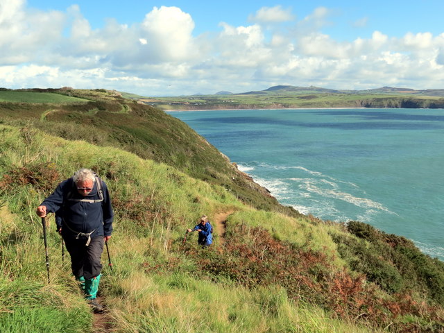
Access to Carreg Ddu is limited due to its remote location and lack of facilities. The island is only accessible by private boat or by joining guided tours that operate during the summer months. Visitors are advised to take caution when exploring the island, as the uneven terrain and unpredictable weather conditions can make it challenging to navigate.

Historically, Carreg Ddu was used as a grazing area for livestock, with remains of old stone walls and animal shelters still visible today. The island's isolation and natural beauty make it an attractive destination for those seeking tranquility and a connection with nature.

Overall, Carreg Ddu offers a unique and unspoiled experience for nature lovers and adventurers looking to explore the rugged beauty of Caernarfonshire's coastline.

If you have any feedback on the listing, please let us know in the comments section below.

Carreg Ddu Images

Images are sourced within 2km of 52.781367/-4.7457187 or Grid Reference SH1423. Thanks to Geograph Open Source API. All images are credited.

Milestone
Milestone
The southern slopes of Mynydd Mawr Bardsey Island in the hazy background.
The southern slopes of Mynydd Mawr
Bardsey Island in the hazy background.
The summit of Mynydd y Gwyddel This small hill is 99m high. Bardsey Island is in a rather misty distance.
The summit of Mynydd y Gwyddel
This small hill is 99m high. Bardsey Island is in a rather misty distance.
Ger Porth y Pistyll / Near Porth y Pistyll Cerddwyr yn dilyn Llwybr Arfordir Cymru ger Porth y Pistyll.

Walkers following the Wales Coast Path near Porth y Pistyll (trans. spring port).
Ger Porth y Pistyll / Near Porth y Pistyll
Cerddwyr yn dilyn Llwybr Arfordir Cymru ger Porth y Pistyll. Walkers following the Wales Coast Path near Porth y Pistyll (trans. spring port).
Ger Pen y Cil / Near Pen y Cil Gat fochyn ar Lwybr Arfordir Cymru ger man o'r enw Pen y Cil

A kissing gate on the Wales Coast Path near a location known as Pen y Cil (trans. top of the recess).
Ger Pen y Cil / Near Pen y Cil
Gat fochyn ar Lwybr Arfordir Cymru ger man o'r enw Pen y Cil A kissing gate on the Wales Coast Path near a location known as Pen y Cil (trans. top of the recess).
Trwy'r gat / Through a gate Cerddwyr yn mynd trwy gat yn Uwchfynydd.

Walkers going through gate at Uwchfynydd (trans. above mountain).
Trwy'r gat / Through a gate
Cerddwyr yn mynd trwy gat yn Uwchfynydd. Walkers going through gate at Uwchfynydd (trans. above mountain).
Llwybr yn Uwchfynydd / Path at Uwchfynydd Llwybr yn mynd drwy gaeau yn Uwchfynydd. Nid yw'r llwybr ar y ddaear yn dilyn yr un a ddynodir ar y Map OS. 

A path going through fields in Uwchfynydd (trans. above mountain). The path on the ground does not correspond with that as shown by the OS Map.
Llwybr yn Uwchfynydd / Path at Uwchfynydd
Llwybr yn mynd drwy gaeau yn Uwchfynydd. Nid yw'r llwybr ar y ddaear yn dilyn yr un a ddynodir ar y Map OS. A path going through fields in Uwchfynydd (trans. above mountain). The path on the ground does not correspond with that as shown by the OS Map.
Ger Bryn Goronwy / Near Bryn Goronwy Gat fochyn ger anhedd-dy o'r enw Bryn Goronwy.

A kissing gate near a property known as Bryn Goronwy (trans. Goronwy's hill).
Ger Bryn Goronwy / Near Bryn Goronwy
Gat fochyn ger anhedd-dy o'r enw Bryn Goronwy. A kissing gate near a property known as Bryn Goronwy (trans. Goronwy's hill).
Hen gat fochyn / Old kissing gate Hen gar fochyn ger Bryn Goronwy.

An old kissing gate near Bryn Goronwy. (trans. Goronwy's hill).
Hen gat fochyn / Old kissing gate
Hen gar fochyn ger Bryn Goronwy. An old kissing gate near Bryn Goronwy. (trans. Goronwy's hill).
Sheep pasture, Uwchmynydd Following a footpath across sheep pasture towards the white farmhouse. The hill in the distance is Mynydd Anelog.
Sheep pasture, Uwchmynydd
Following a footpath across sheep pasture towards the white farmhouse. The hill in the distance is Mynydd Anelog.
Misty coastline from Mynydd y Gwyddel Looking down from the southern slopes of Mynydd y Gwyddel towards the waymarked coast path. A sea mist has reached this far from the NW side of the peninsula.
Misty coastline from Mynydd y Gwyddel
Looking down from the southern slopes of Mynydd y Gwyddel towards the waymarked coast path. A sea mist has reached this far from the NW side of the peninsula.
Waymarker on the coast path Waymarker on the Wales coast path below Mynydd y Gwyddel with a fine specimen of a parasol mushroom [Macropiota procera] close by.
Waymarker on the coast path
Waymarker on the Wales coast path below Mynydd y Gwyddel with a fine specimen of a parasol mushroom [Macropiota procera] close by.
View across Porth Felen Part of the most southerly section of the Llyn coastline. Still a little sea mist reaching this far from the NW coast.
View across Porth Felen
Part of the most southerly section of the Llyn coastline. Still a little sea mist reaching this far from the NW coast.
Trwyn y Gwyddel Trwyn y Gwyddel is this small headland on the west side of Porth Felen.
Trwyn y Gwyddel
Trwyn y Gwyddel is this small headland on the west side of Porth Felen.
North west along the coast Looking NW towards Trwyn y Gwyddel headland.
North west along the coast
Looking NW towards Trwyn y Gwyddel headland.
Heading uphill on the coast path The coast path above Trwyn Bychestyn with mist enshrouded Bardsey in the distance.
Heading uphill on the coast path
The coast path above Trwyn Bychestyn with mist enshrouded Bardsey in the distance.
Across Parwyd inlet Parwyd is the rocky cove below, with the point of Trwyn Bychestyn beyond. Out to sea, just the top of Bardsey is visible poking out of a sea mist rolling in from the north. Nearer to hand is the reef of Carreg Ddu [Black rock].
Across Parwyd inlet
Parwyd is the rocky cove below, with the point of Trwyn Bychestyn beyond. Out to sea, just the top of Bardsey is visible poking out of a sea mist rolling in from the north. Nearer to hand is the reef of Carreg Ddu [Black rock].
On Pen y Cil headland A fine headland covered in gorse, heather and coarse grasses. The view is eastwards towards the tiny island of Ynys Gwylan-fawr.
On Pen y Cil headland
A fine headland covered in gorse, heather and coarse grasses. The view is eastwards towards the tiny island of Ynys Gwylan-fawr.
Show me another place!

Carreg Ddu is located at Grid Ref: SH1423 (Lat: 52.781367, Lng: -4.7457187)

Unitary Authority: Gwynedd

Police Authority: North Wales

What 3 Words

///learn.unrated.stubbed. Near Nefyn, Gwynedd

Nearby Locations

Carreg Ddu

Related Wikis

St Hywyn's Church, Aberdaron

The Church of St Hywyn, Aberdaron, Gwynedd, Wales, is a parish church dating from the 12th century. Its origins are earlier, as a clas church from the...

Bardsey Bird and Field Observatory

Bardsey Bird and Field Observatory is a bird observatory on Bardsey Island, off the Welsh coast. It was founded in 1953 by a group of ornithologists from...

Bardsey Island

Bardsey Island (Welsh: Ynys Enlli), known as the legendary "Island of 20,000 Saints", is located 1.9 miles (3.1 km) off the Llŷn Peninsula in the Welsh...

Aberdaron

Aberdaron (Welsh pronunciation: [abɛrˈdarɔn]) is a community, electoral ward and former fishing village at the western tip of the Llŷn Peninsula in the...

Have you been to Carreg Ddu?

Leave your review of Carreg Ddu below (or comments, questions and feedback).