Bowman's Rock
Island in Pembrokeshire
Wales
Bowman's Rock

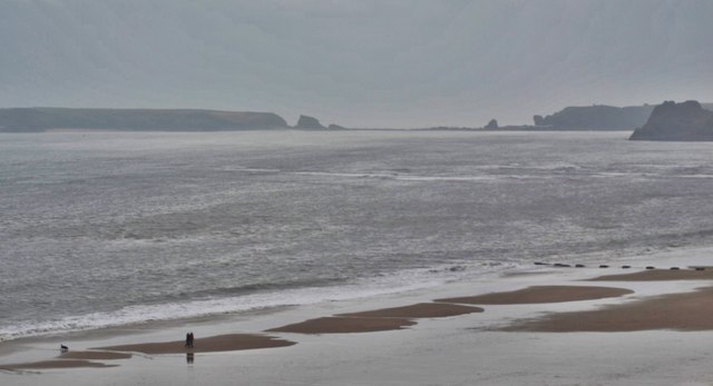
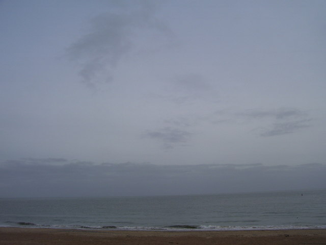
Bowman's Rock is a small island located off the coast of Pembrokeshire, Wales. Situated in the Celtic Sea, this rocky outcrop is known for its unique geological features and rich marine biodiversity. The island is part of the Pembrokeshire Coast National Park and is a popular destination for nature enthusiasts and wildlife lovers.
Covered in lush vegetation, Bowman's Rock offers breathtaking views of the surrounding coastline and the vast expanse of the sea. The island is accessible by boat, making it a favorite spot for kayakers and boaters who enjoy exploring its rugged shores and hidden coves.
One of the main attractions of Bowman's Rock is its diverse range of marine life. The surrounding waters are home to a variety of species, including seals, dolphins, and various seabirds. The island's rocky cliffs provide nesting sites for seabird colonies, making it a perfect place for birdwatching.
In addition to its natural beauty, Bowman's Rock also has historical significance. The island is believed to have been a place of worship for ancient Celtic tribes, and remnants of stone circles and burial mounds can still be found on its shores. These archaeological sites attract history enthusiasts and researchers alike.
Visitors to Bowman's Rock can enjoy a range of outdoor activities, such as hiking, rock climbing, and fishing. The island's tranquil atmosphere and unspoiled surroundings make it an ideal getaway for those seeking a peaceful retreat in nature.
If you have any feedback on the listing, please let us know in the comments section below.
Bowman's Rock Images
Images are sourced within 2km of 51.682142/-4.6962204 or Grid Reference SN1301. Thanks to Geograph Open Source API. All images are credited.


Bowman's Rock is located at Grid Ref: SN1301 (Lat: 51.682142, Lng: -4.6962204)
Unitary Authority: Pembrokeshire
Police Authority: Dyfed Powys
What 3 Words
///prettiest.lion.propose. Near Tenby, Pembrokeshire
Nearby Locations
Related Wikis
Tenby Cottage Hospital
Tenby Cottage Hospital (Welsh: Ysbyty Bwthyn Dinbych y Pysgod) is a community hospital in Tenby, Wales. It is managed by the Hywel Dda University Health...

Broadfield, Pembrokeshire
Broadfield is a small village south of Saundersfoot in the parish and community of St Mary Out Liberty in Pembrokeshire, Wales. == References == ��2�...
The Norton drill hall, Tenby
The Norton drill hall is a former military installation in Tenby, Wales. == History == The building was established as the drill hall for "A Squadron"...
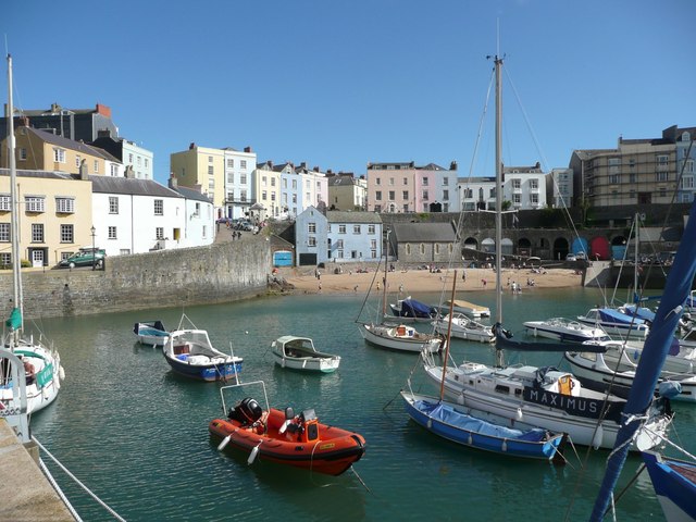
Tenby
Tenby (Welsh: Dinbych-y-pysgod, lit. 'fortlet of the fish') is a seaside town and community in the county of Pembrokeshire, Wales. It lies within Carmarthen...
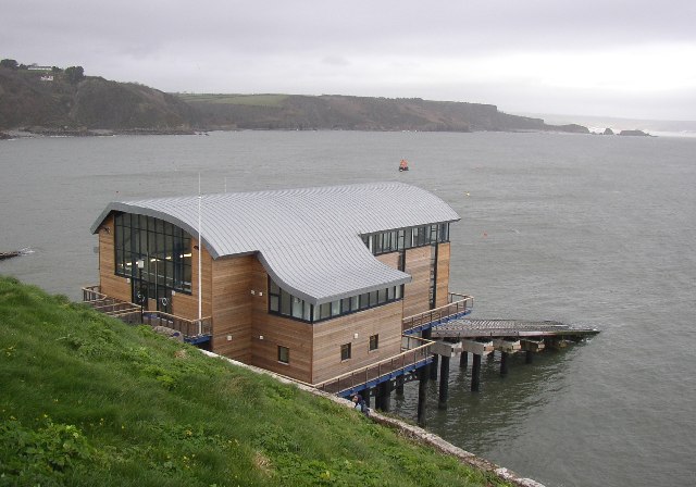
Tenby Lifeboat Station
Tenby Lifeboat Station is a lifeboat station in Tenby, Pembrokeshire, Wales that has been situated to the east of the town since 1852, three generations...

Tenby Castle
Tenby Castle (Welsh: Castell Dinbych-y-pysgod) was a fortification standing on a headland separated by an isthmus from the town of Tenby, Pembrokeshire...
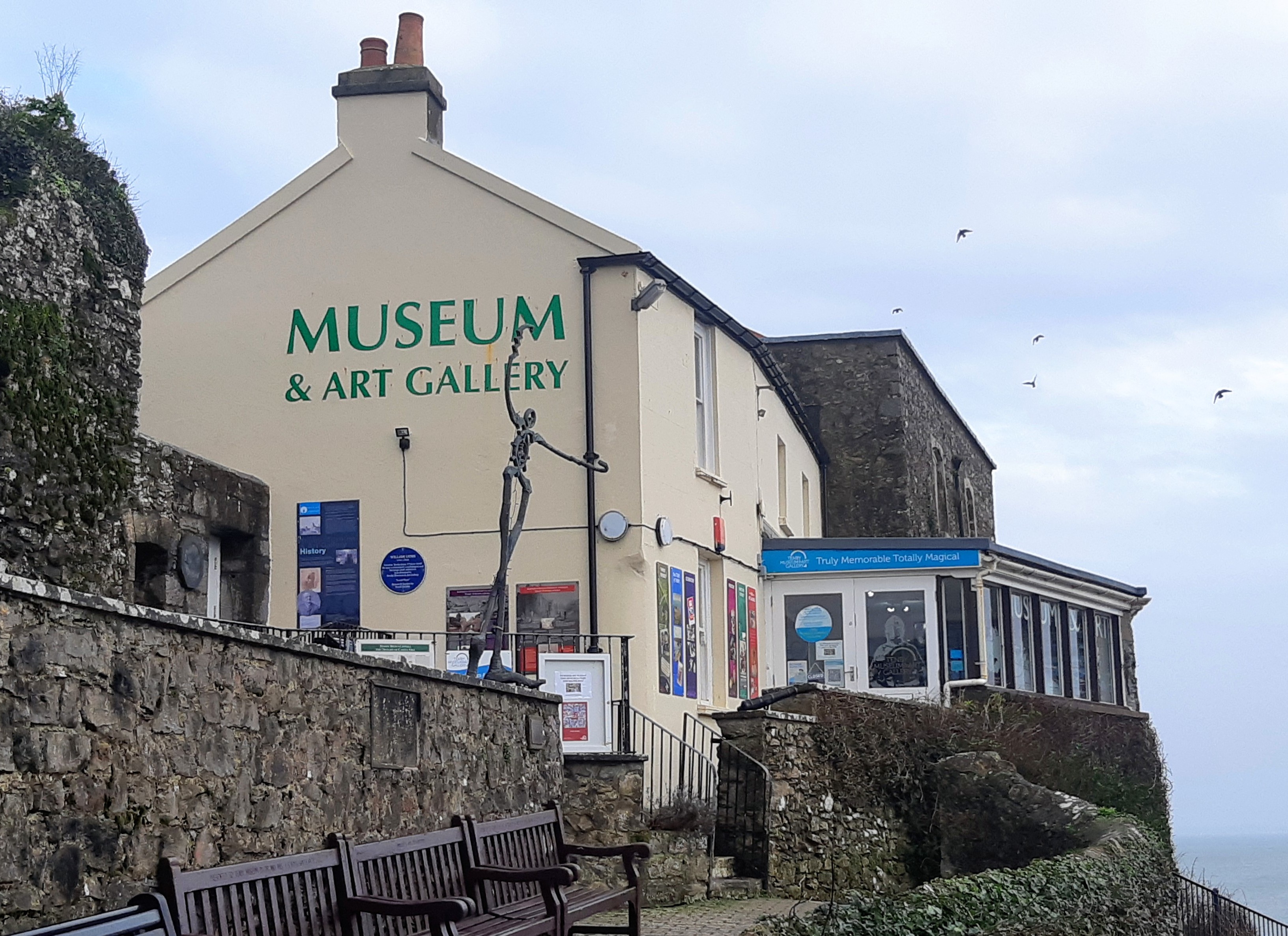
Tenby Museum and Art Gallery
Tenby Museum and Art Gallery, located in Tenby, Pembrokeshire, South West Wales, is the oldest independent museum in Wales. Established in 1878, the museum...
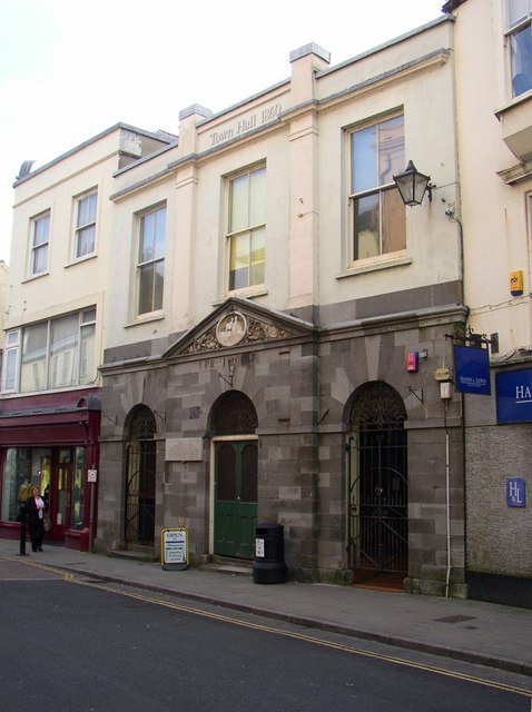
Tenby Town Hall
Tenby Town Hall (Welsh: Neuadd y Dref Dinbych-y-pysgod) is a municipal building in the High Street, Tenby, Pembrokeshire, Wales. The structure, which is...
Related Videos

TENBY | Exploring the holiday seaside town of Tenby Wales
Tenby is a holiday seaside town located in the South West of Wales. It is one of the most popular holiday destinations in Wales, ...

SAUNDERSFOOT Wales | The perfect Wales seaside holiday town?
We visit SAUNDERSFOOT Wales for a tour around this perfect Welsh seaside holiday destination! We'll explore the beach, ...

TENBY Wales | FULL TOUR from beach to town, castle and harbour!
We visit Tenby in Wales for a seaside walk along the seafront and Tenby Beach, around the harbour and the town centre streets ...

Tenby Wales🏴 the most beautiful village in Wales🌞Tenby village 🏖 4k walking video countryside
Tenby Wales the most beautiful village in Wales Explore the enchanting beauty of Tenby village in Wales with ...
Nearby Amenities
Located within 500m of 51.682142,-4.6962204Have you been to Bowman's Rock?
Leave your review of Bowman's Rock below (or comments, questions and feedback).