Cùl Eilean
Island in Sutherland
Scotland
Cùl Eilean

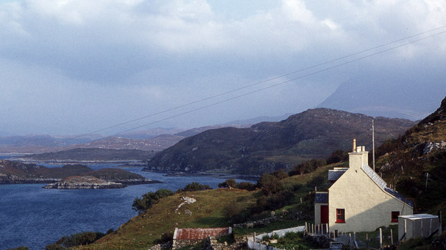
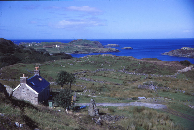
Cùl Eilean is a small island located off the north coast of Sutherland, Scotland. It is situated in the North Atlantic Ocean, approximately 3 kilometers northeast of Durness. The island covers an area of about 1.5 hectares and is characterized by rugged coastal cliffs and rocky shores.
The island's name, Cùl Eilean, translates to "back of the island" in Scottish Gaelic, reflecting its position relative to the mainland. It is accessible by boat, and its proximity to the mainland makes it a popular destination for tourists and nature enthusiasts.
Cùl Eilean is known for its diverse wildlife and scenic beauty. The island is home to a variety of seabirds, including guillemots, razorbills, and puffins, which nest on the cliffs during the breeding season. Seals and otters can also be spotted in the surrounding waters.
The island boasts stunning panoramic views of the surrounding coastline, with its dramatic cliffs and turquoise waters. It offers visitors the opportunity to explore its rocky terrain, take leisurely walks, or simply enjoy the tranquility of the isolated island setting.
In addition to its natural beauty, Cùl Eilean is also steeped in history. The ruins of an ancient chapel can be found on the island, dating back to the 12th century. These historical remnants provide a glimpse into the island's past and add to its allure as a tourist destination.
Overall, Cùl Eilean is a captivating island that offers a blend of natural beauty, wildlife, and historical significance. It provides visitors with a unique opportunity to experience the rugged charm of the Scottish coast in a remote and picturesque setting.
If you have any feedback on the listing, please let us know in the comments section below.
Cùl Eilean Images
Images are sourced within 2km of 58.25204/-5.1986509 or Grid Reference NC1233. Thanks to Geograph Open Source API. All images are credited.


![Drumbeg Stores An award winning village shop [beyond the white house] with slightly less range of foods than M&S in Inverness, but the Mull cheese is very acceptable.](https://s3.geograph.org.uk/geophotos/05/77/65/5776527_b6a2a9b9.jpg)


Cùl Eilean is located at Grid Ref: NC1233 (Lat: 58.25204, Lng: -5.1986509)
Unitary Authority: Highland
Police Authority: Highlands and Islands
What 3 Words
///instructs.ants.regulator. Near Clachtoll, Highland
Related Wikis
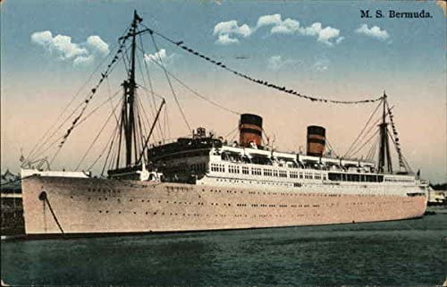
MV Bermuda
MV Bermuda was a passenger motor ship that Furness, Withy's Furness Bermuda Line operated between New York and Bermuda from 1928 until 1931. She was damaged...

Culkein Drumbeg
Culkein Drumbeg (Scottish Gaelic: Cùl-cinn an Droma Bhig) is a remote village on the north west coast of Scotland. It is located 0.93 miles (1.50 km) north...

Drumbeg, Sutherland
Drumbeg (Scottish Gaelic: An Druim Beag) is a remote crofting village on the north west coast of Scotland in Assynt, Sutherland, Scottish Highlands and...

Nedd
Nedd (Scottish Gaelic: An Nead) is a small village, which lies on the western head of Loch Nedd in Lairg, western Sutherland, Scottish Highlands and is...
Nearby Amenities
Located within 500m of 58.25204,-5.1986509Have you been to Cùl Eilean?
Leave your review of Cùl Eilean below (or comments, questions and feedback).