Big Isle

Island in Ayrshire

Scotland

Big Isle

Varyag Memorial, Lendalfoot To the Russian Cruiser.
Varyag Memorial, Lendalfoot Credit: Billy McCrorie

Big Isle is a small island located off the coast of Ayrshire, Scotland. It is situated in the Firth of Clyde, approximately 10 kilometers southeast of the town of Largs. The island covers an area of around 1.5 square kilometers and has a population of less than 100 people.

Big Isle is known for its rugged and picturesque landscape, characterized by rolling hills, rocky cliffs, and lush vegetation. The island is mainly composed of moorland, with some areas of fertile farmland. It is a haven for wildlife, with various bird species, including puffins and gannets, nesting along its shores.

The island has a rich history, with evidence of human occupation dating back thousands of years. It is home to several ancient ruins, including a stone circle and burial sites, indicating its importance in prehistoric times. In more recent history, Big Isle served as a strategic defensive position during various conflicts, including the Viking raids and World War II.

Access to the island is primarily by boat, with occasional ferry services operating from the mainland during the summer months. The island lacks basic amenities such as shops and schools, so residents rely on the mainland for most of their daily needs.

Big Isle offers a tranquil and secluded retreat for visitors, with opportunities for hiking, birdwatching, and enjoying the breathtaking coastal views. Its unspoiled natural beauty and rich history make it a hidden gem in the Ayrshire region.

If you have any feedback on the listing, please let us know in the comments section below.
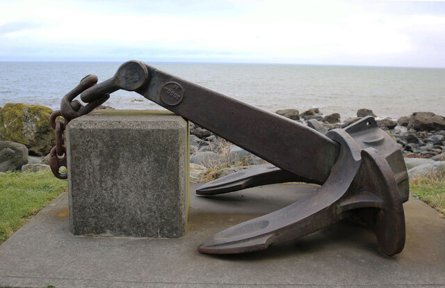
Big Isle Images

Images are sourced within 2km of 55.163967/-4.9532746 or Grid Reference NX1189. Thanks to Geograph Open Source API. All images are credited.

Varyag Memorial, Lendalfoot To the Russian Cruiser.
Varyag Memorial, Lendalfoot
To the Russian Cruiser.
The A77 to Ballantrae And then on to Stranraer.
The A77 to Ballantrae
And then on to Stranraer.
The A77 approaching Lendalfoot Then on to Girvan and Ayr.
The A77 approaching Lendalfoot
Then on to Girvan and Ayr.
Varyag Memorial, Lendalfoot To the Russian Cruiser.
Varyag Memorial, Lendalfoot
To the Russian Cruiser.
Exit from the Varyag Memorial, Lendalfoot
Varyag Anchor, Lendalfoot At the memorial site to the Russian Cruiser.
Varyag Anchor, Lendalfoot
At the memorial site to the Russian Cruiser.
Varyag Memorial, Lendalfoot To the Russian Cruiser.
Varyag Memorial, Lendalfoot
To the Russian Cruiser.
Varyag Memorial, Lendalfoot To the Russian Cruiser.
Varyag Memorial, Lendalfoot
To the Russian Cruiser.
Rocks at Lendalfoot Viewed from the lay-by at the Varyag Memorial site.
Rocks at Lendalfoot
Viewed from the lay-by at the Varyag Memorial site.
Varyag Anchor, Lendalfoot At the Memorial site just south of Lendalfoot.
Varyag Anchor, Lendalfoot
At the Memorial site just south of Lendalfoot.
Picnic Site at Lendalfoot At the Varyag Memorial.
Picnic Site at Lendalfoot
At the Varyag Memorial.
Welcome to Lendalfoot Information Panel at the lay-by at Varyag Memorial site.
Welcome to Lendalfoot
Information Panel at the lay-by at Varyag Memorial site.
Canteen at Lendalfoot Located in the lay-by at the Varyag Memorial site.
Canteen at Lendalfoot
Located in the lay-by at the Varyag Memorial site.
Lay-by at the Varyag Memorial Site, Lendalfoot Just on the right was the Canteen but was closed.
Lay-by at the Varyag Memorial Site, Lendalfoot
Just on the right was the Canteen but was closed.
Varyag Memorial, Lendalfoot To the Russian cruiser, viewed from the A77.
Varyag Memorial, Lendalfoot
To the Russian cruiser, viewed from the A77.
Carleton Bay, Lendalfoot Viewed from the lay-by at the Varyag Memorial.
Carleton Bay, Lendalfoot
Viewed from the lay-by at the Varyag Memorial.
The sun goes down over the South Carrick coast One of those glorious Clyde Coast winter sunsets taken at 15:55 in early December.
The sun goes down over the South Carrick coast
One of those glorious Clyde Coast winter sunsets taken at 15:55 in early December.
Winter sunset colours at The Whilk Taken at 15:50 in early December with the tide slipping out fast. Viewed from the sand bar that links Big Isle with the shore.
Winter sunset colours at The Whilk
Taken at 15:50 in early December with the tide slipping out fast. Viewed from the sand bar that links Big Isle with the shore.
Show me another place!

Big Isle is located at Grid Ref: NX1189 (Lat: 55.163967, Lng: -4.9532746)

Unitary Authority: South Ayrshire

Police Authority: Ayrshire

What 3 Words

///waltzes.tamed.squeaks. Near Girvan, South Ayrshire

Related Wikis

Dumbarton Collegiate Church

The Collegiate Church of St Mary, Dumbarton, Scotland, was founded in about 1453 by Isabella, Countess of Lennox and Duchess of Albany. During the medieval...

Lendalfoot

Lendalfoot is a small village located on Carleton Bay, parish of Colmonell in the old district of Carrick, now South Ayrshire, about six miles (ten kilometres...

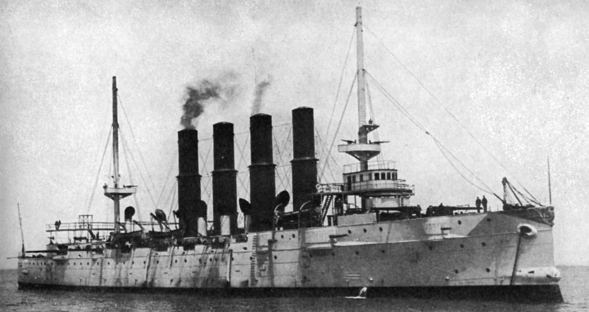
Russian cruiser Varyag (1899)

Varyag (Russian: Варя́г) sometimes also spelled Variag, was a Russian protected cruiser. Varyag became famous for her crew's stoicism at the Battle of...

Bennane Head

Bennane Head is a tapering piece of land formed of hard rock projecting into the Firth of Clyde, Scotland, at the northern end of Ballantrae Bay, 17 kilometres...

Nearby Amenities

Located within 500m of 55.163967,-4.9532746
Created By: almien_coastlines
Lat/Long: 55.162896/-4.95385
Created By: almien_coastlines
Lat/Long: 55.163408/-4.953875
Created By: almien_coastlines
Lat/Long: 55.163394/-4.95477
Created By: almien_coastlines
Lat/Long: 55.16365/-4.954782
Created By: almien_coastlines
Lat/Long: 55.163785/-4.954341
Created By: almien_coastlines
Lat/Long: 55.163792/-4.953894
Created By: almien_coastlines
Lat/Long: 55.163799/-4.953447
Created By: almien_coastlines
Lat/Long: 55.164069/-4.952565
Created By: almien_coastlines
Lat/Long: 55.164212/-4.951677
Created By: almien_coastlines
Lat/Long: 55.163959/-4.951442
Created By: almien_coastlines
Lat/Long: 55.163448/-4.951417
Created By: almien_coastlines
Lat/Long: 55.163315/-4.951634
Created By: almien_coastlines
Lat/Long: 55.163308/-4.952081
Created By: almien_coastlines
Lat/Long: 55.163301/-4.952528
Created By: almien_coastlines
Lat/Long: 55.163031/-4.95341
Created By: almien_coastlines
Lat/Long: 55.162431/-4.95092
Created By: almien_coastlines
Lat/Long: 55.161912/-4.951342
Created By: almien_coastlines
Lat/Long: 55.16151/-4.95244
Created By: almien_coastlines
Lat/Long: 55.160596/-4.953515
Created By: almien_coastlines
Lat/Long: 55.160333/-4.953949
Created By: almien_coastlines
Lat/Long: 55.159814/-4.954372
Parking
Source: survey
Lat/Long: 55.163605/-4.947829
Varyag Monument
Historic: monument
Lat/Long: 55.1634689/-4.9474245
Waste Basket
Waste: mixed;trash;dog_excrement
Lat/Long: 55.1636099/-4.9472709
Bench: yes
Leisure: picnic_table
Material: wood
Lat/Long: 55.1633422/-4.9478046
Bench
Backrest: yes
Material: wood
Lat/Long: 55.1634292/-4.947721
Bench
Backrest: yes
Material: wood
Lat/Long: 55.163362/-4.947428
Waste Basket
Waste: mixed;trash;dog_excrement
Lat/Long: 55.1633664/-4.9486529
Board Type: history
Information: board
Tourism: information
Lat/Long: 55.163434/-4.9483025
Board Type: history
Information: board
Tourism: information
Lat/Long: 55.1635227/-4.9478006
Information: board
Tourism: information
Lat/Long: 55.1634448/-4.947896
Power: pole
Lat/Long: 55.1597079/-4.952854
Power: pole
Lat/Long: 55.1599752/-4.9524118
The data included in this document is from www.openstreetmap.org. The data is made available under ODbL.

Have you been to Big Isle?

Leave your review of Big Isle below (or comments, questions and feedback).