Careg Yspar
Island in Pembrokeshire
Wales
Careg Yspar

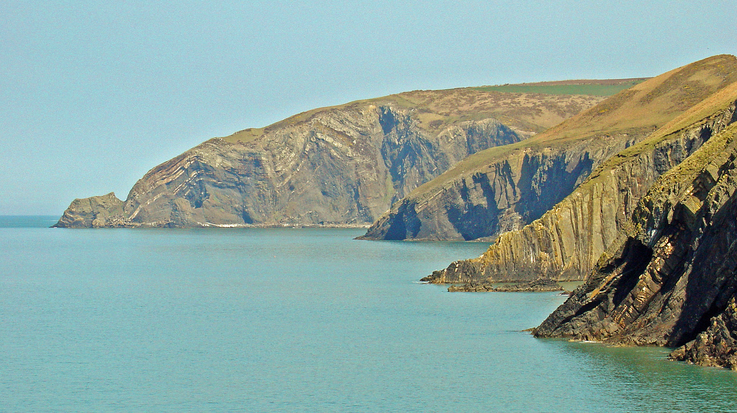
Careg Yspar is a small island located off the coast of Pembrokeshire, Wales. Also known as Carreg Sampson, it is situated in the Atlantic Ocean, approximately 2.5 miles southwest of the town of Fishguard. The island covers an area of around 0.5 acres and is accessible only by boat during low tide.
The island is predominantly rocky, with a rugged coastline and a small, rocky beach. It is home to a number of seabirds, including puffins, guillemots, and razorbills, making it a popular spot for birdwatching enthusiasts. The surrounding waters are also rich in marine life, with seals often found basking on the rocks.
One of the notable features of Careg Yspar is the ancient burial chamber that sits atop its rocky surface. Known as Carreg Sampson Burial Chamber, it is a Neolithic dolmen dating back over 5,000 years. The chamber consists of a large capstone supported by three upright stones, creating a small chamber-like space beneath. It is believed to have served as a communal burial site during the Neolithic period.
Due to its small size and limited accessibility, Careg Yspar is not inhabited by humans and has no facilities or amenities. However, it attracts visitors who are interested in exploring its unique natural beauty, observing the diverse birdlife, and learning about its ancient history. It offers a tranquil and picturesque escape for nature lovers and those seeking a glimpse into Wales' ancient past.
If you have any feedback on the listing, please let us know in the comments section below.
Careg Yspar Images
Images are sourced within 2km of 52.070726/-4.7754159 or Grid Reference SN0945. Thanks to Geograph Open Source API. All images are credited.


Careg Yspar is located at Grid Ref: SN0945 (Lat: 52.070726, Lng: -4.7754159)
Unitary Authority: Pembrokeshire
Police Authority: Dyfed Powys
What 3 Words
///bother.caked.paces. Near Nevern, Pembrokeshire
Nearby Locations
Related Wikis

Aberarth – Carreg Wylan
Aberarth – Carreg Wylan is a Site of Special Scientific Interest in Ceredigion, west Wales. It is a small coastal marine protected area with a reported...
Moylgrove
Moylgrove (Welsh: Trewyddel), also spelled Moylegrove, is a village and parish in north Pembrokeshire, Wales, about 4 miles (6.4 km) from Cardigan, in...

Ceibwr Bay
Ceibwr Bay (Welsh: Bae Ceibwr) is a bay opening into the Irish Sea in Pembrokeshire, west Wales. It is about 7 km west of Cardigan, and 3 km south of the...

St Dogmells Rural District
St Dogmells was a rural district in the administrative county of Pembrokeshire, Wales from 1894 to 1934. == Formation == The district was created by the...
Nearby Amenities
Located within 500m of 52.070726,-4.7754159Have you been to Careg Yspar?
Leave your review of Careg Yspar below (or comments, questions and feedback).