Merton Rock

Island in Cornwall

England

Merton Rock

Cross at Dodman Point
Cross at Dodman Point Credit: don cload

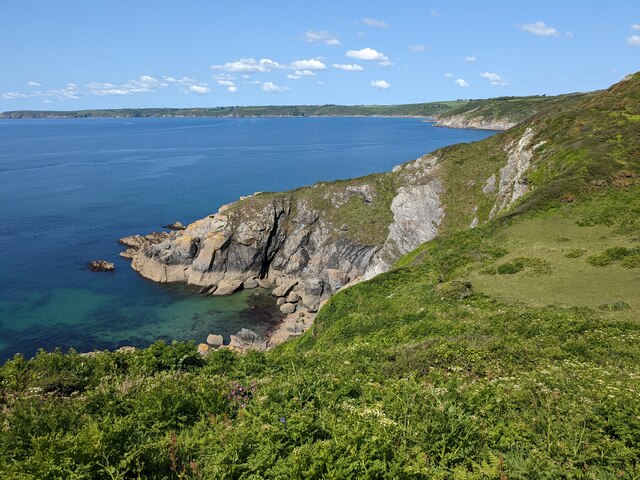
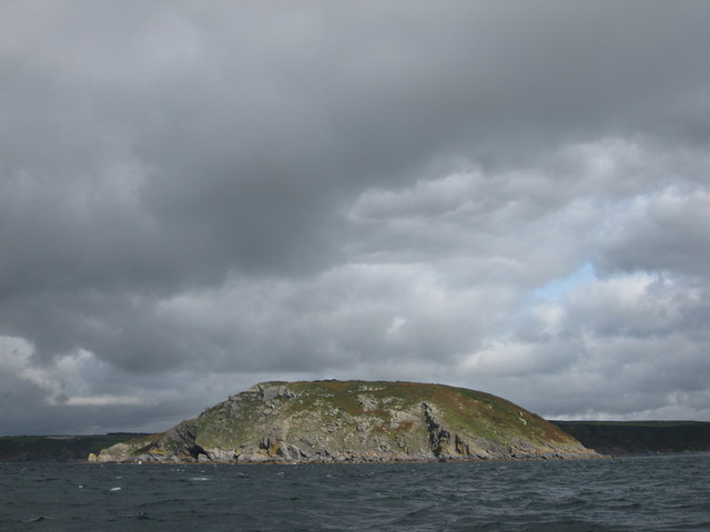
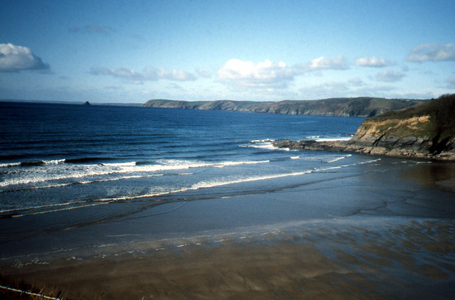
Merton Rock is a small island located off the coast of Cornwall, England. It is situated about 1.5 miles northeast of the town of Penzance and is part of the Isles of Scilly archipelago. The island is known for its rugged and rocky terrain, with steep cliffs and jagged edges that provide stunning panoramic views of the surrounding ocean.

Measuring approximately 20 acres in size, Merton Rock is uninhabited and largely untouched by human presence. Its isolation and natural beauty make it a popular destination for birdwatchers and nature enthusiasts. The island is home to a variety of bird species, including puffins, razorbills, and guillemots, which nest along the cliffs during the breeding season.

Access to Merton Rock is primarily by boat, with several local tour operators offering trips to the island. Visitors can explore the shoreline and observe the diverse marine life that thrives in the surrounding waters. The island's rocky landscape also makes it an ideal spot for rock climbing and bouldering enthusiasts.

Due to its protected status as part of the Isles of Scilly Area of Outstanding Natural Beauty, camping and overnight stays are not permitted on Merton Rock. However, day trips provide ample opportunities to experience the island's unique ecosystem and enjoy the tranquility of this remote location.

Overall, Merton Rock is a picturesque and unspoiled gem in the Cornish coastline, offering visitors a chance to immerse themselves in the beauty of nature and witness the remarkable wildlife that calls this island home.

If you have any feedback on the listing, please let us know in the comments section below.

Merton Rock Images

Images are sourced within 2km of 50.219238/-4.7987642 or Grid Reference SX0039. Thanks to Geograph Open Source API. All images are credited.

Cross at Dodman Point
Coast path at the Bulwark The bank is obscured by tall bracken. You get a much better idea from <a href="https://www.geograph.org.uk/photo/4457128">SX0039 : Path junction near the Bulwark on Dodman Point</a>, taken at the same spot. But this image does include Bow (or is it Vault) Beach in the background. The bulwark is the northern earthwork enclosing cliff castle <span class="nowrap"><a title="https://www.historicengland.org.uk/listing/the-list/list-entry/1020865" rel="nofollow ugc noopener" href="https://www.historicengland.org.uk/listing/the-list/list-entry/1020865">Link</a><img style="margin-left:2px;" alt="External link" title="External link - shift click to open in new window" src="https://s1.geograph.org.uk/img/external.png" width="10" height="10"/></span>
Coast path at the Bulwark
The bank is obscured by tall bracken. You get a much better idea from SX0039 : Path junction near the Bulwark on Dodman Point, taken at the same spot. But this image does include Bow (or is it Vault) Beach in the background. The bulwark is the northern earthwork enclosing cliff castle LinkExternal link
Cattle south of Penare From a footpath that follows the bulwark around the Dodman cliff castle to link the coast path northwest and northnortheast of the point.
Cattle south of Penare
From a footpath that follows the bulwark around the Dodman cliff castle to link the coast path northwest and northnortheast of the point.
Trig pillar and Watch House, Dodman Point
Near Dodman Point Looking towards Bow or Vault Beach.
Near Dodman Point
Looking towards Bow or Vault Beach.
View to the coast from the path to Dodman Point
Dodman Trig Point Flush Bracket S1748 and Watch Tower
Gell Point
Gell Point
Dodman Point Beautiful to the eye, this headland has a nasty reputation amongst mariners throughout the ages.
Dodman Point
Beautiful to the eye, this headland has a nasty reputation amongst mariners throughout the ages.
Stone Cross, Dodman Point
The Dodman
The Dodman
Cross at Dodman Point
Dodman Meadow The meadow land on the Dodman promontory covers the site of an ancient hillfort. In the distance are the hills of the St Austell Granite.
Dodman Meadow
The meadow land on the Dodman promontory covers the site of an ancient hillfort. In the distance are the hills of the St Austell Granite.
Dodman from the south west
Dodman from due south
The cross at Dodman Point
Cross on Dodman Point Approaching this cross on Dodman Point I assumed it was a war memorial, in fact it predates the twentieth century and was erected in 1896 in the hope of the second coming of Jesus Christ.
Cross on Dodman Point
Approaching this cross on Dodman Point I assumed it was a war memorial, in fact it predates the twentieth century and was erected in 1896 in the hope of the second coming of Jesus Christ.
On Dodman Point View to the east from Dodman Point.
On Dodman Point
View to the east from Dodman Point.
Show me another place!

Merton Rock is located at Grid Ref: SX0039 (Lat: 50.219238, Lng: -4.7987642)

Unitary Authority: Cornwall

Police Authority: Devon and Cornwall

What 3 Words

///exulted.custodial.junction. Near Mevagissey, Cornwall

Related Wikis

Dodman Point

Dodman Point (Cornish: Penn Den Varow) near Mevagissey is the highest headland on the south Cornwall coast, measuring 374 feet (114 m). It is also known...

Penare

Penare is a hamlet near Gorran Haven in Cornwall, England, UK. Penare is situated 1 mile (2 km) south-west of Gorran Haven.Pronunciation is PEA - NAR....

Vault Beach

Vault Beach (also Bow Beach) is situated on the south coast of Cornwall, England, UK, near Gorran Haven. The beach consists mainly of shingle but does...

Hemmick Beach

Hemmick Beach is a west-facing beach on the south coast of Cornwall, England. It is situated at the east end of Veryan Bay, on the west side of the Dodman...
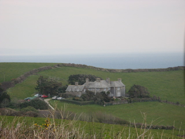
Lamledra

Lamledra is a house near Gorran Haven in Cornwall, England, UK. It is situated immediately above Vault Beach. It was built in 1911 by the barrister, John...

Boswinger

Boswinger is a village in south Cornwall, England, two miles south of Mevagissey (where the 2011 Census population is included). There is a youth hostel...
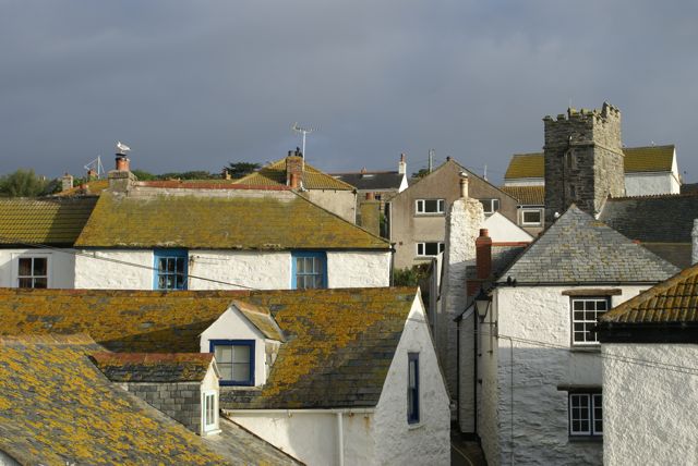
Gorran Haven

Gorran Haven (Cornish: Porthust) is a fishing village, in the civil parish of St Goran, on the south coast of Cornwall, England, UK. It is about 2 miles...

Veryan Bay

Veryan Bay along the southern coast of Cornwall, England, is a curving, natural bay that stretches for 4.6 miles in width and recedes by up to 1.5 miles...

Related Videos

Gorran Haven, nr Mevagissey to Dodman Point - "Two dogs wide!" A summer walk in Cornwall.

In this video we visit Gorran Haven and try a 4 mile circular walk which takes us to Dodman Point one of Cornwall's most ...

A Holiday Park Like No Other | Seaview Gorran Haven

Discover a whole new world at Seaview Gorran Haven. Surrounded by the sea and countryside, it truly is a holiday park like no ...

Discover the Luxury Holiday Park Lifestyle | Seaview Gorran Haven

Are you thinking about acquiring a second holiday home in Cornwall? If so, then look no further than Seaview Gorran Haven!

“Holiday home” tour

jofdestn #Sandy #chancyvlogs #Chancy #AONB #cornwalluk #cornwalllife #hometour #holidaystory #homestay ...

Nearby Amenities

Located within 500m of 50.219238,-4.7987642
Source: PGS
Lat/Long: 50.2186761/-4.8040023
Source: PGS
Lat/Long: 50.2188439/-4.8036928
Source: PGS
Lat/Long: 50.2187663/-4.8033465
Source: PGS
Lat/Long: 50.2188714/-4.802577
Source: PGS
Lat/Long: 50.2187652/-4.8020074
Source: PGS
Lat/Long: 50.2192738/-4.8006014
Source: PGS
Lat/Long: 50.2196296/-4.7986951
Source: PGS
Lat/Long: 50.2203186/-4.7977432
Source: PGS
Lat/Long: 50.2205137/-4.7976827
Source: PGS
Lat/Long: 50.2209653/-4.7975042
Source: PGS
Lat/Long: 50.2214556/-4.7973779
Source: PGS
Lat/Long: 50.2215568/-4.7973295
Source: PGS
Lat/Long: 50.2217046/-4.7972072
Source: PGS
Lat/Long: 50.2223103/-4.7973472
Source: PGS
Lat/Long: 50.2236869/-4.7985282
Source: PGS
Lat/Long: 50.2207204/-4.8051953
Source: PGS
Lat/Long: 50.220677/-4.805412
Source: PGS
Lat/Long: 50.2205334/-4.805474
Source: PGS
Lat/Long: 50.2202538/-4.8048167
Source: PGS
Lat/Long: 50.2200216/-4.8047063
Source: PGS
Lat/Long: 50.2192481/-4.8050737
Source: PGS
Lat/Long: 50.2189992/-4.8053433
Source: PGS
Lat/Long: 50.2187429/-4.8051078
Source: PGS
Lat/Long: 50.2186238/-4.8045009
Dodman Point Cross
Historic: wayside_cross
Image: https://archive.org/details/dodmanpoint/Dodman%20Point%202020-08-28/DSCN2407.JPG
Inscription: In the firm hope of the Second Coming of our Lord Jesus Christ, and for the encouragement of those who strive to serve him, this cross was erected AD 1886
Note: Accurate location import for imagery offset calibration. Please do not move.
Religion: christian
Source: Ordnance Survey (OGL)
Start Date: 1896
Lat/Long: 50.2199342/-4.8031588
Dodman Point
Natural: cape
Wikidata: Q3712516
Lat/Long: 50.220167/-4.8012446
Dodman
Alt Ref: S1748
Description: OS trig pillar
Ele: 113.958
Image: https://archive.org/details/dodmanpoint/Dodman%20Point%202020-08-28/DSCN2344.JPG
Man Made: survey_point
Note: Accurate location import for imagery offset calibration. Please do not move.
Ref: PP176
Source: Ordnance Survey (OGL)
Survey Point: pillar
Lat/Long: 50.2206712/-4.8024203
Bench
Image: https://archive.org/details/dodmanpoint/Dodman%20Point%202020-08-28/DSCN2379.JPG
Indoor: yes
Lat/Long: 50.2206083/-4.8024349
The Dodman
Image: https://archive.org/details/dodmanpoint/Dodman%20Point%202020-08-28/DSCN2370.JPG
Indoor: yes
Information: board
Note: Board with map and information about The Dodman
Operator: National Trust
Tourism: information
Lat/Long: 50.2205984/-4.8024248
Entrance: main
Image: https://archive.org/details/dodmanpoint/Dodman%20Point%202020-08-28/DSCN2354.JPG
Lat/Long: 50.2206087/-4.8024577
Barrier: kissing_gate
Foot: yes
Image: https://archive.org/details/dodmanpoint/Dodman%20Point%202020-08-28/DSCN2333.JPG
Lat/Long: 50.2217319/-4.801662
The data included in this document is from www.openstreetmap.org. The data is made available under ODbL.

Have you been to Merton Rock?

Leave your review of Merton Rock below (or comments, questions and feedback).