Burstead, Little

Settlement in Essex Basildon

England

Burstead, Little

Billericay Fire Station On Laindon Road.
Billericay Fire Station Credit: JThomas

Burstead, Little is a small village located in the county of Essex, England. Situated approximately 25 miles northeast of London, it is part of the borough of Basildon. With a population of around 1,500 residents, Burstead, Little is known for its rural charm and peaceful atmosphere.

The village is surrounded by picturesque countryside, with rolling hills and green fields dominating the landscape. It is dotted with traditional English cottages, many of which date back several centuries, giving the area a sense of history and character.

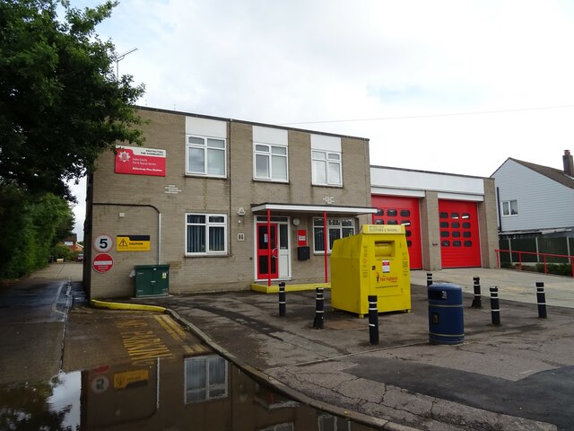
Burstead, Little offers a range of amenities and services for its residents. The village has a primary school, providing education for children aged 4-11, and a local pub which serves as a social hub for the community. There are also several small businesses, including a post office and a convenience store, ensuring that residents have access to basic necessities without having to travel far.

For outdoor enthusiasts, Burstead, Little offers ample opportunities for walking, hiking, and cycling. The surrounding countryside provides numerous trails and paths, allowing residents to explore the natural beauty of the area. Additionally, the nearby Hanningfield Reservoir offers water-based activities such as sailing and fishing.

Overall, Burstead, Little is a charming and idyllic village that offers a tranquil and close-knit community for its residents. Its proximity to London makes it an appealing location for those seeking a quieter lifestyle while still having access to the amenities of a larger city.

If you have any feedback on the listing, please let us know in the comments section below.

Burstead, Little Images

Images are sourced within 2km of 51.603207/0.4095 or Grid Reference TQ6692. Thanks to Geograph Open Source API. All images are credited.

Billericay Fire Station On Laindon Road.
Billericay Fire Station
On Laindon Road.
2nd Billericay Scout Group Hall On Laindon Road.
2nd Billericay Scout Group Hall
On Laindon Road.
Reids Bar & Restaurant, Billericay On Laindon Road.
Reids Bar & Restaurant, Billericay
On Laindon Road.
Laindon Road (A176)
Laindon Road (A176)
Green fields on a windy day A view across green fields on a blustery day. The Mayflower Community Hospital on the edge of Billericay is immediately behind the photographer
Green fields on a windy day
A view across green fields on a blustery day. The Mayflower Community Hospital on the edge of Billericay is immediately behind the photographer
View towards Poles Wood
Steeple View Farm Farmland north of Laindon, Basildon.
Steeple View Farm
Farmland north of Laindon, Basildon.
Converted Barn, Babshole Farm, near Little Bursted.
Tye Common Road, Billericay, Essex Looking south near Tye Common.
Tye Common Road, Billericay, Essex
Looking south near Tye Common.
Parish Church of Little Burstead, Essex The church of St. Mary the Virgin dates back to the mid-14th century and lies south of the village itself.
Parish Church of Little Burstead, Essex
The church of St. Mary the Virgin dates back to the mid-14th century and lies south of the village itself.
Little Burstead, Essex Looking west towards the village green. The building in the centre is the old village school built in 1891.
Little Burstead, Essex
Looking west towards the village green. The building in the centre is the old village school built in 1891.
Dukes Head Public House, Little Burstead, Essex Situated on the south side of Laindon Common, the Dukes Head looks more like a late Victorian railway station than a pub!
Dukes Head Public House, Little Burstead, Essex
Situated on the south side of Laindon Common, the Dukes Head looks more like a late Victorian railway station than a pub!
Freshly ploughed field, Dunton, Essex Looking south from New Road towards Dunton Road.
Freshly ploughed field, Dunton, Essex
Looking south from New Road towards Dunton Road.
Dunton Road, Dunton, Essex A local 'rat-run' which runs parallel to the A127 - for once almost devoid of traffic.
Dunton Road, Dunton, Essex
A local 'rat-run' which runs parallel to the A127 - for once almost devoid of traffic.
Fields near Little Burstead Church, Essex Looking south towards A127 with Langdon Hills in the background.
Fields near Little Burstead Church, Essex
Looking south towards A127 with Langdon Hills in the background.
Great Burstead Parish Church, Essex A medieval church, mainly built in the 14th/15th centuries. It dates back to Norman times and the nave window dates back to this time. The tower & steeple are 14th century and constructed of Kentish Ragstone.
Great Burstead Parish Church, Essex
A medieval church, mainly built in the 14th/15th centuries. It dates back to Norman times and the nave window dates back to this time. The tower & steeple are 14th century and constructed of Kentish Ragstone.
Derelict Farm Buildings near Billericay, Essex Located on the east side of Noak Hill Road near Kennel Lane.
Derelict Farm Buildings near Billericay, Essex
Located on the east side of Noak Hill Road near Kennel Lane.
Stile & Footpath, Little Burstead, Essex Footpath from New Road to Steeple View Farm Looking south with Fords Research Headquarters on the horizon.
Stile & Footpath, Little Burstead, Essex
Footpath from New Road to Steeple View Farm Looking south with Fords Research Headquarters on the horizon.
Show me another place!

Burstead, Little is located at Grid Ref: TQ6692 (Lat: 51.603207, Lng: 0.4095)

Administrative County: Essex

District: Basildon

Police Authority: Essex

What 3 Words

///yard.ideas.bats. Near Billericay, Essex

Related Wikis

Billericay Rural District

Billericay Rural District was a local government district in Essex, England from 1894 to 1934. It consisted of the following parishes: Basildon Brentwood...

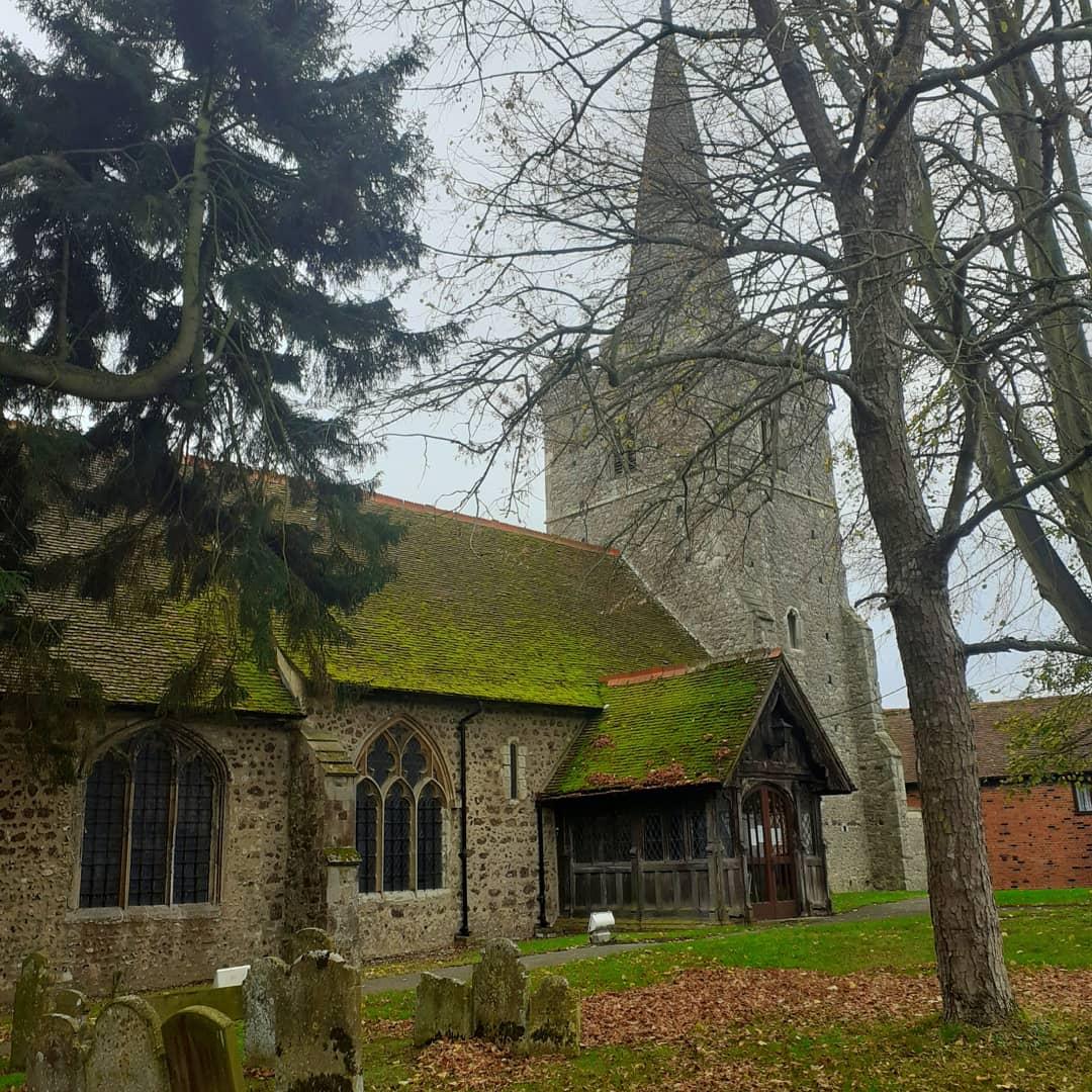
St Mary Magdalene, Great Burstead

St Mary Magdalene is a Grade I-listed parish church in the village of Great Burstead, about 1.5 mi (2.4 km) south of Billericay, Essex, England. The present...

Great Burstead and South Green

Great Burstead and South Green is a civil parish in the Basildon district, in the county of Essex, England. The parish includes the settlements of Great...

Burstead Grange

Burstead Grange was a priory in Essex, England. == References ==

The Billericay School

The Billericay School is an academy secondary school and sixth form college located in Billericay, England. The school is led by headmaster Patrick Berry...

Hutton F.C.

Hutton Football Club is a football club based in Hutton, England. They are currently members of the Eastern Counties League Division One South and play...

Billericay Town F.C.

Billericay Town Football Club is a football club based in Billericay, Essex, England. The club are currently members of the Isthmian League Premier Division...

Basildon and Billericay (UK Parliament constituency)

Basildon and Billericay () is a constituency in Essex represented in the House of Commons of the UK Parliament. Since its 2010 creation it has been represented...

Nearby Amenities

Located within 500m of 51.603207,0.4095
Little Burstead
Is In: Essex, England, UK
Is In Country: UK
Is In County: Essex
Place: village
Source: knowledge
Lat/Long: 51.6052714/0.4107361
Bus Stop
The Memorial
Naptan AtcoCode: 1500IM546
Naptan Bearing: NW
Naptan CommonName: The Memorial
Naptan Crossing: Rectory Road
Naptan Indicator: Adj
Naptan Landmark: The Memorial
Naptan NaptanCode: esxadawg
Naptan Street: Clock House Road
Naptan Verified: no
Public Transport: platform
Source: naptan_import
Lat/Long: 51.603264/0.4052863
Bus Stop
The Memorial
Naptan AtcoCode: 1500IM546AA
Naptan Bearing: SE
Naptan BusStopType: CUS
Naptan CommonName: The Memorial
Naptan Crossing: Rectory Road
Naptan Indicator: Opp
Naptan Landmark: The Memorial
Naptan NaptanCode: esxjajam
Naptan Street: Clock House Road
Naptan Verified: no
Public Transport: platform
Source: naptan_import
Lat/Long: 51.6033747/0.4051477
Give Way
Direction: forward
Lat/Long: 51.6032017/0.4058783
Historic: memorial
Lat/Long: 51.6031398/0.4056532
Telephone
Booth: K6
Covered: booth
Listed Status: Grade II
Man Made: telephone_box
Lat/Long: 51.6030914/0.4058611
Entrance: yes
Lat/Long: 51.6043243/0.4071623
Advertising: board
Lat/Long: 51.604309/0.4072222
Defibrillator
Access: yes
Defibrillator Location: outside Burstead Village Hall
Emergency: defibrillator
Indoor: no
Lat/Long: 51.6043308/0.4071732
Give Way
Direction: backward
Lat/Long: 51.6030433/0.4055373
Give Way
Direction: forward
Lat/Long: 51.6032251/0.405466
Bench
Lat/Long: 51.6031638/0.4057163
The data included in this document is from www.openstreetmap.org. The data is made available under ODbL.

Have you been to Burstead, Little?

Leave your review of Burstead, Little below (or comments, questions and feedback).