Attimidday Rock

Island in Cornwall

England

Attimidday Rock

Cattle south of Penare From a footpath that follows the bulwark around the Dodman cliff castle to link the coast path northwest and northnortheast of the point.
Cattle south of Penare Credit: Derek Harper

Attimidday Rock is a small rocky outcrop located off the coast of Cornwall, England. Situated in the Atlantic Ocean, it is part of the Isles of Scilly archipelago. The island gets its name from the Cornish word "attimidday," which translates to "at midday," alluding to the rock's exposure during low tide.

Measuring approximately 200 meters in length and 100 meters in width, Attimidday Rock is primarily composed of granite, a characteristic feature of the region. It is a rugged and barren landform, with its surface covered in low-lying vegetation and scattered boulders. The island has no permanent human population, but it serves as a nesting site for various seabirds, including gulls, fulmars, and cormorants.

Due to its isolated location, Attimidday Rock is inaccessible for most of the year. However, during low tide, it becomes possible to visit the island by foot or by boat. This makes it a popular destination for birdwatchers, nature enthusiasts, and photographers, who are drawn to the unique flora and fauna found on the island.

The surrounding waters of Attimidday Rock are teeming with marine life, making it a favorite spot for snorkeling and scuba diving. The clear waters offer visibility to explore the vibrant underwater ecosystem, which includes colorful fish, crabs, and various species of seaweed.

In summary, Attimidday Rock is a picturesque and ecologically diverse island off the coast of Cornwall. Its rugged beauty, unique wildlife, and accessibility during low tide make it a must-visit destination for nature lovers and outdoor enthusiasts.

If you have any feedback on the listing, please let us know in the comments section below.

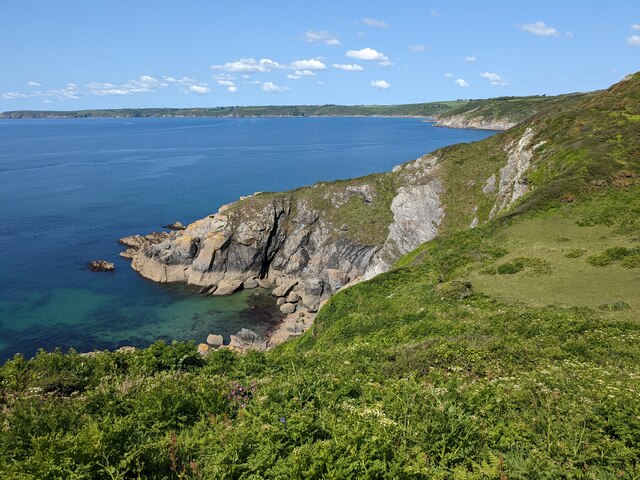
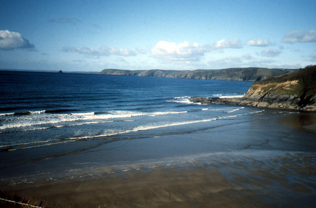
Attimidday Rock Images

Images are sourced within 2km of 50.230027/-4.8283118 or Grid Reference SW9840. Thanks to Geograph Open Source API. All images are credited.

Cattle south of Penare From a footpath that follows the bulwark around the Dodman cliff castle to link the coast path northwest and northnortheast of the point.
Cattle south of Penare
From a footpath that follows the bulwark around the Dodman cliff castle to link the coast path northwest and northnortheast of the point.
View to the coast from the path to Dodman Point
Gell Point
Gell Point
Looking along the SWC towards Boswinger
Path to Dodman Point The footpath from Penare to Dodman Point at the point where it crosses the bank known as the bulwark, possibly an old defensive line from the fort on Dodman Point.
Path to Dodman Point
The footpath from Penare to Dodman Point at the point where it crosses the bank known as the bulwark, possibly an old defensive line from the fort on Dodman Point.
The Bulwark earthwork at the Dodman The Bulwark is part of a defensive rampart protecting the settlement on the Dodman.
The Bulwark earthwork at the Dodman
The Bulwark is part of a defensive rampart protecting the settlement on the Dodman.
Carlithey Point, Dodman A view of Carlithey point from the South West Coast Path
Carlithey Point, Dodman
A view of Carlithey point from the South West Coast Path
Dodman Point Dartmoor ponies a long way from home grazing the National Trust property of Dodman Point. The path is part of the South West Coast Path
Dodman Point
Dartmoor ponies a long way from home grazing the National Trust property of Dodman Point. The path is part of the South West Coast Path
High Point, The Dodman A view of High Point on the western side of Dodman Point from the South West Coast Path
High Point, The Dodman
A view of High Point on the western side of Dodman Point from the South West Coast Path
The South West Coast Path on the west of the Dodman
The Bulwark on the Dodman This earthwork, with a path through it, is part of the defensive fortification for the headland
The Bulwark on the Dodman
This earthwork, with a path through it, is part of the defensive fortification for the headland
Gate on the South West Coast Path
Coast path on the Dodman The signposted footpath junction appears in <a href="https://www.geograph.org.uk/photo/2124126">SW9939 : South West Coastal Path near Dodman Point</a>. This view is from on top of the northern earthwork surround the Iron Age fort, described at <span class="nowrap"><a title="https://historicengland.org.uk/listing/the-list/list-entry/1020865" rel="nofollow ugc noopener" href="https://historicengland.org.uk/listing/the-list/list-entry/1020865">Link</a><img style="margin-left:2px;" alt="External link" title="External link - shift click to open in new window" src="https://s1.geograph.org.uk/img/external.png" width="10" height="10"/></span>  .
Coast path on the Dodman
The signposted footpath junction appears in SW9939 : South West Coastal Path near Dodman Point. This view is from on top of the northern earthwork surround the Iron Age fort, described at LinkExternal link .
High Point A view of <a href="https://www.geograph.org.uk/photo/2428068">SW9939 : High Point, The Dodman</a> from the other side, from the same spot as <a href="https://www.geograph.org.uk/photo/3037069">SW9939 : Coast path on the Dodman</a>, through low cloud.
High Point
A view of SW9939 : High Point, The Dodman from the other side, from the same spot as SW9939 : Coast path on the Dodman, through low cloud.
Footpath junction, Dodman Seen from above in <a href="https://www.geograph.org.uk/photo/3037069">SW9939 : Coast path on the Dodman</a>. The path to Penare, not mapped as a public right of way, runs between banks beside the Iron Age fort, and is also shown in <a href="https://www.geograph.org.uk/photo/2443508">SW9939 : The Bulwark on the Dodman</a>.
Footpath junction, Dodman
Seen from above in SW9939 : Coast path on the Dodman. The path to Penare, not mapped as a public right of way, runs between banks beside the Iron Age fort, and is also shown in SW9939 : The Bulwark on the Dodman.
Coast path above High Point This stretch of path along the top of the coastal slope, with windblown hawthorns, is also shown in <a href="https://www.geograph.org.uk/photo/1472533">SW9939 : Grass and Heath</a>.
Coast path above High Point
This stretch of path along the top of the coastal slope, with windblown hawthorns, is also shown in SW9939 : Grass and Heath.
Coast path above High Point A little further along the stretch of path shown in <a href="https://www.geograph.org.uk/photo/3037135">SW9939 : Coast path above High Point</a>. This is a permissive path.
Coast path above High Point
A little further along the stretch of path shown in SW9939 : Coast path above High Point. This is a permissive path.
Junction of paths and view across Veryan Bay, on the Dodman Point
Show me another place!

Attimidday Rock is located at Grid Ref: SW9840 (Lat: 50.230027, Lng: -4.8283118)

Unitary Authority: Cornwall

Police Authority: Devon and Cornwall

What 3 Words

///intrigues.ambushes.flinch. Near Mevagissey, Cornwall

Related Wikis

Boswinger

Boswinger is a village in south Cornwall, England, two miles south of Mevagissey (where the 2011 Census population is included). There is a youth hostel...

Hemmick Beach

Hemmick Beach is a west-facing beach on the south coast of Cornwall, England. It is situated at the east end of Veryan Bay, on the west side of the Dodman...

Veryan Bay

Veryan Bay (Cornish: Baya Ker) along the southern coast of Cornwall, England, is a curving, natural bay that stretches for 4.6 miles in width and recedes...

Penare

Penare is a hamlet near Gorran Haven in Cornwall, England, UK. Penare is situated 1 mile (2 km) south-west of Gorran Haven.Pronunciation is PEA - NAR....

Related Videos

Gorran Haven, nr Mevagissey to Dodman Point - "Two dogs wide!" A summer walk in Cornwall.

In this video we visit Gorran Haven and try a 4 mile circular walk which takes us to Dodman Point one of Cornwall's most ...

Secluded beach RUINED by GREED

Is it worth visiting Porthluney and Caerhays? If you are considering visiting either of these locations, all you need to know is in this ...

A Holiday Park Like No Other | Seaview Gorran Haven

Discover a whole new world at Seaview Gorran Haven. Surrounded by the sea and countryside, it truly is a holiday park like no ...

Discover the Luxury Holiday Park Lifestyle | Seaview Gorran Haven

Are you thinking about acquiring a second holiday home in Cornwall? If so, then look no further than Seaview Gorran Haven!

Nearby Amenities

Located within 500m of 50.230027,-4.8283118
Source: PGS
Lat/Long: 50.2330041/-4.8324012
Source: PGS
Lat/Long: 50.2332113/-4.8323092
Source: PGS
Lat/Long: 50.2328223/-4.8321433
Source: PGS
Lat/Long: 50.2326276/-4.8319336
Source: PGS
Lat/Long: 50.231796/-4.8306824
Source: PGS
Lat/Long: 50.2311192/-4.8308102
Source: PGS
Lat/Long: 50.2306215/-4.8308055
Source: PGS
Lat/Long: 50.2302367/-4.8306027
Source: PGS
Lat/Long: 50.2305386/-4.8301091
Source: PGS
Lat/Long: 50.2304193/-4.8289317
Source: PGS
Lat/Long: 50.2304907/-4.8278776
Source: PGS
Lat/Long: 50.2306228/-4.8266316
Source: PGS
Lat/Long: 50.2309779/-4.8258176
Source: PGS
Lat/Long: 50.23105/-4.8251062
Source: PGS
Lat/Long: 50.2310262/-4.823451
Source: PGS
Lat/Long: 50.2309588/-4.8234631
Source: PGS
Lat/Long: 50.2309057/-4.8233224
Source: PGS
Lat/Long: 50.2311809/-4.8231344
Source: PGS
Lat/Long: 50.2310239/-4.8222069
Source: PGS
Lat/Long: 50.23104/-4.821931
Black Rock
Name Kw: Karrek Dhu
Place: locality
Source: OS_OpenData_StreetView
Lat/Long: 50.2304141/-4.8232974
Barrier: kissing_gate
Lat/Long: 50.2316456/-4.8294823
Barrier: stile
Foot: yes
Step Count: 1
Stile: stepover
Wheelchair: no
Lat/Long: 50.2335966/-4.8322302
Barrier: kissing_gate
Image: https://archive.org/details/porthluney-photos/Porthluney%20to%20Hemmick%20Beach%202020-08-26/DSCN1852.JPG
Material: wood
Wheelchair: no
Lat/Long: 50.2314538/-4.8261312
Natural: rock
Lat/Long: 50.2316986/-4.8244357
Natural: rock
Lat/Long: 50.231778/-4.8236579
The data included in this document is from www.openstreetmap.org. The data is made available under ODbL.

Have you been to Attimidday Rock?

Leave your review of Attimidday Rock below (or comments, questions and feedback).