Newland

Island in Cornwall

England

Newland

Newland Island, Cornwall A small island named Newland, but sometimes referred to as Puffin Island, lies about one mile (1600 metres) to the north-west of Pentire Point.
Newland Island, Cornwall Credit: David Dixon

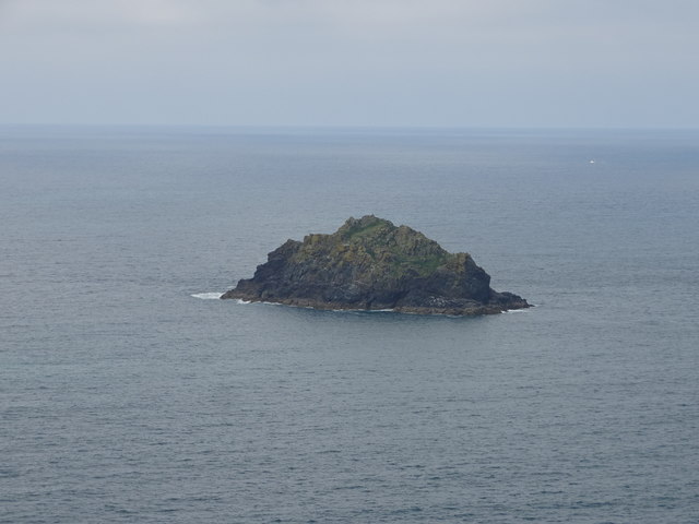
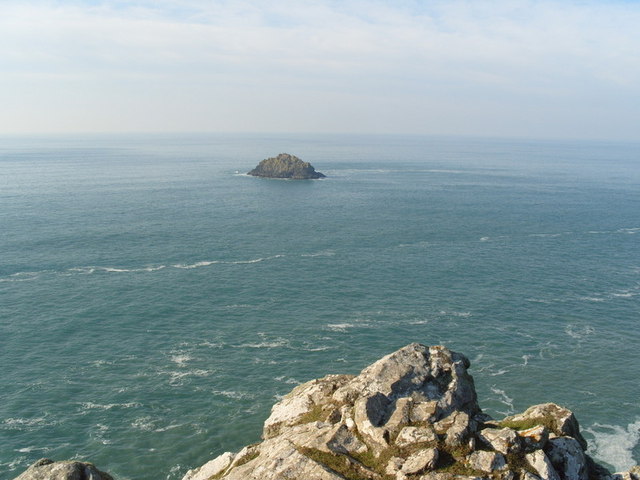
Newland is a small island located off the coast of Cornwall, England. Situated in the Celtic Sea, it covers an area of approximately 1 square mile and has a population of around 100 residents. The island is accessible by boat from the nearby town of Newquay.

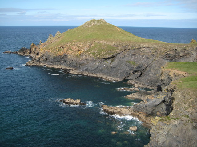
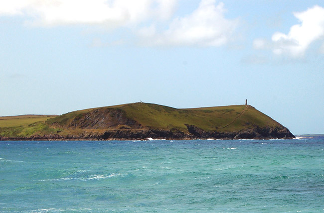
Newland is known for its stunning natural beauty, with rocky cliffs, sandy beaches, and lush greenery. The island offers a peaceful and serene environment, making it a popular destination for nature lovers and those seeking a tranquil retreat. Visitors can enjoy breathtaking coastal walks, sunbathe on the pristine beaches, or explore the diverse flora and fauna that inhabit the area.

The island has a rich history dating back centuries, with evidence of human habitation found in ancient ruins and artifacts. Newland was once a thriving fishing community, and remnants of the old harbor can still be seen today. The island also played a significant role in maritime trade, with its strategic location attracting merchants and sailors.

Today, Newland is primarily a residential area, with a small number of houses and cottages scattered across the island. There are no commercial establishments or tourist facilities, contributing to its unspoiled and untouched charm. Visitors can stay in self-catering accommodations or rent holiday homes, immersing themselves in the peaceful island life.

Newland, Cornwall, is a hidden gem offering a glimpse into the untouched beauty of nature and the rich history of the region. It is a perfect destination for those seeking solitude, relaxation, and a break from the hustle and bustle of everyday life.

If you have any feedback on the listing, please let us know in the comments section below.

Newland Images

Images are sourced within 2km of 50.592459/-4.9480442 or Grid Reference SW9181. Thanks to Geograph Open Source API. All images are credited.

Newland Island, Cornwall A small island named Newland, but sometimes referred to as Puffin Island, lies about one mile (1600 metres) to the north-west of Pentire Point.
Newland Island, Cornwall
A small island named Newland, but sometimes referred to as Puffin Island, lies about one mile (1600 metres) to the north-west of Pentire Point.
Pentire Point A number of tourists/walkers can be seen on the South West Coast Path on top of the headland.
Pentire Point
A number of tourists/walkers can be seen on the South West Coast Path on top of the headland.
Rumps Point from the coastal footpath
Small Inlet
Small Inlet
Coastline northeast of Pentire Point
Coast at Guglane From the southern side of The Rumps, looking across to a headland jutting out into the inlet. Beyond are the cliffs, in <a href="https://www.geograph.org.uk/gridref/SX9380">SX9380</a>, leading out to Pentire Point.
Coast at Guglane
From the southern side of The Rumps, looking across to a headland jutting out into the inlet. Beyond are the cliffs, in SX9380, leading out to Pentire Point.
The Rumps The western of the twin headlands, seen from the west flanks of the eastern. In the foreground are the little blue flowers of spring squill (Scilla verna).
The Rumps
The western of the twin headlands, seen from the west flanks of the eastern. In the foreground are the little blue flowers of spring squill (Scilla verna).
Rock on The Rumps A dramatic rock above a blue sea on the north side of the western headland.
Rock on The Rumps
A dramatic rock above a blue sea on the north side of the western headland.
Sevensouls Rock A dramatically shaped stack that rears up beside the eastern of The Rumps, with The Mouls beyond it.
Sevensouls Rock
A dramatically shaped stack that rears up beside the eastern of The Rumps, with The Mouls beyond it.
Sea squill near The Rumps By the South West Coast Path south of The Rumps. Scilla verna appreciates short turf and the National Trust policy is to use Dartmoor ponies or cattle to graze these cliffs to encourage it and similar plants.
Sea squill near The Rumps
By the South West Coast Path south of The Rumps. Scilla verna appreciates short turf and the National Trust policy is to use Dartmoor ponies or cattle to graze these cliffs to encourage it and similar plants.
Western Rump The western of The Rumps seen across Guglane from the South West Coast Path.
Western Rump
The western of The Rumps seen across Guglane from the South West Coast Path.
Coast path to Pentire Point A sinuous course for the South West Coast Path between the Rumps and Pentire Point, alongside a wall.
Coast path to Pentire Point
A sinuous course for the South West Coast Path between the Rumps and Pentire Point, alongside a wall.
Coast path to Pentire Point A little further west than <a href="https://www.geograph.org.uk/photo/2390499">SW9280 : Coast path to Pentire Point</a>, with the South West Coast Path following footpath 546/31/4 above a steep grassy coastal slope. Offshore is Newland.
Coast path to Pentire Point
A little further west than SW9280 : Coast path to Pentire Point, with the South West Coast Path following footpath 546/31/4 above a steep grassy coastal slope. Offshore is Newland.
The Binyon plaque near Pentire Point Another view of the plaque shown in <a href="https://www.geograph.org.uk/photo/2136442">SW9280 : For The Fallen</a>, where it is easier to read. In the background are The Rumps.
The Binyon plaque near Pentire Point
Another view of the plaque shown in SW9280 : For The Fallen, where it is easier to read. In the background are The Rumps.
Newland ( Off Pentire Point) Newland an Island just off Pentire Point North Cornwall
Newland ( Off Pentire Point)
Newland an Island just off Pentire Point North Cornwall
Pentire Point on the North Cornish Coast Looking back along the Coast Path at Pentire Point towards Polzeath and Hayle Bay
Pentire Point on the North Cornish Coast
Looking back along the Coast Path at Pentire Point towards Polzeath and Hayle Bay
Show me another place!

Newland is located at Grid Ref: SW9181 (Lat: 50.592459, Lng: -4.9480442)

Unitary Authority: Cornwall

Police Authority: Devon and Cornwall

What 3 Words

///probing.scooped.node. Near Polzeath, Cornwall

Related Wikis

River Camel

The River Camel (Cornish: Dowr Kammel, meaning crooked river) is a river in Cornwall, England. It rises on the edge of Bodmin Moor and with its tributaries...

The Rumps

The Rumps (Cornish: Din Pentir, meaning fort at Pentire) (grid reference SW 934 810) is a twin-headland promontory at the north-east corner of Pentire...

Pentire Head

Pentire Head (Cornish: Penn Tir, meaning "headland") is a headland and peninsula on the Atlantic coast in North Cornwall, England, and is about one mile...

Stepper Point

Stepper Point (Cornish: Penn Stuppert) is a headland on the Atlantic coast in north Cornwall, England, United Kingdom. It is at grid reference SW911781...

Have you been to Newland?

Leave your review of Newland below (or comments, questions and feedback).