Gray Rocks

Island in Pembrokeshire

Wales

Gray Rocks

Lindsway Bay Lindsway Bay on the Pembrokeshire Coastal Path. Situated between Monk Haven and Sandy Haven.
Lindsway Bay Credit: BRIAN PERCIVAL

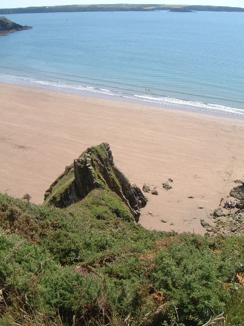
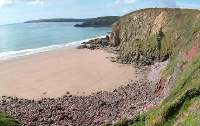
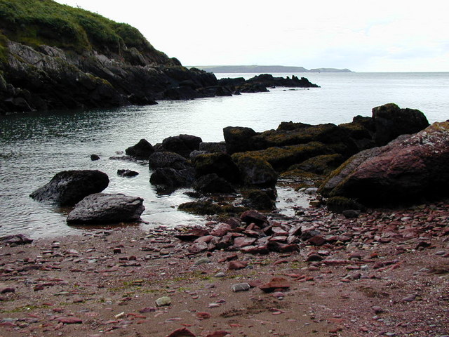
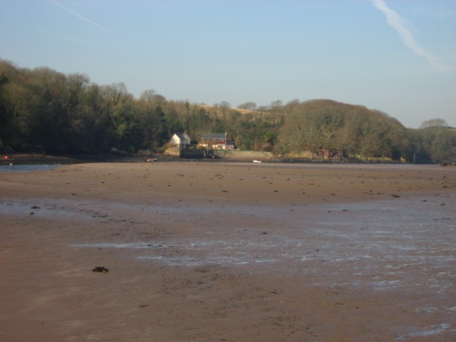
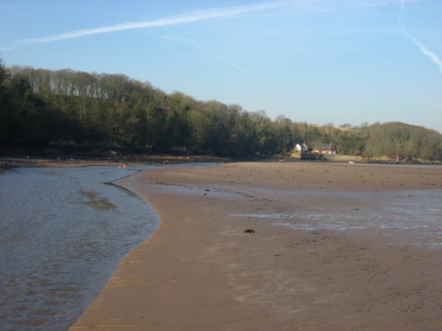
Gray Rocks is a small island located off the coast of Pembrokeshire, Wales. Situated in the Celtic Sea, it is known for its rugged and picturesque landscape, making it a popular destination for nature enthusiasts and adventure seekers.

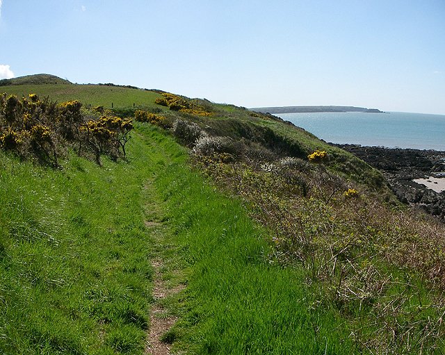
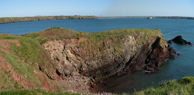
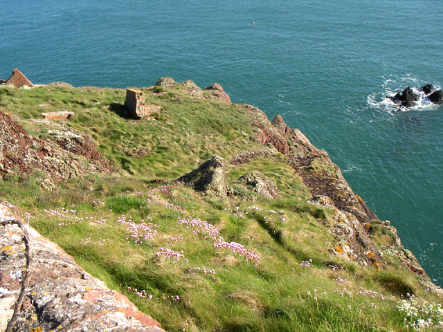
Covered in grass and rocky outcrops, Gray Rocks is home to a diverse range of flora and fauna. The island is a haven for seabirds, such as puffins, guillemots, and razorbills, who nest in the cliffs during the breeding season. Visitors can witness the spectacular sight of these birds diving into the sea for food.

The island also boasts a rich marine life, with seals often seen basking on the rocks or swimming in the surrounding waters. It is not uncommon to spot dolphins and porpoises playing in the waves, adding to the island's charm.

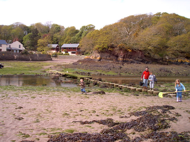
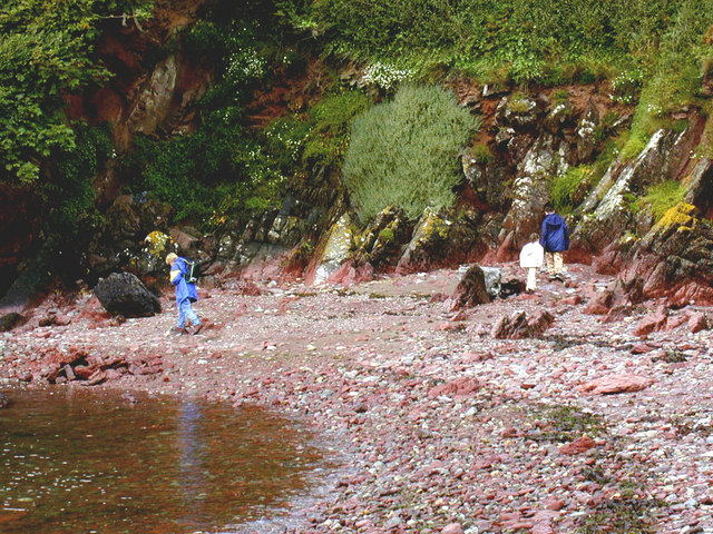
Access to Gray Rocks is limited and is only possible during low tide, when a causeway is revealed connecting it to the mainland. This adds an element of adventure to the visit, as timing is crucial to avoid being stranded on the island when the tide comes in.

Due to its isolated location, Gray Rocks offers a tranquil and untouched environment, perfect for those seeking solitude or a break from the bustling city life. Visitors can enjoy scenic walks along the rugged coastline, take in panoramic views of the surrounding sea, and explore the island's unique geological formations.

Gray Rocks, with its natural beauty and abundant wildlife, is a hidden gem of Pembrokeshire, inviting visitors to immerse themselves in the tranquility and splendor of this enchanting island.

If you have any feedback on the listing, please let us know in the comments section below.

Gray Rocks Images

Images are sourced within 2km of 51.71095/-5.1181264 or Grid Reference SM8405. Thanks to Geograph Open Source API. All images are credited.

Lindsway Bay Lindsway Bay on the Pembrokeshire Coastal Path. Situated between Monk Haven and Sandy Haven.
Lindsway Bay
Lindsway Bay on the Pembrokeshire Coastal Path. Situated between Monk Haven and Sandy Haven.
St. Ishmael's - Lindsway Bay Beautiful beach. Taken looking west.
St. Ishmael's - Lindsway Bay
Beautiful beach. Taken looking west.
Motte The Motte to the north of St.Ishmael's.
Motte
The Motte to the north of St.Ishmael's.
Bicton Bicton farm.
Bicton
Bicton farm.
Coast Path Looking south along the Pembrokeshire coast path. 
The headland on the horizon is the Angle peninsula.
Coast Path
Looking south along the Pembrokeshire coast path. The headland on the horizon is the Angle peninsula.
Little Castle Head The headland called Little Castle head.

The 'lump' left of centre is the 'Fort'.
Little Castle Head
The headland called Little Castle head. The 'lump' left of centre is the 'Fort'.
Great Castle Head Great Castle Head from the bottom corner of the wall that is just inside this grid square at SM 847 059. I think the brickwork that can be seen must be the remains of a pill box.
Great Castle Head
Great Castle Head from the bottom corner of the wall that is just inside this grid square at SM 847 059. I think the brickwork that can be seen must be the remains of a pill box.
The crab bridge Sandy Haven Pill This bridge and stepping stones on the coast path have been used by generations of children to collect crabs. The bridge is only above the tide for around 2 hours either side of low tide.
The crab bridge Sandy Haven Pill
This bridge and stepping stones on the coast path have been used by generations of children to collect crabs. The bridge is only above the tide for around 2 hours either side of low tide.
Monk Haven
Monk Haven
Monk Haven
Monk Haven
Rock plants at Monk Haven
Pond by the path to Monk Haven
Monk Haven
Monk Haven
Monk Haven
Monk Haven
St Ishmael's Church Built in 1100AD the church is dedicated to a 6th century Cornish Saint who was a disciple of St David.
St Ishmael's Church
Built in 1100AD the church is dedicated to a 6th century Cornish Saint who was a disciple of St David.
Sandy Haven from the beach
Sandy Haven Pill reaching the sea.
Show me another place!

Gray Rocks is located at Grid Ref: SM8405 (Lat: 51.71095, Lng: -5.1181264)

Unitary Authority: Pembrokeshire

Police Authority: Dyfed Powys

What 3 Words

///scorching.minute.appointed. Near Herbrandston, Pembrokeshire

Nearby Locations

Gray Rocks

Related Wikis

Milford Haven Waterway

Milford Haven Waterway (Welsh: Dyfrffordd Aberdaugleddau) is a natural harbour in Pembrokeshire, Wales. It is a ria or drowned valley which was flooded...

St Ishmaels

St Ishmaels or St Ishmael's (Welsh: Llanismel) is a village, parish and community close to the Milford Haven Waterway in Pembrokeshire, Wales. The community...

Stack Rock Fort

Stack Rock Fort is a fort built on a small island in the Milford Haven Waterway, Pembrokeshire, Wales. A 3-gun fort was built between 1850 and 1852, and...

Thorne Island

Thorne Island is a rocky islet and part of the community of Angle, Pembrokeshire, Wales, with an area of 2 acres (8,100 m2), dominated by a coastal artillery...

Nearby Amenities

Located within 500m of 51.71095,-5.1181264
Seamark Light 1 Character: F
Seamark Light 1 Colour: red
Seamark Light 1 Height: 27
Seamark Light 1 Range: 3
Seamark Light 1 Sector End: 281
Seamark Light 1 Sector Start: 243
Seamark Light 2 Character: F
Seamark Light 2 Colour: green
Seamark Light 2 Height: 27
Seamark Light 2 Range: 3
Seamark Light 2 Sector End: 299
Seamark Light 2 Sector Start: 281
Seamark Light 3 Character: F
Seamark Light 3 Colour: white
Seamark Light 3 Height: 27
Seamark Light 3 Range: 5
Seamark Light 3 Sector End: 29
Seamark Light 3 Sector Start: 299
Seamark Light Reference: A 5287
Seamark Name: Great Castle Head
Seamark Type: light_major
Source: US NGA Pub. 114. 2011-05-26.
Lat/Long: 51.7113/-5.1177
Seamark Buoy Cardinal Category: south
Seamark Buoy Cardinal Colour: yellow;black
Seamark Buoy Cardinal Shape: pillar
Seamark Name: Behar
Seamark Topmark Colour: black
Seamark Topmark Colour Pattern: horizontal
Seamark Topmark Shape: 2 cones down
Seamark Type: buoy_cardinal
Lat/Long: 51.7066667/-5.1161667
Great Castle Head
Natural: cape
Lat/Long: 51.7104493/-5.1157835
The data included in this document is from www.openstreetmap.org. The data is made available under ODbL.

Have you been to Gray Rocks?

Leave your review of Gray Rocks below (or comments, questions and feedback).