Lismore

Island in Argyllshire

Scotland

Lismore

B8045, Lismore
B8045, Lismore Credit: Richard Webb

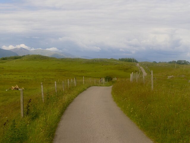
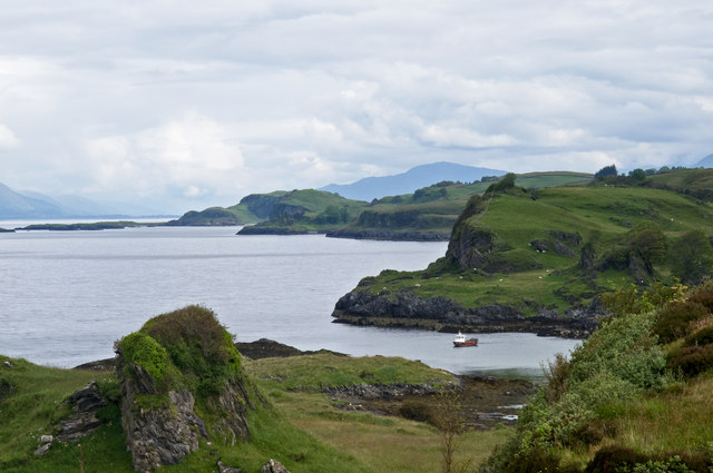
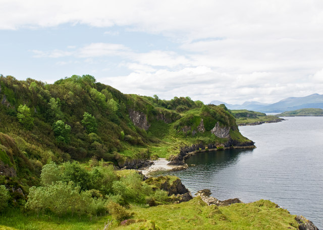
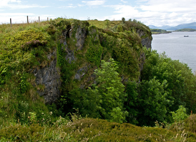
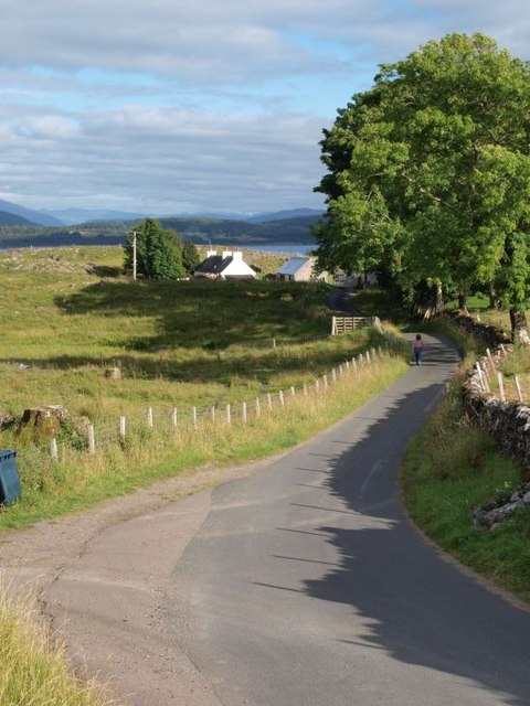
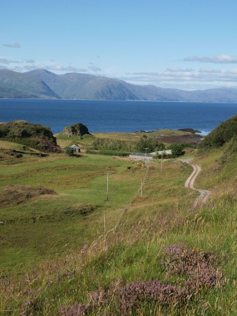
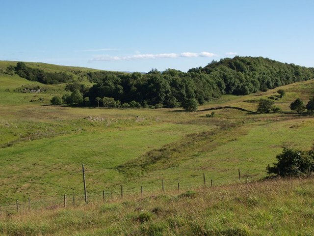
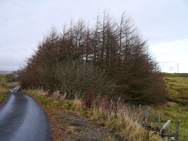
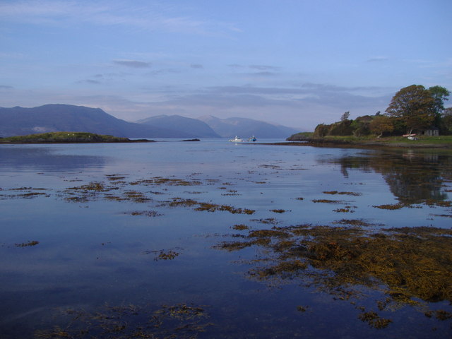
Lismore is a picturesque island located in Argyllshire, Scotland. Situated off the west coast, it is part of the Inner Hebrides archipelago and covers an area of about 2,351 hectares. The island is known for its stunning natural beauty, with rolling hills, lush green landscapes, and breathtaking views of the surrounding sea.

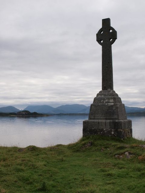
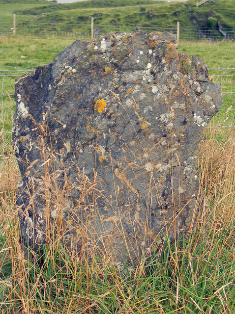
Lismore has a rich history, dating back to ancient times. The island is home to several historical sites, including the remains of a 13th-century cathedral and a 15th-century castle. These remnants offer a glimpse into the island's past and attract visitors interested in exploring its heritage.

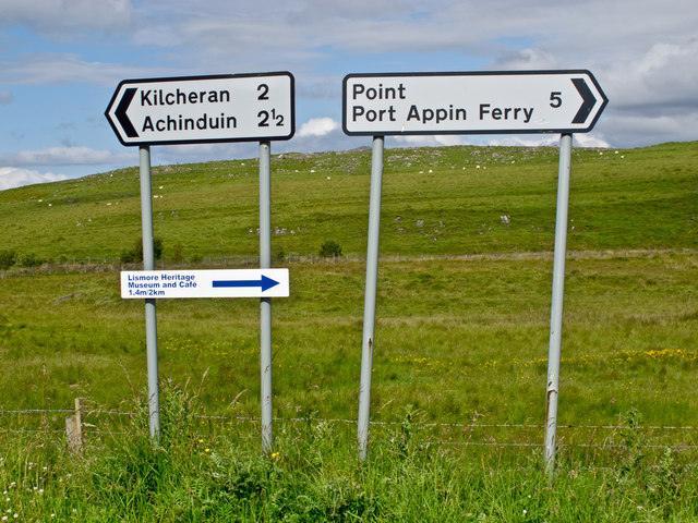
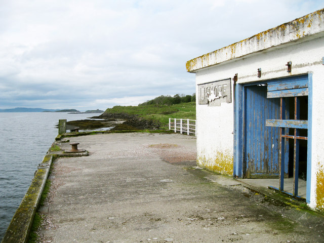
The island has a small population of around 200 residents, who primarily live in the village of Achnacroish. Despite its size, Lismore has a vibrant community, with a primary school, a heritage center, and a post office. The island also has its own Gaelic-speaking church, reflecting the strong cultural traditions of the region.

Lismore is a haven for nature lovers and outdoor enthusiasts. The island offers numerous walking and cycling trails, allowing visitors to discover its natural wonders at their own pace. From wildflowers and birds to seals and otters, Lismore is teeming with wildlife, making it a popular spot for birdwatching and wildlife photography.

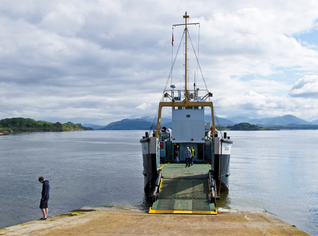
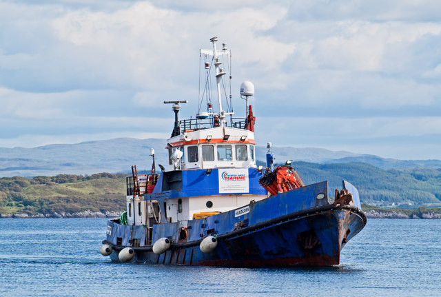
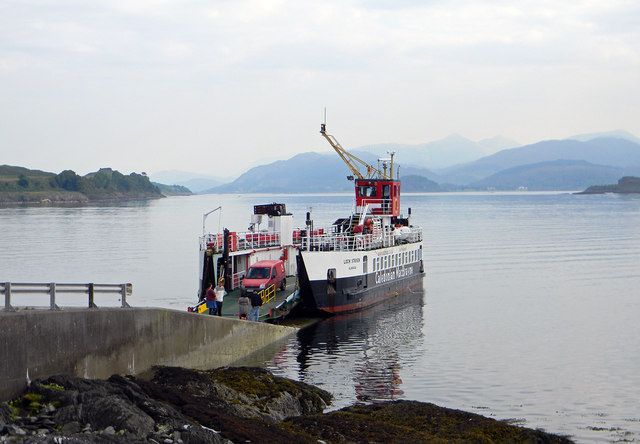
Ferries connect Lismore to the mainland, providing easy access for both residents and tourists. The island is a peaceful retreat, offering a serene and tranquil atmosphere that is perfect for those seeking a break from the hustle and bustle of city life. With its stunning scenery, rich history, and friendly community, Lismore is a hidden gem in the Scottish landscape.

If you have any feedback on the listing, please let us know in the comments section below.

Lismore Images

Images are sourced within 2km of 56.508644/-5.5123721 or Grid Reference NM8340. Thanks to Geograph Open Source API. All images are credited.

B8045, Lismore
B8045, Lismore
Calmac ferry MV Eigg at Achnacroish The Calmac ferry Eigg at Achnacroish, Lismore after unloading vehicles and passengers from an Oban sailing. The Eigg was launched in 1974, and has provided a ferry service to the Isle of Lismore for many years.
Calmac ferry MV Eigg at Achnacroish
The Calmac ferry Eigg at Achnacroish, Lismore after unloading vehicles and passengers from an Oban sailing. The Eigg was launched in 1974, and has provided a ferry service to the Isle of Lismore for many years.
Road signs, Lismore
Road signs, Lismore
Lismore western coastline A view over the western coastline of the Island of Lismore. Largely composed of Dalradian limestone, Lismore is surrounded by raised beaches backed by cliffs. The island overlies the Great Glen fault line, and earth tremors occur here occasionally.
Lismore western coastline
A view over the western coastline of the Island of Lismore. Largely composed of Dalradian limestone, Lismore is surrounded by raised beaches backed by cliffs. The island overlies the Great Glen fault line, and earth tremors occur here occasionally.
The Headcorn at Achnacroish harbour The Headcorn (Clovelly Class A 1766), a work/dive boat approaching the pier at Achnacroish, Lismore. Headcorn is 24.4 metres in length and was launched in 1972.
The Headcorn at Achnacroish harbour
The Headcorn (Clovelly Class A 1766), a work/dive boat approaching the pier at Achnacroish, Lismore. Headcorn is 24.4 metres in length and was launched in 1972.
Lismore coastline Raised beaches and cliffs on the western coast of Lismore, which is largely composed of Dalradian limestone. The island of Bernera, accessible from Lismore at low tide can be seen in the distance.
Lismore coastline
Raised beaches and cliffs on the western coast of Lismore, which is largely composed of Dalradian limestone. The island of Bernera, accessible from Lismore at low tide can be seen in the distance.
Cliffs on the Isle of Lismore
Old steamer pier, Achnacroish The old pier, with its faded 'Lismore' sign, is no longer used; the car ferry from Oban uses the adjacent slipway. According to a plaque on the wall, it was built in 1880 by contractors A & K Macdonald and J Goodwin & Co, with John Strainge as engineer.
Old steamer pier, Achnacroish
The old pier, with its faded 'Lismore' sign, is no longer used; the car ferry from Oban uses the adjacent slipway. According to a plaque on the wall, it was built in 1880 by contractors A & K Macdonald and J Goodwin & Co, with John Strainge as engineer.
Achnacroish harbour, Lismore The slipway for the Oban ferry is at the left. The disused pier seen in other images (e.g. <a href="https://www.geograph.org.uk/photo/951880">NM8540 : Approaching Achnacroish pier</a>) is just off the right of the picture. In the distance one sees mountains on the mainland: Ben Starav, Beinn a'Bheitheir and summits between.
Achnacroish harbour, Lismore
The slipway for the Oban ferry is at the left. The disused pier seen in other images (e.g. NM8540 : Approaching Achnacroish pier) is just off the right of the picture. In the distance one sees mountains on the mainland: Ben Starav, Beinn a'Bheitheir and summits between.
Road to Achnacroish The picture looks east along the road that runs from the 'main' road along the spine of Lismore, to the terminal for the Oban ferry at Achnacroish.
Road to Achnacroish
The picture looks east along the road that runs from the 'main' road along the spine of Lismore, to the terminal for the Oban ferry at Achnacroish.
Road to Salen The track to the right-hand side goes to Salen, where a disused limestone quarry lies just out of sight.
Road to Salen
The track to the right-hand side goes to Salen, where a disused limestone quarry lies just out of sight.
Wooded ridge Many rocky ridges run along the length of Lismore, this one covered in trees.
Wooded ridge
Many rocky ridges run along the length of Lismore, this one covered in trees.
Monument to Waverley Arthur Cameron On the east coast of Lismore this monument commemorates the drowning of Waverley Arthur Cameron in a yachting accident off the shore here on 4 June 1891. It was erected by his father, Duncan Cameron, founder of the Oban Times. Waverley Cameron was editor of the Oban Times at the time of the accident.
Monument to Waverley Arthur Cameron
On the east coast of Lismore this monument commemorates the drowning of Waverley Arthur Cameron in a yachting accident off the shore here on 4 June 1891. It was erected by his father, Duncan Cameron, founder of the Oban Times. Waverley Cameron was editor of the Oban Times at the time of the accident.
Boggy Ground A patch of roadside marshland near Balliveolan.
Boggy Ground
A patch of roadside marshland near Balliveolan.
A Small Plantation A small Larch plantation at Baligrundle.
A Small Plantation
A small Larch plantation at Baligrundle.
Salen Bay, Lismore
Salen Bay, Lismore
Achnacroish slipway - Lismore The CalMac ferry MV Loch Striven unloading at Achnacroish.
Achnacroish slipway - Lismore
The CalMac ferry MV Loch Striven unloading at Achnacroish.
Standing stone - Lismore At the side of the minor road to Achinduin and Achadun Castle.
Standing stone - Lismore
At the side of the minor road to Achinduin and Achadun Castle.
Show me another place!

Lismore is located at Grid Ref: NM8340 (Lat: 56.508644, Lng: -5.5123721)

Unitary Authority: Argyll and Bute

Police Authority: Argyll and West Dunbartonshire

What 3 Words

///bookshelf.exist.limiting. Near Oban, Argyll & Bute

Related Wikis

Achnacroish

Achnacroish (Scottish Gaelic: Achadh na Croise) is a hamlet on the Scottish island of Lismore. The harbour serves the ferry between Lismore and Oban.The...

Lismore, Scotland

Lismore (Scottish Gaelic: Lios Mòr, pronounced [ʎis̪ ˈmoːɾ] possibly meaning "great enclosure" or "garden") is an island of some 2,351 hectares (9.1 square...

Lismore Seminary

Lismore Seminary was situated in Kilcheran House on the island of Lismore in the Inner Hebrides part of Argyll, Scotland. It served as a seminary for the...

Creag Island

Creag Island is an island in Scotland. It is located in Argyll and Bute council area, in the northwestern part of the country, 600 km northwest of the...

Nearby Amenities

Located within 500m of 56.508644,-5.5123721
Post Box
Ref: PA34 39
Lat/Long: 56.5098366/-5.5139318
Power: pole
Lat/Long: 56.504471/-5.5143428
Power: pole
Lat/Long: 56.5054183/-5.5139726
Power: pole
Lat/Long: 56.5062132/-5.5136722
Power: pole
Lat/Long: 56.5068378/-5.5134255
Power: pole
Lat/Long: 56.5074802/-5.5131814
Power: pole
Lat/Long: 56.5081418/-5.51294
Power: pole
Lat/Long: 56.5087827/-5.5124465
Power: pole
Lat/Long: 56.5095123/-5.5119073
Power: pole
Lat/Long: 56.5100022/-5.5115318
Power: pole
Lat/Long: 56.5106712/-5.5110517
Power: pole
Lat/Long: 56.5112484/-5.5106011
Power: pole
Lat/Long: 56.5119736/-5.5100673
Power: pole
Lat/Long: 56.5126085/-5.5091339
Baligrundle
Name Gd: Baile Grunndail
Place: hamlet
Lat/Long: 56.50981/-5.5145036
Power: pole
Lat/Long: 56.506423/-5.5194198
Power: pole
Lat/Long: 56.5066344/-5.5181008
Power: pole
Lat/Long: 56.5061453/-5.5173602
Power: pole
Lat/Long: 56.5056536/-5.5166032
Power: pole
Lat/Long: 56.5053552/-5.5161494
Power: pole
Lat/Long: 56.5050723/-5.5155617
Power: pole
Lat/Long: 56.5047532/-5.5148987
Power: pole
Lat/Long: 56.5042562/-5.5134528
Power: pole
Lat/Long: 56.5100426/-5.514526
Power: pole
Lat/Long: 56.509835/-5.5139606
Power: pole
Lat/Long: 56.5094011/-5.5142322
Power: pole
Lat/Long: 56.5089957/-5.5144684
Power: pole
Lat/Long: 56.5086408/-5.5138113
Power: pole
Lat/Long: 56.5095619/-5.5146765
Barrier: cattle_grid
Lat/Long: 56.5052635/-5.5164542
Barrier: cattle_grid
Lat/Long: 56.5043639/-5.5144125
Power: pole
Lat/Long: 56.5091787/-5.5152334
Power: pole
Lat/Long: 56.5094437/-5.5162889
Power: pole
Lat/Long: 56.5096213/-5.5169903
Power: pole
Lat/Long: 56.5098255/-5.5178177
Power: pole
Lat/Long: 56.5100186/-5.5185795
The data included in this document is from www.openstreetmap.org. The data is made available under ODbL.

Have you been to Lismore?

Leave your review of Lismore below (or comments, questions and feedback).