Black Rock

Island in Cornwall

England

Black Rock

Arriving by ferry at St Mawes
Arriving by ferry at St Mawes Credit: Roy Hughes

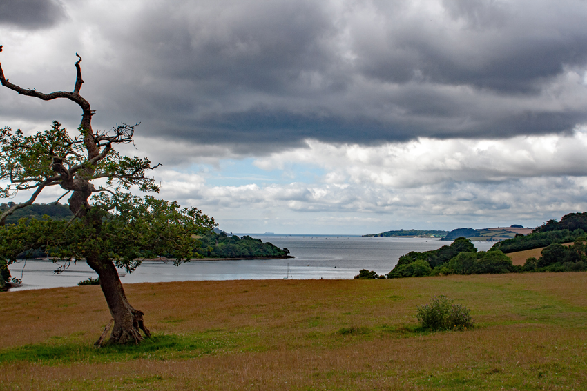
Black Rock is a small island located off the north coast of Cornwall, England. It is situated approximately 1.5 miles west of Widemouth Bay and is part of the Bude area. The island is accessible by foot during low tide, but becomes completely cut off from the mainland during high tide.

Black Rock is known for its rugged and dramatic landscape. It is primarily composed of dark volcanic rock, hence its name. The island is home to a variety of wildlife, including seabirds, seals, and occasionally dolphins, making it a popular spot for nature enthusiasts and birdwatchers.

The island also boasts a picturesque sandy beach, which is a popular attraction for tourists and locals alike. Visitors can enjoy sunbathing, swimming, and exploring the rock pools that are teeming with marine life. The clear waters surrounding the island are ideal for snorkeling and diving.

Black Rock has a rich history, with evidence of human occupation dating back thousands of years. The remains of an Iron Age hillfort can still be seen on the island, providing insight into its ancient past. The island was also used as a lookout during World War II due to its strategic position.

Today, Black Rock remains a tranquil and unspoiled destination, offering visitors the chance to escape the hustle and bustle of everyday life and immerse themselves in the natural beauty of Cornwall's coastline.

If you have any feedback on the listing, please let us know in the comments section below.
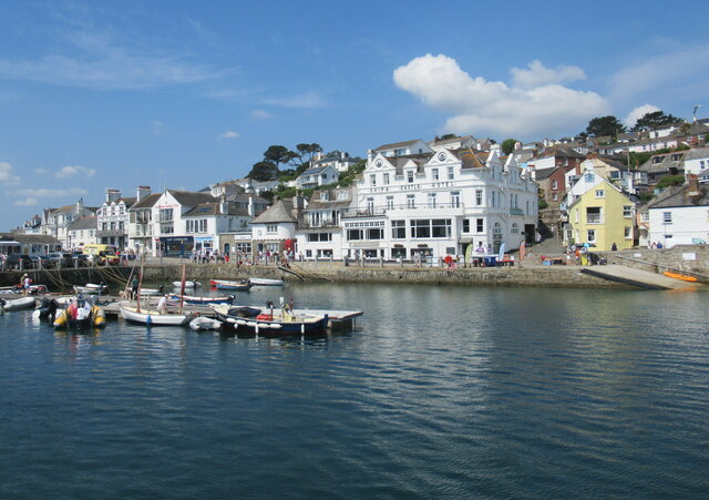
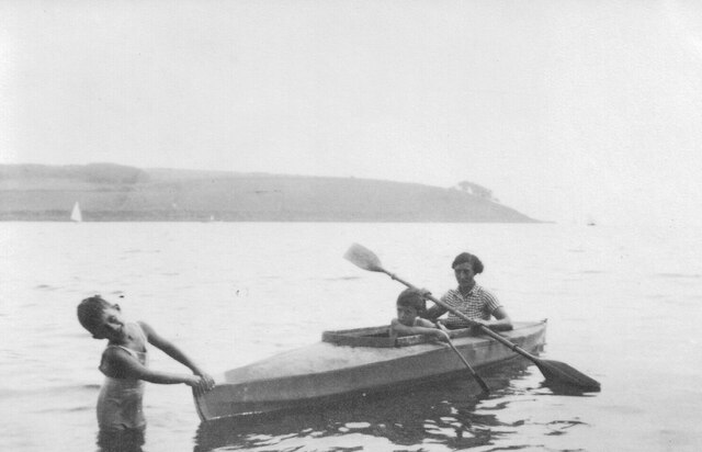
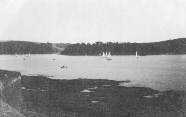
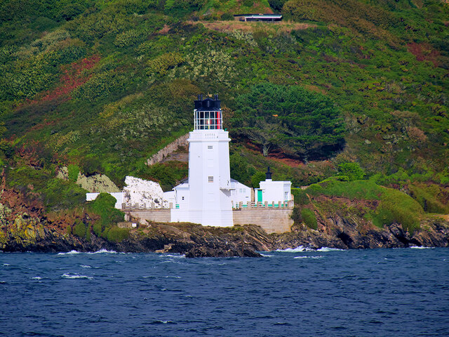
Black Rock Images

Images are sourced within 2km of 50.14543/-5.0332374 or Grid Reference SW8331. Thanks to Geograph Open Source API. All images are credited.

Arriving by ferry at St Mawes
Folbot folding canoe, St Mawes 1938 Folding canoes of fabric over a frame originated with Inuit kayaks. Commercial ones started in Germany with Klepper's Faltboot in 1908. In the UK Jack Kissner started making the Folbot in 1933, and the company continued to 2016. In World War 2 Special Forces used folding canoes, known as cockles, the first ones were based on the Folbot design.
The Folbot in the photo is on Tavern Beach; the photographer was on holiday in "Our Cottage" in Lower Castle Road, just above the beach.
View towards Carricknath Point, as shown in <a href="https://www.geograph.org.uk/photo/29338">SW8432 : Carricknath Point</a>, also a view from St Mawes.
Folbot folding canoe, St Mawes 1938
Folding canoes of fabric over a frame originated with Inuit kayaks. Commercial ones started in Germany with Klepper's Faltboot in 1908. In the UK Jack Kissner started making the Folbot in 1933, and the company continued to 2016. In World War 2 Special Forces used folding canoes, known as cockles, the first ones were based on the Folbot design. The Folbot in the photo is on Tavern Beach; the photographer was on holiday in "Our Cottage" in Lower Castle Road, just above the beach. View towards Carricknath Point, as shown in SW8432 : Carricknath Point, also a view from St Mawes.
Tavern Beach St Mawes with yachts on harbour, 1938 Photo from Lower Castle Road where the photographer was on holiday in "Our Cottage". The sea wall beside the road is seen on the left. Across the estuary is the coast from Carricknath Point to St. Anthony.  A similar recent view is <a href="https://www.geograph.org.uk/photo/774705">SW8432 : St Mawes Harbour, Roseland, Cornwall taken 1964</a>.
Tavern Beach St Mawes with yachts on harbour, 1938
Photo from Lower Castle Road where the photographer was on holiday in "Our Cottage". The sea wall beside the road is seen on the left. Across the estuary is the coast from Carricknath Point to St. Anthony. A similar recent view is SW8432 : St Mawes Harbour, Roseland, Cornwall taken 1964.
Gun emplacement at Pendennis Castle
Black Rock Beacon, Falmouth According to legend, St Mawes, the tenth son of an Irish king was going about his business of preaching one day when he was interrupted by the continued barking of a seal.  His patience ran dry and so, he hurled a large rock at the creature. The rock missed and to this day, so legend says, the rock remains, wedged on top of a cluster of black rocks halfway across the entrance to Falmouth harbour (<span class="nowrap"><a title="https://www.visitfalmouth.com/latest-news/black-rock-falmouth/" rel="nofollow ugc noopener" href="https://www.visitfalmouth.com/latest-news/black-rock-falmouth/">Link</a><img style="margin-left:2px;" alt="External link" title="External link - shift click to open in new window" src="https://s1.geograph.org.uk/img/external.png" width="10" height="10"/></span>  Visit Falmouth).

Black Rock was previously known as Falmouth Rock or Parson’s Rock. During the reign of Charles II, the Rector of Falmouth had a pole erected on Black Rock to warn ships of the danger posed by the isolated rock. The large elm "as thick around as a man" was placed in a hole in the rock and secured by molten lead. A conspicuous red pennant was flown from the pole. Work on building a beacon on the rock began in 1834, three years after St Anthony's lighthouse was built. Masons had to level off a 20-foot square base on the shoal and foundations for the granite structure went six feet down into the rock floor. The conical beacon is 37 foot high, 20 foot wide at the base and four foot wide at its apex. The beacon carries a flashing light with range of three miles (<span class="nowrap"><a title="http://www.falmouthpacket.co.uk/in_port/880436.Rock_lit_up_for_first_time_in_169_years/" rel="nofollow ugc noopener" href="http://www.falmouthpacket.co.uk/in_port/880436.Rock_lit_up_for_first_time_in_169_years/">Link</a><img style="margin-left:2px;" alt="External link" title="External link - shift click to open in new window" src="https://s1.geograph.org.uk/img/external.png" width="10" height="10"/></span>  The Falmouth Packet).
Black Rock Beacon, Falmouth
According to legend, St Mawes, the tenth son of an Irish king was going about his business of preaching one day when he was interrupted by the continued barking of a seal. His patience ran dry and so, he hurled a large rock at the creature. The rock missed and to this day, so legend says, the rock remains, wedged on top of a cluster of black rocks halfway across the entrance to Falmouth harbour (LinkExternal link Visit Falmouth). Black Rock was previously known as Falmouth Rock or Parson’s Rock. During the reign of Charles II, the Rector of Falmouth had a pole erected on Black Rock to warn ships of the danger posed by the isolated rock. The large elm "as thick around as a man" was placed in a hole in the rock and secured by molten lead. A conspicuous red pennant was flown from the pole. Work on building a beacon on the rock began in 1834, three years after St Anthony's lighthouse was built. Masons had to level off a 20-foot square base on the shoal and foundations for the granite structure went six feet down into the rock floor. The conical beacon is 37 foot high, 20 foot wide at the base and four foot wide at its apex. The beacon carries a flashing light with range of three miles (LinkExternal link The Falmouth Packet).
St Anthony's Lighthouse St Anthony's Lighthouse is situated on St Anthony Head, on the eastern side of the entrance to Falmouth harbour. It was built in 1835 by the Chief Engineer of Trinity House to guide shipping away from the Manacles Rocks south of Falmouth Harbour (<span class="nowrap"><a title="https://www.trinityhouse.co.uk/lighthouses-and-lightvessels/st-anthonys-lighthouse" rel="nofollow ugc noopener" href="https://www.trinityhouse.co.uk/lighthouses-and-lightvessels/st-anthonys-lighthouse">Link</a><img style="margin-left:2px;" alt="External link" title="External link - shift click to open in new window" src="https://s1.geograph.org.uk/img/external.png" width="10" height="10"/></span>  Trinity House). It is a Grade II listed building (Historic England List Entry Number: 1136282 <span class="nowrap"><a title="https://historicengland.org.uk/listing/the-list/list-entry/1136282" rel="nofollow ugc noopener" href="https://historicengland.org.uk/listing/the-list/list-entry/1136282">Link</a><img style="margin-left:2px;" alt="External link" title="External link - shift click to open in new window" src="https://s1.geograph.org.uk/img/external.png" width="10" height="10"/></span> )

St Anthony's lighthouse was featured in the UK version of Jim Henson's Fraggle Rock, as "Fraggle Rock Lighthouse" in external scenes.

Today the light is automated, flashing white every 15 seconds
St Anthony's Lighthouse
St Anthony's Lighthouse is situated on St Anthony Head, on the eastern side of the entrance to Falmouth harbour. It was built in 1835 by the Chief Engineer of Trinity House to guide shipping away from the Manacles Rocks south of Falmouth Harbour (LinkExternal link Trinity House). It is a Grade II listed building (Historic England List Entry Number: 1136282 LinkExternal link ) St Anthony's lighthouse was featured in the UK version of Jim Henson's Fraggle Rock, as "Fraggle Rock Lighthouse" in external scenes. Today the light is automated, flashing white every 15 seconds
Balmoral in dry dock at Falmouth Docks
St Mawes Parish Church
Catholic Church of Our Lady Star of the Sea and St Anthony
Former Wesleyan Methodist Chapel
Former Congregational chapel
A train for Truro departing from Falmouth Dock station Two trains are mostly used to provide a half-hourly service on the Falmouth Branch (The Maritime Line), shuttling to and from Truro and passing at Penryn, using a passing loop reinstated in 2009. Many dwellings have been constructed on ex-railway land around the station.
A train for Truro departing from Falmouth Dock station
Two trains are mostly used to provide a half-hourly service on the Falmouth Branch (The Maritime Line), shuttling to and from Truro and passing at Penryn, using a passing loop reinstated in 2009. Many dwellings have been constructed on ex-railway land around the station.
Railway bridge over Bar Road
Spar shop in Bar Road, Falmouth To the right runs a terrace of ex-railway cottages. No mistaking where the harbour is!
Spar shop in Bar Road, Falmouth
To the right runs a terrace of ex-railway cottages. No mistaking where the harbour is!
Path on Pendennis Point A path that leads around the headland at Pendennis Point. It has a fabulous view across the sea.
Path on Pendennis Point
A path that leads around the headland at Pendennis Point. It has a fabulous view across the sea.
Rocks at Pendennis Point Rocky cliffs at Pendennis Point from the footpath. There was significant use of the site during WW2, which the concrete slab alludes to!
Rocks at Pendennis Point
Rocky cliffs at Pendennis Point from the footpath. There was significant use of the site during WW2, which the concrete slab alludes to!
Rocks at Pendennis Point Viewed from on the cliffs, the rocks at Pendennis Point.
Rocks at Pendennis Point
Viewed from on the cliffs, the rocks at Pendennis Point.
Pendennis Head from Pendennis Point Viewed from the path on Pendennis Point, a view over to Falmouth, Pendennis Castle on the hill and the cliffs of the headland.
Pendennis Head from Pendennis Point
Viewed from the path on Pendennis Point, a view over to Falmouth, Pendennis Castle on the hill and the cliffs of the headland.
Show me another place!

Black Rock is located at Grid Ref: SW8331 (Lat: 50.14543, Lng: -5.0332374)

Unitary Authority: Cornwall

Police Authority: Devon and Cornwall

What 3 Words

///shirtless.asked.deflation. Near Falmouth, Cornwall

Nearby Locations

Black Rock

Related Wikis

Carrick Roads

Carrick Roads (Cornish: Dowr Carrek, meaning "rock anchorage") is the estuary of the River Fal on the south coast of Cornwall in England. It joins the...
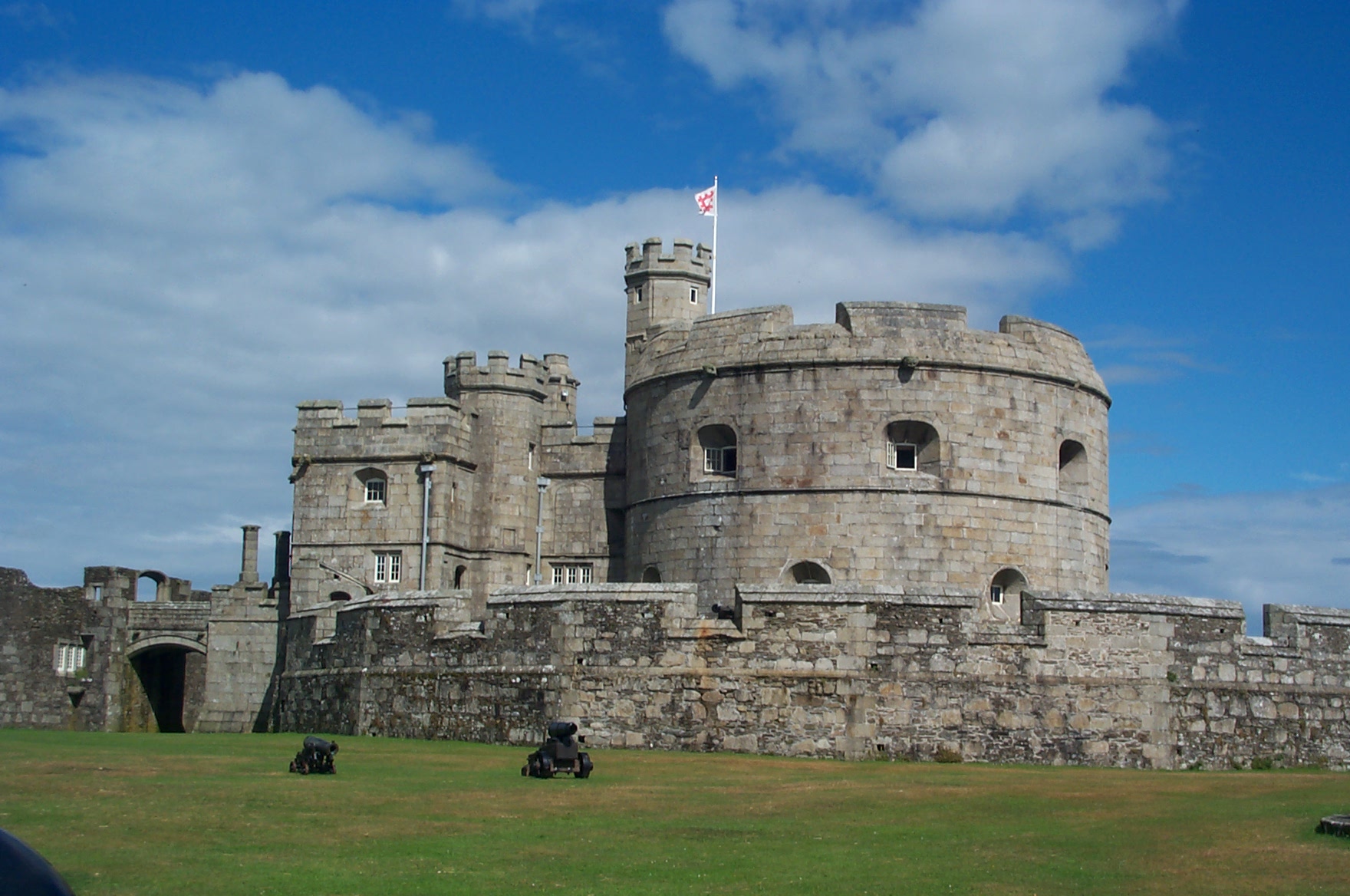
Pendennis Castle

Pendennis Castle (Cornish: Penn Dinas, meaning "headland fortification") is an artillery fort constructed by Henry VIII near Falmouth, Cornwall, England...

Percuil River

The Percuil River is an estuary and stream draining the southern part of the Roseland Peninsula of Cornwall, UK and is one of three major tidal creeks...

SM UB-106

SM UB-106 was a German Type UB III submarine or U-boat in the German Imperial Navy (German: Kaiserliche Marine) during World War I. She was commissioned...

Nearby Amenities

Located within 500m of 50.14543,-5.0332374
Black Rock
Description: Black conical tower
Is In: Cornwall, England, UK
Name Kw: Karrek Reun
Place: locality
Seamark Beacon Isolated Danger Colour: black;red;black
Seamark Beacon Isolated Danger Colour Pattern: horizontal
Seamark Beacon Isolated Danger Shape: tower
Seamark Light Character: Fl
Seamark Light Colour: white
Seamark Light Group: 2
Seamark Light Period: 10
Seamark Light Range: 3
Seamark Topmark Colour: black
Seamark Topmark Shape: 2 spheres
Seamark Type: beacon_isolated_danger
Lat/Long: 50.1453185/-5.0333228
Seamark Buoy Lateral Category: port
Seamark Buoy Lateral Colour: red
Seamark Buoy Lateral Shape: pillar
Seamark Buoy Lateral System: iala-a
Seamark Light Character: Fl
Seamark Light Colour: red
Seamark Light Period: 2.5
Seamark Name: Black Rock
Seamark Topmark Colour: red
Seamark Topmark Shape: cylinder
Seamark Type: buoy_lateral
Lat/Long: 50.1450777/-5.029244
The data included in this document is from www.openstreetmap.org. The data is made available under ODbL.

Have you been to Black Rock?

Leave your review of Black Rock below (or comments, questions and feedback).