Eilean Ràrsaidh

Island in Inverness-shire

Scotland

Eilean Ràrsaidh

The road to Arnisdale
The road to Arnisdale Credit: David Medcalf

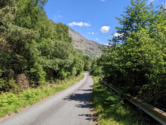
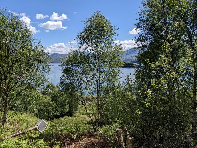
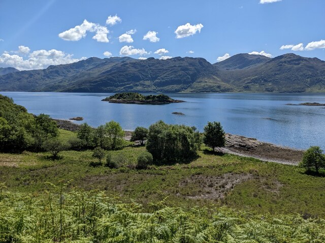
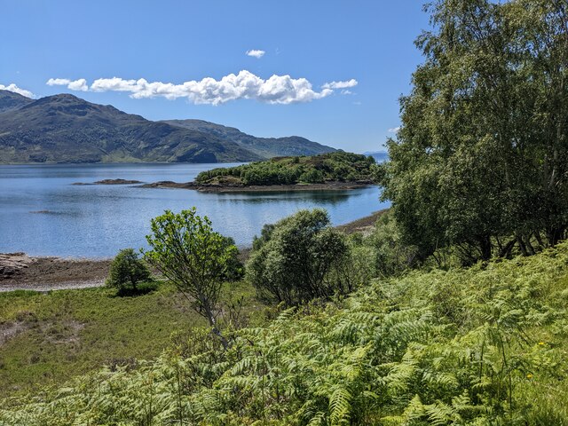
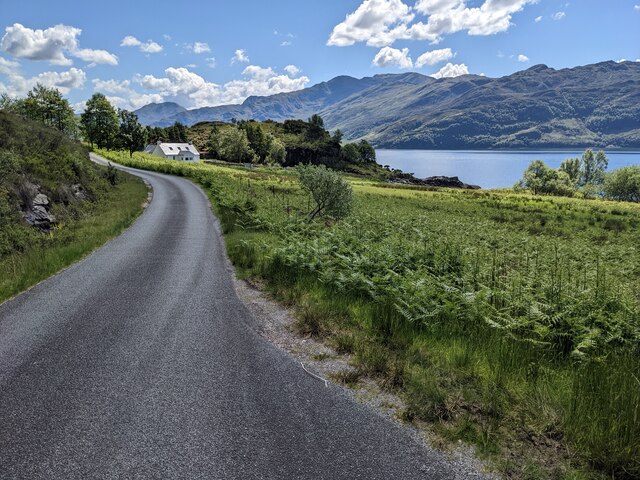
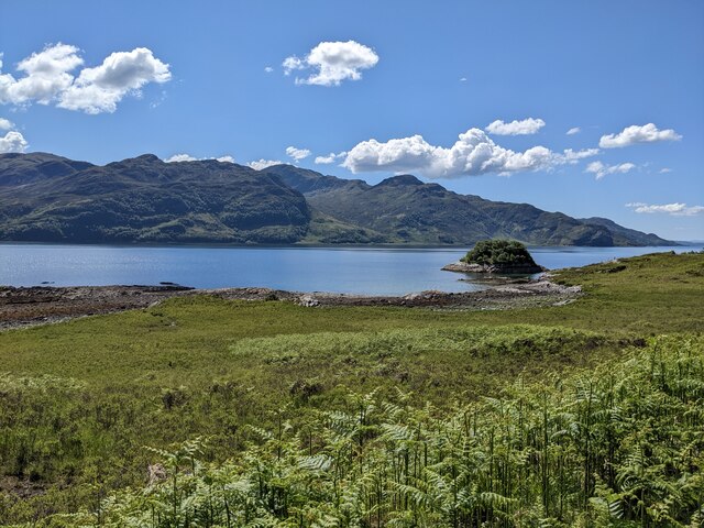
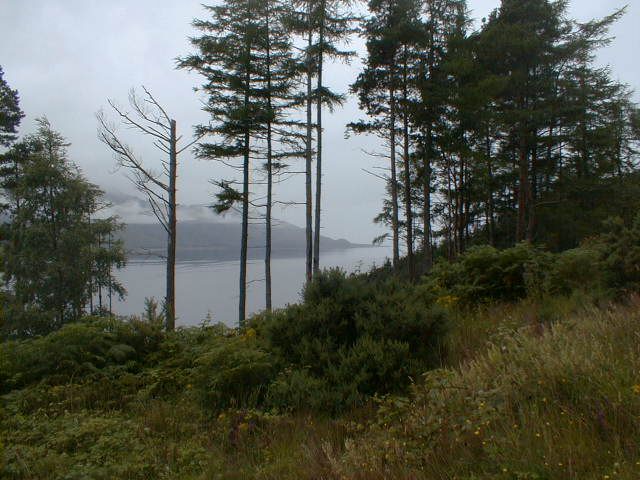
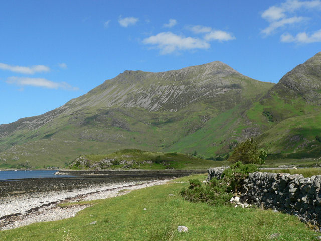
Eilean Ràrsaidh is a small island located in Inverness-shire, Scotland. Situated in the stunning Loch Maree, it is one of many islands that dot the picturesque waters of this iconic Scottish loch. The island covers an area of approximately 1.5 hectares and is accessible by boat.

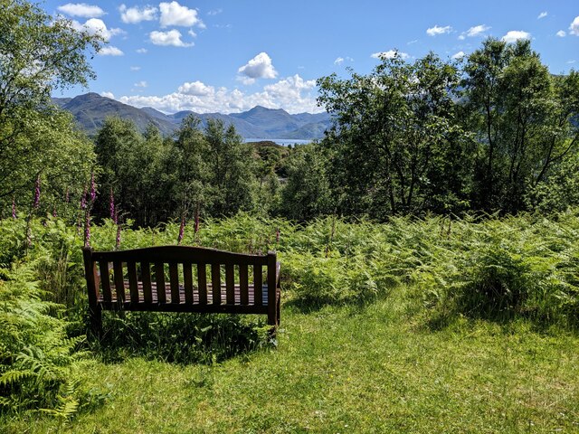
Eilean Ràrsaidh is known for its rugged and untouched natural beauty. The island is covered in dense woodland, with tall trees providing a canopy of greenery. It is also home to a diverse range of wildlife, making it a popular spot for nature enthusiasts. Visitors can spot various bird species, including eagles and ospreys, as well as deer and other mammals that roam the island.

The island's history is also of great interest to many. It is believed to have been inhabited for centuries, with ancient ruins and burial sites discovered on the island. These remnants tell a story of the people who once called Eilean Ràrsaidh home.

For those seeking tranquility and a break from the hustle and bustle of daily life, Eilean Ràrsaidh offers a peaceful retreat. Visitors can explore the island's walking trails, taking in the breathtaking views of the surrounding loch and mountains. There are also opportunities for fishing and boating in the crystal-clear waters.

Overall, Eilean Ràrsaidh is a hidden gem in Inverness-shire, offering a unique blend of natural beauty and historical significance.

If you have any feedback on the listing, please let us know in the comments section below.

Eilean Ràrsaidh Images

Images are sourced within 2km of 57.143179/-5.6174913 or Grid Reference NG8111. Thanks to Geograph Open Source API. All images are credited.

The road to Arnisdale
Thick vegetation above the road
Trees above the Arnisdale road
Trees and rocks above the road
A good view of trees I think the bench was placed before the trees grew so tall.
A good view of trees
I think the bench was placed before the trees grew so tall.
Looking through the trees to Eilean Ràrsaidh
Looking towards Eilean a' Chuilinn
Looking towards Eilean Ràrsaidh
The road near Ràrsaidh
Bracken by the road above Camas Driseach The small island is Eilean Ràrsaidh.
Bracken by the road above Camas Driseach
The small island is Eilean Ràrsaidh.
Dip in the woodland giving view across Loch Hourn
Looking west on Loch Hourn
A glimpse of Knoydart A gap in the trees along the shores of Loch Hourn afford a glimpse of Knoydart.
A glimpse of Knoydart
A gap in the trees along the shores of Loch Hourn afford a glimpse of Knoydart.
View of Loch Hourn Taken from small layby off road after curving around Mam an Staing. May 2009
View of Loch Hourn
Taken from small layby off road after curving around Mam an Staing. May 2009
Blair a' Chaisteil Forestry with a lot of standing dead timber - was there once a fire here?
Blair a' Chaisteil
Forestry with a lot of standing dead timber - was there once a fire here?
Road from Arnisdale to Glenelg
Show me another place!

Eilean Ràrsaidh is located at Grid Ref: NG8111 (Lat: 57.143179, Lng: -5.6174913)

Unitary Authority: Highland

Police Authority: Highlands and Islands

What 3 Words

///mixing.arch.tailors. Near Glenelg, Highland

Related Wikis

Loch Hourn

Loch Hourn (Scottish Gaelic: Loch Shubhairne) is a sea loch which separates the peninsulas of Glenelg to the north and Knoydart to the south, on the west...

Beinn Sgritheall

Beinn Sgritheall or Beinn an Sgrithill (Scottish Gaelic for 'scree mountain'), also anglicized Ben Sgriol, is the highest mountain on the Glenelg peninsula...

Arnisdale

Arnisdale (Scottish Gaelic: Àrnasdal) is a hamlet in the historic county of Inverness-shire in the local authority area of Highlands of Scotland. It lies...

Arnisdale Free Church

Arnisdale Free Church is a church building at one time connected to the Free Church of Scotland. It is sited in Arnisdale, Inverness-shire, Scotland. According...

Nearby Amenities

Located within 500m of 57.143179,-5.6174913
Source: PGS
Lat/Long: 57.1418002/-5.6187847
Source: PGS
Lat/Long: 57.1416556/-5.6191237
Source: PGS
Lat/Long: 57.141747/-5.6195133
Source: PGS
Lat/Long: 57.141869/-5.6197563
Source: PGS
Lat/Long: 57.141892/-5.619974
Source: PGS
Lat/Long: 57.1420082/-5.6202865
Source: PGS
Lat/Long: 57.14226/-5.6207463
Source: PGS
Lat/Long: 57.1424774/-5.6207317
Source: PGS
Lat/Long: 57.1426446/-5.62098
Source: PGS
Lat/Long: 57.1428447/-5.6212791
Source: PGS
Lat/Long: 57.143247/-5.6212673
Source: PGS
Lat/Long: 57.143394/-5.6203353
Source: PGS
Lat/Long: 57.143659/-5.6198833
Source: PGS
Lat/Long: 57.143935/-5.6189603
Source: PGS
Lat/Long: 57.14422/-5.6175673
Source: PGS
Lat/Long: 57.144486/-5.6171143
Source: PGS
Lat/Long: 57.144505/-5.6161733
Source: PGS
Lat/Long: 57.1443031/-5.6156001
Source: PGS
Lat/Long: 57.1442703/-5.6150673
Source: PGS
Lat/Long: 57.1440666/-5.6147041
Source: PGS
Lat/Long: 57.1438367/-5.6141834
Source: PGS
Lat/Long: 57.1431141/-5.6143892
Source: PGS
Lat/Long: 57.1429236/-5.6147041
Source: PGS
Lat/Long: 57.1428053/-5.6151279
Source: PGS
Lat/Long: 57.1429498/-5.6156849
Source: PGS
Lat/Long: 57.142825/-5.6162176
Source: PGS
Lat/Long: 57.1424046/-5.6162661
Source: PGS
Lat/Long: 57.1422666/-5.6165204
Source: PGS
Lat/Long: 57.141928/-5.6169343
Source: PGS
Lat/Long: 57.1421352/-5.6178281
Source: PGS
Lat/Long: 57.141971/-5.6182761
Source: PGS
Lat/Long: 57.1410353/-5.6103806
Source: PGS
Lat/Long: 57.14503/-5.6248385
Source: PGS
Lat/Long: 57.1449252/-5.6241617
Source: PGS
Lat/Long: 57.1448991/-5.6239494
Source: PGS
Lat/Long: 57.1449081/-5.6226229
Source: PGS
Lat/Long: 57.1449367/-5.6222145
Source: PGS
Lat/Long: 57.145014/-5.6221117
Source: PGS
Lat/Long: 57.1452027/-5.6215357
Source: PGS
Lat/Long: 57.1455393/-5.6201226
Source: PGS
Lat/Long: 57.1455609/-5.619979
Source: PGS
Lat/Long: 57.1456263/-5.6196951
Source: PGS
Lat/Long: 57.1459601/-5.6186311
Source: PGS
Lat/Long: 57.1460645/-5.6179139
Source: PGS
Lat/Long: 57.1459081/-5.6158245
Source: PGS
Lat/Long: 57.1456616/-5.613598
Source: PGS
Lat/Long: 57.1457357/-5.6120015
Created By: almien_coastlines
Source: PGS
Lat/Long: 57.145114/-5.610044
Barrier: cattle_grid
Source: survey
Lat/Long: 57.1460943/-5.6220139
Power: pole
Lat/Long: 57.1470606/-5.6155431
Power: pole
Lat/Long: 57.1469356/-5.617004
Power: pole
Lat/Long: 57.1468279/-5.6183787
Power: pole
Lat/Long: 57.1467131/-5.619849
Power: pole
Lat/Long: 57.1466033/-5.6212817
Power: pole
Lat/Long: 57.1463585/-5.6220047
Power: pole
Lat/Long: 57.146077/-5.62284
The data included in this document is from www.openstreetmap.org. The data is made available under ODbL.

Have you been to Eilean Ràrsaidh?

Leave your review of Eilean Ràrsaidh below (or comments, questions and feedback).