An Garbh-Eilean

Island in Ross-shire

Scotland

An Garbh-Eilean

The edge of Reraig Forest The temperate rainforest provides perfect conditions for moss which covers almost every surface.
The edge of Reraig Forest Credit: Doug Lee

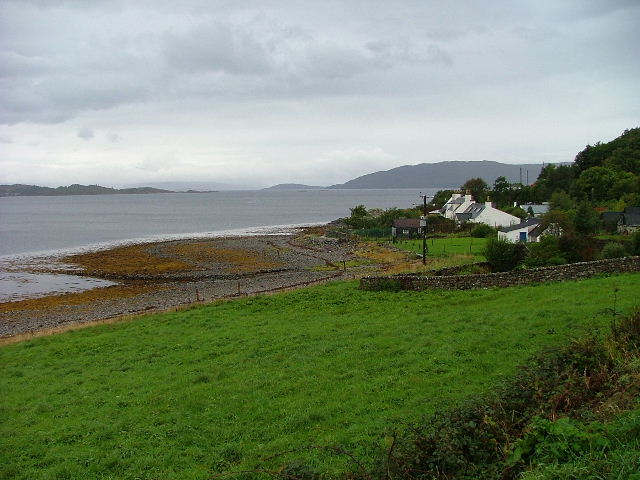
An Garbh-Eilean, also known as the Rough Island, is a small island located in Ross-shire, Scotland. It is situated in the Inner Sound, between the Isle of Skye and the mainland. The island covers an area of approximately 1.5 square kilometers and is primarily composed of rugged terrain, hence the name.

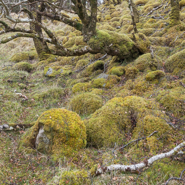
The landscape of An Garbh-Eilean is characterized by rocky cliffs, heather-covered hills, and small pebble beaches. It is a haven for wildlife, with various species of seabirds, including puffins, gannets, and guillemots, nesting on its cliffs. Seals and dolphins can often be spotted in the surrounding waters.

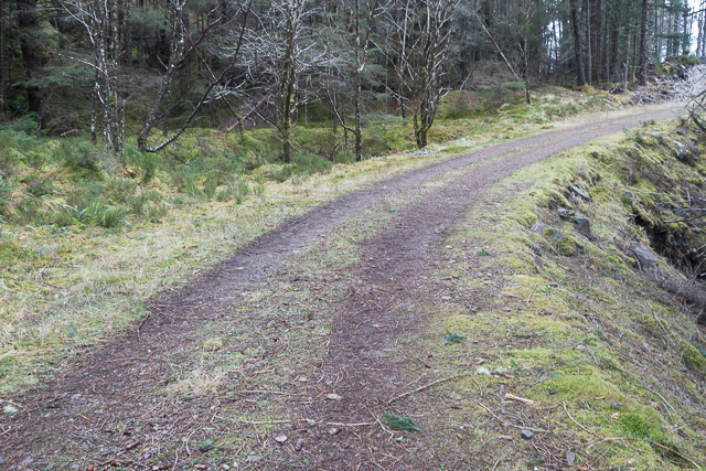
Access to An Garbh-Eilean is limited due to its remote location, and there are no permanent residents on the island. However, it is a popular destination for hikers and nature enthusiasts who visit to enjoy its unspoiled beauty and tranquility. The island offers stunning panoramic views of the surrounding sea and neighboring islands, making it a photographer's paradise.

Historically, An Garbh-Eilean was used for grazing sheep and cattle, and evidence of ancient settlements can still be found, including the remains of stone walls and structures. It is also believed to have been a site of early Christian worship, with a small chapel dedicated to St. Cormac located on the island.

Overall, An Garbh-Eilean is a rugged and picturesque island, offering visitors a glimpse into the remote and wild beauty of the Scottish Highlands.

If you have any feedback on the listing, please let us know in the comments section below.

An Garbh-Eilean Images

Images are sourced within 2km of 57.370477/-5.6465543 or Grid Reference NG8036. Thanks to Geograph Open Source API. All images are credited.

The edge of Reraig Forest The temperate rainforest provides perfect conditions for moss which covers almost every surface.
The edge of Reraig Forest
The temperate rainforest provides perfect conditions for moss which covers almost every surface.
Moss covered rocks and trees at the edge of Reraig Forest The wet and undisturbed conditions within the forest provide the perfect conditions for moss - and it grows everywhere
Moss covered rocks and trees at the edge of Reraig Forest
The wet and undisturbed conditions within the forest provide the perfect conditions for moss - and it grows everywhere
Within Reraig Forest Reraig Forest was planted in 1913.  At various places within the forest you can find evidence of pre-forest structures such as the partially standing wall shown in this photo.  All such walls are thoroughly covered by moss which has prospered in the still, damp conditions within the forest.

The local estate run guided tours of some of the forest, as we found when chatting to the gamekeeper at the end of the day. Anyone wanting to view the interior of the forest would be well advised to go on such a tour unless you are very sure of your ability to navigate in very dense wooded areas.  We're pretty good in such conditions but even so ended up with a somewhat suboptimal route through the trees with a couple of steep sections which might be a little off-putting to some people.
Within Reraig Forest
Reraig Forest was planted in 1913. At various places within the forest you can find evidence of pre-forest structures such as the partially standing wall shown in this photo. All such walls are thoroughly covered by moss which has prospered in the still, damp conditions within the forest. The local estate run guided tours of some of the forest, as we found when chatting to the gamekeeper at the end of the day. Anyone wanting to view the interior of the forest would be well advised to go on such a tour unless you are very sure of your ability to navigate in very dense wooded areas. We're pretty good in such conditions but even so ended up with a somewhat suboptimal route through the trees with a couple of steep sections which might be a little off-putting to some people.
Hillside within Reraig Forest The forest was planted in 1913.  Other than the infrequently used tracks marked on the OS maps there are no paths through the forest.
Hillside within Reraig Forest
The forest was planted in 1913. Other than the infrequently used tracks marked on the OS maps there are no paths through the forest.
Track in Reraig Forest
Forestry track towards Achintaid
Curve in the forestry track
The track to Camasdoun
Skerries south of Kishorn Island
Shore, Loch Kishorn
Shore, Loch Kishorn
Forest track by Faoline
Islands off Rubha na h-Airde The most prominent of the islands in this shot is An Garbh-Eilean.
Islands off Rubha na h-Airde
The most prominent of the islands in this shot is An Garbh-Eilean.
Lochan below Aonach Pairc Dhùghaill
Twisted oak, Meall na h-Àirde Not the spreading oak of southern forests and parks, this tree shows how an exposed site will lead a tree to seek protection from the wind by hugging close to the slope.
Twisted oak, Meall na h-Àirde
Not the spreading oak of southern forests and parks, this tree shows how an exposed site will lead a tree to seek protection from the wind by hugging close to the slope.
Rocky outcrop to the south of Meall na h-Àirde
Rubha na h-Àirde The point of land at the end of Loch Kishorn, with Kishorn Island just out of sight.

Rubha na h-Àirde roughly means "headland of the point" - almost a tautology.

This view is from Coire na Ba (corrie of the cattle?) with the steep sandstone cliffs of the corrie to the side.
Rubha na h-Àirde
The point of land at the end of Loch Kishorn, with Kishorn Island just out of sight. Rubha na h-Àirde roughly means "headland of the point" - almost a tautology. This view is from Coire na Ba (corrie of the cattle?) with the steep sandstone cliffs of the corrie to the side.
Deserted Clachan Probably abandoned in the late nineteenth century, this small settlement of three houses sits on a rocky cliff overlooking the Kishorn Islands to the west of Achintraid.
Deserted Clachan
Probably abandoned in the late nineteenth century, this small settlement of three houses sits on a rocky cliff overlooking the Kishorn Islands to the west of Achintraid.
Show me another place!

An Garbh-Eilean is located at Grid Ref: NG8036 (Lat: 57.370477, Lng: -5.6465543)

Unitary Authority: Highland

Police Authority: Highlands and Islands

What 3 Words

///executive.keener.sentences. Near Lochcarron, Highland

Related Wikis

Loch Kishorn

Loch Kishorn (Scottish Gaelic: Ciseòrn) is a sea loch in the north-west Highlands of Scotland. Kishorn is a collective name used to refer to a group of...

Ardaneaskan

Ardaneaskan (Scottish Gaelic: Àird nan Easgann) is a village on the north shore of Loch Carron in Strathcarron, Ross-shire, in Highland, and is within...

Achintraid

Achintraid (Scottish Gaelic: Achadh na Tràghad) is a small one-time crofting township, situated at the north-eastern end of the sea loch Loch Kishorn,...

Plockton

Plockton (Scottish Gaelic: Am Ploc/Ploc Loch Aillse) is a village in the Lochalsh, Wester Ross area of the Scottish Highlands with a 2020 population of...

Nearby Amenities

Located within 500m of 57.370477,-5.6465543
Source: PGS
Lat/Long: 57.3727732/-5.6393855
Created By: almien_coastlines
Source: PGS
Lat/Long: 57.372587/-5.639226
Source: PGS
Lat/Long: 57.3723407/-5.6390136
The data included in this document is from www.openstreetmap.org. The data is made available under ODbL.

Have you been to An Garbh-Eilean?

Leave your review of An Garbh-Eilean below (or comments, questions and feedback).