Bradley, Little

Settlement in Suffolk West Suffolk

England

Bradley, Little

Private road to Dearsley's Farm and Norley Moat House only Things have changed since this view <a href="https://www.geograph.org.uk/photo/201654">TL7051 : Track to Little Bradley Farm</a> .
Private road to Dearsley's Farm and Norley Moat House only Credit: Robin Webster

Bradley, Little is a small village located in the county of Suffolk, England. Situated approximately five miles southeast of the market town of Stowmarket, it falls within the Mid Suffolk district. The village is surrounded by picturesque countryside, with rolling hills and meandering streams, making it an attractive destination for nature lovers and those seeking a peaceful retreat.

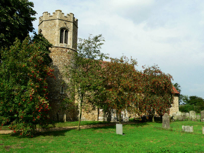
With a population of around 300 residents, Bradley, Little exudes a close-knit community feel. The village is characterized by charming traditional cottages and well-maintained gardens, giving it a quintessentially English village ambiance. The St Mary's Church, a beautiful medieval church dating back to the 14th century, stands as a prominent landmark in the area, adding to the village's historical charm.

Despite its small size, Bradley, Little boasts several amenities for its residents. The village has a primary school, providing education for local children, and a village hall that serves as a hub for community events and gatherings. Additionally, there is a local pub where residents and visitors can enjoy a pint of ale or a hearty meal.

The village is well-connected to neighboring areas, with good road links to Stowmarket and other nearby towns. This allows residents to easily access a wider range of amenities, such as supermarkets, shops, and leisure facilities.

Overall, Bradley, Little offers a tranquil and idyllic setting for those seeking a rural lifestyle, while still being within reach of the conveniences of nearby towns. Its sense of community and natural beauty make it an appealing place to call home.

If you have any feedback on the listing, please let us know in the comments section below.

Bradley, Little Images

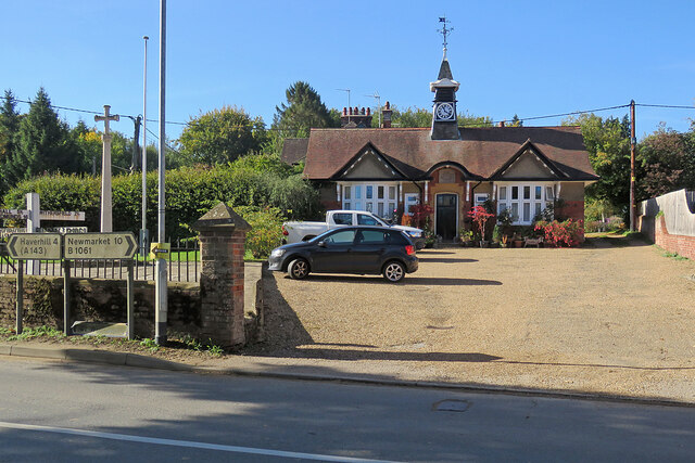
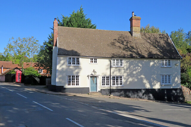
Images are sourced within 2km of 52.141345/0.45597982 or Grid Reference TL6852. Thanks to Geograph Open Source API. All images are credited.

Private road to Dearsley's Farm and Norley Moat House only Things have changed since this view <a href="https://www.geograph.org.uk/photo/201654">TL7051 : Track to Little Bradley Farm</a> .
Private road to Dearsley's Farm and Norley Moat House only
Things have changed since this view TL7051 : Track to Little Bradley Farm .
Broad Road looking east Rather alarming skid marks here!
Broad Road looking east
Rather alarming skid marks here!
Track to Little Bradley Farm A sign on the gatepost indicates that this track is also a permissive path to the village of Little Bradley.
Track to Little Bradley Farm
A sign on the gatepost indicates that this track is also a permissive path to the village of Little Bradley.
Little Thurlow: up Temple End Road A fine October morning.
Little Thurlow: up Temple End Road
A fine October morning.
Little Thurlow: 17th-century brick This fine Grade II* listed red-brick house was built in 1614 as a school by Sir Stephen Soame.
Little Thurlow: 17th-century brick
This fine Grade II* listed red-brick house was built in 1614 as a school by Sir Stephen Soame.
Little Thurlow: The Cock and The Street The Cock is a "C17 timber-framed and plastered house, refronted in the C18 and renovated in the C20" (Grade II listing). It has a new stylised sign, replacing the more traditional one shown in Robert Edwards' <a href="https://www.geograph.org.uk/photo/506396">TL6750 : The village of Little Thurlow</a> (2007). Manor Farmhouse, the 17th-century brick house on the right, is also Grade II listed.
Little Thurlow: The Cock and The Street
The Cock is a "C17 timber-framed and plastered house, refronted in the C18 and renovated in the C20" (Grade II listing). It has a new stylised sign, replacing the more traditional one shown in Robert Edwards' TL6750 : The village of Little Thurlow (2007). Manor Farmhouse, the 17th-century brick house on the right, is also Grade II listed.
Little Thurlow: plaster and thatch This is one of a number of Grade II listed 17th-century timber-framed houses in the village.
Little Thurlow: plaster and thatch
This is one of a number of Grade II listed 17th-century timber-framed houses in the village.
Little Thurlow: north along The Street Some of a good number of Grade II listed timber-framed houses in the village.
Little Thurlow: north along The Street
Some of a good number of Grade II listed timber-framed houses in the village.
Great Thurlow: The Old Reading Room and War Memorial The Reading Room is dated 1903.
Great Thurlow: The Old Reading Room and War Memorial
The Reading Room is dated 1903.
Great Thurlow: at the corner of Bury Road Looking along The Street. The Grade II listed house on the right was once a pub, The Rose and Crown.
Great Thurlow: at the corner of Bury Road
Looking along The Street. The Grade II listed house on the right was once a pub, The Rose and Crown.
Great Thurlow: All Saints "The impression of the church is entirely Perp. W tower with higher stair-turret and a pretty lead spirelet" (Nikolaus Pevsner). "Church dull," wrote Norman Scarfe in the Shell Guide (1960). The picture was taken over the hedge from Bury Road on a sparkling October morning.
Great Thurlow: All Saints
"The impression of the church is entirely Perp. W tower with higher stair-turret and a pretty lead spirelet" (Nikolaus Pevsner). "Church dull," wrote Norman Scarfe in the Shell Guide (1960). The picture was taken over the hedge from Bury Road on a sparkling October morning.
Great Thurlow: cottages on Bury Road Grade II listed 17th- and 18th-century cottages opposite the parish church on Bury Road.
Great Thurlow: cottages on Bury Road
Grade II listed 17th- and 18th-century cottages opposite the parish church on Bury Road.
Great Thurlow: in the churchyard Grade II listed 17th- and 18th-century cottages opposite the parish church on Bury Road. The barn on the right is also Grade II listed.
Great Thurlow: in the churchyard
Grade II listed 17th- and 18th-century cottages opposite the parish church on Bury Road. The barn on the right is also Grade II listed.
Great Thurlow: ford and bridge on Bury Road This is the River Stour, not many meandering miles from its source near Weston Colville, over the county boundary in Cambridgeshire. It doesn't look as if the ford is much used. Nikolaus Pevsner was taken by the cast-iron railings on the bridge, but they don't show well from this angle.
Great Thurlow: ford and bridge on Bury Road
This is the River Stour, not many meandering miles from its source near Weston Colville, over the county boundary in Cambridgeshire. It doesn't look as if the ford is much used. Nikolaus Pevsner was taken by the cast-iron railings on the bridge, but they don't show well from this angle.
Great Thurlow: once a public house This handsome 17th-century timber-framed house was once The Rose & Crown. For the listing, and an interesting historical photo, see <span class="nowrap"><a title="https://britishlistedbuildings.co.uk/101181908-rose-and-crown-public-house-great-thurlow#.Y0bEji0w0t_" rel="nofollow ugc noopener" href="https://britishlistedbuildings.co.uk/101181908-rose-and-crown-public-house-great-thurlow#.Y0bEji0w0t_">Link</a><img style="margin-left:2px;" alt="External link" title="External link - shift click to open in new window" src="https://s1.geograph.org.uk/img/external.png" width="10" height="10"/></span> .
Great Thurlow: once a public house
This handsome 17th-century timber-framed house was once The Rose & Crown. For the listing, and an interesting historical photo, see LinkExternal link .
Great Thurlow: signposts, stacks and thatch This is where the road from Withersfield meets The Street (left) and Wratting Road (right). The Grade II listed thatched house dates from the 17th century.
Great Thurlow: signposts, stacks and thatch
This is where the road from Withersfield meets The Street (left) and Wratting Road (right). The Grade II listed thatched house dates from the 17th century.
The road to Cowlinge East of East Green on the way from Great Bradley.
The road to Cowlinge
East of East Green on the way from Great Bradley.
East Green: Three Tuns As its name suggests, this house on the road from Cowlinge to Great Bradley (right) was once a public house. <a href="https://www.geograph.org.uk/photo/47860">TL6853 : Former 'Three Tuns' pub, East Green, Great Bradley, Suffolk</a> (2004) shows the previous roof.
East Green: Three Tuns
As its name suggests, this house on the road from Cowlinge to Great Bradley (right) was once a public house. TL6853 : Former 'Three Tuns' pub, East Green, Great Bradley, Suffolk (2004) shows the previous roof.
Show me another place!

Bradley, Little is located at Grid Ref: TL6852 (Lat: 52.141345, Lng: 0.45597982)

Administrative County: Suffolk

District: West Suffolk

Police Authority: Suffolk

What 3 Words

///supposed.stencil.technical. Near Kedington, Suffolk

Related Wikis

Little Bradley

Little Bradley is a small village and civil parish in the West Suffolk district, in the county of Suffolk, England. According to Eilert Ekwall, the meaning...

Castle Newnham School

Castle Newnham School is a coeducational all-through school located over two sites in Bedford, Bedfordshire, England. The school was formed in January...

Little Thurlow Green

Little Thurlow Green is a hamlet in the West Suffolk district, in the county of Suffolk. Nearby settlements include the town of Haverhill and the villages...

Little Thurlow

Little Thurlow is a village and civil parish in the West Suffolk district of Suffolk in eastern England, located around a mile north-east of its sister...

Nearby Amenities

Located within 500m of 52.141345,0.45597982
Post Box
Collection Times: Mo-Fr 16:45; Sa 10:15
Operator: Royal Mail
Post Box Type: lamp
Ref: CB9 50
Royal Cypher: EIIR
Royal Cypher Wikidata: Q33102113
Source: survey
Lat/Long: 52.1410164/0.4551227
Little Bradley
Is In: Suffolk, England, UK
Place: village
Source Name: dictaphone
Wikidata: Q2035425
Lat/Long: 52.1409669/0.4554908
Bus Stop
Village Noticeboard
Naptan AtcoCode: 390050158
Naptan Bearing: NE
Naptan BusStopType: CUS
Naptan CommonName: Village Noticeboard
Naptan Indicator: o/s
Naptan Landmark: Village Noticeboard
Naptan NaptanCode: sufgdmja
Naptan Street: The Green
Naptan Verified: no
Source: naptan_import
Lat/Long: 52.1410875/0.455157
The data included in this document is from www.openstreetmap.org. The data is made available under ODbL.

Have you been to Bradley, Little?

Leave your review of Bradley, Little below (or comments, questions and feedback).