Ebber Rocks

Island in Cornwall

England

Ebber Rocks

Coverack - The harbour from The Cove Coverack is a charming little coast village on the eastern side of the Lizard peninsula. This view of the harbour is from near the end of the B3294 by the Paris Hotel.
Coverack - The harbour from The Cove Credit: Rob Farrow

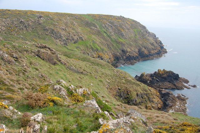
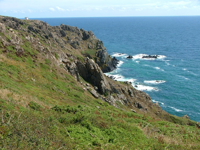
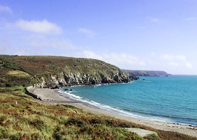
Ebber Rocks is a small island located off the coast of Cornwall, England. Situated in the Atlantic Ocean, it is part of the Isles of Scilly archipelago. The island is known for its rugged and rocky landscape, giving it its distinctive name.

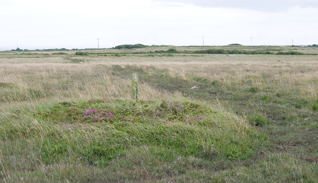
Covering a land area of approximately 10 acres, Ebber Rocks is predominantly made up of granite, which is characteristic of the region. The island is uninhabited and lacks any significant vegetation, with only a few hardy plants managing to survive in the harsh coastal environment.

Despite its small size, Ebber Rocks boasts a rich diversity of marine life. The surrounding waters are teeming with a variety of fish species, making it a popular spot for fishing enthusiasts. The island is also home to an array of seabirds, including gulls, cormorants, and puffins, which nest on the rocky cliffs.

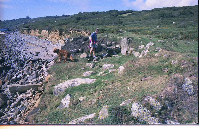
Access to Ebber Rocks is limited due to its remote location and treacherous waters. However, it can be reached by boat during low tide, providing an opportunity for visitors to explore its rocky shores and observe the wildlife. The island's isolation and rugged beauty make it a popular destination for nature lovers and photographers looking to capture its unique charm.

Overall, Ebber Rocks offers a glimpse into the raw and untamed beauty of Cornwall's coastline. Its rocky terrain, diverse marine life, and remote location make it a captivating destination for those seeking an off-the-beaten-path adventure.

If you have any feedback on the listing, please let us know in the comments section below.

Ebber Rocks Images

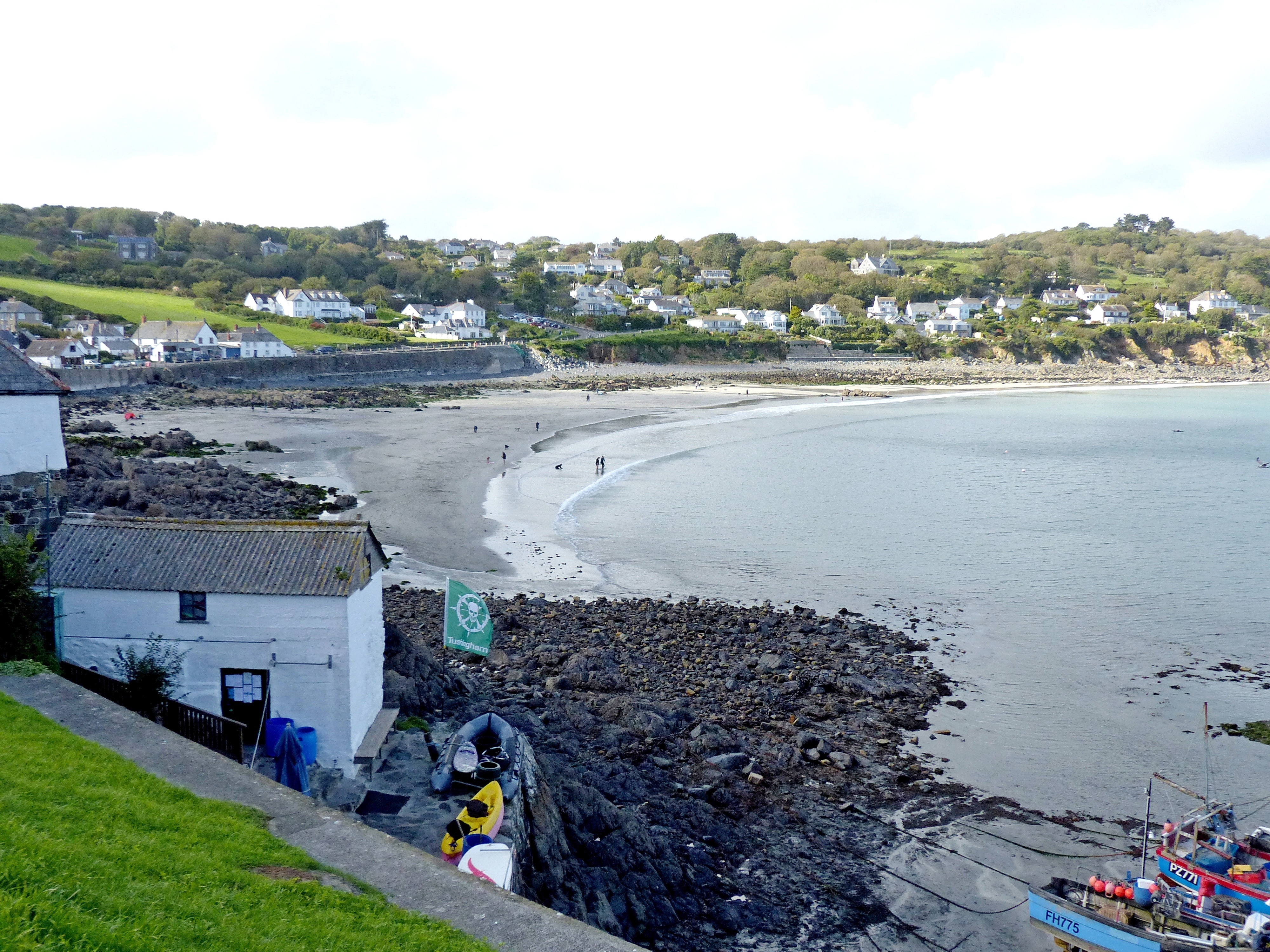
Images are sourced within 2km of 50.007717/-5.0976687 or Grid Reference SW7816. Thanks to Geograph Open Source API. All images are credited.

Coverack - The harbour from The Cove Coverack is a charming little coast village on the eastern side of the Lizard peninsula. This view of the harbour is from near the end of the B3294 by the Paris Hotel.
Coverack - The harbour from The Cove
Coverack is a charming little coast village on the eastern side of the Lizard peninsula. This view of the harbour is from near the end of the B3294 by the Paris Hotel.
Old fenceposts at Chynhalls Point
Coverack Harbour Spring sunshine giving the water a bright blue hue.
Coverack Harbour
Spring sunshine giving the water a bright blue hue.
On Black Head Gorse and rocks fringe the coastal footpath.
On Black Head
Gorse and rocks fringe the coastal footpath.
Rock Formation near Treleaver This rock formation is by the coastal path just before it descends towards Beagles Hole.
Rock Formation near Treleaver
This rock formation is by the coastal path just before it descends towards Beagles Hole.
View from Beagles Point Taken from the coastal path at Beagles Point, looking down on Beagles Hole and Meludjack with the headland of The Bees and Pedn Boar beyond.
View from Beagles Point
Taken from the coastal path at Beagles Point, looking down on Beagles Hole and Meludjack with the headland of The Bees and Pedn Boar beyond.
Downas Cove From Beagles Point, looking down on the cove with Carrick Luz beyond.
Downas Cove
From Beagles Point, looking down on the cove with Carrick Luz beyond.
Downas Cove Taking by the stream which flows through Downas Valley and into the sea at the cove.
Downas Cove
Taking by the stream which flows through Downas Valley and into the sea at the cove.
Downas Cove Looking down on the cove from The Gaider.
Downas Cove
Looking down on the cove from The Gaider.
Beach and harbour, Coverack
Coverack Harbour The west-facing Coverack Harbour hosts around 40 boats.
Coverack Harbour
The west-facing Coverack Harbour hosts around 40 boats.
Coverack War Memorial A granite cross in  the churchyard of St Peter's Church.
Coverack War Memorial
A granite cross in the churchyard of St Peter's Church.
High water at Coverack A combination of high tide and a heavy swell lead to waves breaking over the sea wall in Coverack.
High water at Coverack
A combination of high tide and a heavy swell lead to waves breaking over the sea wall in Coverack.
St Peter's Church, Coverack 19th century church overlooking Coverack Cove, with a simple wooden lych gate at its entrance.
St Peter's Church, Coverack
19th century church overlooking Coverack Cove, with a simple wooden lych gate at its entrance.
St Peter's Church, Coverack 19th century church overlooking Coverack Cove.
St Peter's Church, Coverack
19th century church overlooking Coverack Cove.
St Peter's Church, Coverack 19th century church overlooking Coverack Cove.
St Peter's Church, Coverack
19th century church overlooking Coverack Cove.
Cottages in Coverack A group of cottages in Coverack.  The two thatched buildings on the left, Carndu and Trevarrow, date from the early 19th century and are grade II listed - see <span class="nowrap"><a title="www.historicengland.org.uk/listing/the-list/list-entry/1328528" rel="nofollow ugc noopener" href="http://www.historicengland.org.uk/listing/the-list/list-entry/1328528">Link</a><img style="margin-left:2px;" alt="External link" title="External link - shift click to open in new window" src="https://s1.geograph.org.uk/img/external.png" width="10" height="10"/></span>.
Cottages in Coverack
A group of cottages in Coverack. The two thatched buildings on the left, Carndu and Trevarrow, date from the early 19th century and are grade II listed - see LinkExternal link.
Show me another place!

Ebber Rocks is located at Grid Ref: SW7816 (Lat: 50.007717, Lng: -5.0976687)

Unitary Authority: Cornwall

Police Authority: Devon and Cornwall

What 3 Words

///names.tungsten.amaze. Near Landewednack, Cornwall

Nearby Locations

Ebber Rocks

Related Wikis

Coverack

Coverack (Cornish: Porthkovrek, meaning cove of the stream) is a coastal village and fishing port in Cornwall, England. It lies in the parish of St Keverne...

Kennack to Coverack

Kennack to Coverack is a coastal Site of Special Scientific Interest (SSSI) on the Lizard Peninsula in Cornwall, England, UK, noted for both its biological...

Coverack to Porthoustock

Coverack to Porthoustock is a coastal Site of Special Scientific Interest (SSSI) in Cornwall, England, UK, noted for both its biological and geological...

Three Brothers of Grugith

The Three Brothers of Grugith (Cornish: An Tri Broder a Grugwydh) is a prehistoric site, a dolmen of the Neolithic Age, near St Keverne in Cornwall, England...

Trelan

Trelan (Cornish: Trelann) is a hamlet in the parish of St Keverne in Cornwall, England, United Kingdom, on the eastern borders of Goonhilly Downs.Trelan...

Zoar, Cornwall

Zoar (Cornish: Zoara) is a hamlet on the Lizard Peninsula in south Cornwall, England, UK. It is situated 1+1⁄2 miles (2.4 km) northwest of the coastal...

Gwenter

Gwenter (Cornish: Gwynstir) is a hamlet in the parish of St Keverne (where the 2011 census population was included), Cornwall, England.Gwenter lies within...

Kennack Sands

Kennack Sands is a beach and sand-dune system on the east coast of the Lizard Peninsula, Cornwall, England, UK. == Geography == The beach is approximately...

Nearby Amenities

Located within 500m of 50.007717,-5.0976687
Ebber Rocks
Is In: Cornwall, England, UK
Place: locality
Lat/Long: 50.0079879/-5.0977281
Barrier: kissing_gate
Lat/Long: 50.0088809/-5.1008449
Barrier: kissing_gate
Lat/Long: 50.0094018/-5.1007071
Barrier: stile
Material: wood
Step Count: 3
Stile: stepover
Lat/Long: 50.0059475/-5.102521
BLACK HEAD
Description: OS trig pillar
Ele: 73.179
Man Made: survey_point
Material: concrete
Note: Accurate location import for imagery offset calibration
Ref: S7607
Source: Ordnance Survey (OGL)
Survey Point: pillar
Lat/Long: 50.0080785/-5.1041185
Bench
Survey Date: 2023-08-28
Lat/Long: 50.0053372/-5.1025107
The data included in this document is from www.openstreetmap.org. The data is made available under ODbL.

Have you been to Ebber Rocks?

Leave your review of Ebber Rocks below (or comments, questions and feedback).