Shuna

Island in Argyllshire

Scotland

Shuna

Luing - Toberonochy - Cottages Most of the older cottages in Toberonochy are Category 'B' listed, including this row of rubble-built cottages.
See listing here: <span class="nowrap"><a title="http://portal.historicenvironment.scot/designation/LB12198" rel="nofollow ugc noopener" href="http://portal.historicenvironment.scot/designation/LB12198">Link</a><img style="margin-left:2px;" alt="External link" title="External link - shift click to open in new window" src="https://s1.geograph.org.uk/img/external.png" width="10" height="10"/></span>
Pretty-much the whole of Toberonochy is a conservation area - see <span class="nowrap"><a title="https://www.argyll-bute.gov.uk/sites/default/files/planning-and-environment/Toberonochy%20Conservation%20Area.pdf" rel="nofollow ugc noopener" href="https://www.argyll-bute.gov.uk/sites/default/files/planning-and-environment/Toberonochy%20Conservation%20Area.pdf">Link</a><img style="margin-left:2px;" alt="External link" title="External link - shift click to open in new window" src="https://s1.geograph.org.uk/img/external.png" width="10" height="10"/></span>
Luing - Toberonochy - Cottages Credit: Rob Farrow

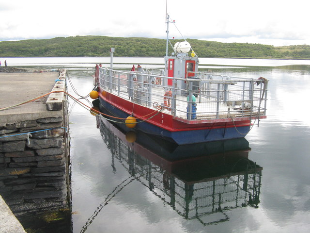
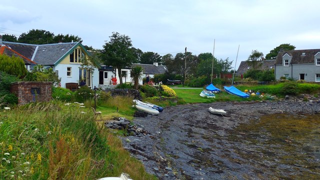
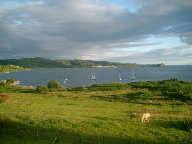
Shuna, located in Argyllshire, Scotland, is a picturesque island situated in the Inner Hebrides. Covering an area of approximately 1,000 acres, it is nestled in the stunning Loch Linnhe, surrounded by breathtaking natural beauty. The island is accessible only by boat, with a regular ferry service connecting it to the mainland.

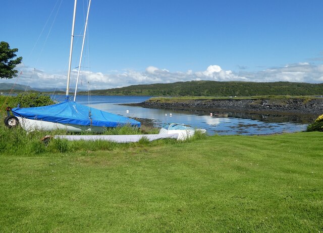
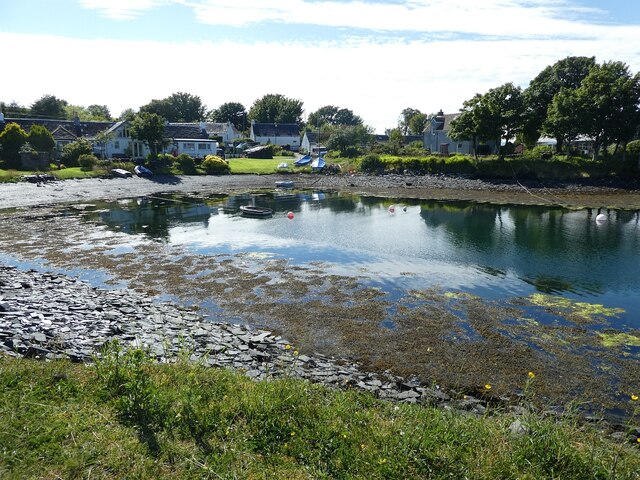
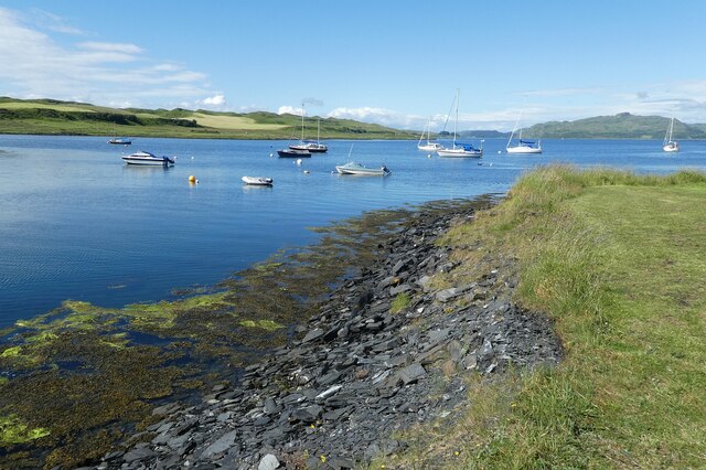
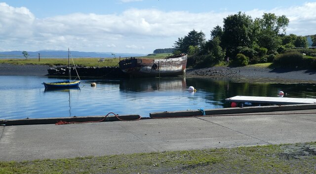
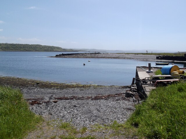
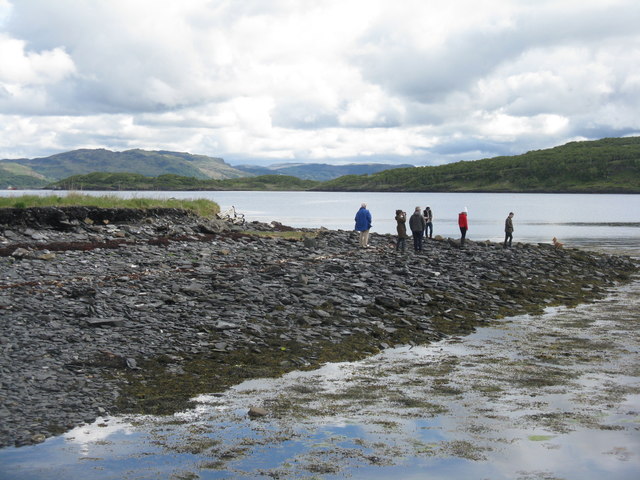
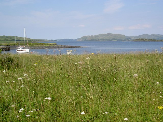
Shuna is known for its rugged coastline, adorned with dramatic cliffs and secluded sandy beaches. The island's landscape is characterized by rolling hills, verdant forests, and open moorland, offering countless opportunities for outdoor activities such as hiking, birdwatching, and nature exploration. The tranquility and unspoiled nature of Shuna make it a haven for wildlife, including deer, otters, seals, and various bird species.

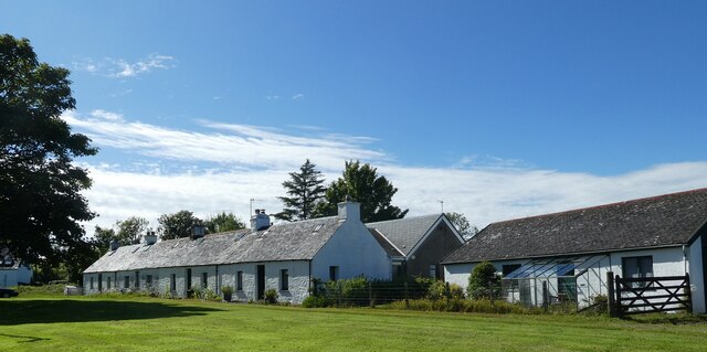
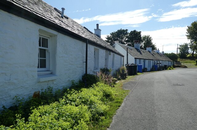
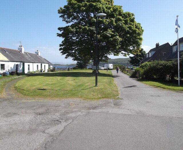
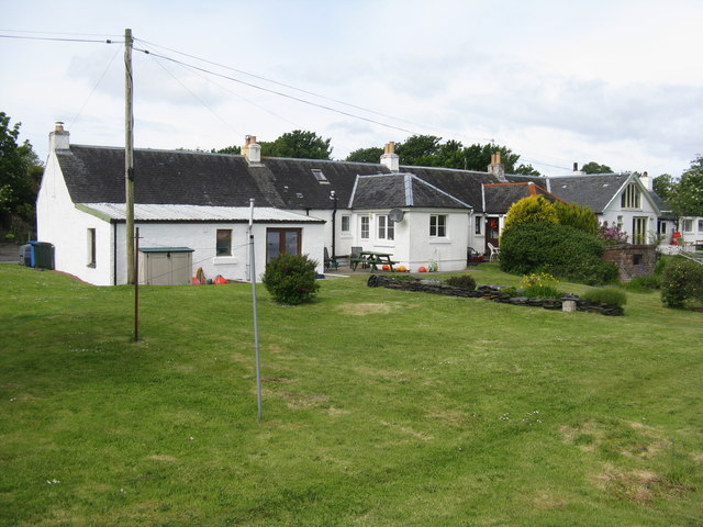
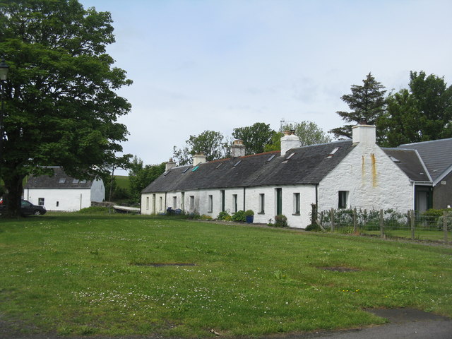
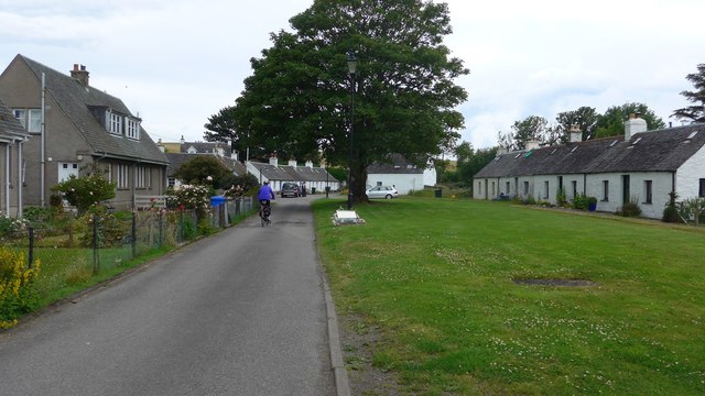
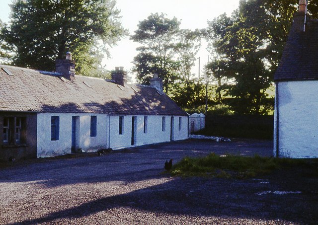
The island features a small population, primarily consisting of a handful of residents who cherish its peacefulness and close-knit community. There are a few residential properties on Shuna, along with a picturesque 19th-century church, which adds to the island's charm.

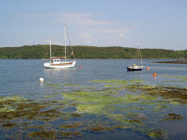
Visitors to Shuna can enjoy a range of recreational activities, including fishing, sailing, and kayaking in the surrounding waters. The island also offers opportunities for camping and self-catering accommodation for those seeking a unique and off-the-beaten-path experience.

Overall, Shuna offers a serene escape from the bustle of modern life, providing a tranquil retreat for nature lovers and those seeking solace in the stunning landscapes of the Scottish Highlands.

If you have any feedback on the listing, please let us know in the comments section below.

Shuna Images

Images are sourced within 2km of 56.213876/-5.6041042 or Grid Reference NM7608. Thanks to Geograph Open Source API. All images are credited.

Luing - Toberonochy - Cottages Most of the older cottages in Toberonochy are Category 'B' listed, including this row of rubble-built cottages.
See listing here: <span class="nowrap"><a title="http://portal.historicenvironment.scot/designation/LB12198" rel="nofollow ugc noopener" href="http://portal.historicenvironment.scot/designation/LB12198">Link</a><img style="margin-left:2px;" alt="External link" title="External link - shift click to open in new window" src="https://s1.geograph.org.uk/img/external.png" width="10" height="10"/></span>
Pretty-much the whole of Toberonochy is a conservation area - see <span class="nowrap"><a title="https://www.argyll-bute.gov.uk/sites/default/files/planning-and-environment/Toberonochy%20Conservation%20Area.pdf" rel="nofollow ugc noopener" href="https://www.argyll-bute.gov.uk/sites/default/files/planning-and-environment/Toberonochy%20Conservation%20Area.pdf">Link</a><img style="margin-left:2px;" alt="External link" title="External link - shift click to open in new window" src="https://s1.geograph.org.uk/img/external.png" width="10" height="10"/></span>
Luing - Toberonochy - Cottages
Most of the older cottages in Toberonochy are Category 'B' listed, including this row of rubble-built cottages. See listing here: LinkExternal link Pretty-much the whole of Toberonochy is a conservation area - see LinkExternal link
Luing - Toberonochy - Beached dinghies A couple of dinghies hauled up beside one of several inlets or quays on the coast by the village of Toberonochy, Luing's second largest settlement after Cullipool.
Luing - Toberonochy - Beached dinghies
A couple of dinghies hauled up beside one of several inlets or quays on the coast by the village of Toberonochy, Luing's second largest settlement after Cullipool.
Luing - Toberonochy - Northern harbour There is quite a large parking area with inlets on either side of it which form Toberonochy Harbour. Houses on the end of this northern inlet have a very pleasant outlook.
Cf. <a href="https://www.geograph.org.uk/photo/7259159">NM7508 : Luing - Toberonochy - Southern harbour</a>
Luing - Toberonochy - Northern harbour
There is quite a large parking area with inlets on either side of it which form Toberonochy Harbour. Houses on the end of this northern inlet have a very pleasant outlook. Cf. NM7508 : Luing - Toberonochy - Southern harbour
Luing - Looking up Shuna Sound from Toberonochy This is a view along the northern section of Shuna Sound from beside Toberonochy Harbour. The land on the left is part of the Isle of Luing, while that on the right is the very lightly populated Isle of Shuna. Although Shuna has just three permanent residents (or some references say one!), there are several holiday properties that can be hired there - see <span class="nowrap"><a title="http://www.islandofshuna.co.uk/Cottages.html" rel="nofollow ugc noopener" href="http://www.islandofshuna.co.uk/Cottages.html">Link</a><img style="margin-left:2px;" alt="External link" title="External link - shift click to open in new window" src="https://s1.geograph.org.uk/img/external.png" width="10" height="10"/></span>
Shuna has an area of 451ha (1,114 acres), taking its population as 3, it has a population density of just 0.7/km2 (1.8/sq mi). Its highest point is Druim na Dubh Ghlaic at 90m (295')
Luing - Looking up Shuna Sound from Toberonochy
This is a view along the northern section of Shuna Sound from beside Toberonochy Harbour. The land on the left is part of the Isle of Luing, while that on the right is the very lightly populated Isle of Shuna. Although Shuna has just three permanent residents (or some references say one!), there are several holiday properties that can be hired there - see LinkExternal link Shuna has an area of 451ha (1,114 acres), taking its population as 3, it has a population density of just 0.7/km2 (1.8/sq mi). Its highest point is Druim na Dubh Ghlaic at 90m (295')
Luing - Toberonochy - Southern harbour The hull of an old boat leans against the western bank of the southern harbour at Toberonochy. Cf. <a href="https://www.geograph.org.uk/photo/7259140">NM7408 : Luing - Toberonochy - Northern harbour</a>
Luing - Toberonochy - Southern harbour
The hull of an old boat leans against the western bank of the southern harbour at Toberonochy. Cf. NM7408 : Luing - Toberonochy - Northern harbour
Luing - Toberonochy - The road out of the village Looking along the street that leads out of the picturesque little village of Toberonochy on the Isle of Luing. Almost the entire village is HES Category 'B' listed - see <span class="nowrap"><a title="http://portal.historicenvironment.scot/designation/LB12198" rel="nofollow ugc noopener" href="http://portal.historicenvironment.scot/designation/LB12198">Link</a><img style="margin-left:2px;" alt="External link" title="External link - shift click to open in new window" src="https://s1.geograph.org.uk/img/external.png" width="10" height="10"/></span>
Luing - Toberonochy - The road out of the village
Looking along the street that leads out of the picturesque little village of Toberonochy on the Isle of Luing. Almost the entire village is HES Category 'B' listed - see LinkExternal link
Toberonochty A beautiful day
Toberonochty
A beautiful day
The harbour, Toberonochty
Cottages at Toberonochy At the southeastern end of Luing.
Cottages at Toberonochy
At the southeastern end of Luing.
Cottages at Toberonochy And a small village green.
Cottages at Toberonochy
And a small village green.
Slaty beach at Toberonochy Overlooking Shuna Sound.
Slaty beach at Toberonochy
Overlooking Shuna Sound.
The pier at Toberonochy  With a small ro-ro ferry moored. The trees beyond are on the island of Shuna.
The pier at Toberonochy
With a small ro-ro ferry moored. The trees beyond are on the island of Shuna.
Pier and moorings at Toberonochy The sloop in the distance is heading north up Shuna Sound.
Pier and moorings at Toberonochy
The sloop in the distance is heading north up Shuna Sound.
Toberonochy shore Toberonochy was another of the slate mining villages on the slate islands of Luing.  Now many of the houses are holiday homes.
Toberonochy shore
Toberonochy was another of the slate mining villages on the slate islands of Luing. Now many of the houses are holiday homes.
Houses at Toberonochy Toberonochy was another of the slate mining villages on the slate islands of Luing. Now many of the houses are holiday homes.
Houses at Toberonochy
Toberonochy was another of the slate mining villages on the slate islands of Luing. Now many of the houses are holiday homes.
The bay at Toberonochy
The Sound of Shuna at Toberonochy
Street in Toberonochy
Show me another place!

Shuna is located at Grid Ref: NM7608 (Lat: 56.213876, Lng: -5.6041042)

Unitary Authority: Argyll and Bute

Police Authority: Argyll and West Dunbartonshire

What 3 Words

///share.adjusting.angers. Near Lochbuie, Argyll & Bute

Nearby Locations

Druim na Dubh Ghlaic Shuna

Related Wikis

Shuna, Slate Islands

Shuna (Scottish Gaelic: Siuna) is one of the Slate Islands lying east of Luing on the west coast of Scotland. == History == In 1815, James Yates, a Glasgow...

Ardinamir

Ardinamir is an anchorage and small settlement on the island of Luing in Argyll and Bute, Scotland. == References ==

Craobh Haven

Craobh Haven Scottish Gaelic pronunciation: [kɾɯːv] is a small purpose-built village and sailing port on the west coast of Argyll and Bute, Scotland. It...

Luing

Luing ( LING; Scottish Gaelic: Luinn) is one of the Slate Islands, Firth of Lorn, in the west of Argyll in Scotland, about 16 miles (26 km) south of Oban...

Asknish Bay

Asknish Bay is a small, remote, southwest-facing coastal embayment, located next to the small settlement of Arduaine within Argyll and Bute, Scotland....

Craignish

Craignish (Scottish Gaelic, Creiginis) is a peninsula in Argyll, on the west coast of Scotland. It lies around 25 miles (40 km) south of Oban, and 10 miles...

Slate Islands

The Slate Islands are an island group in the Inner Hebrides, lying immediately off the west coast of Scotland, north of Jura and southwest of Oban. The...

Arduaine

Arduaine (Scottish Gaelic: An Àird Uaine, lit. 'green/fertile promontory or headland', pronounced "Ard oo an-ye") is a village in Argyll and Bute, Scotland...

Nearby Amenities

Located within 500m of 56.213876,-5.6041042
Druim na Dubh Ghlaic
Corbett: no
Ele: 90
Graham: no
Marilyn: no
Munro: no
Natural: peak
Lat/Long: 56.2168726/-5.6063687
Ruined Castle Farm
Place: locality
Lat/Long: 56.2152006/-5.5981779
The data included in this document is from www.openstreetmap.org. The data is made available under ODbL.

Have you been to Shuna?

Leave your review of Shuna below (or comments, questions and feedback).