An Sean Sgeir

Island in Ross-shire

Scotland

An Sean Sgeir

Rubha Reidh lighthouse This lighthouse is at the end of the (very narrow and twisty in places) road from Gairloch. The light was automated in 1986 and the attached house, once the keeper's house, was sold. It is now a private home and is not open to the public. The lighthouse is a category B listed building.
Rubha Reidh lighthouse Credit: Bill Kasman

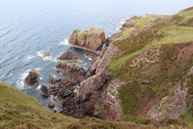
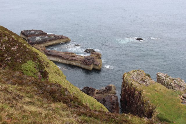
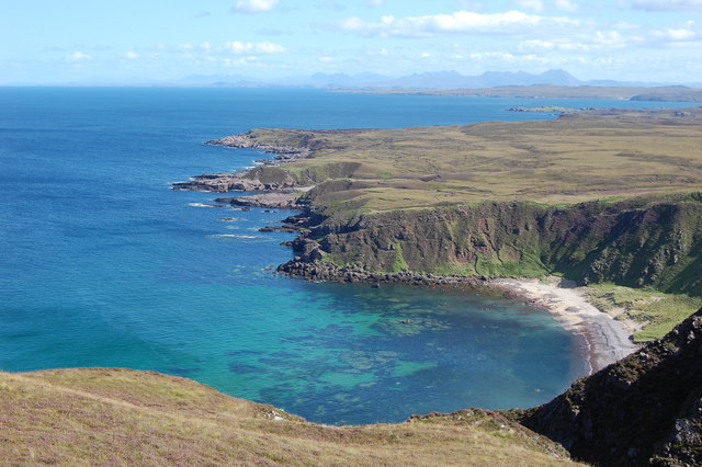
An Sean Sgeir, also known as "The Skerry," is a small uninhabited island located off the coast of Ross-shire in Scotland. This rocky outcrop is situated in the North Atlantic Ocean, approximately 1.5 miles east of the mainland. An Sean Sgeir stands at an impressive height of 16 meters and covers an area of about 0.04 hectares.

The island is known for its unique wildlife and is recognized as an important seabird breeding site. It serves as a nesting ground for a variety of seabird species, including guillemots, razorbills, and puffins. The surrounding waters are also home to an abundant marine life, with seals and dolphins often spotted in the area.

Due to its remote location and treacherous waters, An Sean Sgeir has historically posed a danger to ships navigating the region. The island's jagged rocks and hidden reefs have caused numerous shipwrecks throughout the years. As a result, it is recommended for vessels to maintain a safe distance from the island.

While An Sean Sgeir may not be accessible to the general public due to its hazardous nature, it continues to be admired from afar by nature enthusiasts and birdwatchers. Its rugged landscape and significant bird population make it a fascinating sight for those interested in Scotland's natural beauty.

If you have any feedback on the listing, please let us know in the comments section below.

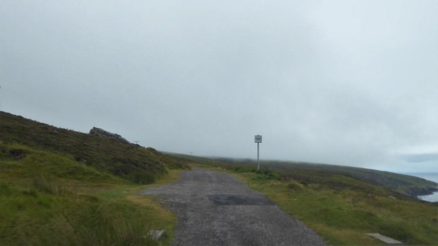
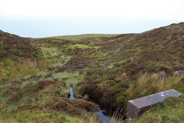
An Sean Sgeir Images

Images are sourced within 2km of 57.862182/-5.8071019 or Grid Reference NG7492. Thanks to Geograph Open Source API. All images are credited.

Rubha Reidh lighthouse This lighthouse is at the end of the (very narrow and twisty in places) road from Gairloch. The light was automated in 1986 and the attached house, once the keeper's house, was sold. It is now a private home and is not open to the public. The lighthouse is a category B listed building.
Rubha Reidh lighthouse
This lighthouse is at the end of the (very narrow and twisty in places) road from Gairloch. The light was automated in 1986 and the attached house, once the keeper's house, was sold. It is now a private home and is not open to the public. The lighthouse is a category B listed building.
Approaching the lighthouse The road from Melvaig to the Rubha Rèidh lighthouse is maintained by the Northern Lighthouse Board. It is seen here as one nears the lighthouse.
Approaching the lighthouse
The road from Melvaig to the Rubha Rèidh lighthouse is maintained by the Northern Lighthouse Board. It is seen here as one nears the lighthouse.
Old jetty at Port an Amaill
Stacks below Creag Camas an Fhraoich
Looking down to Camas Mòr
Ruins at Camustrolvaig
Old footings in grass below Rubha Rèidh Lighthouse
Passing place on the road to Rubha Rèidh
A burn dropping to Camasan Dearga
West facing cliffs at Rubha Reidh
Road to Rubha Reidh Lighthouse
Rubha Reidh Lighthouse
Stac Dubh
Stac Dubh
Sea stack with natural arch
Rock girt bay at Camas Mòr
Camas Mòr
Camas Mòr
View of Camas Mor Our affectionate family name for this beautiful and remote beach is 'The Spooky Beach'. Remote as it is, there's always a feeling you're being watched...
View of Camas Mor
Our affectionate family name for this beautiful and remote beach is 'The Spooky Beach'. Remote as it is, there's always a feeling you're being watched...
The track to the lighthouse The track that leads to Rubha Reidh lighthouse.  We were travelling on motorbikes and got to a small layby near to the lighthouse.  I wanted to see the lighthouse, but was just soo scared to venture any further.  Maybe someday I will return on a bicycle and make it to the end of the road/track.  A bonus to stopping where we did we got a sighting of Minke Whale.
The track to the lighthouse
The track that leads to Rubha Reidh lighthouse. We were travelling on motorbikes and got to a small layby near to the lighthouse. I wanted to see the lighthouse, but was just soo scared to venture any further. Maybe someday I will return on a bicycle and make it to the end of the road/track. A bonus to stopping where we did we got a sighting of Minke Whale.
Show me another place!

An Sean Sgeir is located at Grid Ref: NG7492 (Lat: 57.862182, Lng: -5.8071019)

Unitary Authority: Highland

Police Authority: Highlands and Islands

What 3 Words

///cricket.evaporate.quote. Near Gairloch, Highland

Related Wikis

Rua Reidh Lighthouse

Rua Reidh Lighthouse stands close to the entrance to Loch Ewe in Wester Ross, Scotland. == History == The name "Rua Reidh" is a semi-anglicisation of...

Melvaig

Melvaig is a remote village on the coast of western Ross-shire, Scottish Highlands and is in the Scottish council area of Highland. It is a cliff top...

Aultgrishan

Aultgrishan (Gaelic: ) is a small crofting community near Gairloch, Ross-shire. It adjoins Melvaig, within Highland region and is in the Scottish council...

Cove, Highland

Cove is a remote hamlet located on the northwestern shore of the sea loch Loch Ewe, and 8 mi (13 km) northwest of Poolewe in Ross-shire, Scottish Highlands...

Nearby Amenities

Located within 500m of 57.862182,-5.8071019
Source: PGS
Lat/Long: 57.8614112/-5.7990512
Source: PGS
Lat/Long: 57.8615272/-5.7997962
Source: PGS
Lat/Long: 57.8612416/-5.8010429
Created By: almien_coastlines
Source: PGS
Lat/Long: 57.861524/-5.806123
Source: PGS
Lat/Long: 57.8611558/-5.8065866
Source: PGS
Lat/Long: 57.8613095/-5.807063
Source: PGS
Lat/Long: 57.8614485/-5.8076555
Source: PGS
Lat/Long: 57.8612946/-5.8080954
Source: PGS
Lat/Long: 57.8611866/-5.8086159
Source: PGS
Lat/Long: 57.860885/-5.8091396
Created By: almien_coastlines
Source: PGS
Lat/Long: 57.860672/-5.809902
Source: PGS
Lat/Long: 57.860601/-5.8103468
Source: PGS
Lat/Long: 57.8601068/-5.811006
Created By: almien_coastlines
Source: PGS
Lat/Long: 57.859991/-5.811771
Source: PGS
Lat/Long: 57.8593869/-5.8129352
Source: PGS
Lat/Long: 57.8593278/-5.8131323
Source: PGS
Lat/Long: 57.8589744/-5.8125145
Rubha Reidh
Man Made: lighthouse
Seamark Light Character: Fl
Seamark Light Colour: white
Seamark Light Group: 4
Seamark Light Height: 37
Seamark Light Period: 15
Seamark Light Range: 24
Seamark Light Reference: A 3900
Seamark Light Sequence: 0.4+(2.1)+0.4+(2.1)+0.4+(2.1)+0.4+(7.1)
Seamark Name: Rubh Reidh
Seamark Radio Station Category: ais
Seamark Type: light_major
Wikidata: Q7375626
Wikipedia: en:Rua Reidh Lighthouse
Lat/Long: 57.8587603/-5.8116223
Source: PGS
Lat/Long: 57.861607/-5.8035706
Source: PGS
Lat/Long: 57.8614694/-5.8021262
Source: PGS
Lat/Long: 57.8612071/-5.8030913
Jetty
Lat/Long: 57.8610688/-5.8070992
Port An Amaill
Place: locality
Lat/Long: 57.8612879/-5.8070122
Power: pole
Lat/Long: 57.8585968/-5.8103072
Power: pole
Lat/Long: 57.8590425/-5.8109989
The data included in this document is from www.openstreetmap.org. The data is made available under ODbL.

Have you been to An Sean Sgeir?

Leave your review of An Sean Sgeir below (or comments, questions and feedback).