Carreg Frân

Island in Pembrokeshire

Wales

Carreg Frân

Field Boundaries Dry stone walled field boundaries on the Pembrokeshire Coast Path.
Field Boundaries Credit: Chris McAuley

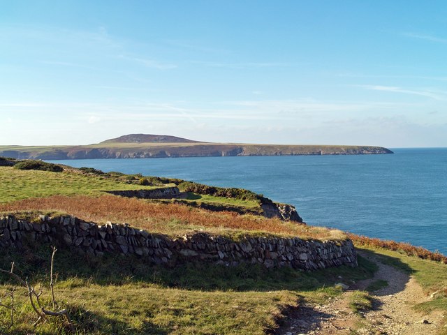
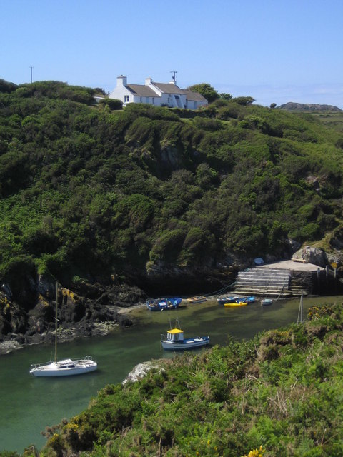
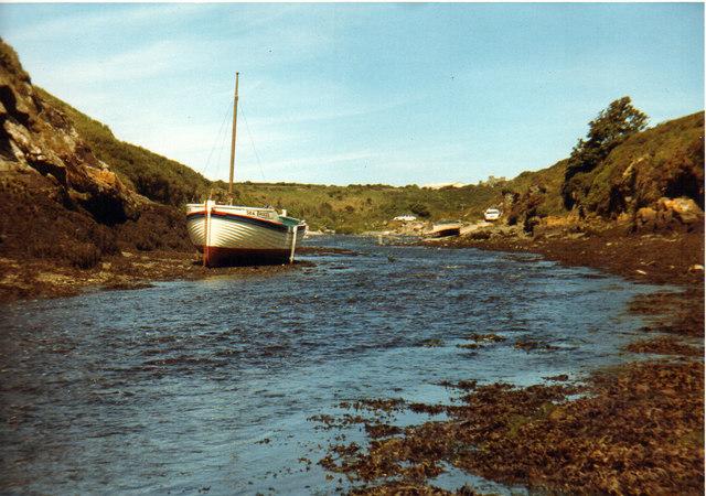
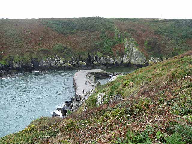
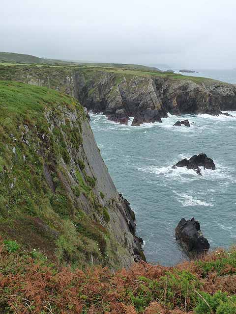
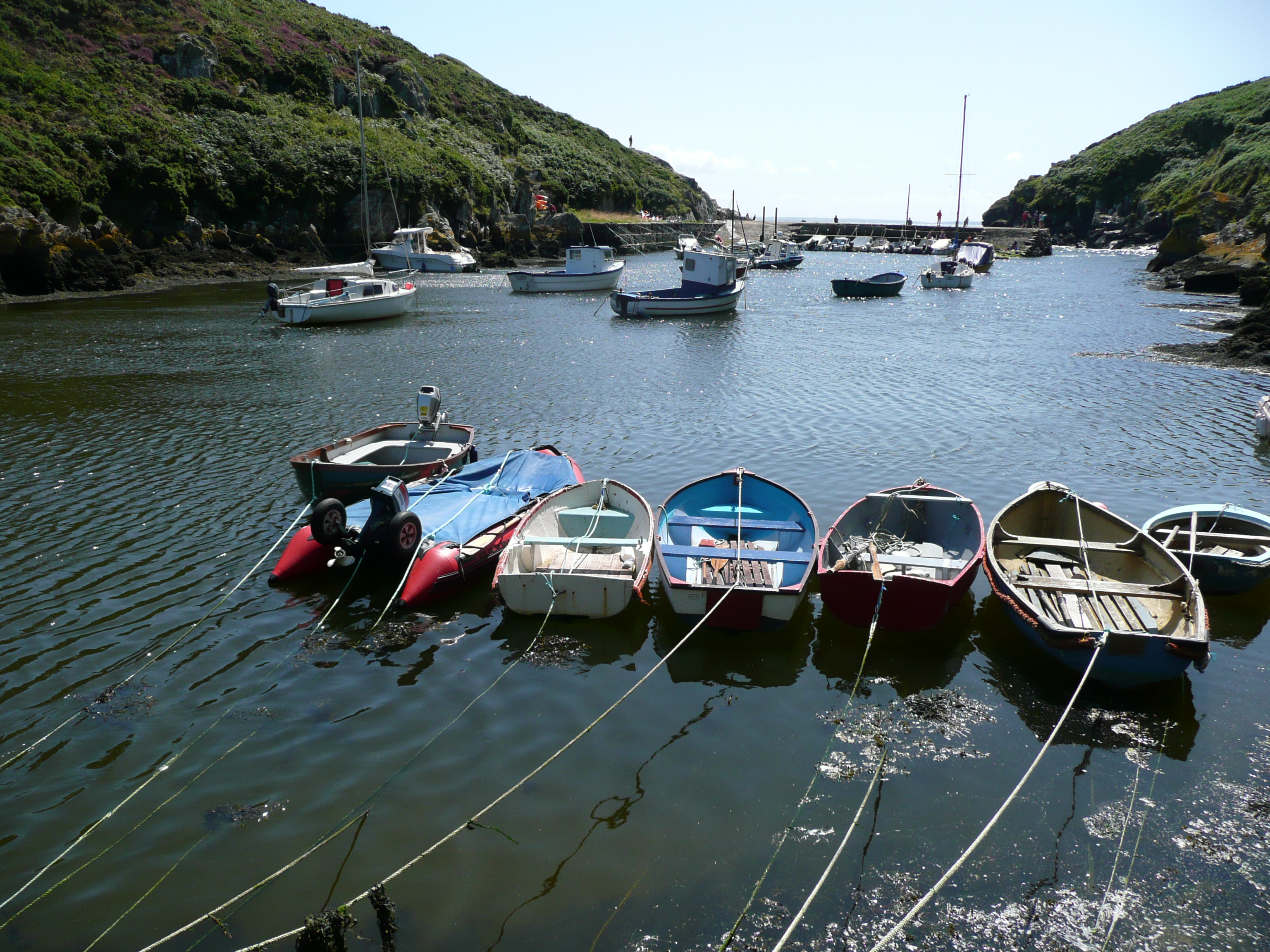
Carreg Frân is a small island located off the coast of Pembrokeshire, Wales. The island is known for its rugged and rocky terrain, with cliffs rising up from the surrounding sea. At low tide, a causeway connects the island to the mainland, allowing visitors to explore its natural beauty.

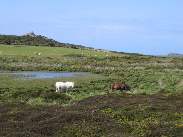
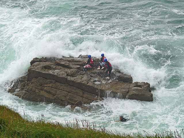
Carreg Frân is home to a variety of wildlife, including seabirds such as puffins, guillemots, and razorbills. The island also has a rich marine life, with seals often spotted in the surrounding waters.

Visitors to Carreg Frân can enjoy hiking along the island's coastal paths, taking in the stunning views of the sea and nearby coastline. The island is also a popular spot for birdwatching, with opportunities to see a wide range of seabirds in their natural habitat.

Overall, Carreg Frân offers a peaceful and scenic escape from the hustle and bustle of everyday life, making it a perfect destination for nature lovers and outdoor enthusiasts.

If you have any feedback on the listing, please let us know in the comments section below.

Carreg Frân Images

Images are sourced within 2km of 51.858785/-5.2958583 or Grid Reference SM7322. Thanks to Geograph Open Source API. All images are credited.

Field Boundaries Dry stone walled field boundaries on the Pembrokeshire Coast Path.
Field Boundaries
Dry stone walled field boundaries on the Pembrokeshire Coast Path.
Pool on headland above Ogof Mrs Morgan Diminished in size due to dry weather.
Pool on headland above Ogof Mrs Morgan
Diminished in size due to dry weather.
Porth Clais
Porth Clais
Porth Clais 1971
Porth Clais 1971
Breakwater at the mouth of Porth Clais Harbour At one time, the port for St David's.
Breakwater at the mouth of Porth Clais Harbour
At one time, the port for St David's.
Porth y Ffynnon Looking across the bay of Porth y Ffynnon to the headland of Trwyn Cynddeiriog.
Porth y Ffynnon
Looking across the bay of Porth y Ffynnon to the headland of Trwyn Cynddeiriog.
Coasteering at Chanter's Seat Some people derive their pleasure in strange ways.
Coasteering at Chanter's Seat
Some people derive their pleasure in strange ways.
Coasteering at Chanter's Seat Some people derive their pleasure in strange ways.
Coasteering at Chanter's Seat
Some people derive their pleasure in strange ways.
Coasteering at Chanter's Seat Some people derive their pleasure in strange ways.
Coasteering at Chanter's Seat
Some people derive their pleasure in strange ways.
Port Clais harbour
Port Clais harbour
Footpath and limekiln at Porthclais
Looking across Porth y Ffynnon St Non's retreat is visible in the distance.
Looking across Porth y Ffynnon
St Non's retreat is visible in the distance.
Cliffs at Porth y Ffynnon With St Non's Retreat on the upper left of the photo.
Cliffs at Porth y Ffynnon
With St Non's Retreat on the upper left of the photo.
Purple Slab The apt name designated by climbers. There are several climbs crossing this section of cliff.
Purple Slab
The apt name designated by climbers. There are several climbs crossing this section of cliff.
Near the base of the Purple Slab
Rock scenery at Trwyn Cynddeiriog Taken from the base of the Purple Slab, looking south.
Rock scenery at Trwyn Cynddeiriog
Taken from the base of the Purple Slab, looking south.
Looking down the Purple Slab At low tide.
Looking down the Purple Slab
At low tide.
Rock scenery in Porth y Ffynnon
Show me another place!

Carreg Frân is located at Grid Ref: SM7322 (Lat: 51.858785, Lng: -5.2958583)

Unitary Authority: Pembrokeshire

Police Authority: Dyfed Powys

What 3 Words

///difficult.tarred.feelers. Near St Davids, Pembrokeshire

Nearby Locations

Carreg Frân

Related Wikis

River Alun, Pembrokeshire

The River Alun is a small river in northwest Pembrokeshire, Wales, which rises near Tretio Common and flows southwestwards to St Davids to empty into St...

Porthclais

Porthclais (also known as Porth Clais) is a small sheltered inlet harbour near St Davids, Pembrokeshire, Wales, in the community of St Davids and the Cathedral...

Pen Dal-aderyn

Pen Dal-aderyn is the westernmost point of mainland Wales. It is in Pembrokeshire, west of St Davids. It means 'Bird-catching Head' in Welsh. == External... ==

Trefeiddan Moor

Trefeiddan Moor is a Site of Special Scientific Interest (or SSSI) in Pembrokeshire, South Wales. It has been designated as a Site of Special Scientific...

Nearby Amenities

Located within 500m of 51.858785,-5.2958583
Source: OS_Opendata_Vectormap_District
Lat/Long: 51.8618622/-5.2935132
Source: OS_Opendata_Vectormap_District
Lat/Long: 51.8619075/-5.2934413
Source: OS_Opendata_Vectormap_District
Lat/Long: 51.8619618/-5.2933803
Source: OS_Opendata_Vectormap_District
Lat/Long: 51.8619937/-5.2933179
Source: OS_Opendata_Vectormap_District
Lat/Long: 51.8620568/-5.293071
Source: OS_Opendata_Vectormap_District
Lat/Long: 51.8620931/-5.2930045
Source: OS_Opendata_Vectormap_District
Lat/Long: 51.8620938/-5.2928533
Source: OS_Opendata_Vectormap_District
Lat/Long: 51.8620915/-5.2928088
Source: OS_Opendata_Vectormap_District
Lat/Long: 51.8621642/-5.2927056
Source: OS_Opendata_Vectormap_District
Lat/Long: 51.8621375/-5.2926045
Source: OS_Opendata_Vectormap_District
Lat/Long: 51.8621324/-5.2923647
Source: OS_Opendata_Vectormap_District
Lat/Long: 51.8621465/-5.2923568
Source: OS_Opendata_Vectormap_District
Lat/Long: 51.8621737/-5.2923604
Source: OS_Opendata_Vectormap_District
Lat/Long: 51.8622068/-5.2924254
The data included in this document is from www.openstreetmap.org. The data is made available under ODbL.

Have you been to Carreg Frân?

Leave your review of Carreg Frân below (or comments, questions and feedback).